If you look at what happened in Washington and Oregon yesterday, there is real danger.
LCES to the max.
Read one of the fires in Washington burned 350k in one day…all range land but ran 50 miles
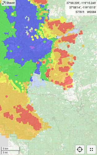
Is there an evacuation map for the north side? Specifically Oakhurst? Could only find Mariposa county maps, not Madera.
3 posts were merged into an existing topic: CA-SNF-Creek ???
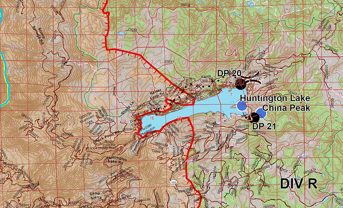
Fire is at China Peak Ski Resort.
Three strike engines and a water tender sent to ski resort. structures impacted.
75 acre spot west of courtwright reservoir. AA15 sighted it. Bringing tankers in from south. High winds are driving into a crown fire. Going to try drive it into a rocky area to slow it.
He’s got clear air to work it, unlike the main fire smoke. This spot plume is topping at 18k feet.
6 posts were merged into an existing topic: CA-SNF-Creek ???
143,929 a/o 1738L via Inciweb
Spot by Courtright Reservoir now is ~150 acres per AA. Got about 6 retardant drops in @ the bottom of it.
Fingers crossed that the granite slabs throughout the area around Shaver helped with at least some of the homes up there
Creek South Zone IAP 9-9-2020 to 9-10-2020
Fire crossed the Lerona Fuel Break in Jose Basin. Div.29 requests 20 engines to Auberry rd. above the casino up to meadow lakes. Have not heard a plan for the engines. Fire is already approaching meadow lakes from the south. The mile high area might already be inside the fire. It has been creeping from the south given the meadow cam’s view.
FKU sending a IA response to hwy 168 bottom of 4 lane. There calling it a new fire, per S.O. report. Maybe a spot?
The fire was in mile high the night before and early yesterday morning and a few structures were lost.
2 posts were merged into an existing topic: CA-SNF-Creek ???
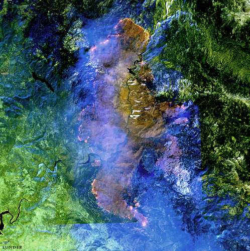
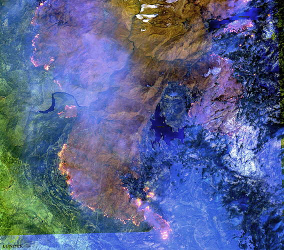
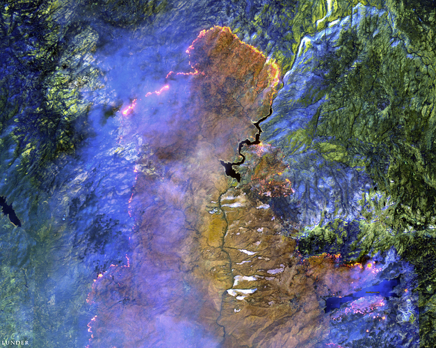
We got a Sentinel satellite orbit over the fire yesterday, 9/8/2020 at about 1100 hrs.
Here are some images I made from it - a great snapshot of the big picture on the fire.
Thanks for sharing the awesome sat images, and enhancements. Very fortunate to have the bird passing over the area.
