Looking like 944 is heading that way from mcclellan.
Tankers 76,78,160,163,and 944 assigned.
Air Attack and all tankers returning to base due to smoky/visibility over the fire.
Ongoing damage assessment.
https://calfire-forestry.maps.arcgis.com/apps/webappviewer/index.html?id=1933470ef8ea4c7e9cede56adf54efe1&extent=-13377356.4387%2C4419677.6073%2C-13142541.8878%2C4523937.7139%2C102100
Always amazed me when a fire ripped through a bunch of houses that some escaped undamaged. I know this assessment is far from complete, but it looks like a lot of structures in Shaver Lake made it through.
It’s looking like many of them survived in shaver. Also I’m surprised at what survived in pine ridge.
You think maybe some firefighters were going house to house with fire suppression efforts? We’ve done it in the past. You don’t save every home but you give it your best shot. It was called “bump and run”.
196,667 and 8% containment via Inciweb at 1953L. Gaining on it through hard, nasty, dirty work. Fingers crossed when this inversion breaks.
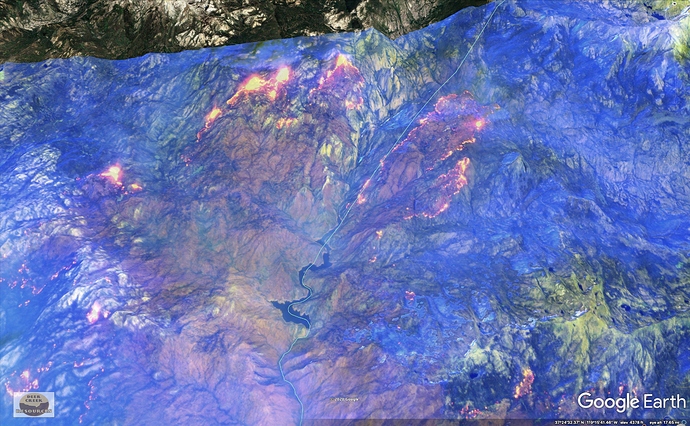
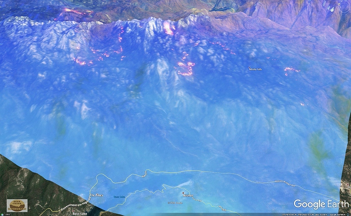
Owyhee IR aircraft over the Creek Fire. Also the Cerberus Metroliner off Fresno headed northwest.
They did an excellent job with what they had, pine ridge and alder springs was just a no win situation being at the hotest part of a fire making a 3000 acre run.
AA 88P requests 3 LATS and 3 S2’s direct to fire. Did not catch the AG
comm’s as to what mission they were going to use them in.
AA had those 6 tankers for 4 hours going a round robin out of Fresno and
Porterville. I did not listen to the AA channel nor AG so, still don’t know where
they were dropping. Guess you could find the air trackers and see their path.
Smoked out across Creek and Bulfrog fires. Air show off at 1400.
Air assets worked the SE corner of the Creek (east of Shaver Lake and north of Dinkey Creek) and a drop on the Bulldog before they got smoked out.
Making a big push in the northeast sections.
See you there! PT 79 from Valley Fire
201,908 acres and 10% contained.
Quoting John Gleichweit @SmokeyBehr this one is a pucker factor to the umteenth!!!
212,744 @ 10% as of 0918L via Inciweb.
A/A reports insufficient viz this morning for air ops, but they’ll take a look every couple of hours.
Smoke from Castle Fire impacting operations. Ground viz less than 1/2 mile here just west of Bass Lake at 3650ft.
Hopefully they can keep that slopover on jose basin road in check, it crossed over in lerona where the fire had burned 3/4 of the way around the houses then hit the line punched in on the west side so it’s working it’s way through that pocket while crews protect the structures there.
212,744 @ 16% as of the 1900 Inciweb update, which included this note:
Acreage did not increase because we were unable to collect IR data during the day due to loss of resource to higher priorities in the southern region. Indication of fire growth was observed through satellite Intel, but we were unable to determine the exact amount of growth.
The slop held in place with no additional growth.


