7549 acres, 65% contained. N40Y is currently (2300 8/5) doing a mapping flight over the fire after passes over Donnell and Ferguson fires.
This is the unit I worked for in 2000-2002! Good job crews!
Air Ground command National Air tactics 66 166.675
Air tac reports unable to launch fixed or rotor wing due to smoke.
Update 8/7 evening: 8,484 acres, 70% contained (up from 65%)
Moderate fire behavior flanking, creeping and backing
I believe that percent maybe depend on the size of their box. You may be correct. It would be nice to see the box they are working within. Big build up of resources at Mammoth airport yesterday when I went by.
The dotted, green line is “the box”.
Thanks FireDonkey. the lads on ground and air have done an outstanding job in some really tough land… also compliments to the USFS mule teams that have been supplying them.
Well, SouthOps tonight is still reporting it at 70%; acreage went up a bit to 8,711. The green box is plenty bigger than the fire footprint - lets hope they don’t need that entire box! That’s rough country up there, take care everyone!
NIMO Team activated hope to take control of the incident Monday 8/13, ICP and all operational support will move west to the Sierra on the Bass Lake Ranger district
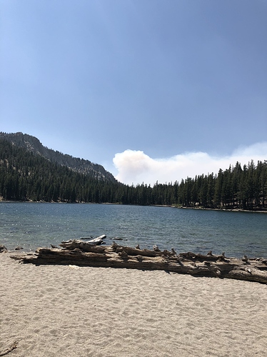
Hi RED14: Where was this picture taken?
This was taken from McLeod Lake in Mammoth looking west.
Thanks for the info.
Does anybody know the reason for the NIMO activation? Drawdown of available teams? Politics since it was managed fire called contained and came back to life? Wilderness? Just curious since its approximately 8500 acres and 70% contained? Thanks
I was curious about this as well.
10,004 acres and 70% contained.
Could see the header from meadow lakes and alders springs this afternoon. Those areas are 35 miles south southwest.
AA15 just landed at fresno replaced by n40y for mapping mission it looks like.
Large header visible from prather.
An AA has continued to fly out of Fresno Airport at 0900 for past 10 days to report over the fire and fly the fire with relief for most of each day. I am out of range to hear any air tactical traffic.
Also at the period between 20:00 and 21:00 AA51 (the IR flight from fox field) has completed IR and filming flights each night.
This fire seems to continue to be a going concern, probably hard to find hot spots for the ground crews because of the terrain.
9/6 update
13.347 acres, 85%. Actions involve largely monitoring and holding lines, and rehab in low-risk areas able to access. The divisions on the eastern flank of the fire have been declared fully contained. Ifrared flights have shown minimal growth in areas where the fire is still active.

