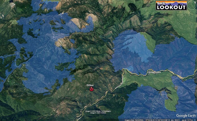
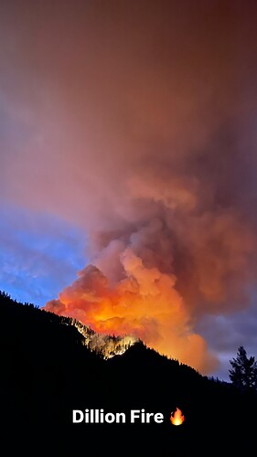
Resources enroute to a fire in the area of Ti Bar rd and HWY 96. Large building column on the cameras.
30 min timelapse is pretty wild
Well that escalated quickly
Holy Mackrell real big real fast++
Edit: The heat signature footprint on GOES W is already quite large.
I swear this one came out of nowhere.
Seems like a lot of people are going to spending time in Happy Camp real soon
Hope it’s in Orleans out of the smoke instead of Happy Camp.
Someone check my eyes but it looks like the column is beginning to rotate…
15 min lapse definitely looked like it had rotation hard to tell if it continued around a axis or started to catch transport winds or something
Yeah this one looks even bigger than what the Shelly looked like at the start, this one I imagine is going to go big! Any burn scars around it??
Well there’s a few folks on here who dabble in the map output and I believe pyrogeography will chime in soon enough with a detailed response and the product you seek.
The Klamath burns religiously every year and while I haven’t been on nearly as much fires in the Six Rivers the similar fuel type tells me there should be some history nearby.
OMG - NOT ANOTHER DILLON!!
You old timers will understand …..
Between the flaming acres at night effect & the timelapse views of the column its all i can do to not blurt out some crazy prediction on acres/size etc.. If i didnt know it was a fire i’d say someone was blowing things up out there after seeing the camera video. Imo this one gets todays vote for most nutty / amazing column activity.. so far!
type 3 team already ordered.
edit: northcoast
Plume looks similar to the beginning of the Slater up the road.
It’s definitely rotating, can’t tell if there’s lightning in the pyro or if that’s just the light and camera tweaking out.
A tileset: ALERTWest - Tile Display
For those curious, the Cave Junction camera is 43 miles away from the fire.
300 acres..
FIRIS mapped 922.4 acres about midnight , according to WD.

