I’ve been listening to AA-102 working several fires in east Humboldt and west Trinity counties. From what I can hear, it sounds like difficult access. Does appear to be lighting caused.
Sounded like SRF and HUU were working them together, or at least dividing them up amongst themselves, and working them like a complex.
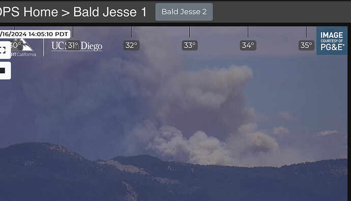
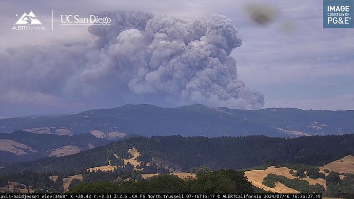
I believe this is the Hill fire within the complex ?
ALERTCalifornia - Bald Jesse 1
T3 IMT assembled
These clouds are probably around ~25000 feet up based on HRRR soundings… and this plume is poking higher than that.
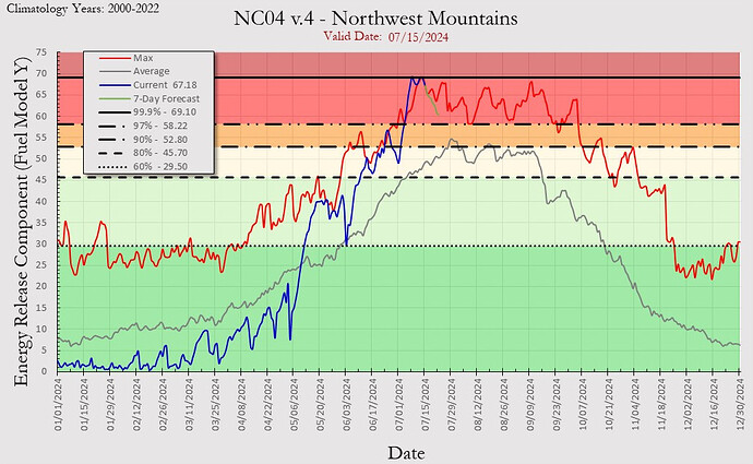
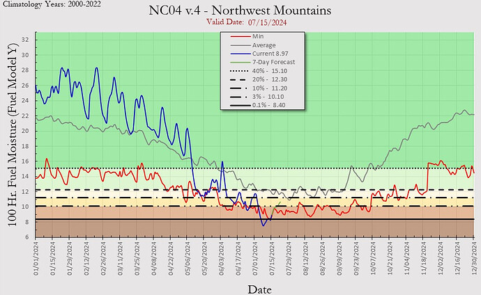
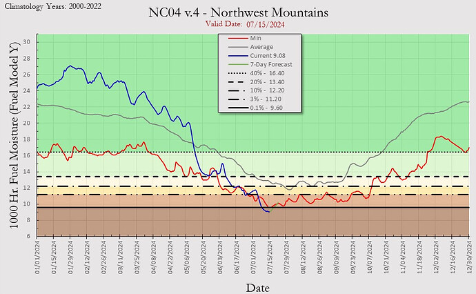
For those that insisted not that long ago that higher elevation and or coastal fuels will lag to valley fuels… I believe these FACTS coupled with images shall quiet the naysayers.
ERC, 100 hr, 1000r stats…
I must say sir I don’t like the implications of those graphs 
SRF-Hill fire extended frequencies assigned today:
Air Tactics FM: 167.0625
Air/Ground: 170.3125 and 159.450 t192.8 (CDF A/G13). Not sure if they’re taking both for A/G CMD and A/G TAC, or SRF and HUU both put in duplicate orders and they’re only using one.
AM Victors: 118.775, 120.025
Futz, graphs & nomograms not needed, but still appreciated, bcuz that picture above by itself is worth 100 charts & graphs, imo!!
When you are breaking ERC records in the NW mtns PSA that is a lot of energy released!
2000 acres per Watch Duty
Looks like it ran the drainage and then ran out of slope?
Timelapse, here:
https://x.com/wildland_zko/status/1813382003775115419
