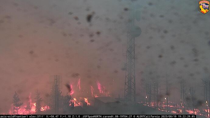
This was the old SRF Bluff Complex. The Lone Pine Fire has now been added to the complex and it has been renamed. California IIMT 2 (Johnny) has been activated with an in-brief tomorrow evening.
Looks like at least one of the fires (presumably the Pilot) has been burning very well for at least the past 3 hours on the Bald Jesse cam. Punched through the inversion and chewing up some acreage.
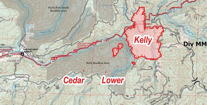
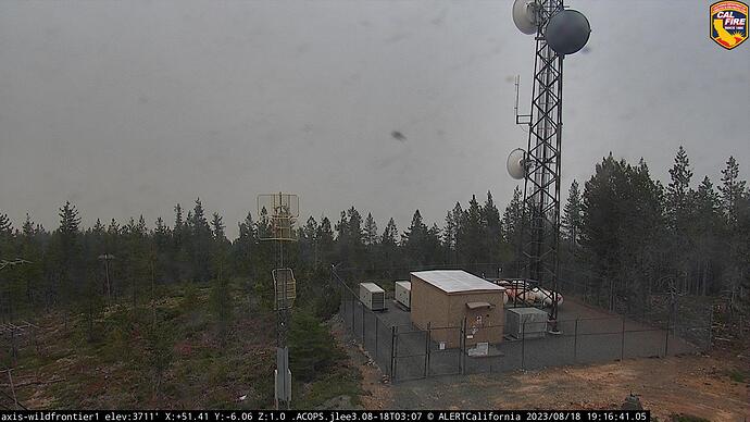
I believe the Kelly, Cedar and Lower fires are a short distance east of the Cam Site:
ALERTCalifornia - Wild Frontier 1 - Wild Frontier
As of Noon 8-18 it’s has an inversion capping the fires. Watched it back down into the Kelly Creek drainage yesterday. Confluence or Head waters of three drainage’s join up according to the IAP map.
Could be potential for running up to the ridges once the inversion breaks??
Portion of IAP Map surrounding this cam site: map released 8-17-23
Hope my research is correct.
Pacific Power has de-energized the main transmission line that serves Del Norte County, California, and Crescent City. Duration unknown.
7593 acres as of Friday morning. The 17th shows 13 fires and 18th shows 12 fires on the Maps.
That was being called the 3-9 fire.
20,549 CA team 15 in command type 2 team
California IIMT 2 (Johnny) has taken command of the Six Rivers Lightning Complex as of 1800 hours. This complex includes the following fires on the Six Rivers NF:
Lone Pine
Pearch
Mosquito
Blue
Blue 2
Let-er-Buck
On the Redwoods National and State Parks:
Devil
Lost
Glenn
All other fires on the Six Rivers/HUU are part of other complexes.
Mod’s please make whatever changes need to be made to clean things up.
I saw that split up and the other fires, Holiday, kelly, coon, Cedar, Corral, Diamond, et.al. Which IAP maps show in Branch 5.
Which seems like several of these will burn together??
CIIMT Team15 (type 2) assigned Smith River Complex on the SRF
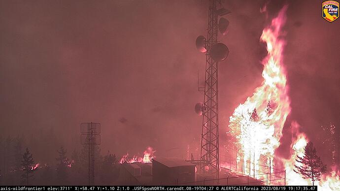
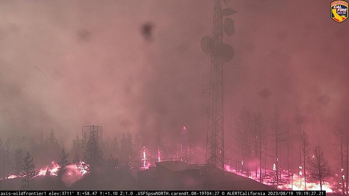
This is the complex I have been watching some perimeter runs from Wild Frontier Cam.
ALERTCalifornia - Wild Frontier 1 (as above)
I was counting the current mapped acres of this morning and yes.
The Kelly fire was at 8k yesterday morning and by this morning is 14k (well it is by now).
Yes that’s what I meant earlier. Sorry for the hassle I was in the middle of something
Tonight’s fire runs are causing lighting over the area: (18:30)
Combined with the tropical moisture coming up.
Note: MODS - maybe change this to “Smith River Complex” and name off the fires near the “Kelly”??
Looks similar to the Shirley peak cameras from the French fire.
somehow it’s still working
Looks like good defensible space inside the fence line. Bet the shelter and tower made it through. Some scary visuals though.
As radio tech whom has installed 1000’s of feet of cable on tower sites, I am pretty sure some of those cable (plastic jacketed copper) runs feeding the dishes and antennas are melted to the point of severe damage. With the stand of trees torching off the radiant heat was damaging.
The building is non combustible and two propane tanks feed generators. There is obviously the microwave carrying the video feed is still working, until the propane runs out.
Is the ICP in Gasquet or ???

