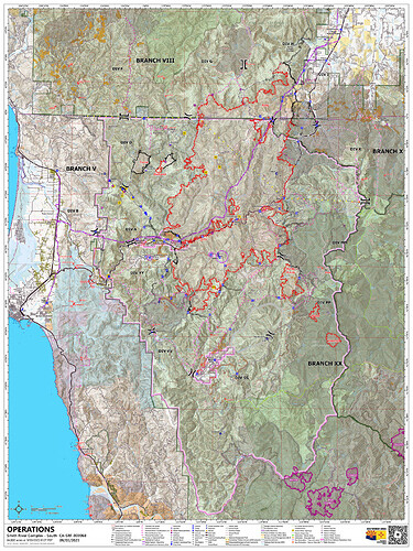
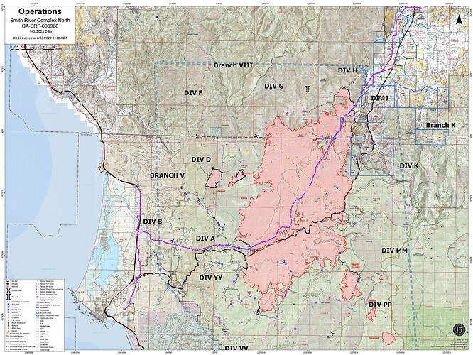
From the lightning that came over the complex on Thursday, we have picked up 5 additional starts. 4 of SRF and one in the Redwood National Park. 3 on the forest are staffed and crews are making progress. The 4th is in Wooley Creek and is unstaffed for all the usual reasons. There are a total of 19 fires in the complex.
Tell me about Wooley Creek?
Zactly Milehighbar
Multiple fires have gone through the drainage leaving huge snag patches and jack straw fuel on the ground. Very steep, rugged terrain. The drainage is in alinement with the predominant wind as well as diurnal winds and is a south west facing drainage.
Copy, thanks.
The Hancock in Wooley Creek made an 800+ acre slope, fuel, and wind driven run yesterday.
DP is up for 083123 maps.takserver.us. They reduced the file size by 75% but the clarity has reduced some. Its a balance for sure. Glad FTP is back up and running.
I wont be publishing DataPackages for a few days, headed on a vacation. TAK users you will have to go old school and download directly from the FTP and use the ATAK import feature. Be safe out there folks.
9/3 Update
84,802 acres w/ 10,083 acres in Oregon @ 12% contained - per ONCC.
Anticipated Incident Containment or Completion Date: 12/01/2023
The Lower, Cedar, Holiday and Coon fires merged with the Kelly, the Wimer merged with the Corral, and Jedadiah merged with the Prescott Fire, and are shown as 100% contained. The Doe and Corral fires are 100% contained.
Kelly is the largest fire in the complex at 70,587 Acres 2% contained.
2,955 Personnel Assigned
Today’s Ops Maps:
SOUTH (It also covers the North, just not as much detail as the map below)
NORTH
Highway 199 closed again this afternoon due to a rock slide 3 miles south of Patrick Creek and increased fire activity
Just posted an article on The Lookout which runs through last night’s IR for NW California fires and gives a little interp of current burning conditions. NW California Fires - 9/13/2023 Infrared Interpretation - The Lookout


