I wont be publishing DataPackages for a few days, headed on a vacation. TAK users you will have to go old school and download directly from the FTP and use the ATAK import feature. Be safe out there folks.
9/3 Update
84,802 acres w/ 10,083 acres in Oregon @ 12% contained - per ONCC.
Anticipated Incident Containment or Completion Date: 12/01/2023
The Lower, Cedar, Holiday and Coon fires merged with the Kelly, the Wimer merged with the Corral, and Jedadiah merged with the Prescott Fire, and are shown as 100% contained. The Doe and Corral fires are 100% contained.
Kelly is the largest fire in the complex at 70,587 Acres 2% contained.
2,955 Personnel Assigned
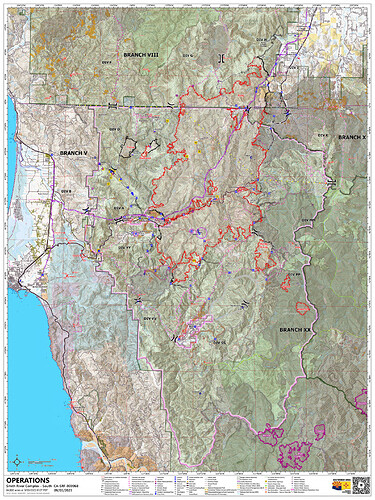
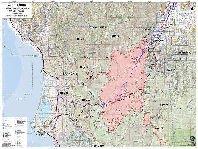
Today’s Ops Maps:
SOUTH (It also covers the North, just not as much detail as the map below)
NORTH
Highway 199 closed again this afternoon due to a rock slide 3 miles south of Patrick Creek and increased fire activity
Just posted an article on The Lookout which runs through last night’s IR for NW California fires and gives a little interp of current burning conditions. NW California Fires - 9/13/2023 Infrared Interpretation - The Lookout

