State ID: CA
3 letter designator: STF
Fire name: Bone
Location: Jawbone Pass
38.041833,-119.926000
Reported acres: 85 now 261 (7.1.2023) 281 (7.3.2023)
Rate of spread:
Report on Conditions:
Structure threat: None
Resources:
Hazards:
Weather:
Radio channels:
Scanner link: Calaveras and Alpine Counties Fire, Cal Fire and USFS Live Audio Feed
Webcam link: ALERTCalifornia
Agency Website: https://www.fs.fed.us/
https://inciweb.nwcg.gov/incident-information/castf-2023-bone-lightning-fire
3 Likes
Lightning Caused Bone Fire Being Managed to Achieve Multiple Objectives
SONORA, California June 28, 2023 – What began as a lightning-caused wildfire along Jawbone Pass in the pre-planned Cherry North Prescribed (RX) Burn Unit on the Stanislaus National Forest’s Groveland Ranger District is being managed to achieve multiple objectives.
The lightning ignition was originally detected on June 15, and district fire managers immediately began work to ensure this naturally ignited fire stayed within pre-determined boundaries. Much of the work, including thinning vegetation along containment lines and clearing roads impacted by winter storm damage has already been completed based upon pre-existing prescribed fire plans.
“This lightning strike happened right in an area where we had already done significant planning and prep work,” said Groveland District Fire Management Officer, Pat Laeng. “Assuming weather conditions remained favorable, we had every intention of performing prescribed fire operations on this pre-defined unit in the very near term.”
“Allowing natural fire to spread in areas where it can be safely and effectively managed helps restore natural fire return intervals, increasing forest resiliency and aiding in reducing catastrophic wildfire risk to our communities,” said Stanislaus National Forest Supervisor, Jason Kuiken.
Kuiken noted that every fire – prescribed or wildfire – has a containment strategy developed using a full spectrum of management actions that consider fire and fuel conditions, predicted short- and long-term weather conditions, values at risk, resource availability, land management plans and designations, smoke impacts, and the potential for successful consumption of fuel loads.
“Every management strategy identifies places suppression resources need to prioritize activities based on values at risk. However, containment strategies may include identification of natural barriers or locations where fire could be ecologically beneficial,” said Kuiken. “It should also be pointed out, these burn units, and where the fire started, are within the Rim Fire burn scar which itself acts as yet another containment tool.”
Approximately 80 firefighting resources currently assigned to the near-completed Strawberry Prescribed Fire have been reassigned to the Groveland District to improve existing containment lines within the Cherry North RX Burn units. In addition, fire managers intend to utilize and reinforce existing Forest Service Roads, and utilize Cherry Creek, Reynolds Creek, and Cherry Lake as potential natural containment lines.
Current warming trends that halted operations on the Strawberry Prescribed Fire Project are not having the same impact on the Bone Fire located nearly 2000 feet higher in elevation where temperatures are normally 5 -10 degrees cooler. Conditions will be assessed on a continual basis, and should the fire not meet the objectives of the Cherry North Rx Burn Plan then full suppression efforts will be utilized.
“All told, we’re hoping to complete 961 acres of fuels mitigation,” said Laeng. “All of this is of course dependent on the continued availability of resources, weather, and other critical factors.”
Benjamin Cossel
Public Affairs Officer
Forest Service
Stanislaus National Forest
p: 209-288-6261
c: 209-916-5919
benjamin.cossel@usda.gov
19777 Greenley Road
Sonora, CA 95370
www.fs.fed.us
5 Likes
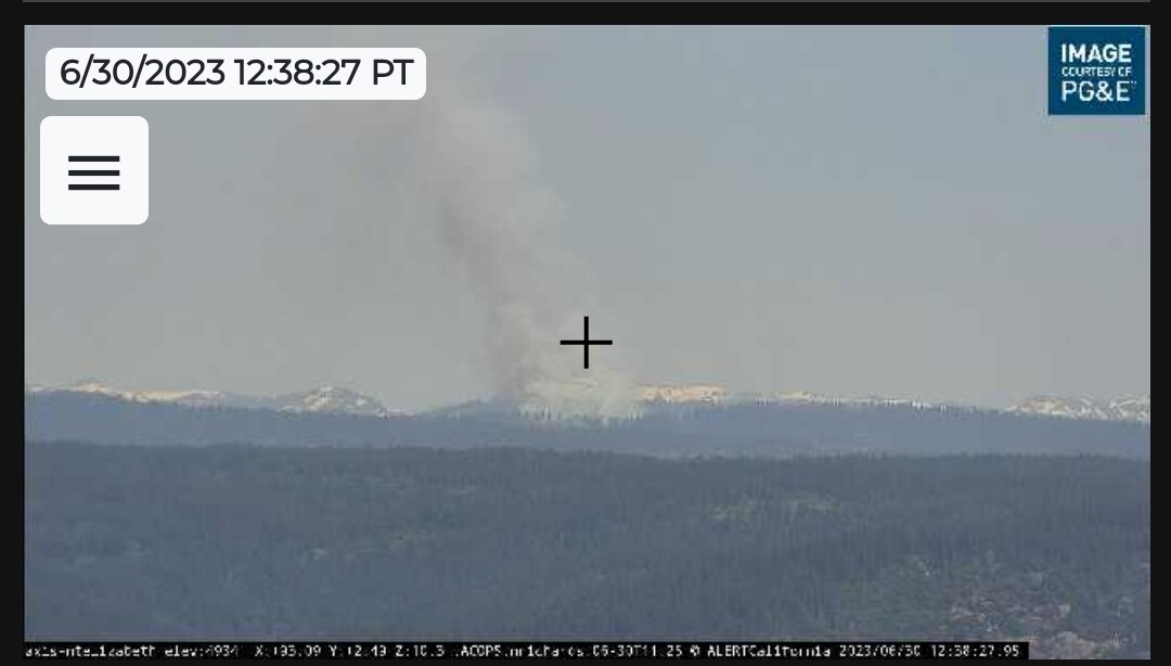
been pretty active yesterday and today. went from 4 acres to 85 yesterday. this is from earlier today. you can see it cranking away on the playback for Mt Elizabeth in the link up above. several cams were on it earlier too
haven’t been hearing any radio traffic on the online feed. might try my scanner tomorrow.
We have it up on Watch Duty too
Bone Fire @ Jawbone Pass, Tuolumne County, CA - #BoneFire https://share.watchduty.org/i/5145
It’s on NIFC too but I didn’t see it on wildcad.
5 Likes
Bone Lightning Fire Update
Saturday July 1, 2023
Stanislaus National Forest
Incident Management Team (Type-3)
Bone Lightning Fire Inciweb: Castf 2023 Bone Lightning Fire Information | InciWeb
Fire Statistics:
Location: The Bone Lightning Fire is located in a remote area of the Stanislaus National Forest on the Groveland Ranger District north west of Cherry Lake.
Acres burned to date: 261
Cause: Lightning
Total Personnel: 80 consisting of (2) Hot Shot crews, (3) Type 2 engines, (1) Wildland Fire Module
Injuries: 0
Background:
The Bone Lightning Fire was detected on June 15, 2023 in the pre-planned Cherry North Prescribed (RX) Burn on the Groveland Ranger District. This area had already been pre-prepped for the planned burn. Fire managers are utilizing the pre-determined boundaries to ensure this naturally lightning ignited fire stays within pre-determined boundaries.
Today’s Activities:
This morning a .10 acre spot fire occurred outside the containment line. Crews and engines promptly responded and contained the spot fire. No other spot fires occurred today.
Following spot fire containment, fire resources focused on prepping more containment lines within the project area and performed ignition operations on the fire.
All ignitions are meeting fire objectives even with higher temperatures and lower relative humidities. Fire crews are maintaining safe work environments, with the goal of fully containing the Bone Lightning Fire at approximately 900 acres.
Benjamin Cossel
Public Affairs Officer
Forest Service
Stanislaus National Forest
6 Likes
Bone Lightning Fire Inciweb: Castf 2023 Bone Lightning Fire Information | InciWeb
Fire Statistics:
Location: The Bone Lightning Fire is located in a remote area of the Stanislaus National Forest on the Groveland Ranger District north west of Cherry Lake.
Acres burned to date: 281
Today’s Activities:
Overnight winds last night increased the potential for spot fires on the 2N05 road. This morning, crews took extra precaution and concentrated on the 2N05 road holding fire and patrolling for spot fires.
Once the concerns for spot fires were eliminated, crews cleaned up unburned pockets of fuel along the eastern edge of the 2NO5 road.
In the afternoon, fire crews began ignitions on the north side of the fire, taking burning operations slow and steady. Their work will continue into the evening, until the burning window closes.
The slow pace allows this naturally ignited fire to spread in areas where it can be safely managed in order to restore natural fire return interval, increase forest resiliency and aid in reducing hazardous fuels lessening the probability of catastrophic fire.
6 Likes
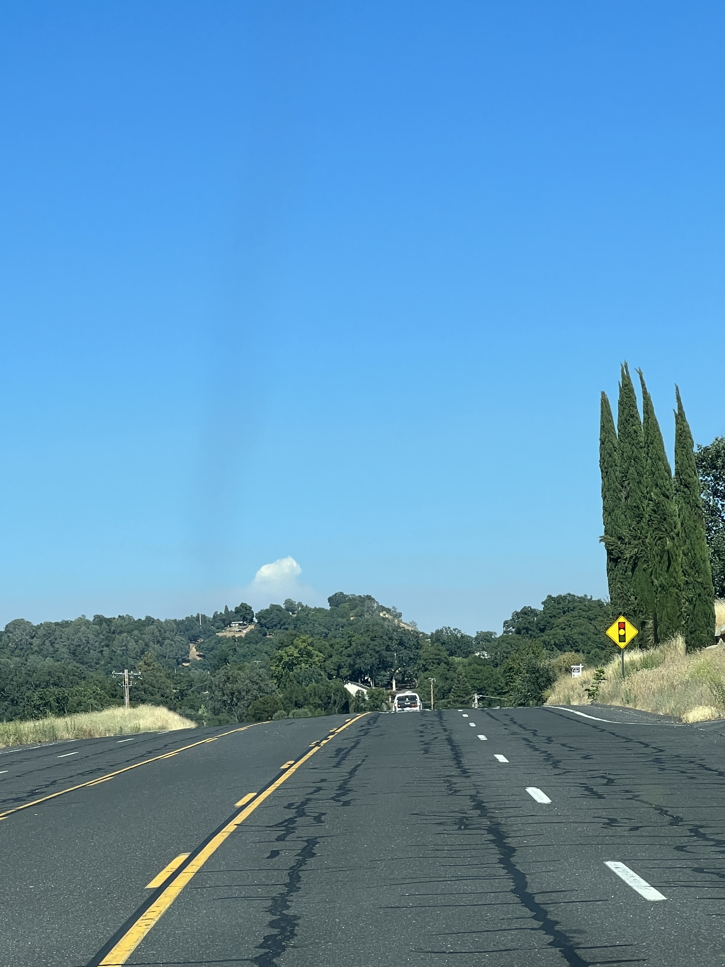
AA51 overhead this morning.
3 Likes
The Bone Lightning Fire is located in a remote area of the Stanislaus National Forest on the Groveland Ranger District north west of Cherry Lake.
Acres burned to date: 339
Cause: Lightning
Total Personnel: 110
Injuries: 0
Background:
The Bone Lightning Fire was detected on June 15, 2023 in the pre-planned Cherry North Prescribed (RX) Burn on the Groveland Ranger District. This area had already been pre-prepped for this planned burn. Fire managers are utilizing the pre-determined boundaries to ensure this naturally lightning ignited fire stays within these boundaries.
Today’s Activities:
Today, fire personnel completed burning operations on the northeast side of 2N05. The area is dense with large down woody debris. Fire is used to reduce hazardous fuels in the unit. (See attached photo).
Fire personnel prepped and improved the western boundary of the fire along 3N01. Working from the north and coming up from the south, fire personnel identified and felled trees that could be hazardous and potentially impede containment efforts once burning operations begin in this unit.
More resources showed up today including one Hot Shot crew and one Forest Service engine bringing the total workforce to 110 personnel to assist in the safe burning implantation of the Bone Lightning Fire.
5 Likes
The Bone Lightning Fire is located in a remote area of the Stanislaus National Forest on the Groveland Ranger District north west of Cherry Lake.
Acres burned to date: 425
Cause: Lightning
Total Personnel: 110
Injuries: 0
Background:
The Bone Lightning Fire was detected on June 15, 2023 in the pre-planned Cherry North Prescribed (RX) Burn on the Groveland Ranger District. This area had already been pre-prepped for this planned burn. Fire managers are utilizing the pre-determined boundaries to ensure this naturally lightning ignited fire stays within these boundaries.
Today’s Activities:
Crews brought fire from the ridge top west towards 3N01 North. This road will be used as a control line for the western perimeter of the Bone Fire. The road will also be used to provide a buffer from a large patch of standing dead trees (snags) that fire personnel plan to burn. Fire personnel will use the 3N01 road for firing operations minimizing their exposure to these hazard trees.
In the interior of the fire, crews ignited and cleaned up pockets of unburned fuels reducing the buildup of flammable material.
2 Likes
2 Likes
829 acres 72% contained per wildcad
4 Likes
I saw that same view myself! They should be getting to the end of it… they were shooting for 961 acres. gonna be Smokey ate my house tonight I bet.
PS I heard they broke camp already.
4 Likes

The Bone Lightning Fire is located in a remote area of the Stanislaus National Forest on the Groveland Ranger District north west of Cherry Lake.
Acres burned to date: 1,163
Cause: Lightning
Total Personnel: 110
Injuries: 0
Background:
The Bone Lightning Fire was detected on June 15, 2023 in the pre-planned Cherry North Prescribed (RX) Burn on the Groveland Ranger District. This area had already been pre-prepped for this planned burn. Fire managers are utilizing the pre-determined boundaries to ensure this naturally lightning ignited fire stays within these boundaries.
Today’s Activities:
Today, fire professionals on the Bone Lightning Fire completed burning operations for this fire that has been managed for multiple resource benefits.
Crews diligently checked for any potential fire where burning material could roll out of the perimeter line at the narrow sliver of the project area between 3N01 and 2N05 on the western edge of the fire. This ensured the fire stays within the perimeter control line.
Along the northern perimeter of the fire, crews worked the handline beefing up mop up previously conducted, securing a strong fifty-foot buffer. From the handline in this northern edge of the fire down to 3N01, crews began mopping up, working towards the south.
In other areas of the fire, crews completed burning approximately 100 acres remaining from yesterday’s operation in the area, south of the fire’s origin and bordered by the 2N05 road. A column of smoke could be seen during this operation.
While resources are still available, fire fighters returned to prepare the 2N12 road west of 3N01 readying the unit for a future prescribed burn, possibly this fall.
With the successful completion of burning today, the incident will be releasing some resources. However, fire crews will still remain on the fire for at least a week, patrolling and conducting mop up, ensuring the fire remains in its current footprint. The Bone Lightning Fire is a naturally caused wildfire being managed for multiple benefits, contributing to a more resilient landscape.
5 Likes