CA-STF-Henry ???

WildCAD is showing a fire near Spicer Meadows Reservoir.

Strawberry cam has a glow in view:

http://www.alertwildfire.org/sierra/index.html?camera=Axis-Strawberry&v=fd40729

Inciweb has it here: Henry Fire Update for July 11, 2021 - InciWeb the Incident Information System

300 acres and 13% contained. Confinement strategy with natural barriers.

Henry must have got aligned overnight. Showing a nice heat signature early this morning with a well defined smoke plume.

From Sunday evening 209:
Henry, Vegetation Fire, Alpine County, Update East of Lake Alpine in the Carson-Iceberg Wilderness Federal DPA, FRA, Stanislaus National Forest · 300 acres (+0 acres), brush and timber, 13% contained (+0% containment) · Active fire behavior with backing, creeping and isolated torching · Trail closures in the area · Burning in Carson-Iceberg Wilderness

2 Likes

Just a good old fashioned night time burning operation, all is well.

2 Likes

From July 10:

Stanislaus National Forest, CA – A lightning fire in the Calaveras Ranger District of the Stanislaus National Forest has grown to 80-acres.

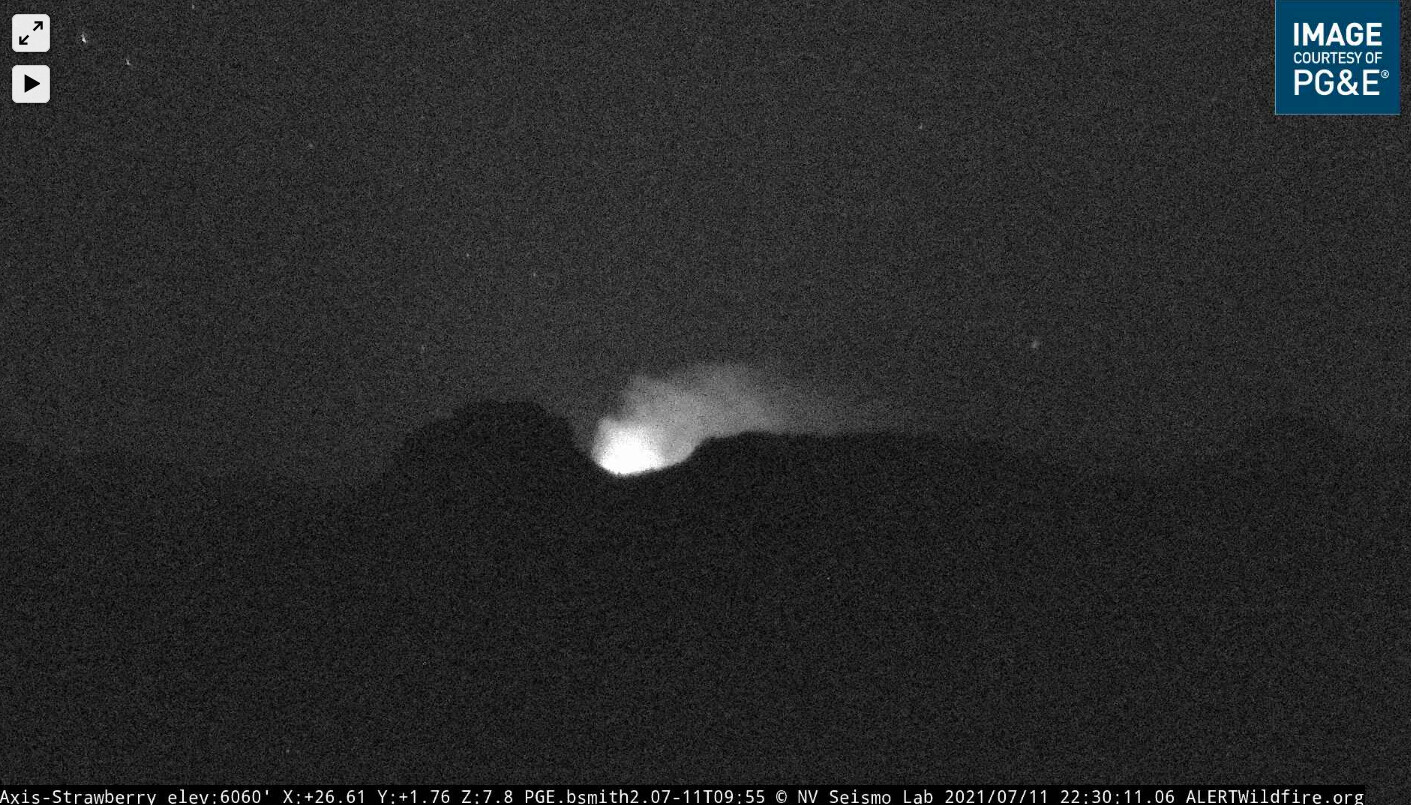
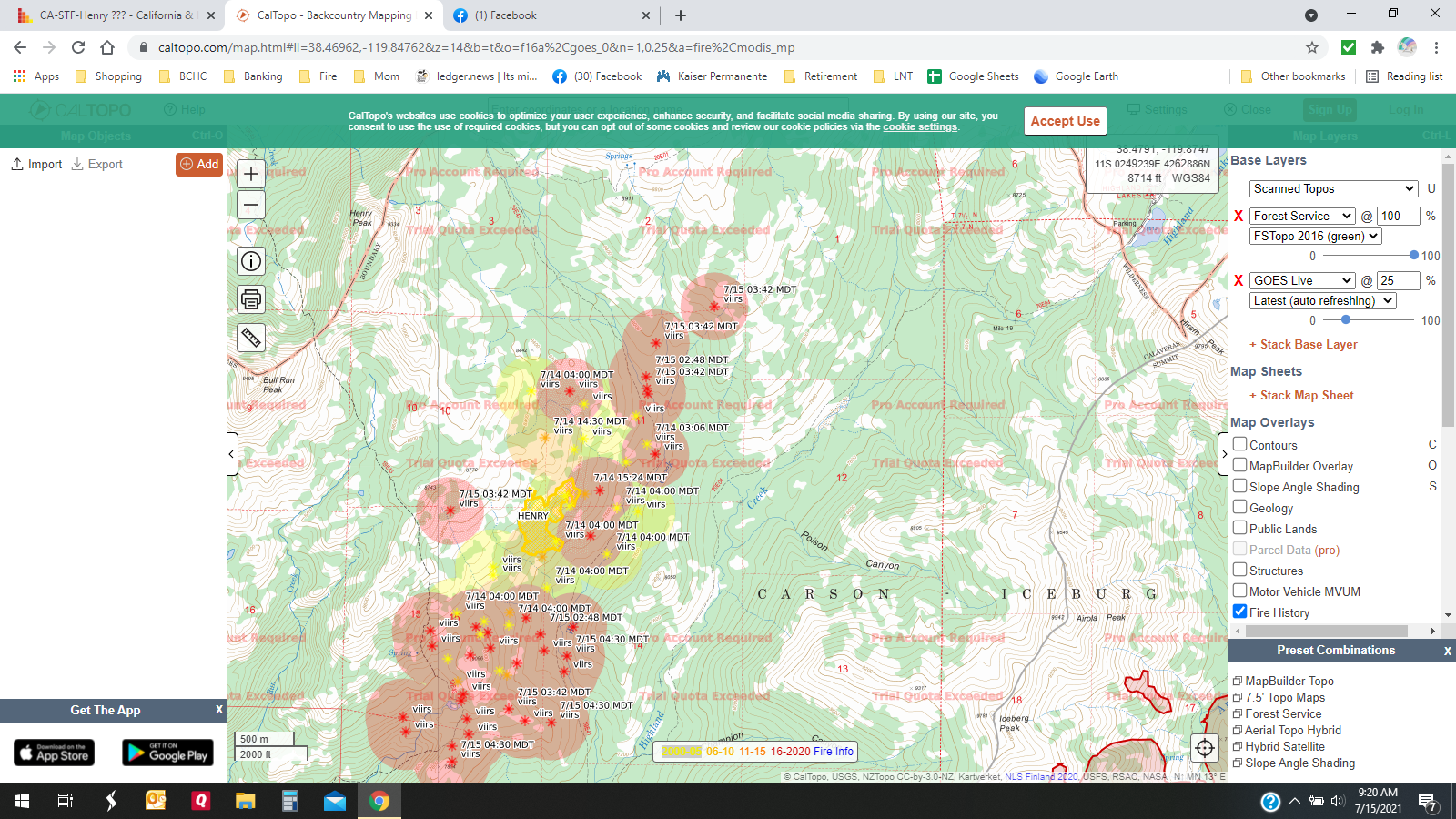
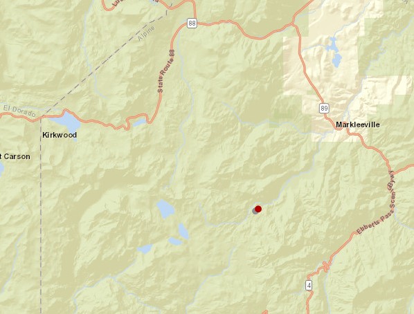
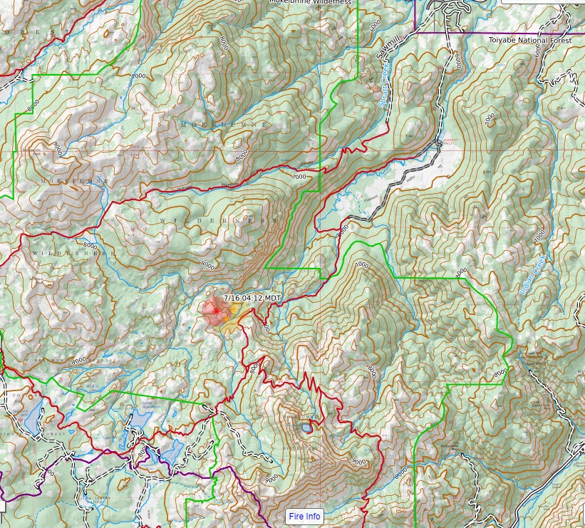
Dubbed the “Henry Fire,” it broke out last month during a lightning storm in the Carson-Iceberg Wilderness northeast of Spicer Reservoir and southwest of Highland Lakes at 7,500 ft. elevation. As reported here, Yosemite National Park is also working on 19 lightning strike fires.

Fire managers are utilizing a confine and contain strategy using ridges, creeks, trails, and natural barriers to suppress the fire. They add that the terrain is steep with brush, patches of conifer trees and granite outcroppings.

Regarding the current conditions fire officials relay that as weather and fuel conditions are favorable, crews will continue to conduct burning operations to strengthen containment lines. They explain that those operations remove vegetation between the edge of the fire and containment lines. Ground crews’ objectives are to maintain fire north of Hiram Meadow, south of Carson-Iceberg Wilderness boundary, east of trail 19E43, and west of trail 19E41. A fire closure was issued today for the Henry Fire area, click here to view the order and the trail closures.

Forest officials note that except for a 12-acre blaze last year near Henry Peak, the area has not seen a fire in over 20 years. They advise, “Reintroducing fire into fire-adapted ecosystems has several ecological benefits such as reducing hazardous fuels, promoting new plant growth, and improving watershed quality.”

Resources assigned to the fire include 50 personnel of four Hand crews and a Type 3 Incident Management Team. Smoke may be more visible during the daylight hours and settle overnight in the canyons.

Written by Tracey Petersen.

Report breaking news, traffic or weather to our News Hotline 532-6397. Send Mother Lode News Story photos to news@clarkebroadcasting.com. Sign up for our FREE myMotherLode.com Daily Newsletters by clicking here.

3 Likes
2 Likes

July 12 must of been a different kind of a day because it put up one heck of a header.

4 Likes

Just heard tanker 132 depart fresno to this fire… hot and moving on this fire?

I found the Air Tactics 169.150 and hear 82, 131 and 83 was released off the Inyo and might get reassigned to this.

Caltop shows its still has recent heat and is moving North and West.

https://caltopo.com/map.html#ll=39.87525,-121.39515&z=14&b=t&o=f16a%2Cgoes_0&n=1,0.25&a=fire%2Cmodis_mp

Wild CAD is placing it at 650 acres at “present” time.

4 Likes

Hi, the caltopo map is not sgowing the CA-STF HENRY. Not sure whar it is.

1 Like

https://caltopo.com/map.html#

It is there, that map was just centered on the Dixie fire.
See if my link is in the right place?
Not sure my link is working.
However, caltopo is interactive, so wherever it puts you, just zoom out to orient yourself with the state, then pan/scroll to the STF,
north of Dardanelle,
NE of Spicer Reservoir.

4 Likes

I had to scroll around to find it like Paulito said. I also had to ignore the watermark about “trial quota exceeded” which had always stopped me before. Thank you Paulito for your instructions. Here is a screen shot:

2 Likes

Thanks, first time I have used it.

Any update on this one? Heard this one might get an IMT order.

ALERTWildfire | Shasta Modoc
Either a firing op or Henry found a little more steam…

1 Like

Is that Henry, or something new?

Was just trying to pin it down and it looks like new heat on the Wifire Map

Hawkins 3

1 Like

The Henry fire is in the background, this one started popping up yesterday evening.

2 Likes

Thanks TBS

Checked Inciweb and either missed it or…

Is there a fire name yet that you’re aware of?

Believe the name is Tamarck. Ownership HTF. Has been in monitor status for a while, but really starting to pick up. Black Mountain Shots just arrived on scene and ordered air attack and a type 1 helicopter. No idea on size yet.

3 Likes

Inciweb = Updated : 1:58 hrs. ago
Size : 1,040 Acres
Contained : 21%

2 Likes

Sorry that was for The Henry

3 Likes

So maybe someone can start a new thread, and knock off the Henry rumors. It’s 20% contained, and 1,000 acres at almost 10,000 feet in elevation. Not a likely IMT candidate at the moment.

4 Likes