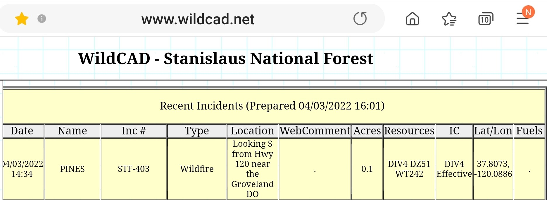
State ID:CA
3 letter designator:STF
Fire name:PINES
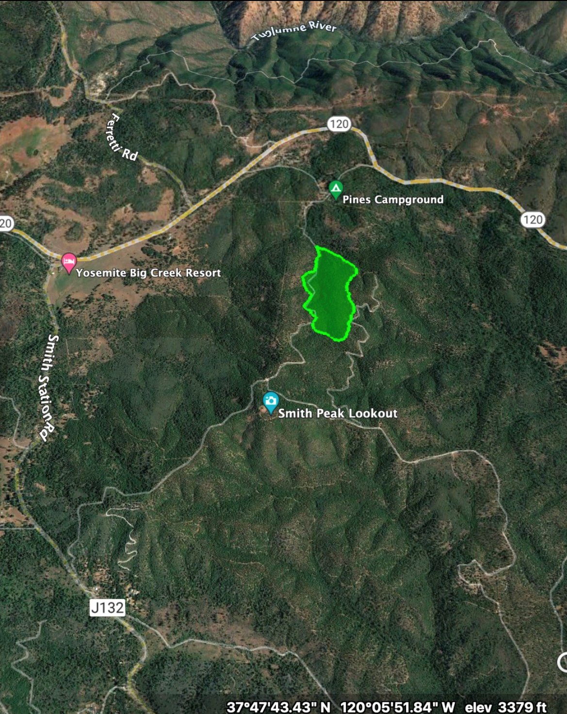
Location: Highway 120 at Smith peak lookout rd
Reported acres: 10
Rate of spread: moderate
Report on Conditions:
Structure threat:ukn
Resources:ukn
Hazards:
Weather:
Radio channels:
Scanner link:Cal Fire Working Incidents - TCU Live Audio Feed
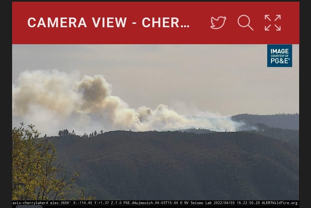
Webcam link:ALERT Wildfire
Agency Website:
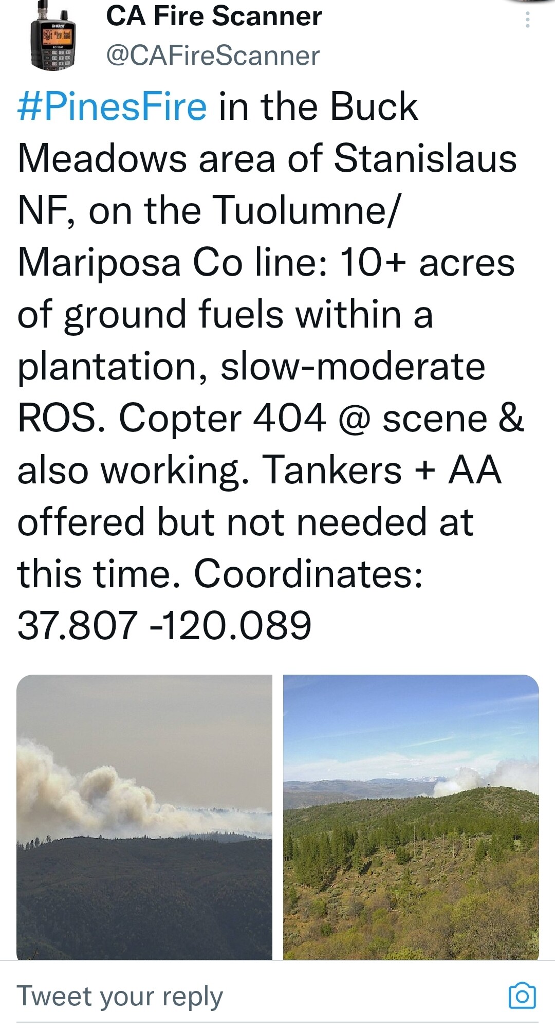
Burning in ground fuels of a tree plantation ic saw no need for fixed wing(30 min ago).


OCFA’s FIRIS Intel 24 on the Pines Incident, Stanislaus National Forest. Fire is mapped at 67 acres at 16:50 hours.
https://twitter.com/FIRIS/status/1510789361637330947/video/1
4 Likes
100% contained.
7 Likes