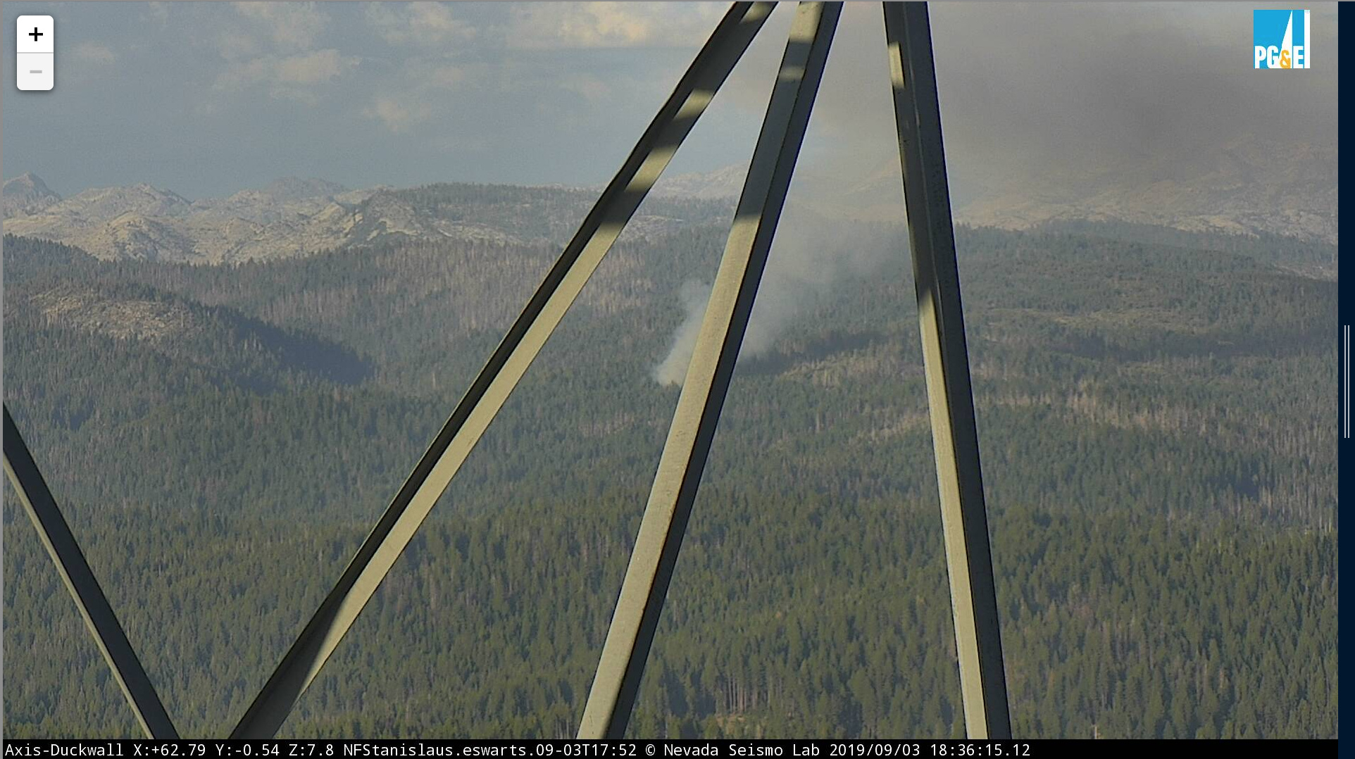
Visible on the Duckwall cam - http://www.alertwildfire.org/sierra/index.html
Looks to be north of Cherry Lake.
Visible on the Duckwall cam - http://www.alertwildfire.org/sierra/index.html
Looks to be north of Cherry Lake.
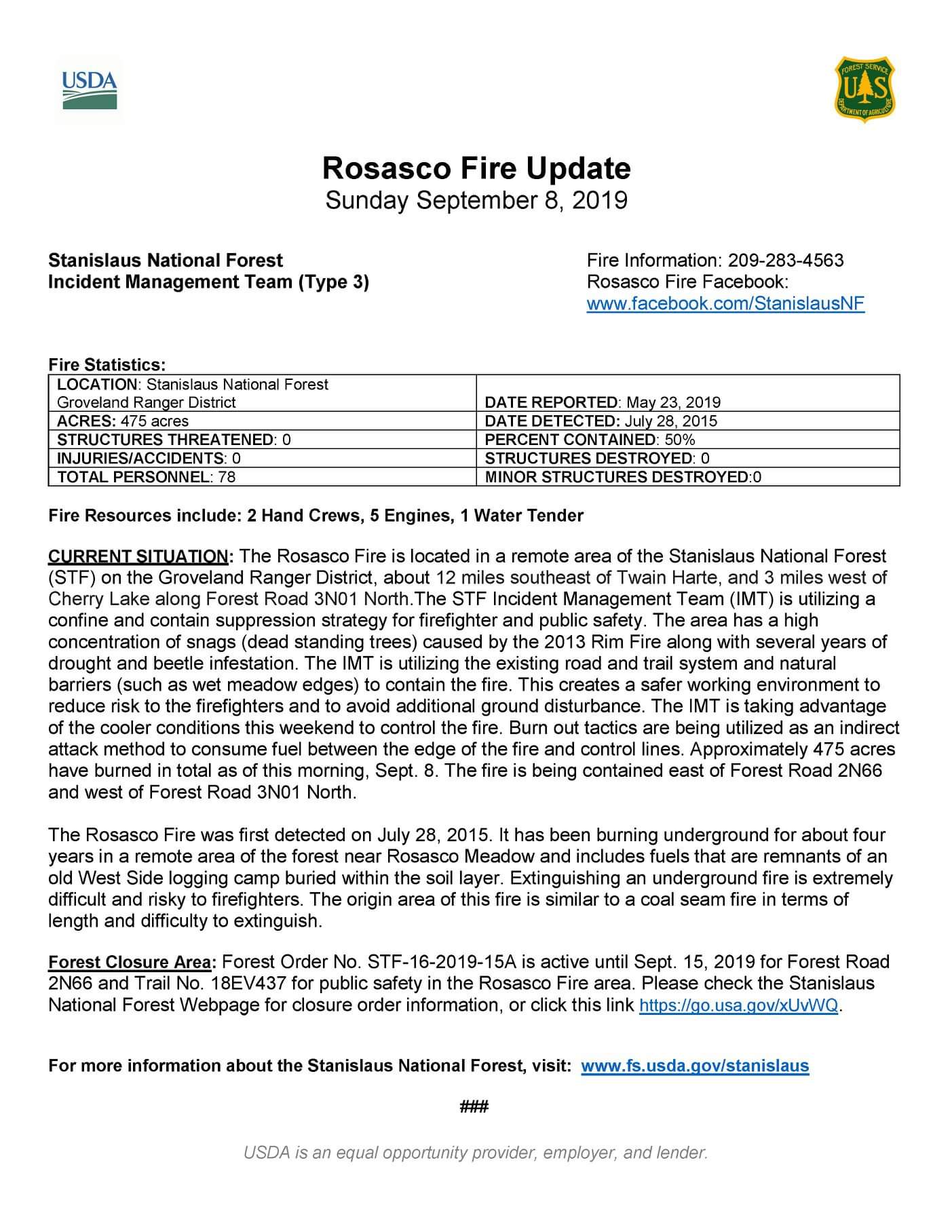
So technically the Rim fire is still not out after 6 years?
That article makes it sound like it’s a 40-50 year old fire still burning, kind of a confusing read.
Another article from 2015 say it’s a hotspot leftover from the rim fire, it would be interesting to know what is burning.
I’m just gonna go ahead and say it. Sounds like one of those sand fires everyone keeps talking about. 
You beat me to it!!!
Wait…what
Buddy of mine works on STF, he says it’s an old logging deck buried many years ago. Pops every spring, well 6 years later and Rim continues,
Considering the whole sand fire legend was started by an NPS employee sounds good LOL
BLM guys with a parkie.
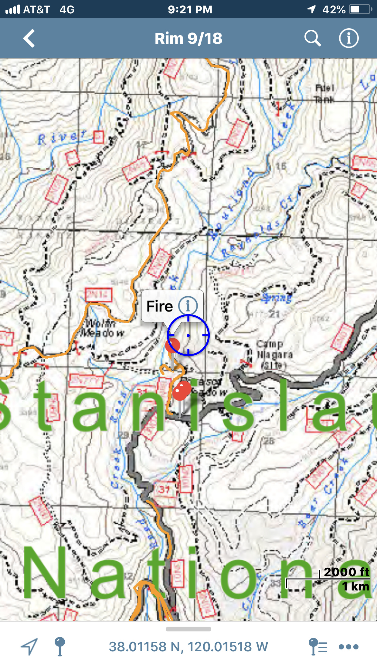
Fire on the Stanislaus??
Sierra -Foothill Cameras
Duckwall camera
Thats the Prescribed burn near cherry lake but they are calling it a firing op because there’s something burning underground leftover from the rim fire in 2013.
Looking at the duckwall mtn. cam to the east, definitely much larger fire in timber on the Rim burn scar.
Wide base today.
How do they commit resources (if any) during peak season.
It’s been in a constant monitor status since 2014 and always seem to get a smoke check report in that area. For the last week they have been firing off sections near the hot spot, actually tonight looks fairly calm compared to recent nights.
they are trying to burn off above ground fuels due to a underground coal spur that has been burning since the rim fire but only recently detected (???). better than getting a rx and all the hassle and cost tagged to the rim fire.