
State ID:CA
3 letter designator:TCU
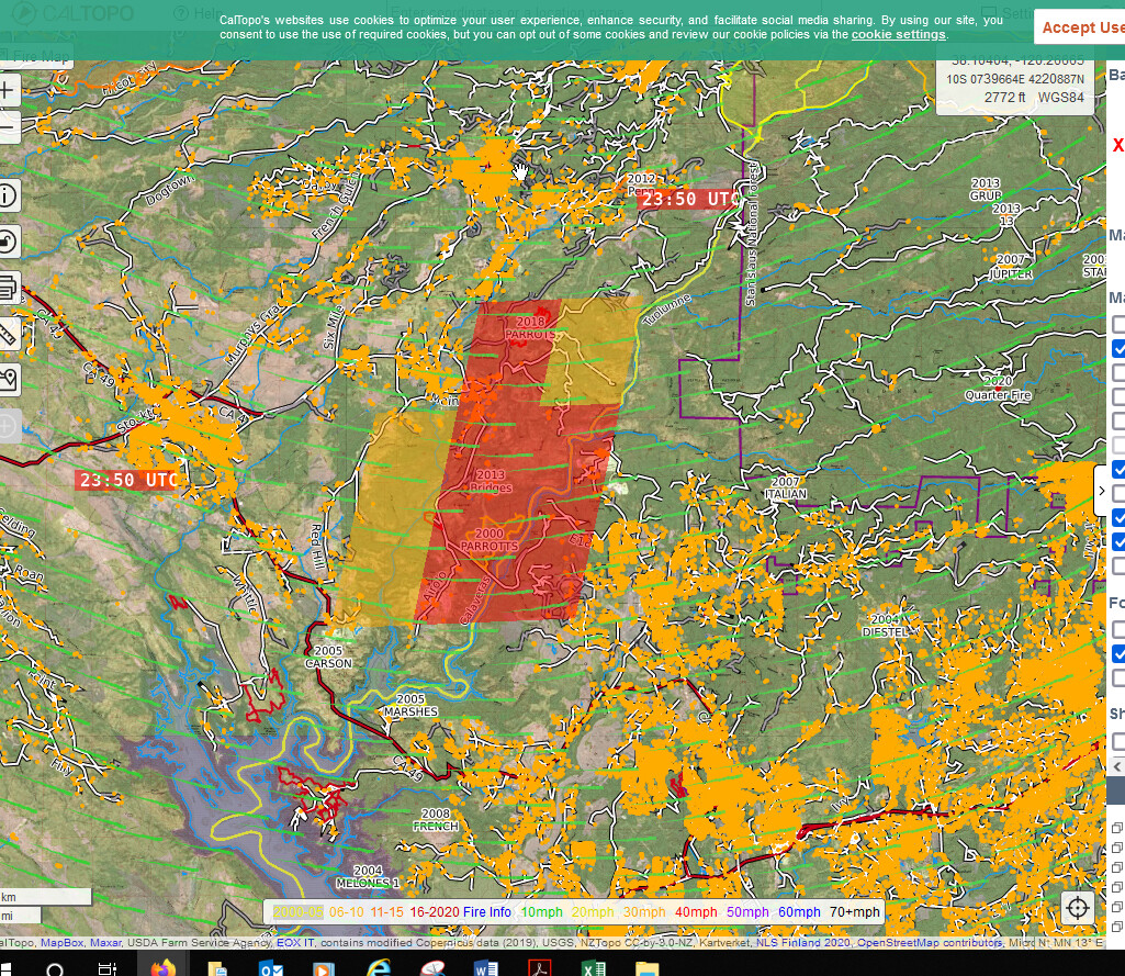
Fire name:Airola
Location:Stanislaus river arm Calaveras side 1/2 mile up from parrots ferry bridge
Reported acres:25
Rate of spread:moderate
Report on Conditions:started at shoreline burning up hill in heavy brush, no vehicle access
Structure threat:
Resources:
Hazards:
Weather:
Radio channels:
Scanner link:
Webcam link: ALERTWildfire | Sierra-Foothills
Agency Website:
Evacuations: ArcGIS Web Application
3 Likes
100 acres, M to RROS, 1/2 mile up from bridge and started up from the lake. no vehicle access at this time.
This will be burning in chamise and grass mostly chamise tell it hits the top. This is very bad Folks a start we didn’t need.
6 Likes
AA states 3-500 acres with EROS. Potential for 2-3000 acres.
6 Likes
Now burning in brush and oak woodland with multiple exposure.
2 Likes
ST 9423C and Castle Crews 1&2 to the fire Immediate Need
1 Like
KCRA Live Copter 3 has live footage

4 Likes
Scan/ 10 dozers on order once they get to staging let’s get them into Romeo and get some indirect line going Staging area at hwy 4 and Parrotts Ferry Rd… Per scanner
1 Like

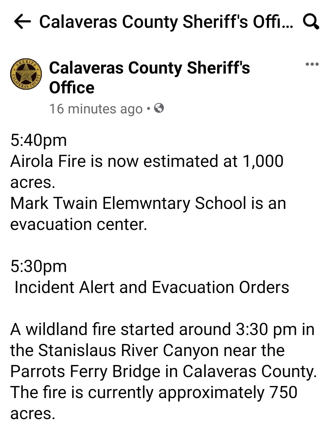
5:40pm
Airola Fire is now estimated at 1,000 acres.
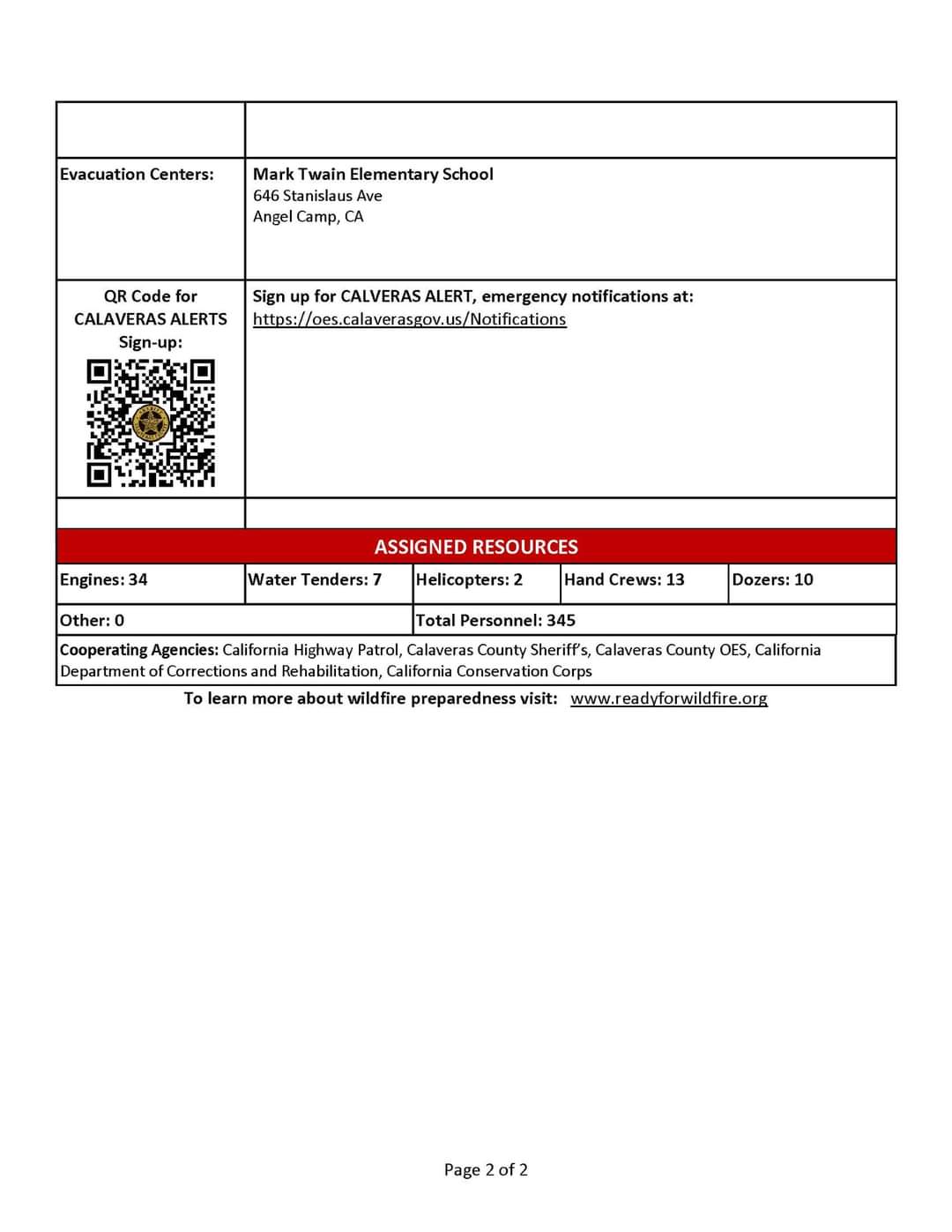
Mark Twain Elemwntary School is an evacuation center.
5:30pm
Incident Alert and Evacuation Orders
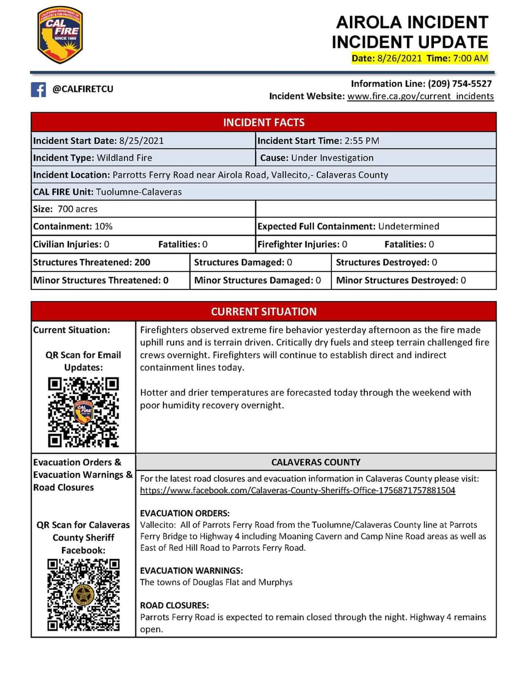
A wildland fire started around 3:30 pm in the Stanislaus River Canyon near the Parrots Ferry Bridge in Calaveras County. The fire is currently approximately 750 acres.
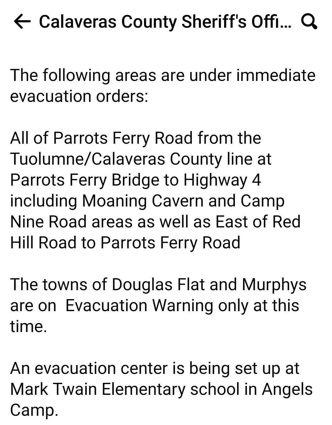
The following areas are under immediate evacuation orders:
All of Parrots Ferry Road from the Tuolumne/Calaveras County line at Parrots Ferry Bridge to Highway 4 including Moaning Cavern and Camp Nine Road areas as well as East of Red Hill Road to Parrots Ferry Road
The towns of Douglas Flat and Murphys are on Evacuation Warning only at this time.
An evacuation center is being set up at Mark Twain Elementary school in Angels Camp.
1 Like
AA says he’s double the retardant on right flank. Buy some time for the Dozers. Sounds like the dozers are walking over that way. Also left flank looking good holding in the retardant and crews are making good progress on that flank. I thought he said 540 acres but not sure.
5 Likes
AA had two VLATS from MCC drop around 1930. Also was using the copters and S2’s till cut off. Heard three copters for tomorrow order. Fire was looking a lot better this evening. Still a lot off work to be done and lines to put in. For having 20 of it’s front line engines out of county. That was solid work by all involved. Damn good job! My worry is that eastside down by the lake hooking around and running up slope. That should have a good down canyon wind tonite. Maybe that will slow it down?
9 Likes
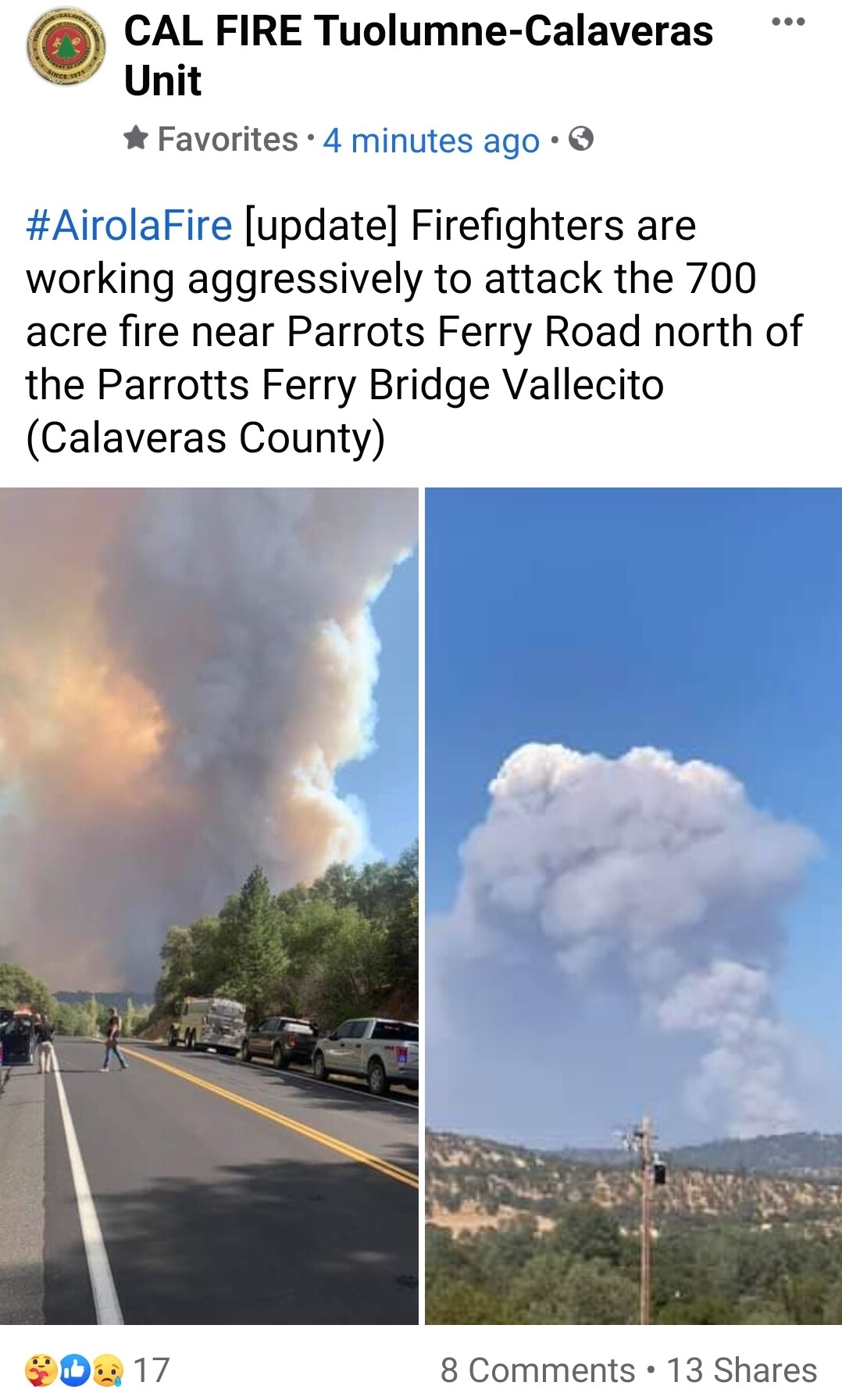
#AirolaFire 8-26-21 Morning Update
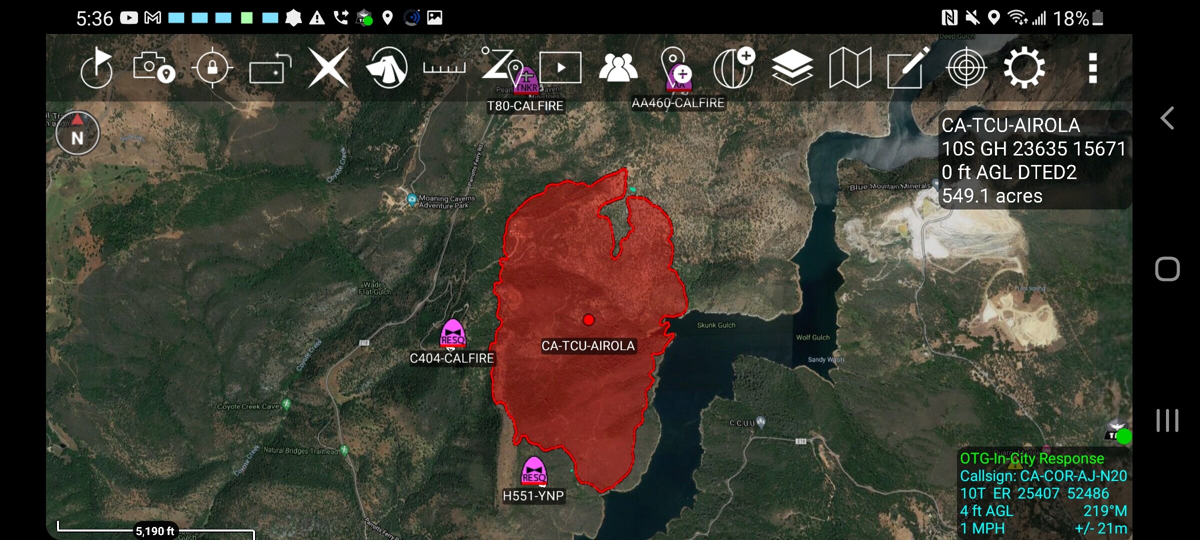
700 Acres, 10% contained near Parrots Ferry Road and Airola Rd, Vallecito (Calaveras County)
2 Likes
#AirolaFire off Parrotts Ferry Rd and Airola Rd, west of Columbia in Calaveras County is 700 acres and 55% contained.
CAL FIRE Tuolumne-Calaveras Unit
3 Likes