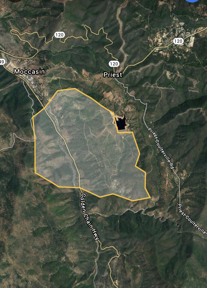
updated estimate: 1200 acres E of Hwy49 / 500 acres W of 49
4 Likes
Incredibly rough estimate, just based off listening to scanner logistics.
Google earth called my shape 1,683 acres. But it is very rough.
Big jackass creek runs E-W just south of fire.
Rattlesnake Creek branches from Big Jackass creek north into the fire.
4 Likes
Yikes my husband is one of the few dozers on this one. Please keep any info coming … that country is scary and steep!
11 Likes
I’m getting out of the scanner loop because TCU Broadcastify channel stays on dispatch and IA channels…
But reports of spotting across Big Jackass and running along the ridge.
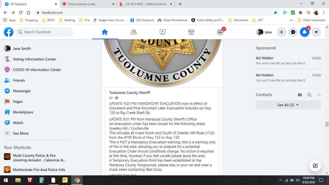
Expanded evacs to include Boneyard on highway 132, and highway 120 east to second garrote including Cherokee trail and Yosemite springs.
5 Likes
They are opening up the old contingency dozer lines from the detwiler fire.
3 Likes
UPDATE 8:08 PM Old Hwy 120 is now under mandatory evacuation.
2 Likes
3 posts were merged into an existing topic: CA-TCU-Mocc??
The Sacramento Regional IMT ( a type 3 IMT) has been mobilized to this incident, reporting this morning. This may be a sign of where the state is now with IMT availability or the unit hopes to pick it up in the next couple of days, and only needs logistics and plans support. Time will tell.
3 Likes
2800 Acres AM Update
3 Likes
2 posts were merged into an existing topic: CA-TCU-Mocc??
Firing ops in division M going well.
4 Likes
2 Likes
More firing ops took place earlier and went well.
5 Likes
The folks here must have done a great job. Demobing resources. XLC 1202A just sent from here to the Dolan on the LPF.
1 Like
Great work done by all on this one! The crews put in solid line in some extremely steep rough country and the engines punched line in right behind them.
And on to the next!
9 Likes