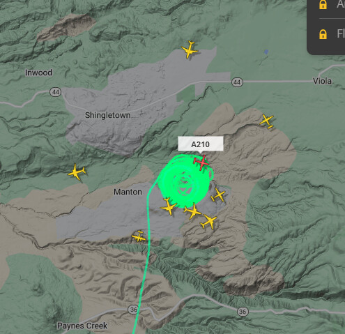
CA-TGU-Forward

State ID: CA
3 letter designator: TGU
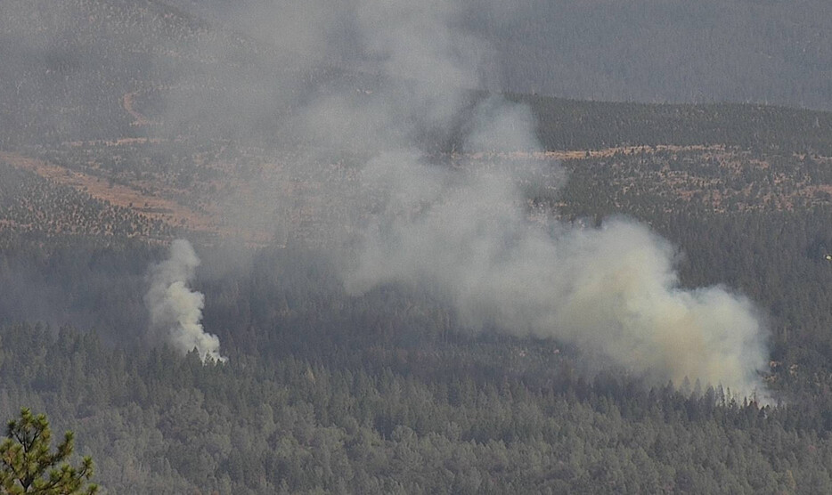
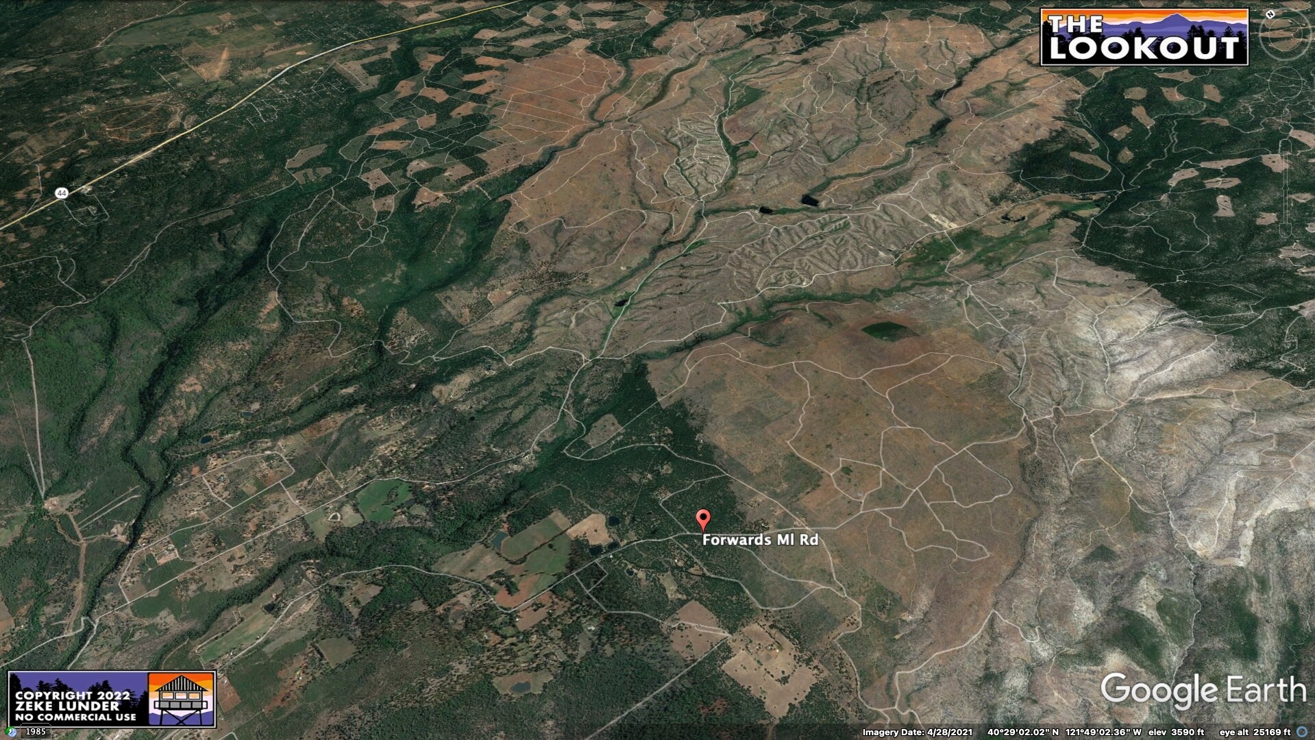
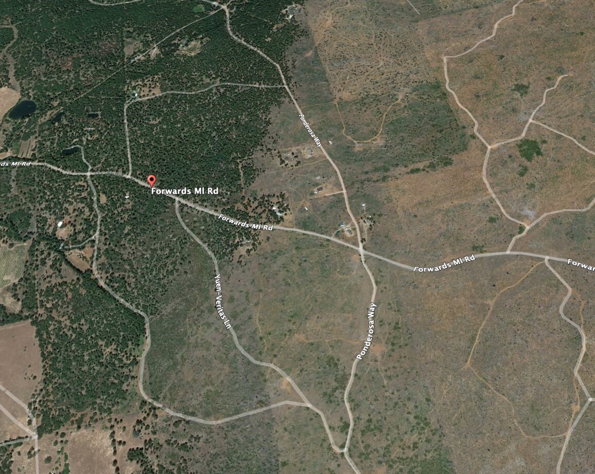
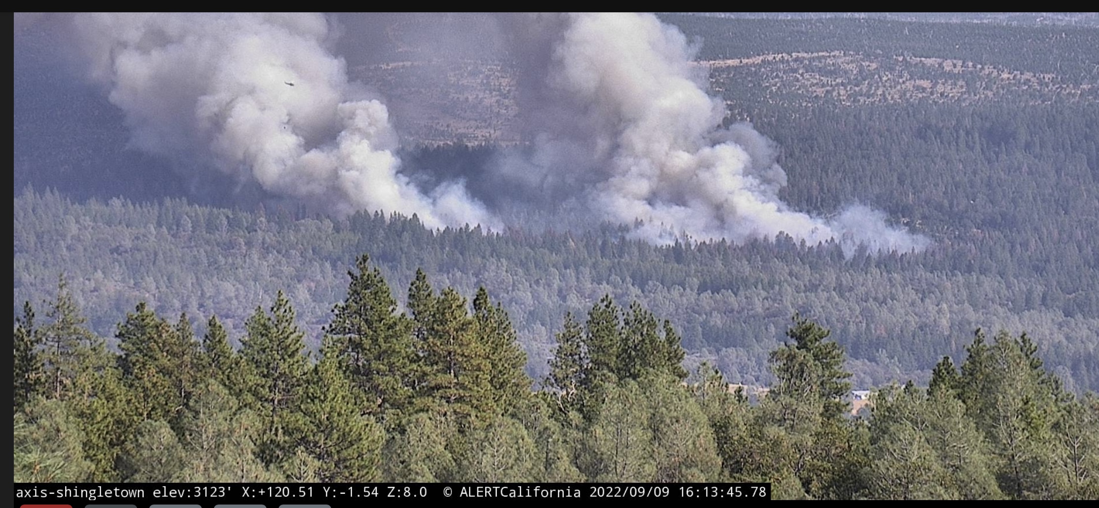
Fire name: Forward
Location: Ponderosa Way x Forward Road
Reported acres: 3-5
Rate of spread: MROS
Report on Conditions: Timber with access problems
Structure threat: Yes
Resources: Full wildland dispatch from TGU,
Hazards:
Weather:
Radio channels:
Scanner link:
Webcam link:Shingletown CAM
Agency Website:

https://www.alertwildfire.org/region/shastamodoc/?camera=Axis-Shingletown

New start

2 Likes

Forward Fire, Ponderosa Way @ Forward Rd. Manton, AA 2-3 ac. in the timber MROS, additional engines and aircraft requested

1 Like

There is a spot way out ahead of the main fire.

4 Likes

That’s just west of the massive 2012 Ponderosa Fire scar.

3 Likes

Inskip hill cam looks like it maybe getting well established.

https://www.alertwildfire.org/region/shastamodoc/?camera=Axis-InskipHill1

3 Likes

Inskip cam portrays an entirely different picture than the apparently frozen Shingletown Cam.

1 Like

Shingletown cam been out of commission since 330 - no good ideas other than Inskip upwind

3 Likes

75 acres, critical rate of spread, AA requested 4 addl tankers

3 Likes

Jake, It’s back up running now

3 Likes

Weather
PGE Bluff Springs 98F 12RH W7G13 - Forward Rd at Ponderosa - right at fire

PGE Manton Ridge 97F 13RH SW 6G13 - out in front of fire to NE
PGE Power House Rd 103F 12RH W 7G11 behind and upwind the fire to SW

3 Likes

Can hear some aircraft traffic here

3 Likes

FIRIS providing a more sobering 25 acres total for the main and spots, both side of Digger Creek (county line)

AA taking 2 VLAT’s from MCC

5 Likes

Inskip cam showing numerous more spots out in front of the fire

4 Likes

Looked like a copter tried working one of them, but to no effect.

3 Likes

Per IC fire currently 35-40 acres

2 Likes

Intel ship just mapped it at 95 acres

1 Like

image

There are at least 7 tankers in this shot , coming out of Redding and Sac

1 Like

Im wondering if the Ponderosa burn scar from 10 years back is going to have any effect on this fire’s progression when it makes it to the site. Satellite imagry has that area looking incredibly sparse but it looks fairly lush on the cams.

1 Like

From what I’ve seen from being there recently is that its really hit or miss. There is a lot of brush growing back but some areas are sparse. There’s definitely a good amount of fuel.

2 Likes

I posted this in the Q&A

4 Likes