#RanchFire off Colyer Springs Rd and Raglin Ridge Rd, southwest of Red Bluff in Tehama county is 550 acres and 10% contained.
3 Likes
Air Attack up over fire. Div A first priority, Div M second priority.
Requesting all four type2 and two type1 rotor over the fire, and just requested four type3 and two type1 tankers over the fire. Helibase set up at Red Bluff Airport.
4 Likes
Fire activity is picking up looking at the eagles nest camera.
1 Like
They’ve lost the SW corner of the fire, Division A. Last numbers I heard was 20 and 50 acre slops RROS with some ranch structures ahead of it. With that loss they upped the aircraft order to four addl T1 rotor and two VLAT.
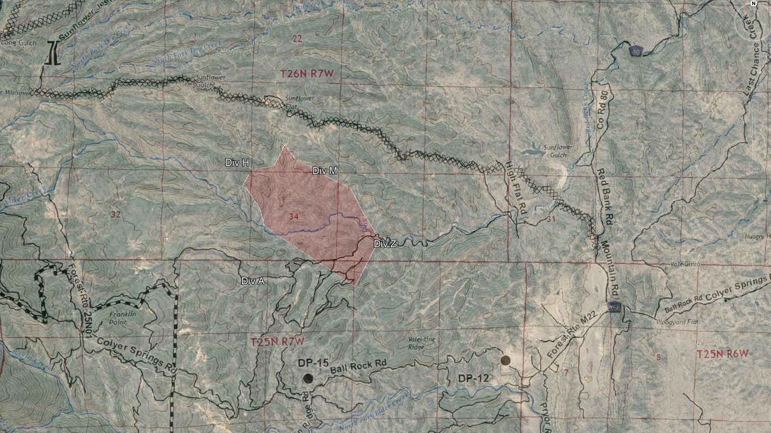
Below is a map I created estimating the fire area based on MODIS/VIIRS, radio traffic, and yesterday’s photo from air attack. I have not heard reference to a Div Z though, that’s more of a place holder. The image overlay is southern end of TGU-Red Bank’s final Ops map, which shows the dozer line they put in along Sunflower Jeep Trail, and some more local references to the roads out there.
10 Likes
750 acres 15%
3 Likes
Two Type 6 ST ordered out of Region IV to report to Incident 0700 tomorrow.
#RanchFire off Colyer Springs Rd and Raglin Ridge Rd, southwest of Red Bluff in Tehama county is 1,308 acres and 15% contained
Fire has reached Colyear Springs Road near Raglin Ridge Road as of 8am. Control objectives for the south side of the fire will be to keep it north of North Fork Elder Creek Drainage. MNF resources including Dozer 3 were brought in last night I believe to help in the Div A.
Evac warnings extended now to Pryor Road, Moody Road and Cameo Lane.
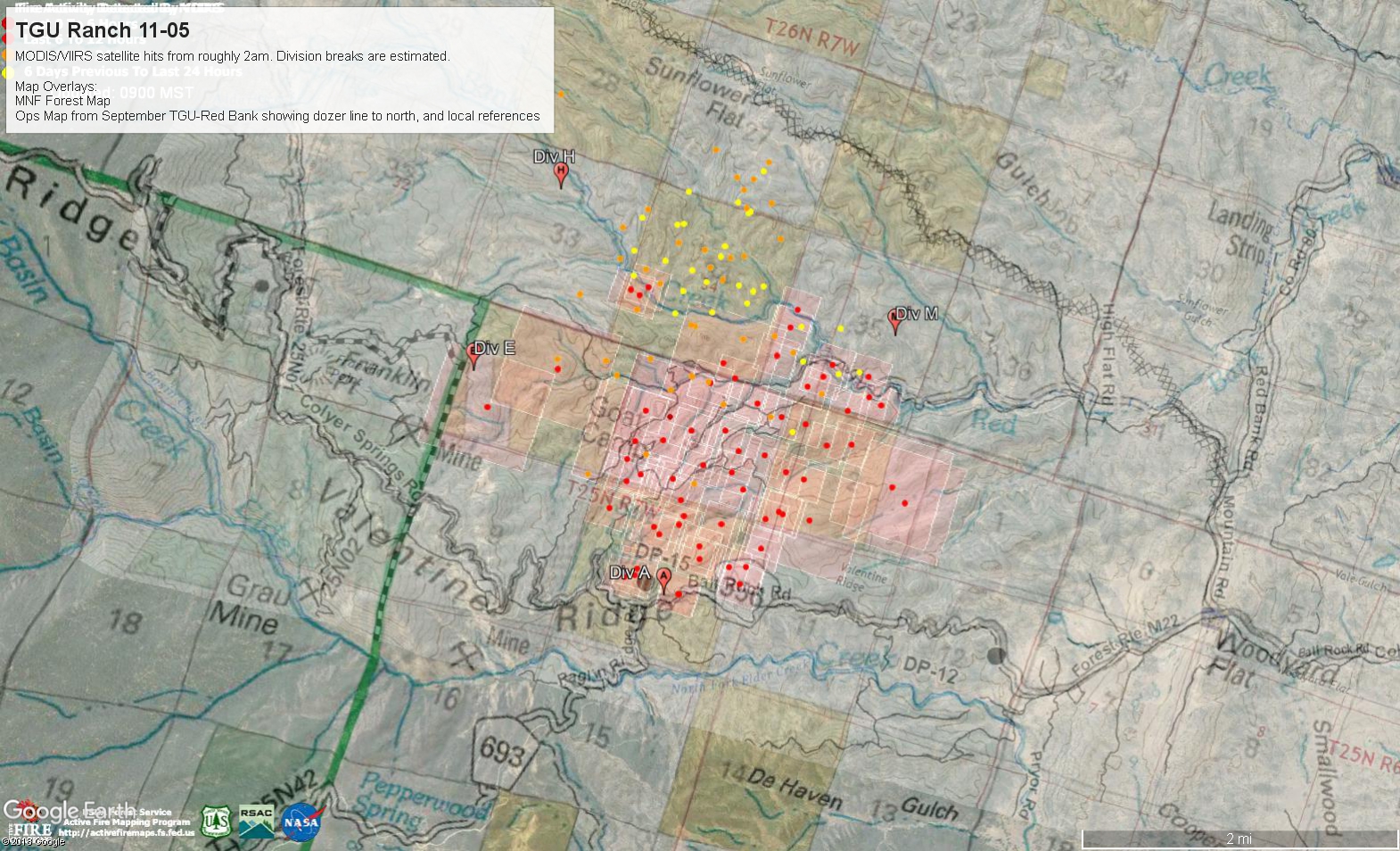
The Norcalscan GIS Dept produced the map below, MNF Forest Map, old Ops Map from September’s TGU-Red Bank incident showing dozer lines on the north end and local references, crudely overlaid on Google Earth, as well as MODIS/VIIRS from approx 2am this morning, and estimated Division breaks for day ops. Nothing published publicly yet.
6 Likes
130pm: 3760 acres Lots of spotting south of Colyear Springs Rd but so far wrapping line around them with dozer. Still in heavy brush. Lots of iron ordered up for immediate need, agency or private. Going to do some large defensive firing ops to try and hold Colyear Springs Rd east down into the grass.
Playing with some maps. https://caltopo.com/m/LEN1
Nothing current on the NIFC FTP side yet, just Monday morning’s perimeter.
3 Likes
3600 acres 15% contained per Cal Fire.
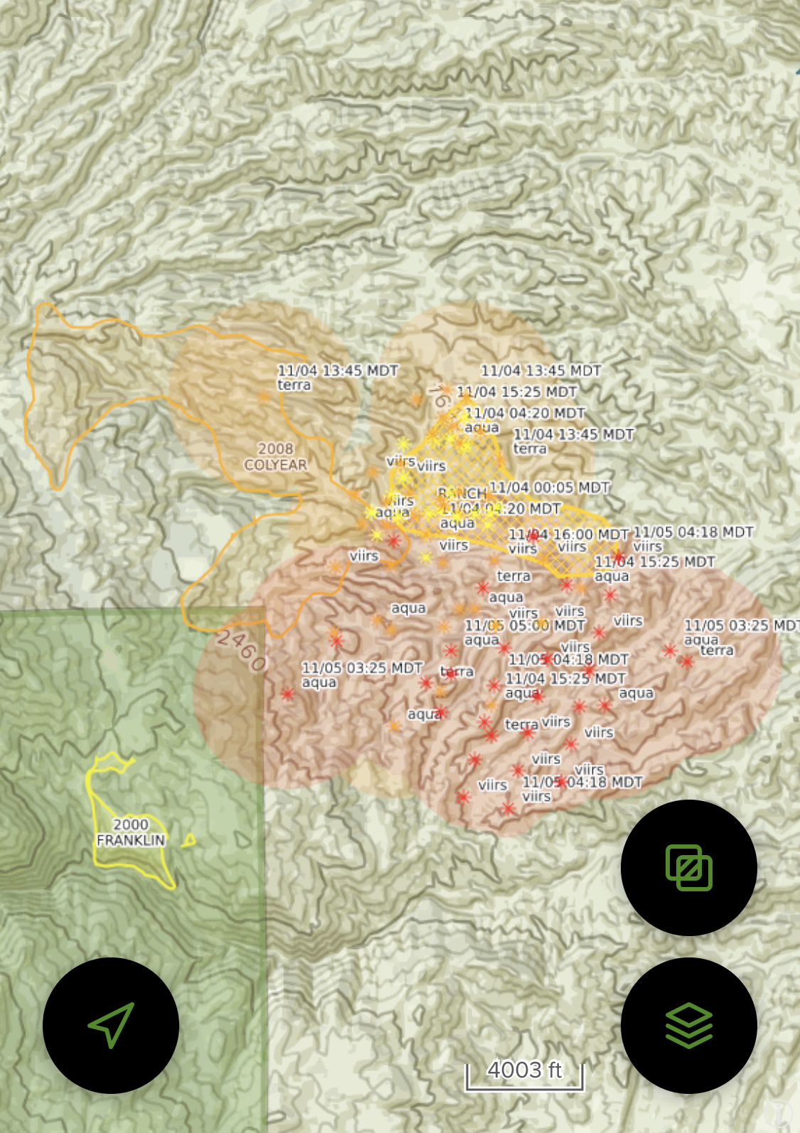
No IR heat showing on GOES17, and MODIS/VIIRS had a few hits from last night’s firing ops. Looking real good. Going to continue the firing ops this morning along Div A and the southeast corner of the fire, bringing the fire down into the grasses out of the brush, as well as some established dozer line and road systems along Red Bank Road.
They are planning and prepping for a big firing op later on the west and north sides to tie in dozer line and road systems to the black. If this piece goes through as planned it’ll double the fire size.
So expect some ugly-looking smoke columns on the cams today.
13 Likes
Fire is dead along the western edge. Crews were able to go in and put a direct line in. Unless something changes today they will probably finish the firing ops off Div A and cancel the rest of the firing ops
4 Likes