State ID: CA
3 letter designator: TGU
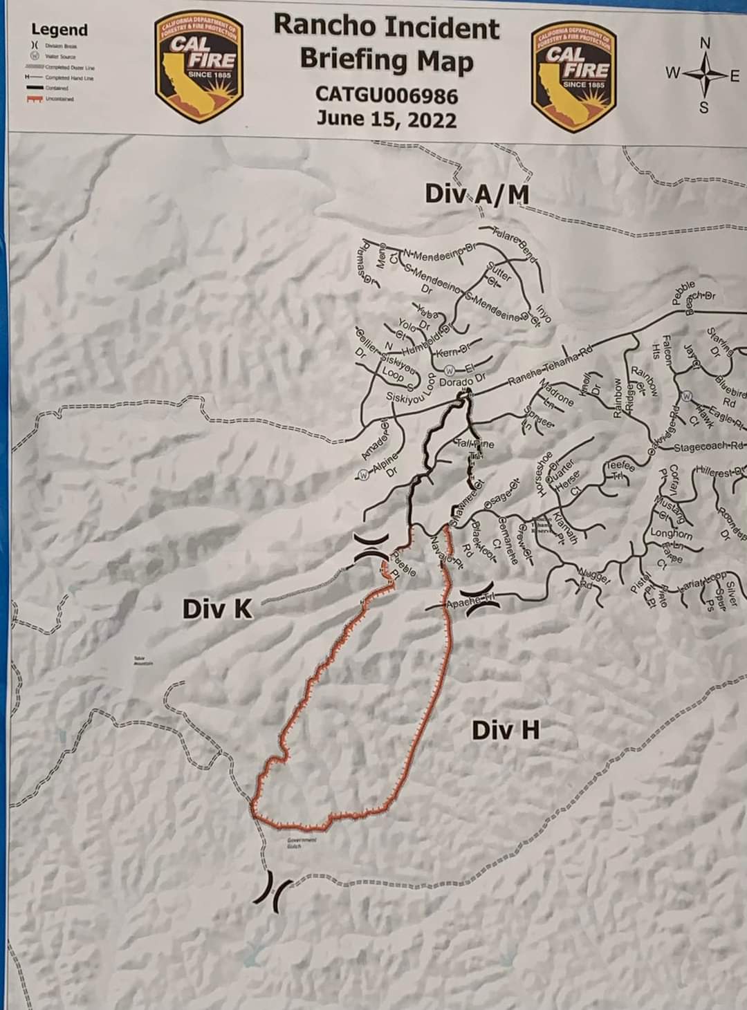
Fire name: Rancho 2022
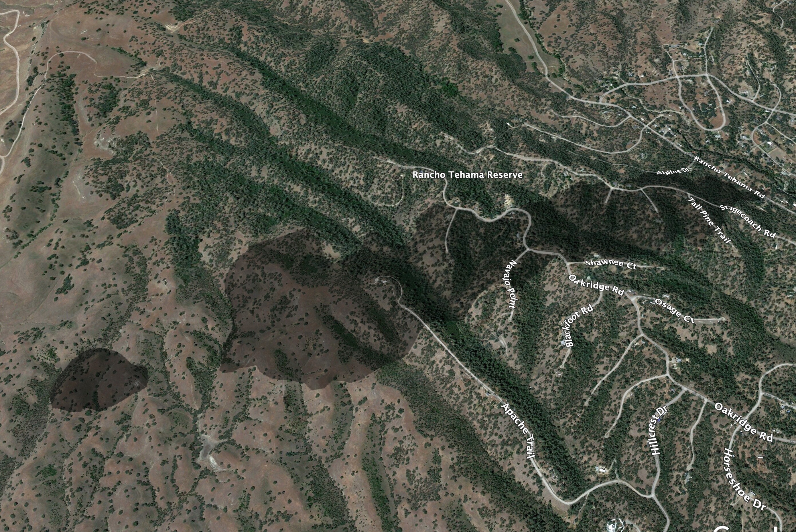
Location: Rancho Tehama, west of Red Bluff
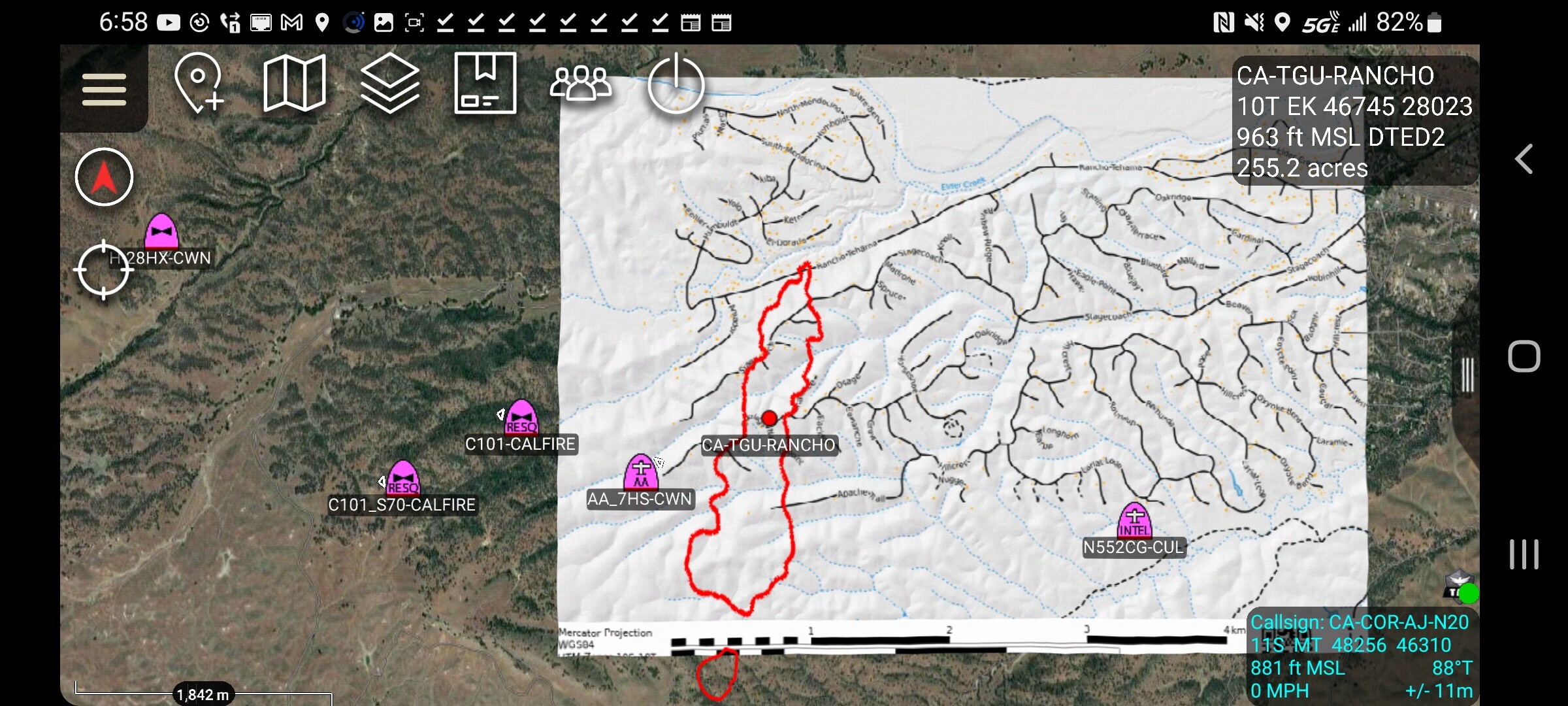
Reported acres: 60+
Rate of spread: Rapid
Report on Conditions: 60 acres with spot fires and structure threat.
Structure threat: Multiple structures threatened.
Resources: Full TGU response and large additional resource order.
Hazards:
Weather:
Radio channels:
Scanner link: Tehama County Fire Dispatch Live Audio Feed
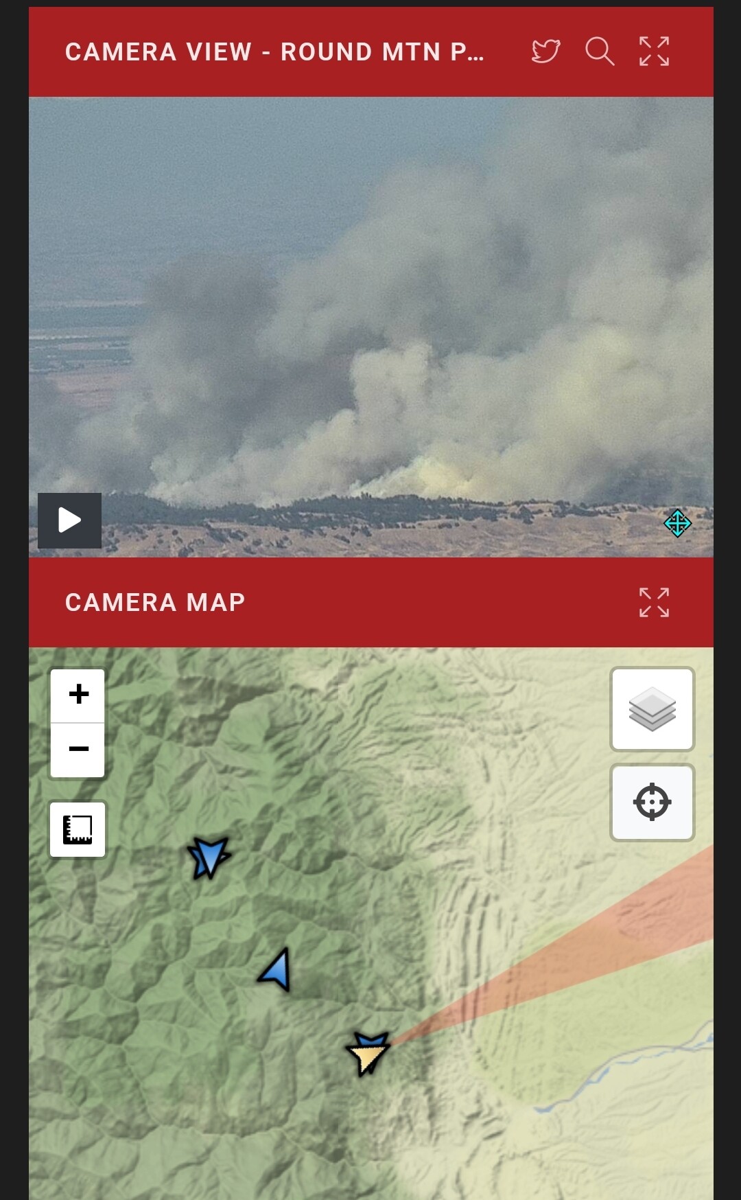
Webcam link: ALERT Wildfire
Agency Website:
3 Likes
Per IC: 80-100 acres. Crossed Apache Trail.
2 Likes
I just copied Copter 104 being dispatched to this area. Looking at it on Google Earth, there is a very large and difficult structure threat.
3 Likes
This feed will have command, air tactics and air/ground
100 acres per air attack. [Apache Trail](Apache Trail https://goo.gl/maps/urbuFJsjuaKn4i1L8) is one of the primary roads with spots that have become established.
2 Likes
This scanner has great audio of the fire. Ground, air, etc
3 Likes
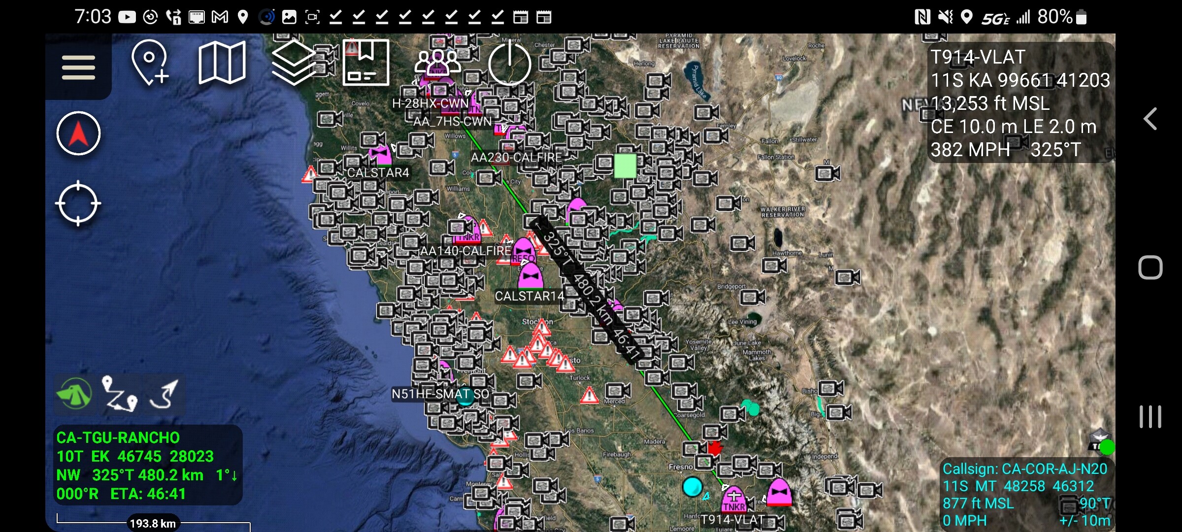
AA requesting 2 VLAT, Type 2 Copter, no divert on aircraft for life safety threat.
5 Likes
IC: requesting medical helicopter to airport. Moderate-dangerous rate of spread.
2 Likes
IC: 250 acres, crossed Apache Trail, requesting 8 dozers, staging area manager, additional tac channel.
4 Likes
Tankers 910 and 914 assigned and are coming out of San Bernardino.
6 Likes
Approximately 600 Acres (this may change with better mapping later) activity has moderated some and good progress is starting to be made. https://link.watchduty.org/incident/297/reports/1594
3 Likes
2050hrs per IC: 700 acres, 20% contained, 10 structures destroyed, 4 damaged, 150 threatened.
10 Likes