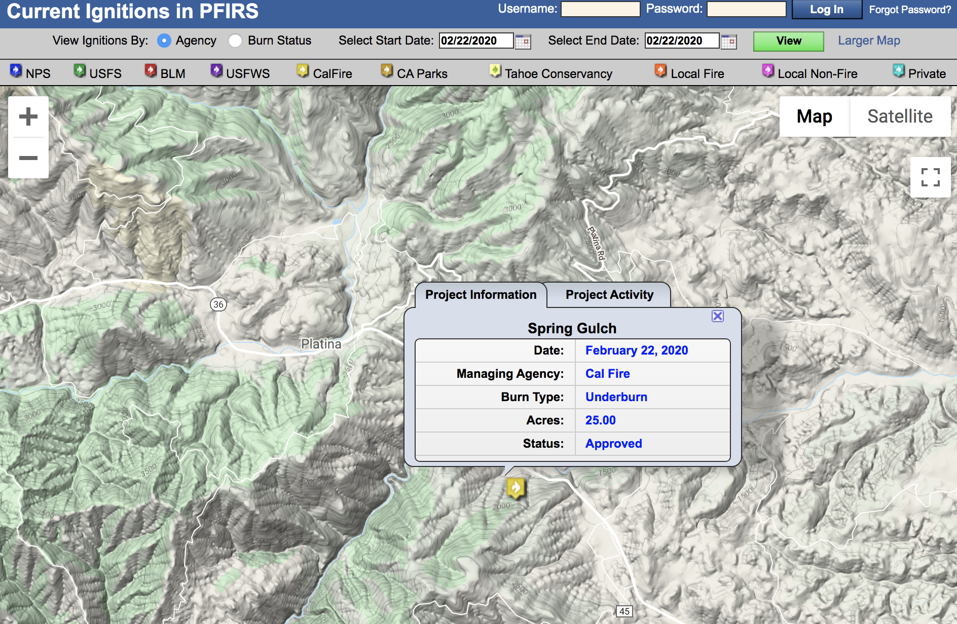
Actrive control burn in the Beegum Road / Highway 36 area within TGU/SHU/SHF response area. Per FB page, there has been an escape on the 200 acre burn with 100 prescribed acres burn with a rapid rate of spread.
2514 at scene and is now IC, concurs with previous size up (didn’t catch it) and wanted to continue all equipment and would be placing a call for more information.
Anybody on this thread care to comment how it burned if you were there? I’m curious as to how it burned in February and what the fuels are currently like…
Let all participants use this as a learning tool to educate and reduce risks to future vm burns they are involved in.
Let all non participants realize this is the cost of doing business. That sometimes the risks are unable to be completely mitigated, but that the participants while remorseful of any adverse effects will use this as a learning tool to educate and reduce risks to future vm burns.
Let no one cast aspersions as all this does is make future needed/required vm burns just that more difficult.
We did a VMP burn in Butte County last week in oak litter and some grass thatch. Greenup is vigorous and the only places that really carried fire were grass thatch and litter. We were on a fairly shaded West-facing slope, at the cool end of our prescription, with partial overcast. Fine fuel moistures got down to about 7%, temps were in the mid-60s, and our RH bottomed out about 30%. Probability of ignition never got above 50%.
The best fire effects we had were on slopes where we had some direct (1-2mph) wind to move things along. In general, we could have used a little wind to get a little better consumption of the 10hr fuels.
There are a couple clips of fire behavior here: