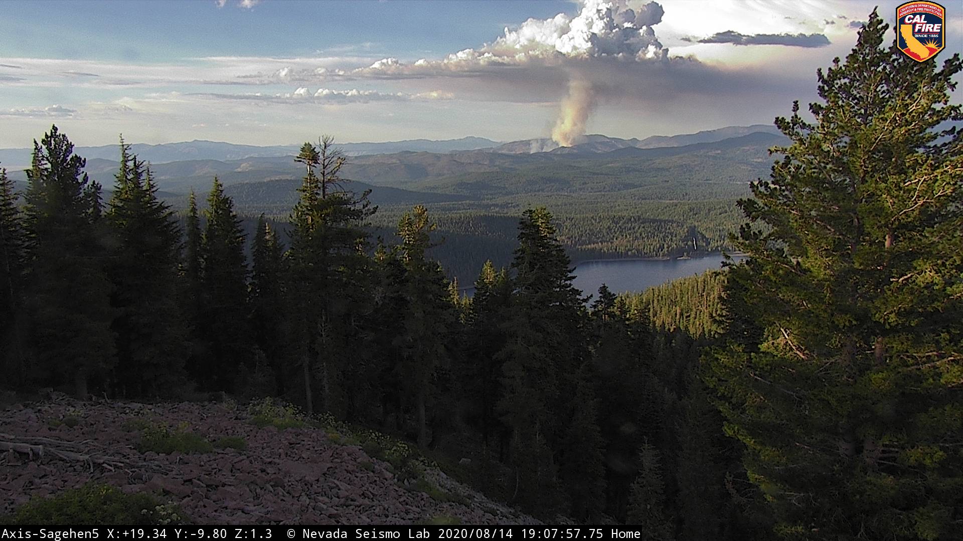
Beckworth Cam showing a significant column building in the SE corner of the Sierra Valley just east of Loyalton, very northern tip of the Tahoe. While the map shows a few bits of the HTF in there as well, my intel shows TNF though for now. Aircraft orbiting here on google maps.
T88, 89 on it load return from Reno Stead
Also Babbit Peak cam - just south of the fire.
WX
PGE Liberty on the west side of Sierra Valley - 91F 20RH W7G19
TNF Portable - south of the fire in the Smithneck Creek drainage it looks like, midslope, 87F 22RH N2G5
2 Likes
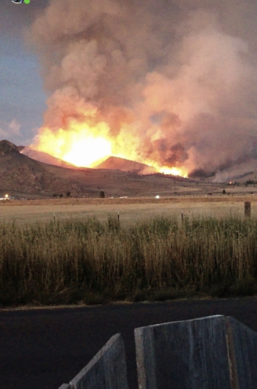
Possibly a lightning strike? Looking at the radar, looks like a cell just rolled through there!
2 Likes
Those coordinates go to downtown Loyalton it looks like. Aircraft orbiting here . TNF Wildcad is a day old it looks like.
LNF Copter 510 enroute
LOP
August 15, 2020, 2:00am
8
Looks like 2 of the MAFFS from MCC working it
http://www.alertwildfire.org/tahoe/index.html?camera=Axis-Sagehen5&v=81e004f
not sure if the fire created the pyro cloud or it it mixed with a passing thunderstorm?
stymie
August 15, 2020, 2:06am
10
Staverville Canyon. East of Loyalton. South of Mt. Ina Coolbrith. TNF
3 Likes
A904G
August 15, 2020, 2:13am
12
T-910 diverted to this fire
1 Like
stymie
August 15, 2020, 2:30am
13
This needs to be moved to I A…
2 Likes
LOP
August 15, 2020, 2:33am
14
Or at least start an IA. I don’t have enough info
stymie
August 15, 2020, 2:35am
15
I can’t get it to let me start one…
belle
August 15, 2020, 2:43am
16
Do the three hour rewind and you’ll see some of the thunderstorm activity:
http://www.alertwildfire.org/tahoe/index.html?camera=Axis-Constantia&v=81e004f
Or, the Babbitt camera… the rewind shows the thunderstorms too.
1 Like
I will open an IA thread in 30-45, if one isn’t opened by then. It’s a little tough on an iPhone to do.
1 Like