Thanks for the update.
Lots of air tankers timed out today.
Yes, Placer/El Dorado county line and FS Tahoe/Eldorado NFs boundaries don’t follow each other. Bunker Hill LO on ENF is a couple of miles into Placer Co. If I recall correctly, county line is down around the Airport Flat CG area. The FS and county boundaries get closer as you go west, down the Rubicon, but don’t ever match each other (I think?)
Good morning. Addl extended freqs assigned today…
Air/Ground 166.6125
Air/Ground 159.405 (192.8) CDF Tac 22
Victors 132.875
Two additional A/G’s, not sure if the original was working for them or not (interference) or they’re zoning two tactical A/G’s and leaving one for command, etc. Without the 205 not sure on actual assignment.
NOPS morning update puts it at 6,870 acres 0%
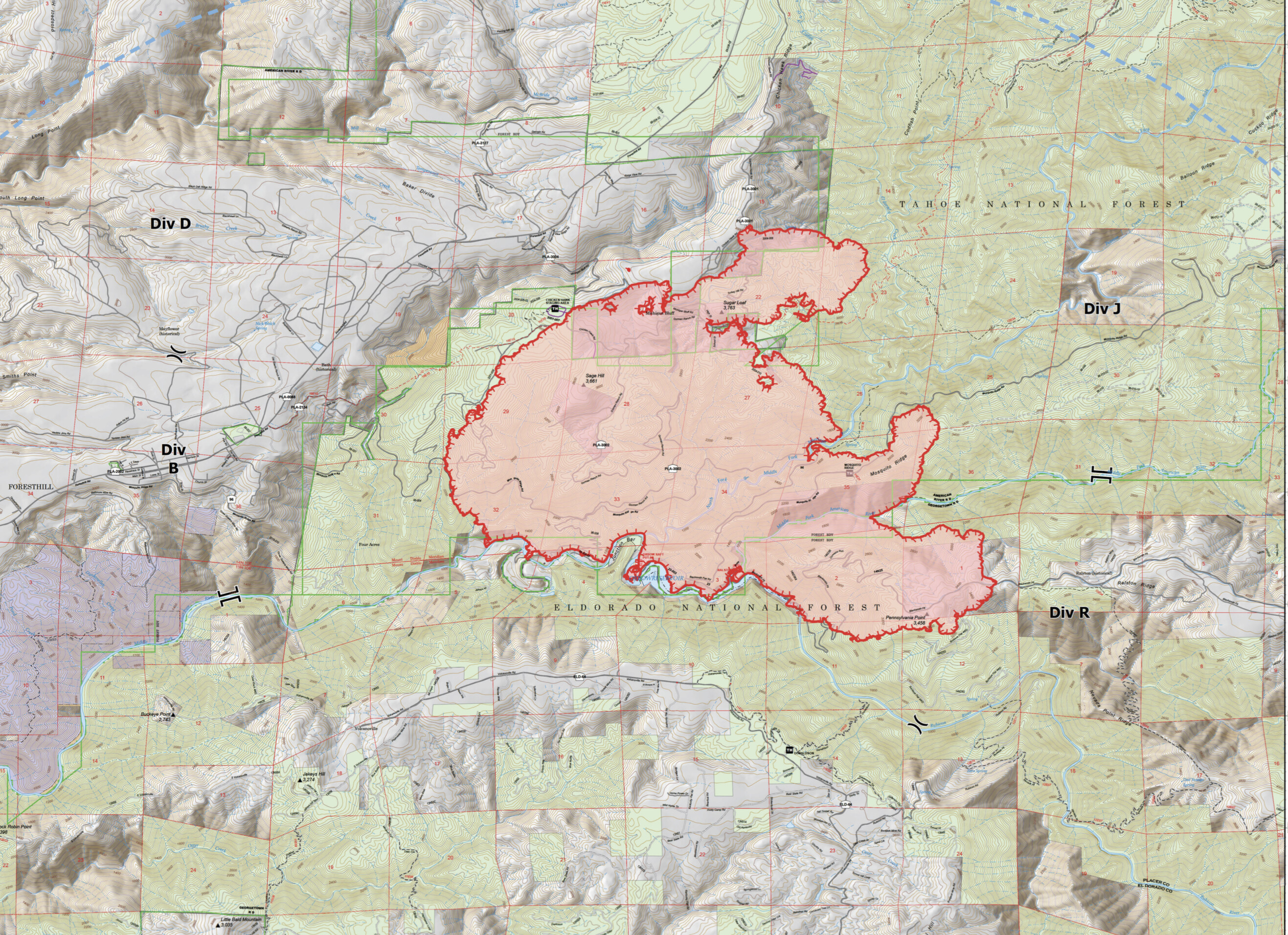
Ops Map for Today (sorry no time to run the original file through the Deluxe Fire Map Resizer Machine this morning, so screen shot is what you get.)
Found a scanner covering this incident exclusively
Fire is impacting Volcanoville Rd. and there are spots south of Volcanoville Rd.
That’s a scary amount of energy
Northern California Major Incident Feed is now live with Command, Air to Ground, Air Tactics and MCC Base Victor
Topped 40,000 ft. Watch out for lightning.
Eldorado SO, Branch 20, Div T strongly considering upgrading Georgetown evacuation from “warning” to “ order” due to reflex tine to get people our.
Foresthill Road closed @ I80 in Auburn.