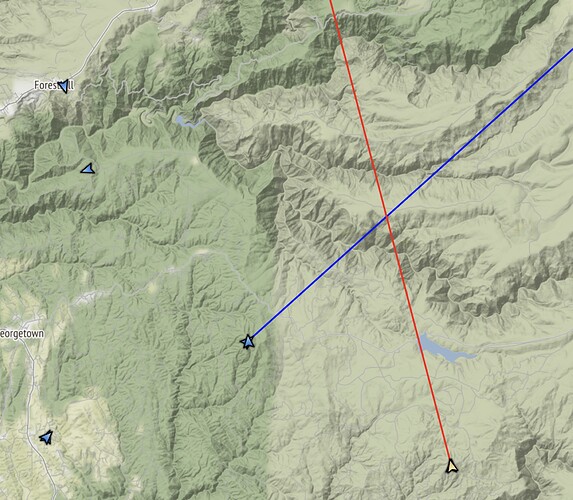
Location? How far out? Thought I heard they were ordered into SLT, before heading to the fire?
They were just clearing the south end of Lake Tahoe when they popped up, tracking reception on the 50 corridor is poor, so not seeing them currently.
T210 over Quintette from MCC
Looks to be dropping near Stumpy and the King scar?
T132 right behind him
Where are the CL 215/415’s scooping out of?
Critical need for Fire Suppression Repair to repair Chicken Hawk Rd. which is quickly degrading, or it will become impassible within the next couple days.
Any updates on the fire activity today? Is this thing slowing down with the weather coming in?
Perhaps it would be useful to create a new thread named aviation asset movement. All of the flight radar comments kind of get in the way of what is going on on the ground. I appreciate intel on where retardant lines are being placed, but I continually have to scroll past minute details on fixed wing asset movement.
The visual assault of the psychedelic death cams returns!
Dude, those things can be trauma inducing & addictive as H-E-Double Hockey Sticks!
Am wondering if we are stating to get some influence from the moisture to the south of us. Temp has dropped 4* in the past hour and we are starting to get some light, 0-5 MPM, winds from the SE. This is a change from earlier in the afternoon when we had a SW breeze. This is along the Highway 50 corridor in the Camino area, Watching the radar, some light showers have made it just north of Highway 88, east of Jackson. They are moving SE to NW. Just an observation.
The east side of the fire looks to be cooking pretty good on the Bald Mtn camera in past hour.
Camera cross puts it on Nevada Point Ridge(?) Across Rubicon canyon from Stumpy Meadows Res. ALERT Wildfire
What’s the date?
Looks to be no bueno
Disregard date query.
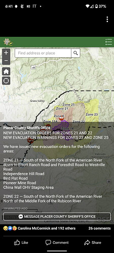
Any idea why they have mandatory evacuations established out so far?
Could be the only road out off the ridge comes close to fire edge. Communities up the ridge might be fine, but would be cut off. Not many options to cross the rivers/forks until you get lower.
The fire ran 5 miles in a day on Thursday, and livestock owners, for instance, need a lot of advance time. Limited egress options up there, too. Better for FFs if people are out of the way with their goats and horses well before the fire’s at the back of their property.
Hoping those in Div GG and CC can advise. Does anyone have any info on the holding features along Wentworth Springs and the viability with this time wedge at hand? If they don’t hold it there there aren’t many holding opportunities before it reaches the populated areas of Eldorado County (Pollock Pines/Fresh Pond), only the South Fork American drainage, which is steep and inaccessible. This assuming it continues to the S/SW along the Rubicon drainage and South.
Also which direction are they expecting the most spread with the winds that are predicted?


