NEU has send 2 arguments to TNF for a fire in Graniteville, 1 Engine then a few minutes later DZR/CRW. Any Info?
1 Like
Not the time for arguing right now 
14 Likes
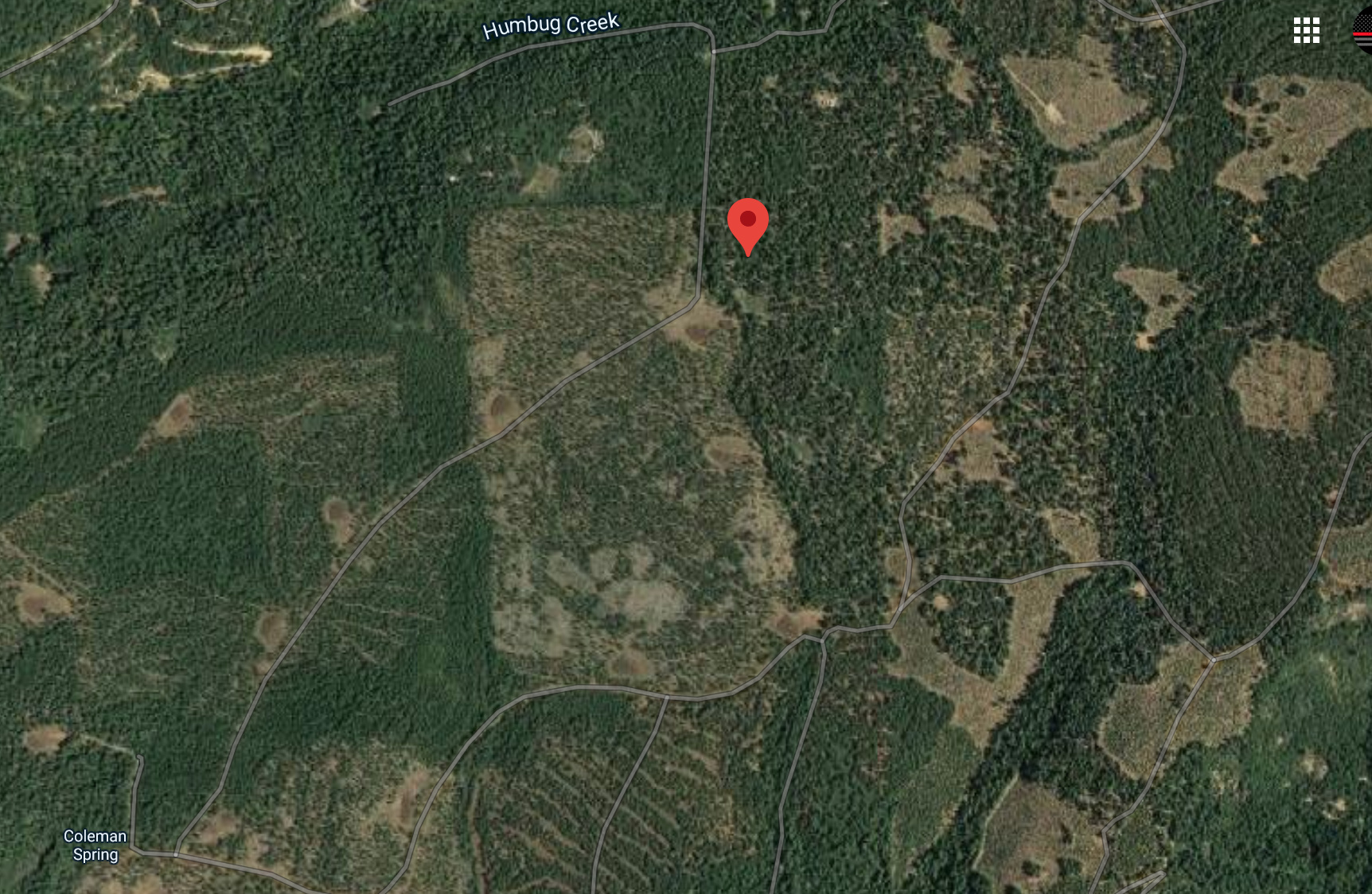
TNF WildCad has this as the Relief Fire, coordinates given 39 23.196, -120 51.162. That puts it North of Dempsey Springs Rd; West of Snow Tent Rd; South of Humbug Creek, in Nevada County.
AA17; TNF B32; E332, E334; WT 31, 32. on the dispatch
No information on acreage or ROS
3 Likes
The scanner was scratchy but the IC called it 1.5 acres.
3 Likes
Augmentations/Arguments…Tomato/tomato 
8 Likes
Right!..any new starts throw the world at it and stop it in it’s tracks…or what’s left of it.
2 Likes
From IC “Still holding at 1 .25 acres”
1 Like
This, and with the upcoming wind event and PG&E PSPS, stop it now before it really becomes a problem.
Silver lining to all of the smoke cover, surface heating and subsequent local wind patterns are minimized to not conflagrate an already receptive fuel bed
3 Likes
Not certain of the exact location, but sounds like this is down on the south facing slope at the bottom of the Yuba river, where it is a BIG canyon. Remote access through the town of Washington or up from Graniteville on small roads. Either way about a hour to drive. Have been down there. A lot of mountain misery and pines.
2 Likes
With the right conditions, could be a Jones incident all over again coming out of the canyon, plus the 49’er fire with the wind event (irony of the date not withstanding). Only saving grace is the location… Less populated AND TNF doing all of the fuel mitigation along the 20 corridor.
Regardless, a good stop is a good stop. Good job to all involved!
1 Like