State ID:CA
3 letter designator:TNF
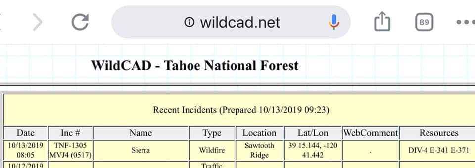
Fire name:SIERRA
Location:NEAR BLUE CANYON
Reported acres:
Rate of spread:
Report on Conditions:
Structure threat:
Resources:
Hazards:
Weather:
Radio channels:
Scanner link:
Webcam link:
Agency Website:
Weather at Blue Canyon RAWS (1.75 miles NW of fire):
Temp. 53
Dew Pt. 26
RH 30%
Wind 1 ESE
The Lat/Long on CAD has in in the North Fork American River but Grass Valley Dispatch was saying its on Sawtooth Ridge so some confusion. Either location would put it about 2.5 miles south of I-80 from Blue Canyon. CAD only has 2 engines and a Div. Chief assigned but I have heard request for a dozer and Water Tender and some traffic with Sierra AA.
I have not heard a current update on conditions but last I got was 5 acres but that was 3 or 4 hours ago. Have heard more resources have been requested/responding including 2 Type 1 Hilo’s, Beckworth IHC, 1 type 3 AT (S2T), several engines and patrols, and at least 1 Type 2 Helo. Very remote area with few roads near the fire based on the Lat/long. I think there could be some alinement of wind and terrain, but wind is still less than 10 mph per Blue Canyon RAWS.