State ID: CA
3 letter designator: TUU
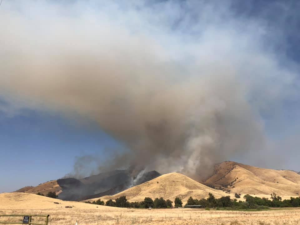
Fire name: Creek
Location: Dry Creek North of Lomitas
Reported acres: Unconfirmed report of 150
Rate of spread: Moderate
Report on Conditions: Off of Dry Creek, North of Lomitas (CA216) AA 95L, T-101, 74, 75, 76, 100. H-552
Structure threat: Limited
Resources:
Hazards:
Weather:
Radio channels: TUU Local
Scanner link: https://www.broadcastify.com/listen/feed/25881/web
Webcam link:
Agency Website:
2 Likes
IC was asked about dozer commit time and stated the fire is still 100% uncontained and can’t give commit times for equipment.
AlertWildfire - Colvin Mountain Cam locked in for a nice view.
2 Likes
FKU Dozer 4340 added to the response
New incident: #CreekFire off Cry Creek Dr and Lomitas Drive, east of Woodlake in Tulare County is 150 acres. https://t.co/8H35kllXgs https://t.co/gETXXqWzsO
A strike team of type 3’s is on order from Kern for TUU.
Edit: This request has been canceled due to the IC not requesting anymore engines.
Dozers and airshow per IC.
IC is ordering 2 strike teams of crews.
KRN ST9321C 324, 336, 345, 356, 376
1 Like
IC ordering 2 additional water tenders.
Looking at the camera looks like they have slowed the rate of spread drastically, and might have caught it at the ridge.
4 Likes
Still flying aircraft, working on the left flank of the fire.
AA just ordered a type 1 helicopter and the training tanker(s) from Columbia.
1 Like
The left flank is the most active, working on a firing plan
IC requesting a Division group supervisor.
2 Likes
400 acres 10% contained
2 Likes
South Ops offered up a strike team of crews and the IC requested them to the fire.
IC ordered a type 3 strike team
ST 9321C from Kern County has been reordered to the Creek incident, Immediate need.
They got cancelled and just got re dispatched. KRN Crew 11 assigned as well.
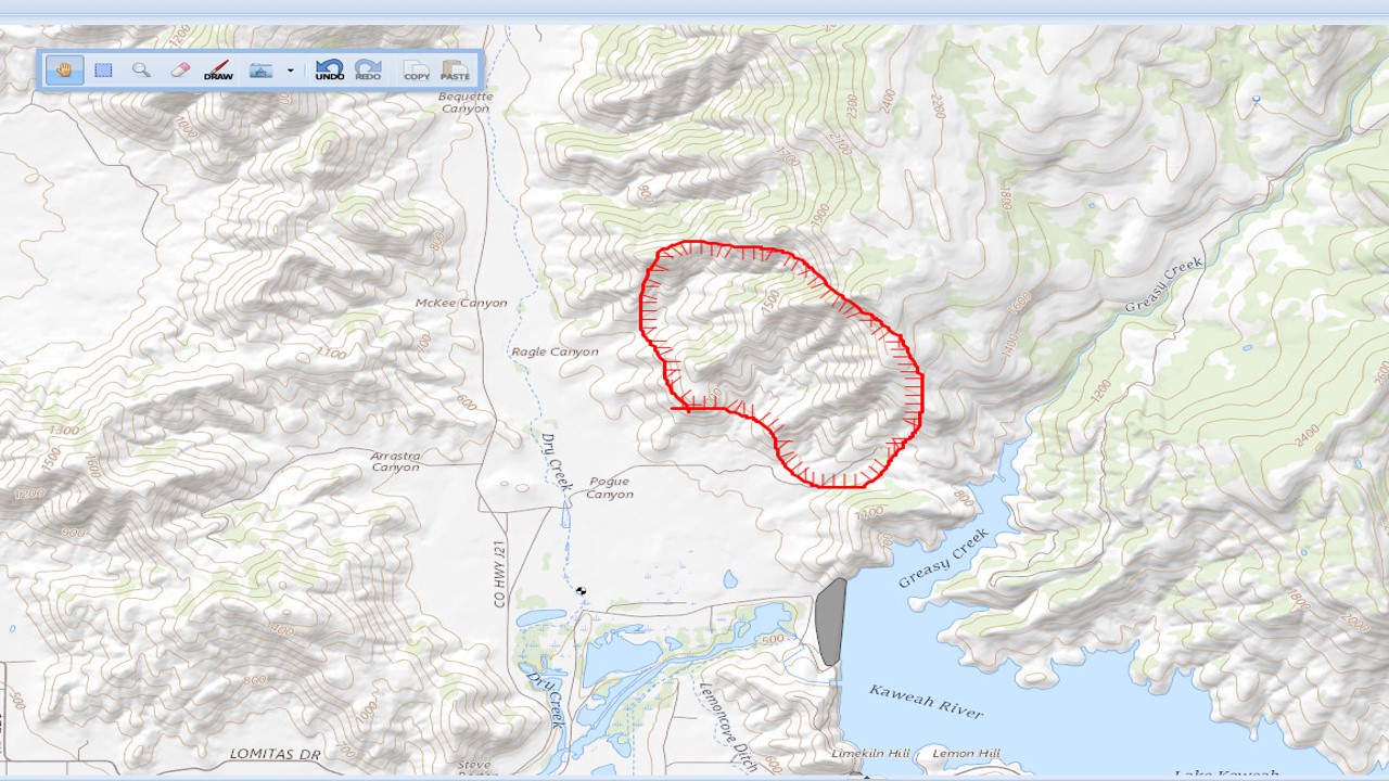
Based on the above posts, the pic attached, and where AA is flying over on Flightradar, this is a crude representation of the location of the fire. If anyone has a more precise location, let me know and I’d be happy to update the map. The perimeter on the map calcs to about 550ac…but I’m just making a educated stab in the dark…!
1 Like
Looks they fired out the lower part of the right flank and tied into the portion backing downslope. That’s what I saw looking at the rocky hill cam.