State ID: CA
3 letter designator: VNC
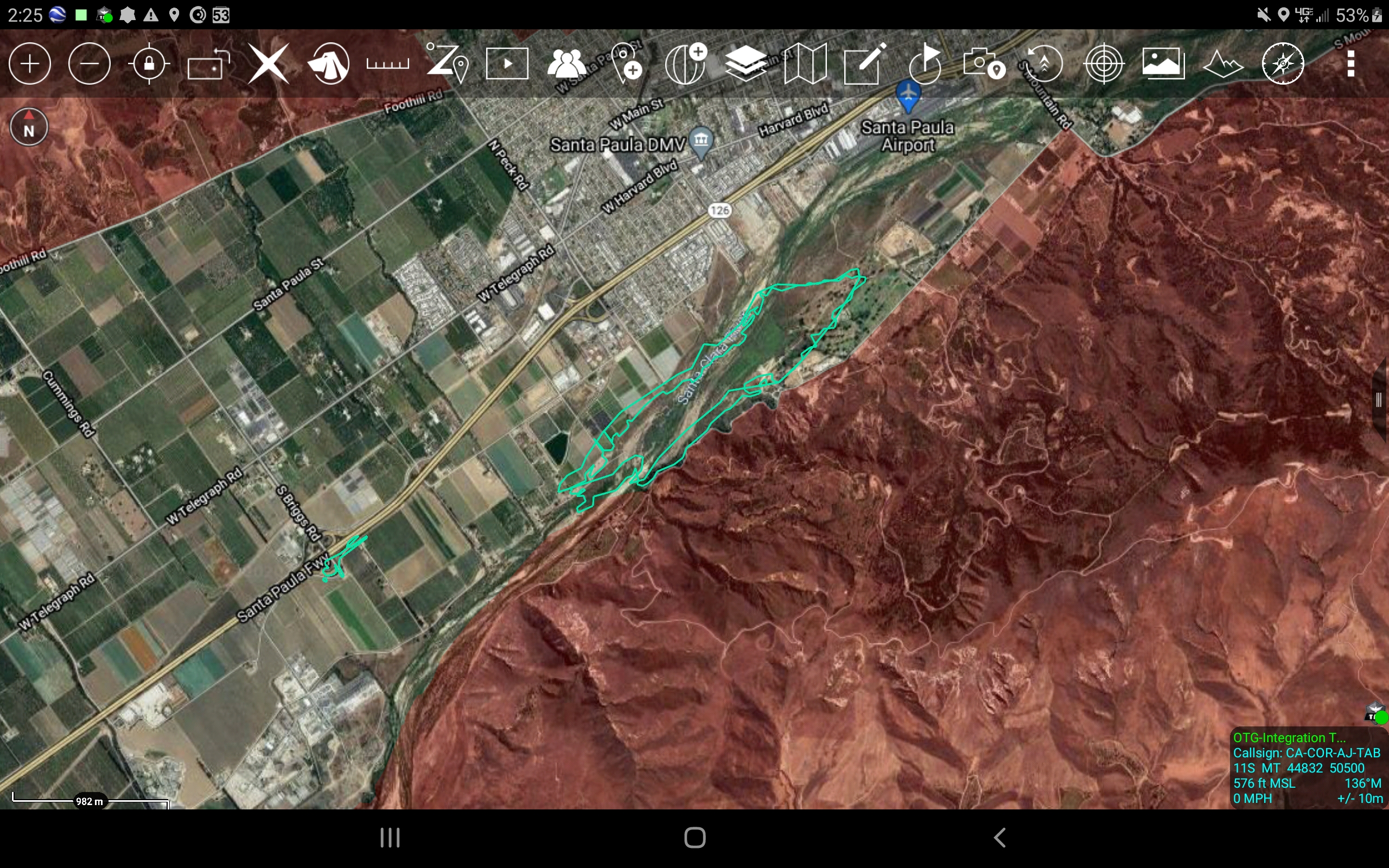
Fire name: Cornell
Location: 640 Cornell Drive; Santa Paula, CA
Reported acres: 5
Rate of spread: rapid
Report on Conditions: wind driven under a Santa Ana condition, burning in the Santa Clara riverbed & Maria Fire burn scar.
Structure threat: yes
Resources: VNC, AA12, T02, T41
Hazards: downed powerlines at the heel of the fire
Weather: E winds 35 MPH
Radio channels:
Scanner link: https://www.broadcastify.com/webPlayer/30587
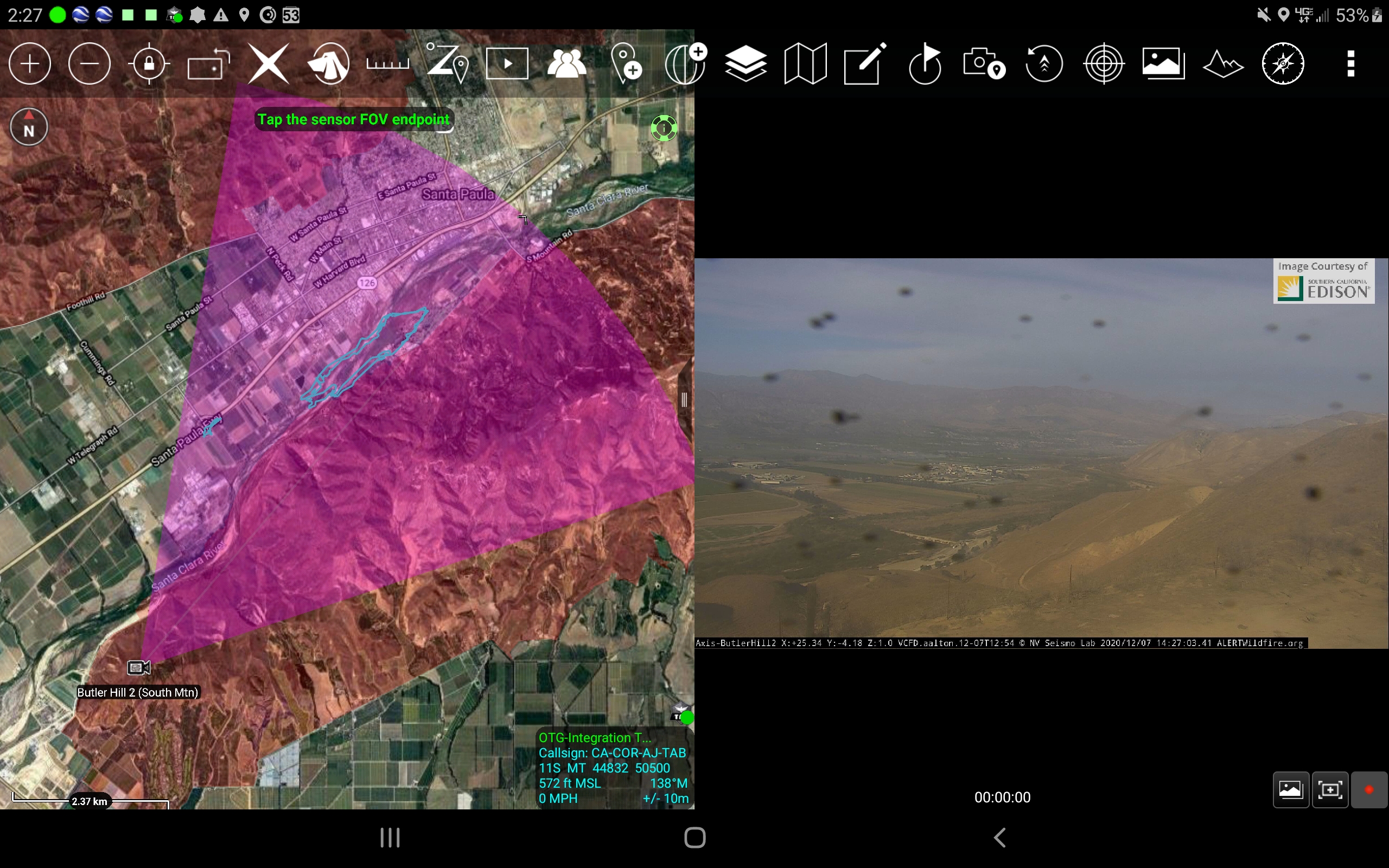
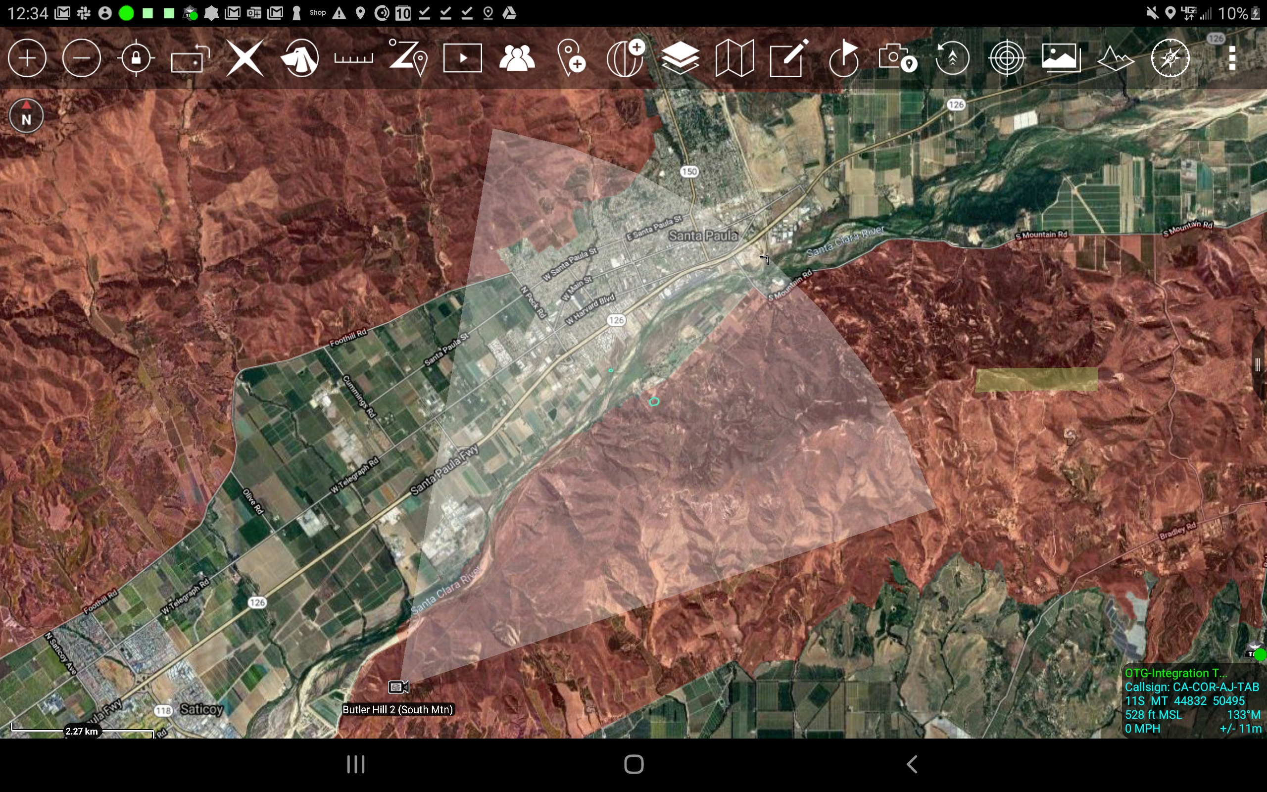
Webcam link: http://www.alertwildfire.org/orangecoca/index.html?camera=Axis-ButlerHill1&v=7a7f1b9
Agency Website:
1 Like
E26 reporting a 3-5 acre wind driven fire in the riverbed, 35mph winds out of the east. Started a taskforce & type 3 engine strike team.
1 Like
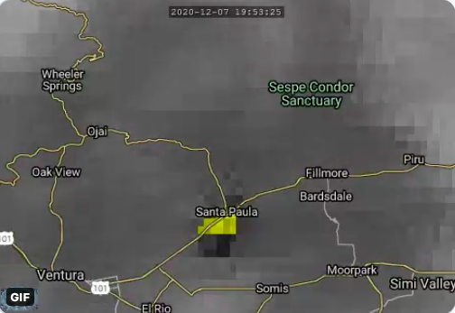
Showing up on Satellite.
2 Likes
Helicopter over the fire is recommending ordering: A dedicated Helco and 3 water dropping helicopter, for a total of 5 copters.
5 Likes
Evacuations being issued for Shell road from highway 126 to Todd road
1 Like
Live video: https://abc7.com/watch/23340/
1 Like
Type 1 engines reporting to Hwy 126 & S Peck Rd for structure protection.
1 Like
Fire has crossed the river bed and is now on both sides. The head of the fire is on the north side.
1 Like
Total of 4 tankers on order. 2 are on scene with AA 12 right now.
1 Like
Spot fire reported on the 126 @ Briggs Road
1 Like
25 acres with potential for 100+
2 Likes
5 additional engines and a water tender ordered.
1 Like
There is a spot fire in the gore point at Briggs and Highway 126. It jumped the over pass and is on both sides. Calling it the Briggs incident. Unit asking for 2 additional type 1s and a WT.
The IC and ops are talking about making it part of Cornell incident
1 Like
AA saying fire behavior has moderated due to lack of fuel, still some things smoldering in the fields. Still active fire at Briggs and Highway 126, with rotorcraft working it, and engines on scene.
Putting tankers on load and hold
AA calling it 65-70 acres.
1 Like
Watching tanker drops, there was almost 3 wingspans of drift anyway. Drops were ending up in the middle of green ag fields
2 Likes
Of interesting note, fire appears to have burned through cultivated, green fields in places.
1 Like
It should run out of fuel soon. The river bed gets sparse as it moves west.
2 Likes
Intel 43(42?) mapped the fire as 173.5 acres.
2 Likes