State ID:CA
3 letter designator:VNC
Fire name:Elizabeth
Location:
Reported acres:10
Rate of spread:Moderate
Report on Conditions:
Structure threat:None
Resources:2nd Alarm
Hazards:Power Lines
Weather:94/10/N/NE 1-6G10
Radio channels:
Scanner link:
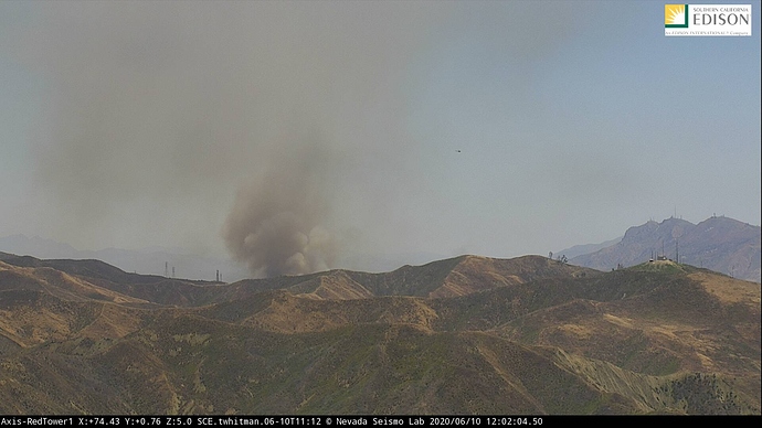
Webcam link: http://www.alertwildfire.org/orangecoca/index.html?camera=Axis-ButlerHill2&v=81e002f
Agency Website:
1 Like
2 Fixed wing with lead plane ordered
2 Additional airtankers for a total of 4
1 Like
Rotor wing aircraft include 2 VCFD 2 LACoFD 1USFS (532)
2 Fixed wing with lead on order
50 acres still MROS
Williams structure defense group being established with VC B14
Tanker 102 en route
AA52 T131 T167 en route off SBD
Updated potential 300acres
Winds are fighting each other, weather pattern of N/NE still in place with winds aloft but being close to the coast the on shore flow surface winds are pushing it east.
LAC 1105 Alpha is the responding Type 1 ST.
1 Like
Missed updated size but releasing resources
Looks like it broke loose and is taking off again.
250-300 acres but VNC is calling it 60-70 percent contained.
Edit…VNC saying 20 percent contained. not 60-70
3 Likes

