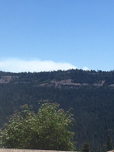
Putting up a decent column on the north side of hetch hetchy.
http://www.alertwildfire.org/sierra/index.html?camera=Axis-Duckwall&v=fd40731
Wondering if this was the smoke reported just after the strawberry fire. Not sure if it was being staffed yet but STF had calls for the hetch hetchy area.
I believe it is confine and contain for this one, 551 has been going between fires on recon.
Looks like 5HT made its way over to the tilthill from the eastside… size up 50-75ac
Correct spelling of this is TILTO.
Another good angle
http://www.alertwildfire.org/sierra/index.html?camera=Axis-Hobron&v=fd40731
edit* thanks 9270
I even checked that the link worked, but didn’t notice the different region.
I must have started my journey up in Shasta and it kept that region in the link. 
I think that would be the Sierra and Foothill cameras not Shasta Modoc, Duckwall and Hobron cameras
Correct spelling is Tiltill. It’s the valley to the east of the fire.
Wildcad STF posted a smoke check “Duckwall” north of Duckwall at 11:47. No resources listed.
This was about an hour ago at Little Sweden across from Bald Helitack
Be Safe!!
Fire in the Park.
Thanks. I will post Duckwall if this one is different. 
Looks like the fire made a run yesterday 9/7 up to the Branigan Lake. Even burning well at 1am.
Last update on YNP website: 8/28 (Inciweb also has same as of 1hr ago update)
Tiltill
Location: North of Hetch Hetchy, Tiltill Valley.
Discovery Date: July 31. 2021
Size: 1,990 acres
Containment: 90%
Strategy: Confine and Contain
Thats a good burn. I was backpacking there several years ago and that area was so chocked full of brush. The brush was double overhead in some places.
I was up there in April of this year and hiked up Mt Gibson which is in the middle of the burn. It was covered with trees to the top so the views might be a little better now. There’s a lot of nice granite in that area. As far as fires go, this one seems fairly benign, could even be beneficial. I’ll probably head up there again early next year for some before-and-after photos.
More spread beyond the Branigian Lakes:
https://caltopo.com/map.html#ll=38.02788,-119.68223&z=14&b=t&o=f16a%2Cr&n=1,0.25&a=mba%2Csma%2Cfire%2Cmodis_mp
PARK Notice: (not much to report to the public)
The trail between Lake Vernon and Tiltill Valley (and area north of that) is closed due to a fire.

