
4 posts were merged into an existing topic: CA-YNP-Washburn?
From the sounds of the discussions they have been having it appears that they are going to minimize the fixed wing use based on objectives, visibility of remaining targets, and the increased number of rotor wing available and en-route. So they want to work on hammering it with the rotor wing.
In summary. DIVS A to M, they’ve doubled up on the retardant line and the fire is backing down to it. On the right flank, can’t work due to lack of an adequate exit route. I believe he said they are running out of targets on the left flank too. Thought it was a good time to put in Helco and daisy chain rotor assets.
(update to 1:44 PDT) run the last couple of tankers and then put the fixed on hold. Another discussion on getting Helco as the rotor use increases.
4 Likes
The discussion was that the smoke is obscuring the right flank to reinforce it today. That right flank had it double up drops yesterday right up to cut off. They wanted to go back in on the right since the left flank Div.A and head of the fire Div.M are looking good so far according to AA.
IC is working out a drop area/line to be contingency for the right flank Div.Z should it spot outside the line without good vision due to the column smoke bending over it. Then the tankers will go back to work…hopefully.
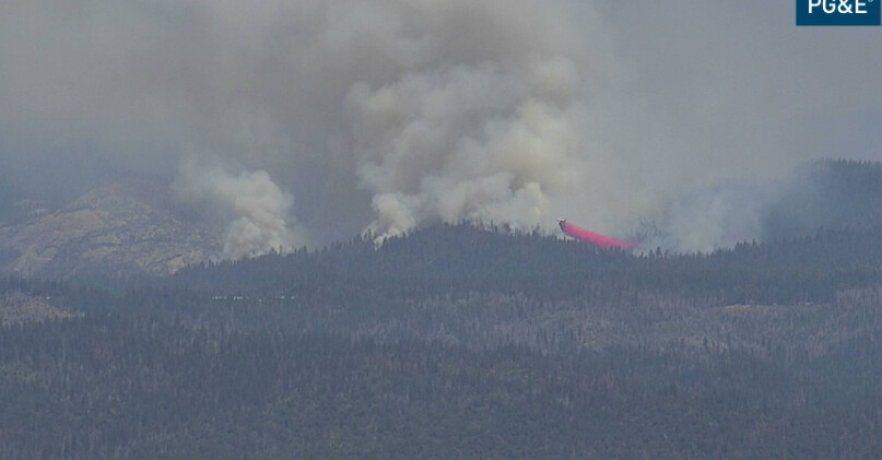
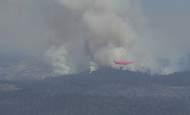
The tankers are still working in between the copters on the left. It sounds as though each one returning from this mission is on load and hold.
7 Likes
(Update to 2:12). All tankers on load and hold (as @apx8000 said). On the left flank, retardant from DIVS A to the paved road, sounded like it was doubled up. On the left “shoulder” they are working rotors. Also mentioned the A-M break was smoked in. I heard they placed the order for a Helco and the one ATGS was returning to Chico leaving 52. It was mentioned they wanted to “bury it in retardant.” Some might think that a little much, but what I’ve seen on the ground on my visits I would say not–just look at the heat signature at night.
They identified 8 rotor wing assigned; 520, 551, 55B, 25M, 3HT, 7KA, 5HT, and one I couldn’t hear. Then there was a discussion about a dup ID. I think that’s a good assemblage to get some serious work done and knock this thing out.
FYI - the couple of posts that discussed the issue of duplicate helitanker numbers on this incident was moved to Helitanker Numbering??. It is short but important for safety.
7 Likes
AA states right shoulder fire activity picking up at the M and Z break. Monitor it for next hour and see if it spots over.
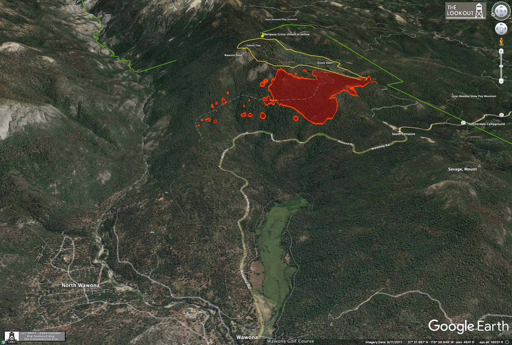
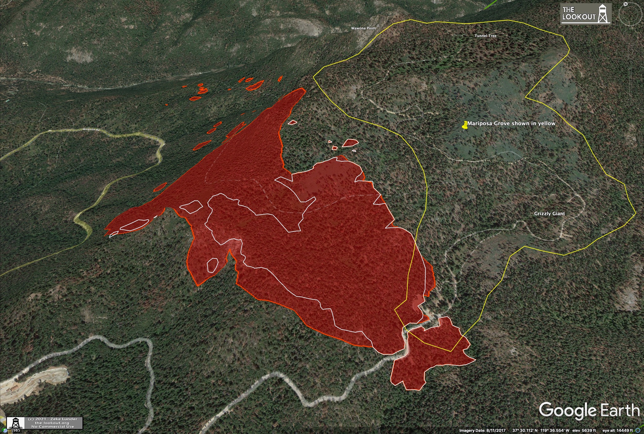
Multi-spots hwy41 and Merced river drainage areas. Below Wawona Point. Looking for retardant line location… requesting Lead Plane and all five type 1 tankers including VLAT.
EDIT UPDATE @16:00 is 2 total Lead planes, might use one as Helco, Total 7 type 1 tankers and 2 VLATS.
7 Likes
Per AA all retardant that the head has been spotted over
4 Likes
Spots on the north end
2 Likes
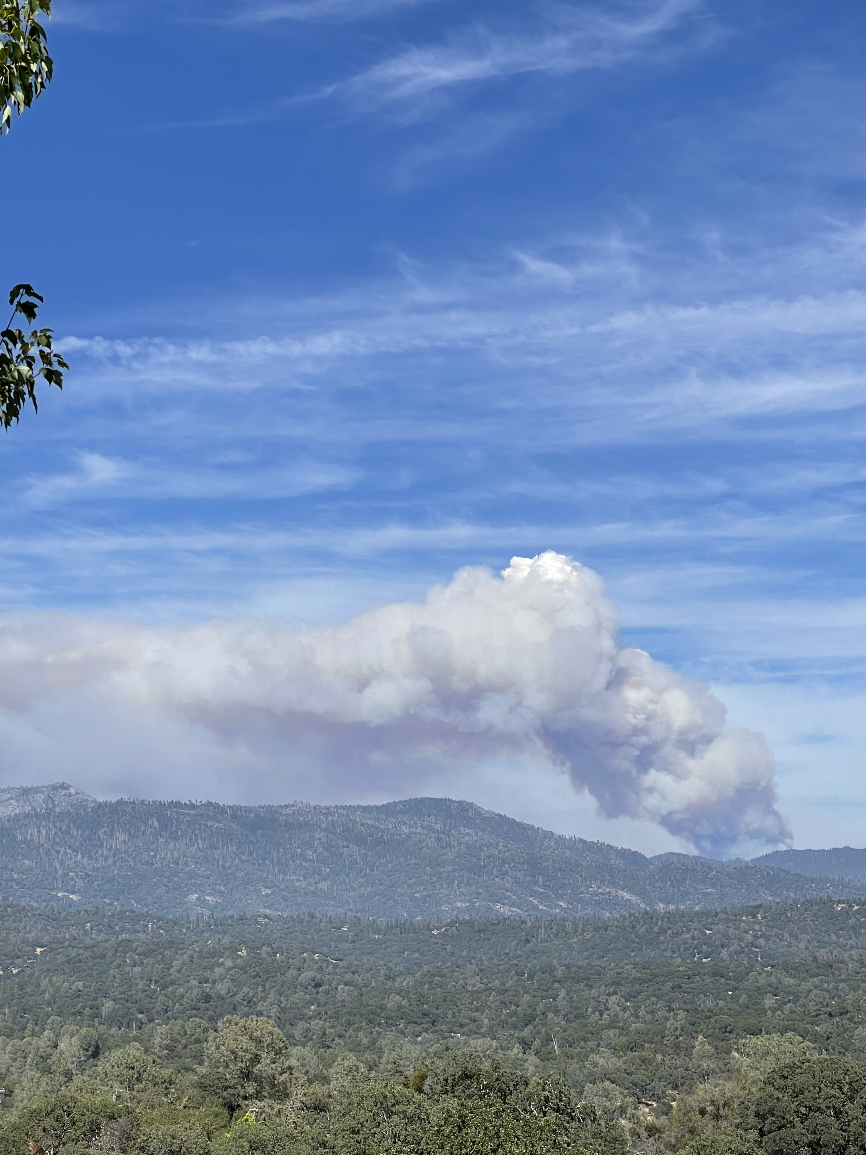
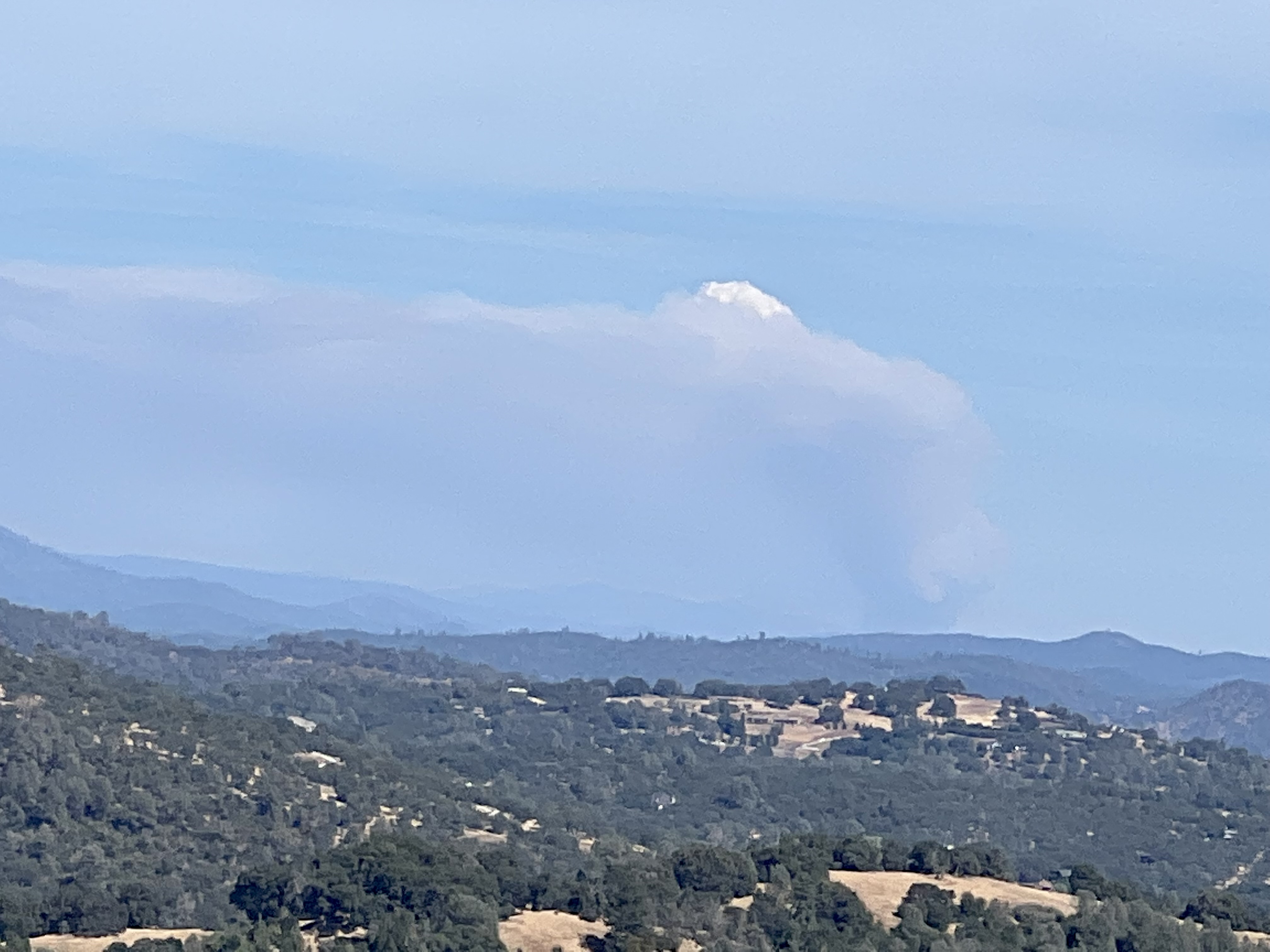
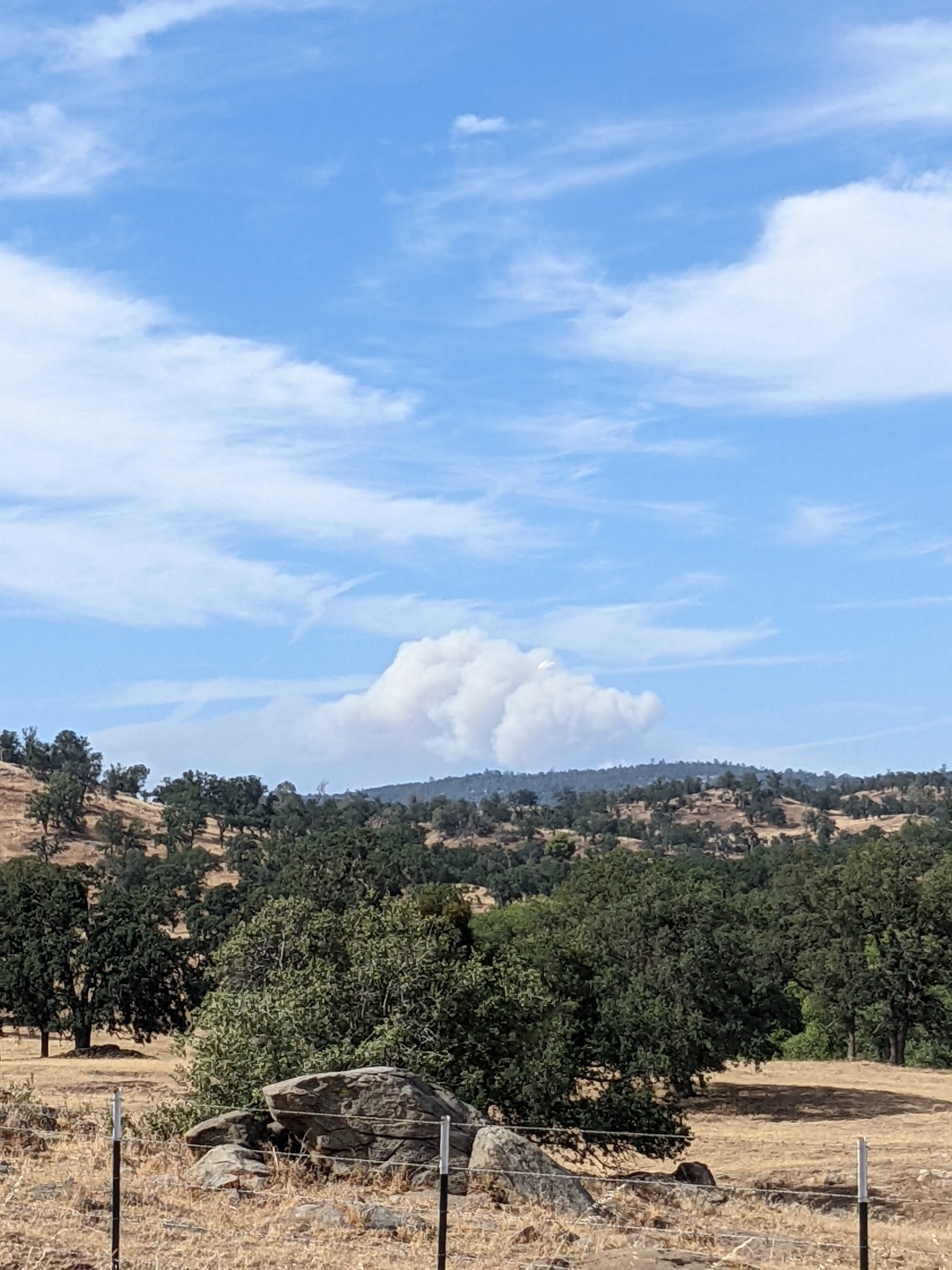
That Column is getting ugly, looks to have quite a bit of lift in it now. It is gonna keep throwing spots, especially with receptive dead and down fuels.
Spotting 1/2 to 3/4 mile ahead now.
10 Likes
It was going well, until it wasn’t… So, it just made a run up through the center, ran through the retardant and threw spot fires estimated about 3/4 of a mile down slope (north aspect heavy fuels) towards the south fork of the Merced.
Going north, after Wawona Point, the drop-off is intense to the South Fork of the Merced a couple thousand feet below. Not sure what the NFES number is for a parachute, but I can’t imagine working on that thick north-slope steep terrain, much less trying to figure out if there are any spot fires under that canopy that IR can’t easily see, until…
(update at 1600) So, the order just placed is for 6 Type 1 Tankers and 2 VLATs. Discussion on it’s spotting over what ever they do. They know they’ll need to stop short (300 feet) of the riparian areas (south fork). This just got a lot more complicated. Possible plan they (OSC & ATGS) are discussing is to start at Wawona with the tankers and paint the ridge down to the south fork. Intel mapped it at 466 acres with spots up to .7 of a mile towards the river. (MHO) The box must get bigger, there is no good place.
9 Likes
466 Acres, multiple spots all east of Hwy 41, spots 8/10ths mile ahead of main fire. Per Washburn AA
6 Likes
New FIRIS data just dropped - captured at 15:54.
It’s going to push up the bowl toward Wawona Point in next hour or two, if it hasn’t already. Nothing they’ll do to keep it out of the South Fork. And if it behaves anything like last night, downslope winds are going to spot it over anything they paint to the west this afternoon.
Good news is the heel hasn’t grown since 0900 (white line) and spread toward the grove has been very slow.
10 Likes
So far - a bright spot?
The one kinda bright spot today is that the wind component didn’t really make the complete transition to a predicted SW, so it didn’t push as hard as to the northeast and into the Grove.
Combine that with the hard work they put in on the right flank and it appears, so far, they are avoiding an unrecoverable international ecological and PR disaster.
12 Likes
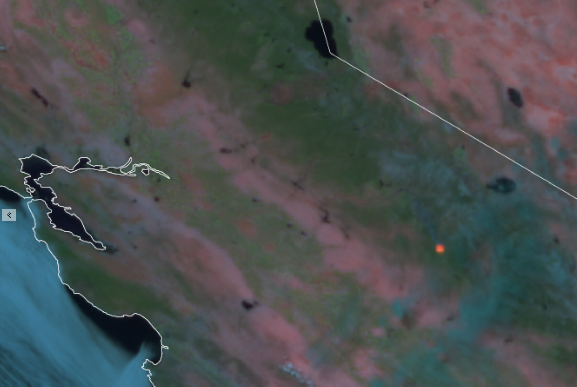
The new GOES 18 satellite showing some good heat: RAMMB/CIRA SLIDER: Satellite Loop Interactive Data Explorer in Real-time with GOES-16 and Himawari-8 Satellite Imagery
5 Likes
The fixed wing air show back in full swing, with T-914 off MCC.
2 Likes
Tanker 01 O2 102 105 132 910 and 914.
6 Likes