Hello all.
Does anyone have experience or firsthand knowledge of how often Cal FIRE updates their GeoJson API of incidents.
I am creating a non-mission critical ArcGis Dashboard and utilizing their public API. I know it’s not as fast as the IRWIN layer for ArcGis but it is more accurate. Plus, the IRWIN layer does not go back years.
Here is their API address
https://www.fire.ca.gov/umbraco/api/IncidentApi/GeoJsonList?inactive=true
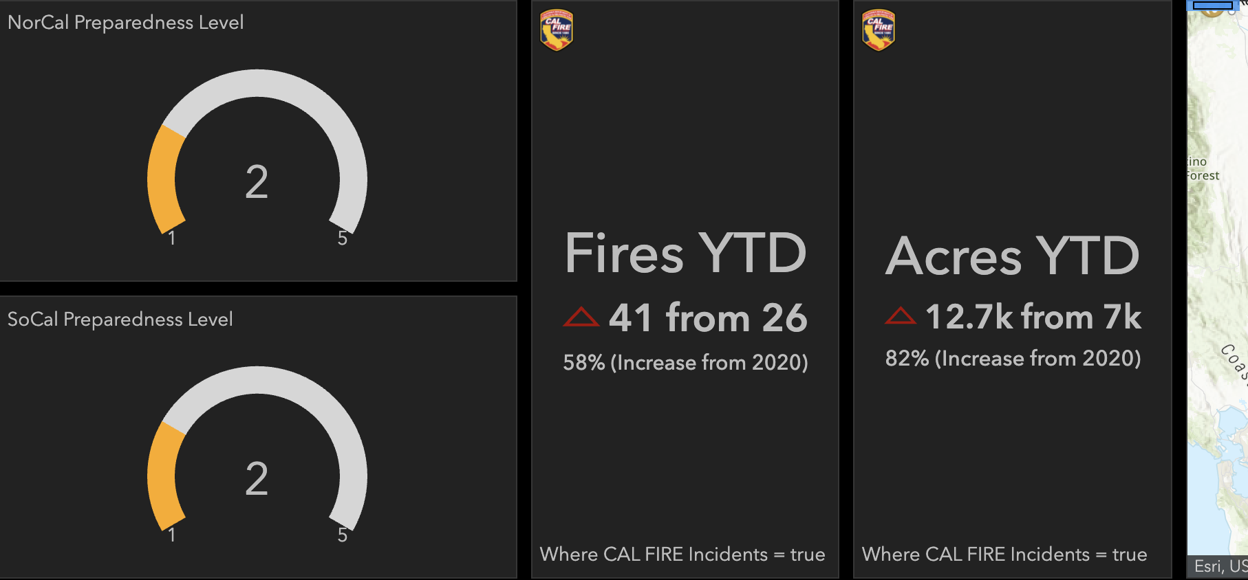
It’s interesting to see when CAL FIRE puts out a press release saying CA is experiencing ##% increase in fires and ##% increase in acreage. I wonder if they are including all fires in the state (non-CAL Fire Incidents like USFS, NP etc.) or just CAL FIRE responsibility.
For example, my dashboard calculated from the latest API call 58% increase in Fires YTD compared to last year and 82% increase in Acreage compared to last year at this time (those numbers where higher a week ago but the spread has narrowed a bit). Dashboard is set to CAL FIRE Incident = true
I’ll be working on other agencies USFS NPS BLM but the past data via an api is not as good so far.
Thanks all