
3 Likes
4 Likes
3 Likes
2 Likes
3 Likes
The first Lookout YouTube briefing of the 2023 NorCal California Fire Season is live!

17 Likes
4 Likes
When Models agree… Interesting to say the least! https://www.youtube.com/watch?v=E28lB-LtZqc
6 Likes
Thanks for Intel Zeke! Always very informative and unbiased! We appreciate you brother! 

7 Likes

While everyone will be watching the rain… watch the backdoor for wind…
7 Likes
Hopefully the rain is significant enough as to not have to worry about the wind.
1 Like
3 Likes

Summary:
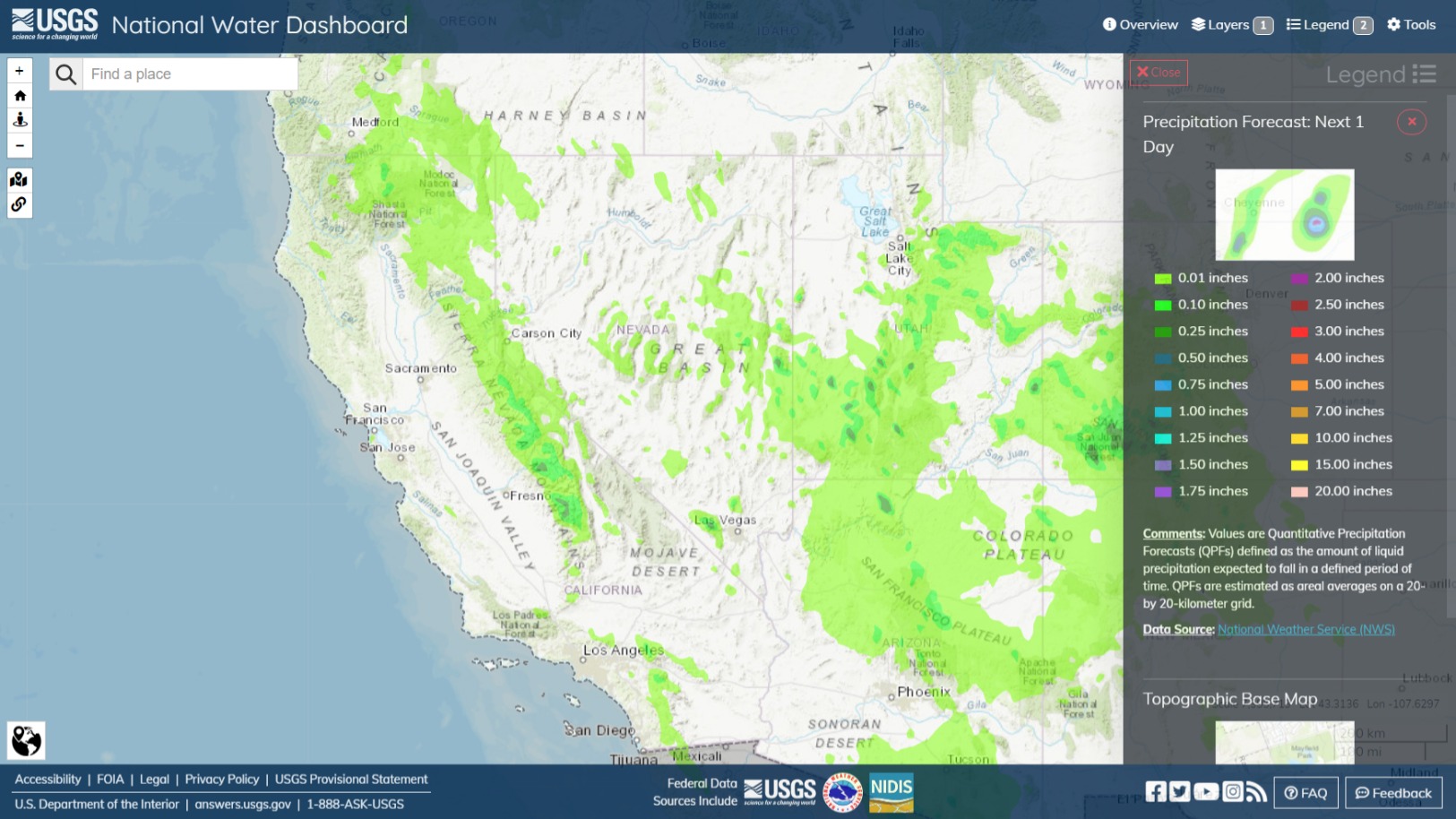
- Low pressure off the central CA coast will continue to bring scattered showers and thunderstorms to the higher terrain of northern CA and northern NV up into the upper Klamath River basin in OR for the next couple days.
- A surge of tropical moisture associated with now Hurricane Hilary will make its way northward and impact the region this weekend into early next week. Moderate to heavy precip is expected, focused across portions of coastal southern CA, southeast CA, and southern NV.
- Totals will generally range from 1" to 3" for coastal southern CA and southern NV. Southeast CA from Inyo county down to Imperial county may see between 3" and 6" of precip with some higher totals on east facing slopes (approaching 10").
- River rises are expected in Southern California and San Diego areas beginning Saturday night due to the potential heavy rainfall from Hurricane Hilary.
- No critial stages exceedances expected for the next couple days.
Confidence: Medium
Staffing Level: Normal
Detailed Hydrometeorological Discussion: cnrfc.noaa.gov/discussion
5 Likes
2 Likes
Keep one thing in mind. Insurers are in the business to make MONEY. Insuring our needs is how t ey do that. No good outlook for profit by insurers means they will not get involved.
4 Likes