Summary:
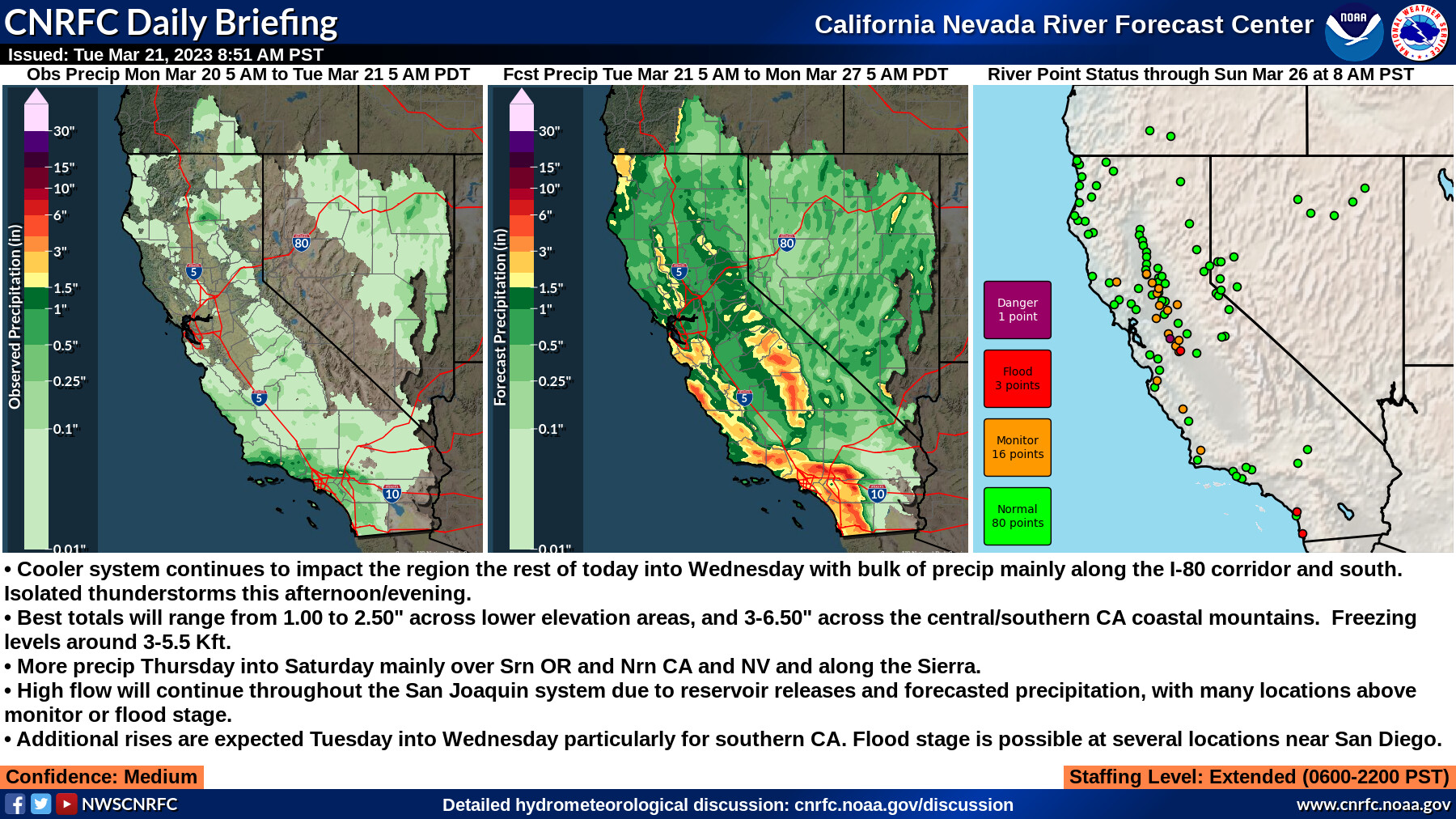
- Cooler system continues to impact the region the rest of today into Wednesday with bulk of precip mainly along the I-80 corridor and south. Isolated thunderstorms this afternoon/evening.
- Best totals will range from 1.00 to 2.50" across lower elevation areas, and 3-6.50" across the central/southern CA coastal mountains. Freezing levels around 3-5.5 Kft.
- More precip Thursday into Saturday mainly over Srn OR and Nrn CA and NV and along the Sierra.
- High flow will continue throughout the San Joaquin system due to reservoir releases and forecasted precipitation, with many locations above monitor or flood stage.
- Additional rises are expected Tuesday into Wednesday particularly for southern CA. Flood stage is possible at several locations near San Diego.
Confidence: Medium
Staffing Level: Extended (0600-2200 PST)
3 Likes
1 Like
Summary:
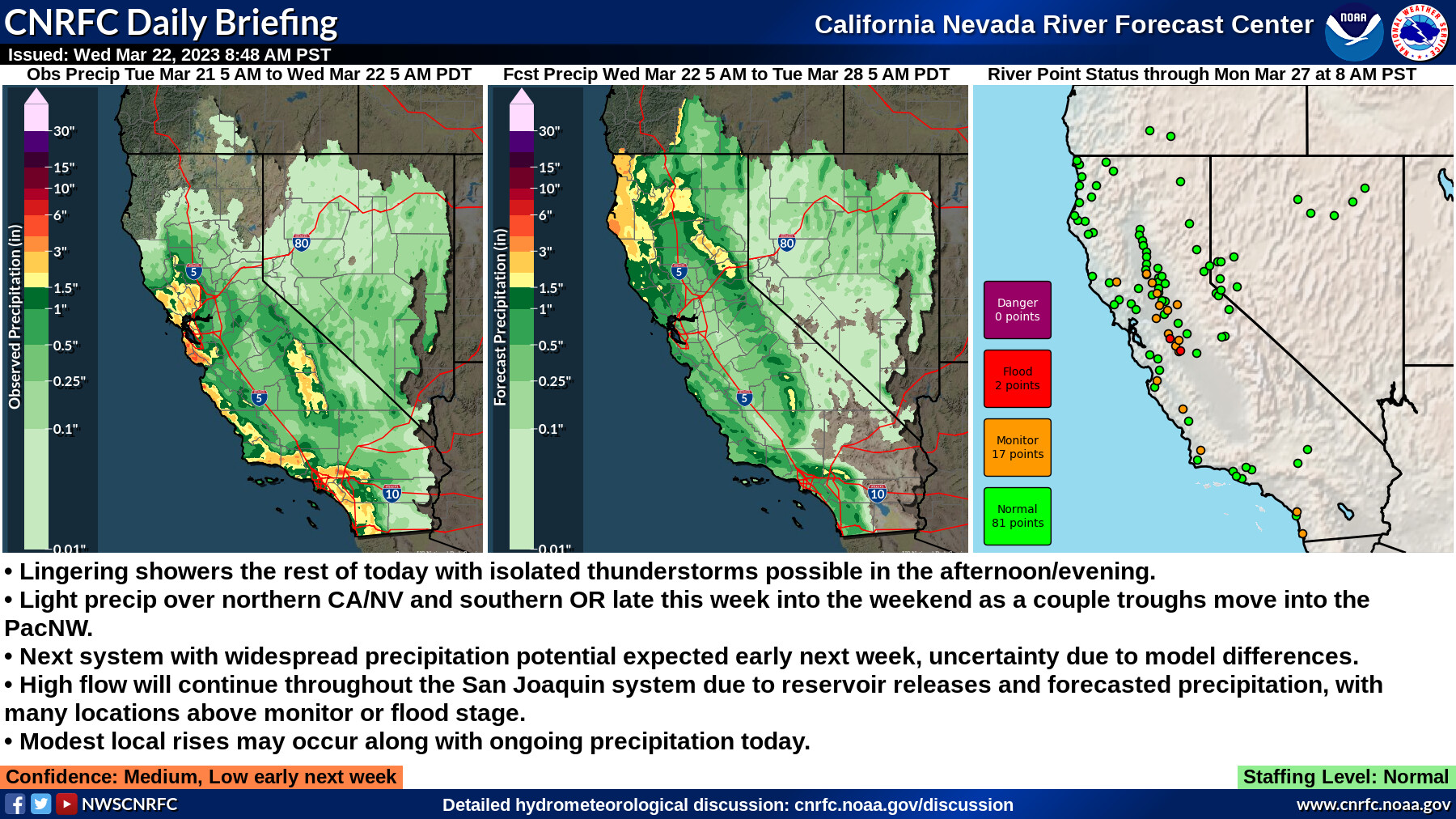
- Lingering showers the rest of today with isolated thunderstorms possible in the afternoon/evening.
- Light precip over northern CA/NV and southern OR late this week into the weekend as a couple troughs move into the PacNW.
- Next system with widespread precipitation potential expected early next week, uncertainty due to model differences.
- High flow will continue throughout the San Joaquin system due to reservoir releases and forecasted precipitation, with many locations above monitor or flood stage.
- Modest local rises may occur along with ongoing precipitation today.
Confidence: Medium, Low early next week
Staffing Level: Normal
My impression is that Dr. Daniel Swain swings a pretty big stick in IMET circles. In this Office Hours, he explains some of the factors in the last-minute movement of this ‘changeup’ storm, the struggle for fine-grained accuracy, the danger of high winds, and responds to questions.
New Flood Warnings from Half Moon Bay. The Santa Margarita River on Camp Pendelton and the San Diego River at Fashion Valley have new Flood Warnings for roadways, bridges and into parking structures from this storm. Ongoing Flood Stages on the Santa Rosa River.
3 Likes
Tornado hit Montebello area of Los Angeles around 11:00 hours. Damage to commercial structures.
2 Likes
3 Likes
3 Likes
3 Likes
2 Likes
4 Likes
2 Likes
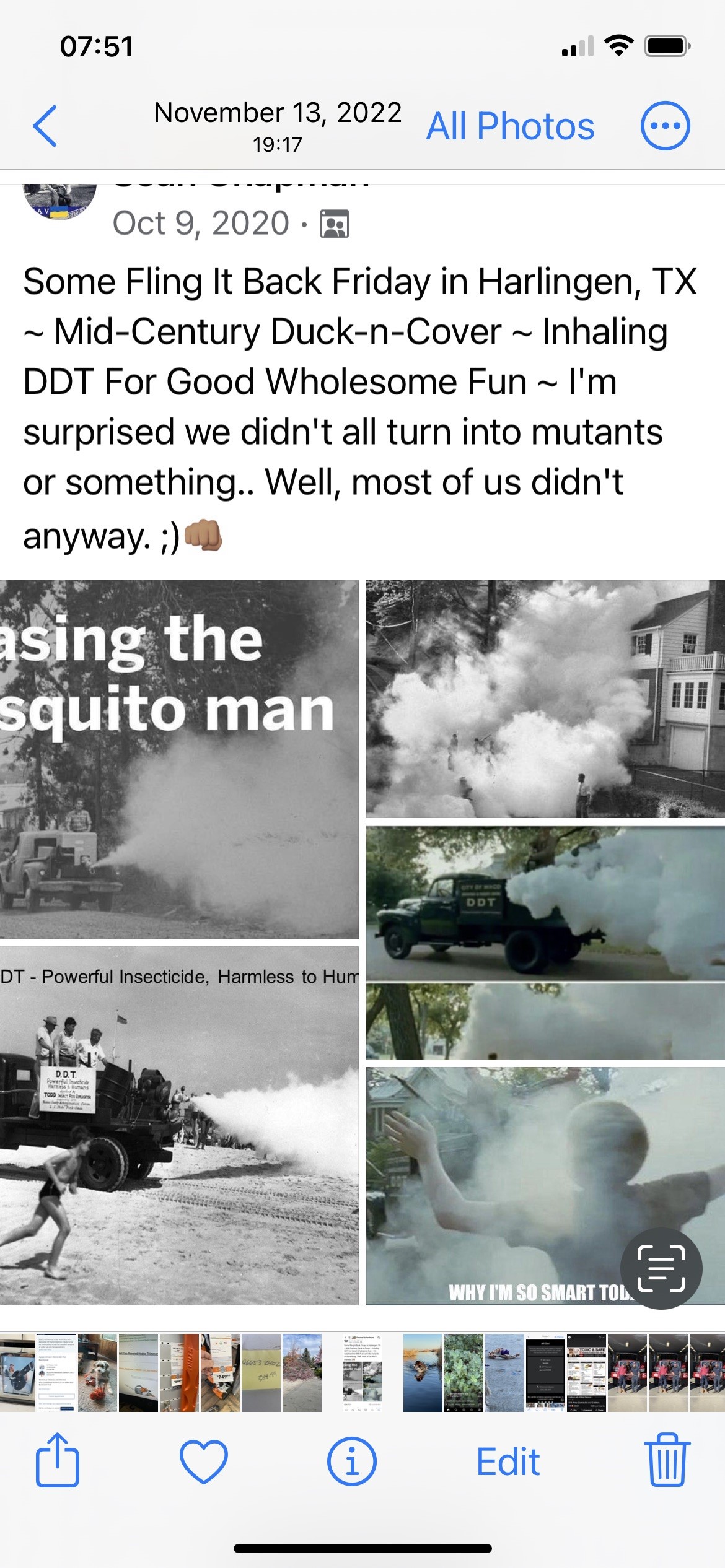
FUN FACT! Back in the day when I grew up South Texas. The Mosquito Fogger was a big deal to us kids running thru the fog. This event happen all over the south.
2 Likes
2 Likes
5 Likes
3 Likes
4 Likes
2 Likes
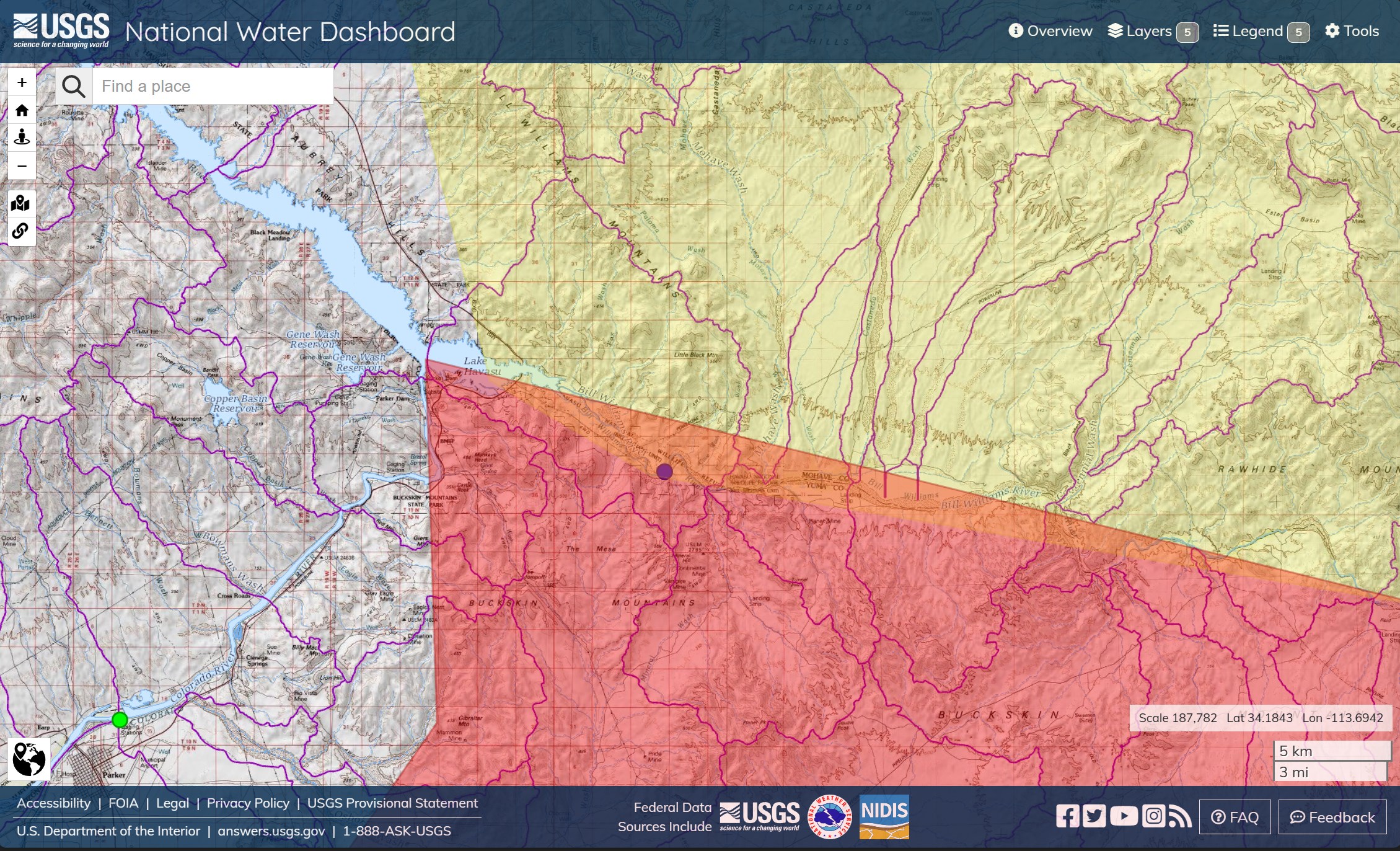
Parker Dam, Lake Havasu. High Wind and Red Flag conditions. This is actually over the state line at a turn of the Colorado River. Streamflow at Parker is nominal. Southeast of Lake Havasu, there is above normal current through the Wildlife Refuge.
Red Flag Warning issued May 1 at 1:24AM MST until May 1 at 8:00PM MST by NWS Phoenix AZ
- AFFECTED AREA…Central Deserts.
- TIMING…From 11am through 8pm MST today.
- WINDS…South 15 to 25 mph with gusts up to 35 mph.
- RELATIVE HUMIDITY…As low as 10 percent.
- IMPACTS…Fuels are dry and fire danger is high. These conditions combined with low relative humidity and strong winds will lead to widespread hazardous fire weather conditions.
2 Likes
3 Likes