Well here it is. I decided not to go on a rant on LinkedIn after Dan Berlant posted the new zone 4 map and allow someone from cal fire explain how this map is made. Good grief its like finger painting. No response yet from CF and I dont expect one.
What is the method/science to get to this output? They say in their video it uses fuel weather topo ember cast but how can you get an output like this with jagged lines? Crazy. My neighbor half his lot is moderate the other not. Cal Fire imho needs to explain how this came to be.
https://experience.arcgis.com/experience/6a9cb66bb1824cd98756812af41292a0

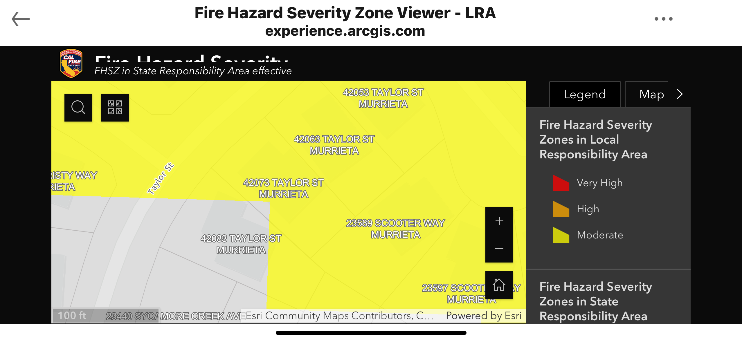
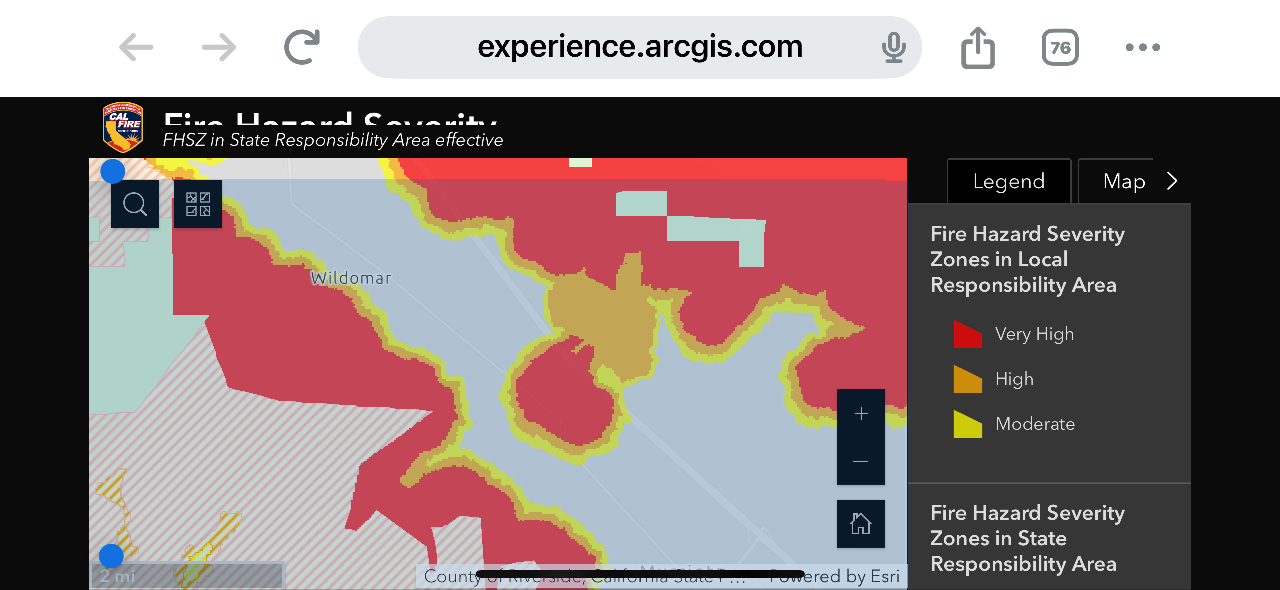
The center of that red blob. 2 to 3 foot chamise.
Here is google maps for it.
https://maps.app.goo.gl/GwQMBYwYenR6zohH9?g_st=com.google.maps.preview.copy
On a due north you could say i would get some embers but come on nothing is carrying here. In 2 to 3 ft chamise.