Wow!
How many here in this forum have 401K, 457B plans?
Where is your earnings invested?
What is the methodology, purpose or your individual investment?
I do what chatgpt tells me to do…i tell it not to be woke. I want earnings.
But with that said still interesting to hear the nexus of communities burning down is due to climate change like there is this 1:1 link.
Been windy here like this for a long time. People taking zero responsibility for their own choice and then want to blame insurance companies for going uh yeah your community is a disaster waiting to happen and they were dead on right.
The record profits even with payouts got my attention.
Who can make superbowl adds and comercials that run all day on tv….insurance companies…
It is interesting how cities are now becoming wildfire hazards. For 100 foot clearance, will they have to remove every other home for clearance or on the small lots, possibly only keep every third home the meet the 100 foot clearance?
You think there is a home shortage now ! That I remember, ever sine the Panorama Fire in San Bernardino, CA. Neighborhoods have proven to be a fire catastrophe waiting to happen given enough wind. Yet zoning still allows for homes to be built within 10 feet of each other.
Wildland fires get the blame for poor planning on subdivisions. Proper clearance might have reduced the intensity of the Eaton and Palisades Fires.
This is all up and down the state. Population in 1970 almost 20 million, Population 2024
39.5 million according to goggle. The Developers or Development Corporations along with City or County planning slap the homes up close together zero lot lines or just about. The Almighty Dollar
was a BIG factor in this. The more you cram in a smaller space the more revenue in return. All that green space or shaded Fuel Break not making any revenue but cost to maintain.
I got the popcorn out for phase 4 for my neck of the woods. I had zero risk on the LRA in 2011. Well I should say they only marked High Hazard back then.
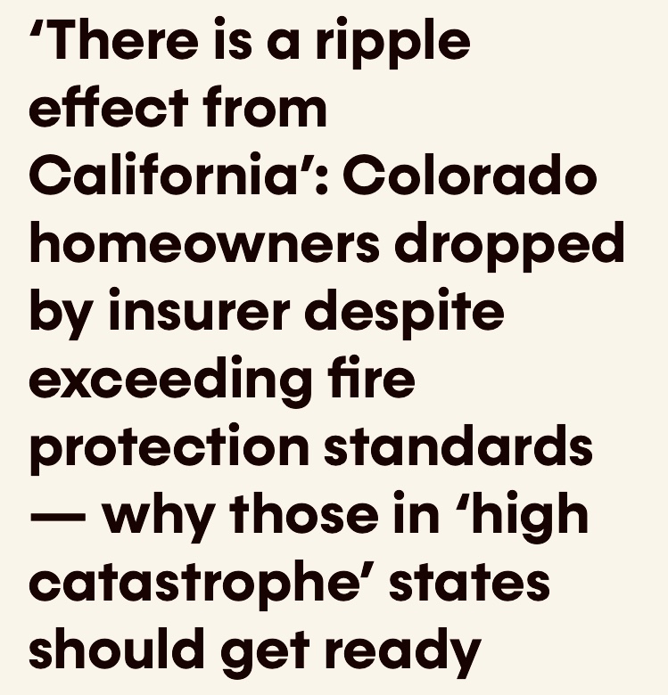
Well here it is. I decided not to go on a rant on LinkedIn after Dan Berlant posted the new zone 4 map and allow someone from cal fire explain how this map is made. Good grief its like finger painting. No response yet from CF and I dont expect one.
What is the method/science to get to this output? They say in their video it uses fuel weather topo ember cast but how can you get an output like this with jagged lines? Crazy. My neighbor half his lot is moderate the other not. Cal Fire imho needs to explain how this came to be.
https://experience.arcgis.com/experience/6a9cb66bb1824cd98756812af41292a0

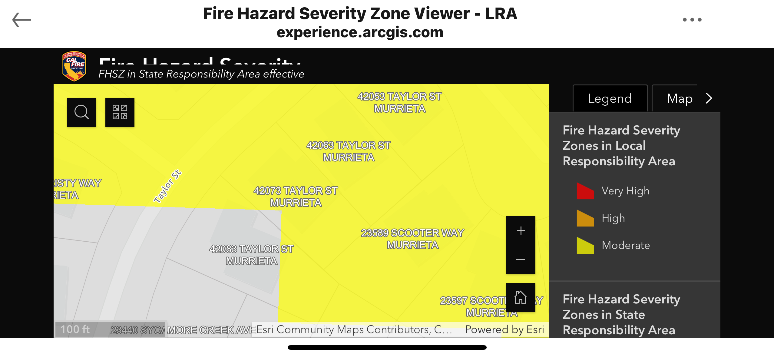
The center of that red blob. 2 to 3 foot chamise.
Here is google maps for it.
https://maps.app.goo.gl/GwQMBYwYenR6zohH9?g_st=com.google.maps.preview.copy
On a due north you could say i would get some embers but come on nothing is carrying here. In 2 to 3 ft chamise.
Since the mapping is intended to drive where to require specific building codes on FUTURE development, they are trying to capture potential (worst-case) future fuel loading, not necessarily the current hazard. So that 2-3 foot chamise, while not a problem now, could eventually be 40 years old, much taller, and full of four decades of dead and down material.