I see this fire hazard map for SRA .
Is there a similar map for the FRA ?
https://calfire-forestry.maps.arcgis.com/apps/webappviewer/index.html?id=4466cf1d2b9947bea1d4269997e86553
1 Like
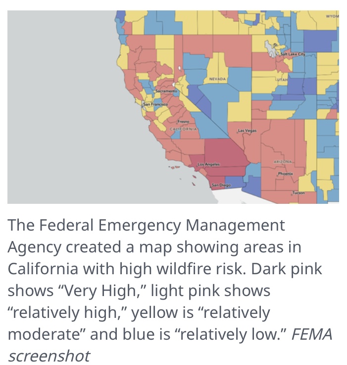
Well, considering the beach cities of Oceanside to Tijuana are shown in dark pink.
It’s no wonder insurance companies are leaving California in droves:man_facepalming:
4 Likes
And Inyo county is low? Wth
3 Likes