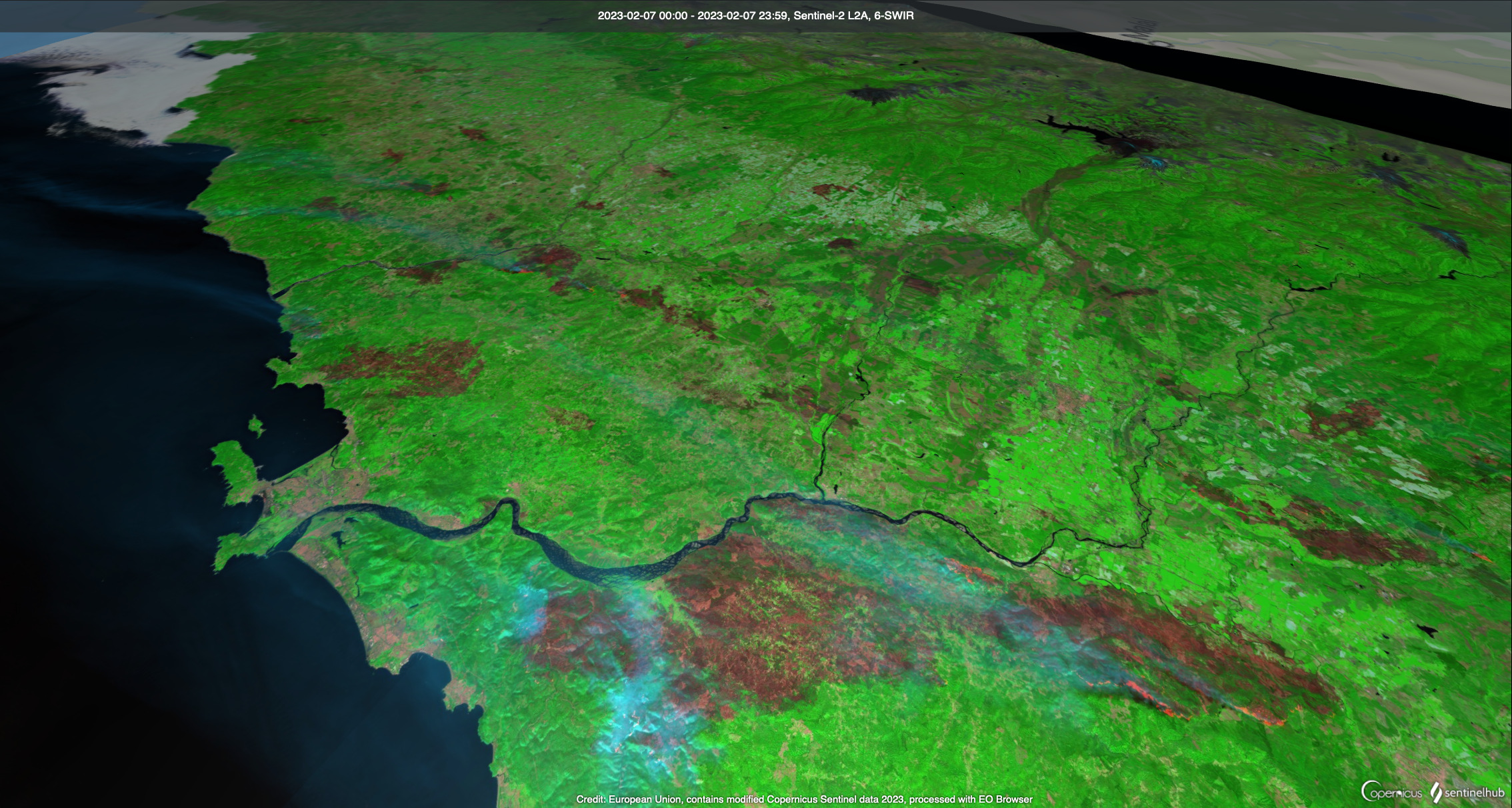
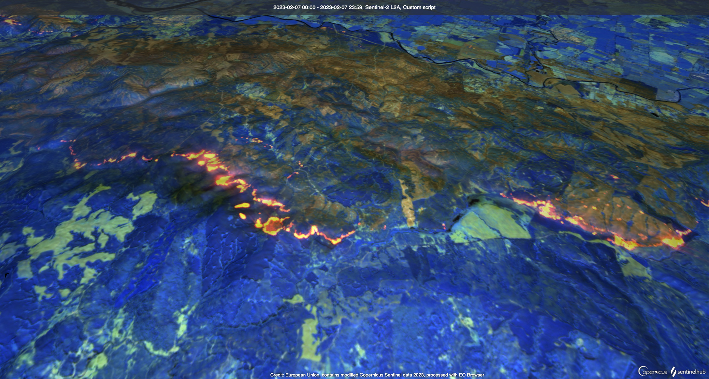
Megafires are cranking in Central Chile. VIIRs imagery at 2/4/23 05:30GMT.
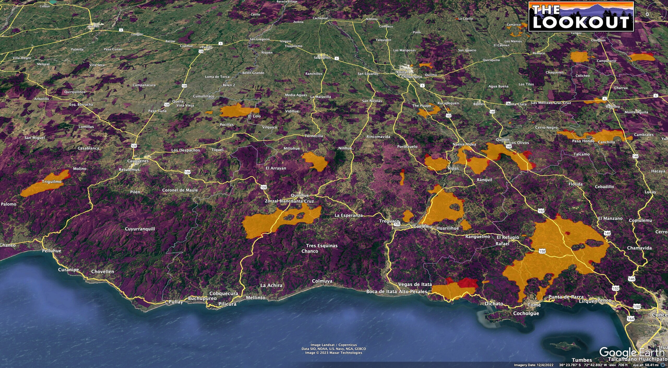
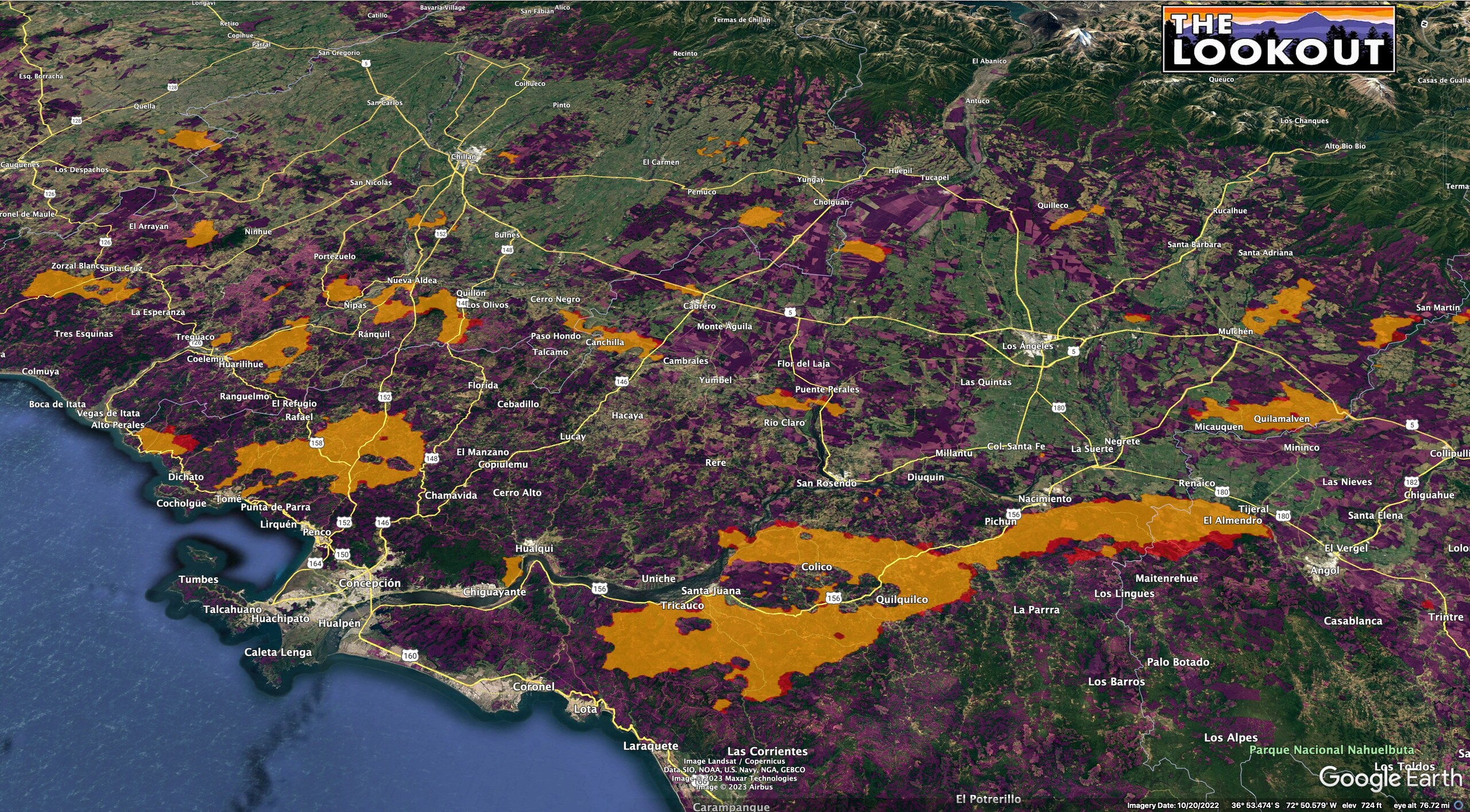
Purple areas are eucalyptus and radiata pine plantations.


5 Likes
2 Likes
228800 acres measured with heat hits for the largest fire.
4 Likes
Ugh
Eucalyptus plantations
ALL BAD
4 Likes
I did some mapping of the wildfires in Chile today. As of 0530 GMT on 2/4/23, the fires had burned about 500,000 acres (orange). By 1700 GMT, they have grown to 595,000 acres (red)
. Purple areas are tree plantations.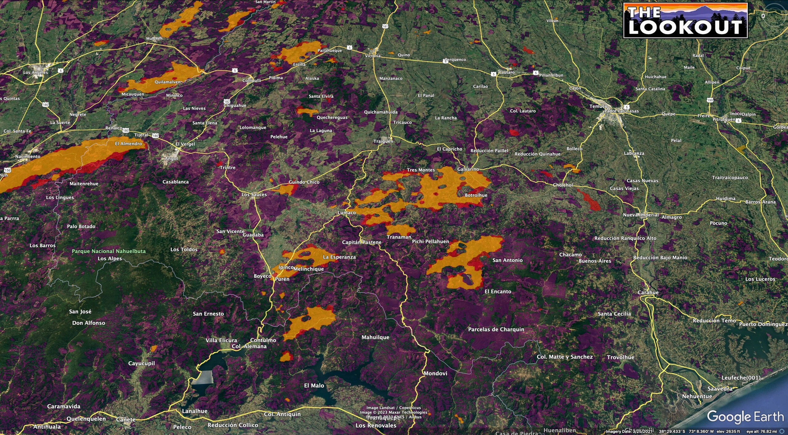
Source: NOAA VIIRs satellite data.
5 Likes
In the past 24 hours, satellite-based estimates based on NASA FIRMS data indicate that the largest fire spread 80 kilometers (50 miles) west and northwest, impacting an area of nearly 100,000 hectares (230,000 acres). The fires appear to have spread from Renaico northwest toward the Pacific Coast city of Lota, while burning past Santa Juana and likely crossing north over the Biobío River.
Chile: Wildfires intensify, disaster impacts expand

Mirador Nacimiento, Chile, 2017
24h forecast…7am Monday…up to 35 mph northerlies through Laja - Nacimiento - Los Angeles. 88 degrees, 53% humidity in Los Angeles.
2 Likes
2 Likes
Interesting the official acreage number is 99,000 acres. Looks closer to 600,000 using VIIRs and MODIS data.
2 Likes
In the past 5 days, the Chile wildfires have grown about 250k acres and now cover about 800k acres (325k hectares). About 60% of the burned area (485k acres) is tree plantations (including 270k acres of radiata pine, and 200k acres of eucalyptus).


The most explosive fire growth has been in areas which were fairly contiguous tree plantations. Purple areas are burned plantations. 2/9/23
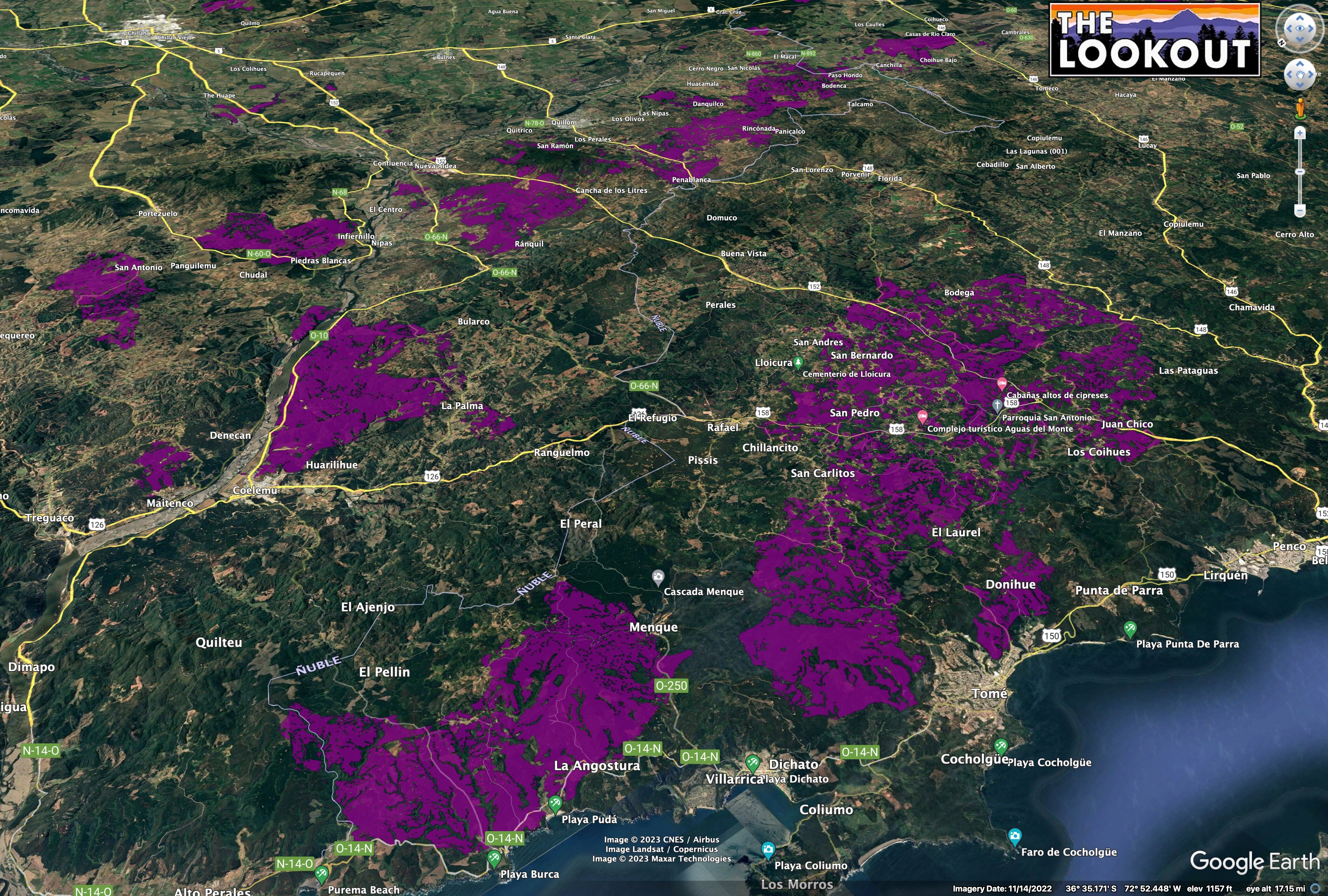

Landcover data from 2013-2016 from CONAF (Chilean Forest Service). Fire perimeters from VIIRs satellite data.
4 Likes
1 Like
Chile is burning again, here’s a post:
3 Likes
Fire is certainly one of the most primal & un relenting things Humans have in common..
Images like these say so much.
Words are not needed because the images by themselves are more than enough to trigger anxiety, depression, sorrow, pain and more - no matter what part of the world you happen to reside..
4 Likes
This webcam shot shows the insane density/fuel loading in the plantations. The second one shows the fires within the first hour or so. These came from a comment I got on LinkedIn from one of the camera operators. He said the second fire started about 30 minutes after the first.


6 Likes
7 Likes
Thanks for the update and a little education on the Fires in Chile. Had no idea on the fuel types and the amount of plantations all over that country. This reminds my of Calif no doubt, and trying to get people in the mind set of Clearance. Going to take small steps and Fire safe communities so to speak. Also a lot of clearing, thinning and Burning. Getting people to buy into that seems to be a problem.
5 Likes
Thanks.
Chile is a really interesting country in its similarities to California. The capital, Santiago, is at about the same latitude as San Diego, and the southern tip is like SE Alaska. In between, there are a lot of places you’d swear you were in San Luis Obispo, Mendocino County, or Big Sur.
It gets even more uncanny when you’re looking at the same vegetation types - for example Monterey Pine and Cyrpress, with Scotch broom or gorse underneath them. I got to travel a bit in Argentina on the eastside of the Andes at the same latitude as Lassen County and the ponderosa pine plantations felt like I was on the Beckworth District of the Plumas NF - I was thinking maybe they were planted with stock from the Northern Sierra?
The fires that made the biggest runs earlier this week don’t look like they’re moving much, but some of the fires that are more inland have made some runs in the past day or two. I’ll be going on The Hotshot Wakeup Podcast on Friday to talk about the geography and forestry industry of Chile a bit.
6 Likes
This is disgusting.
Firefighters face attacks, drones and arsonists while battling deadly blazes in Chile
2 Likes