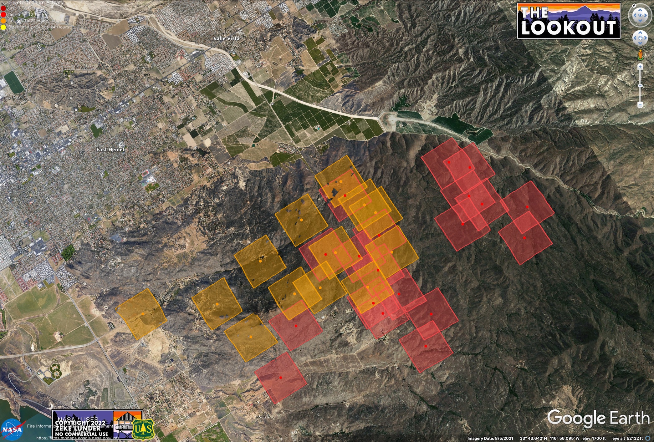
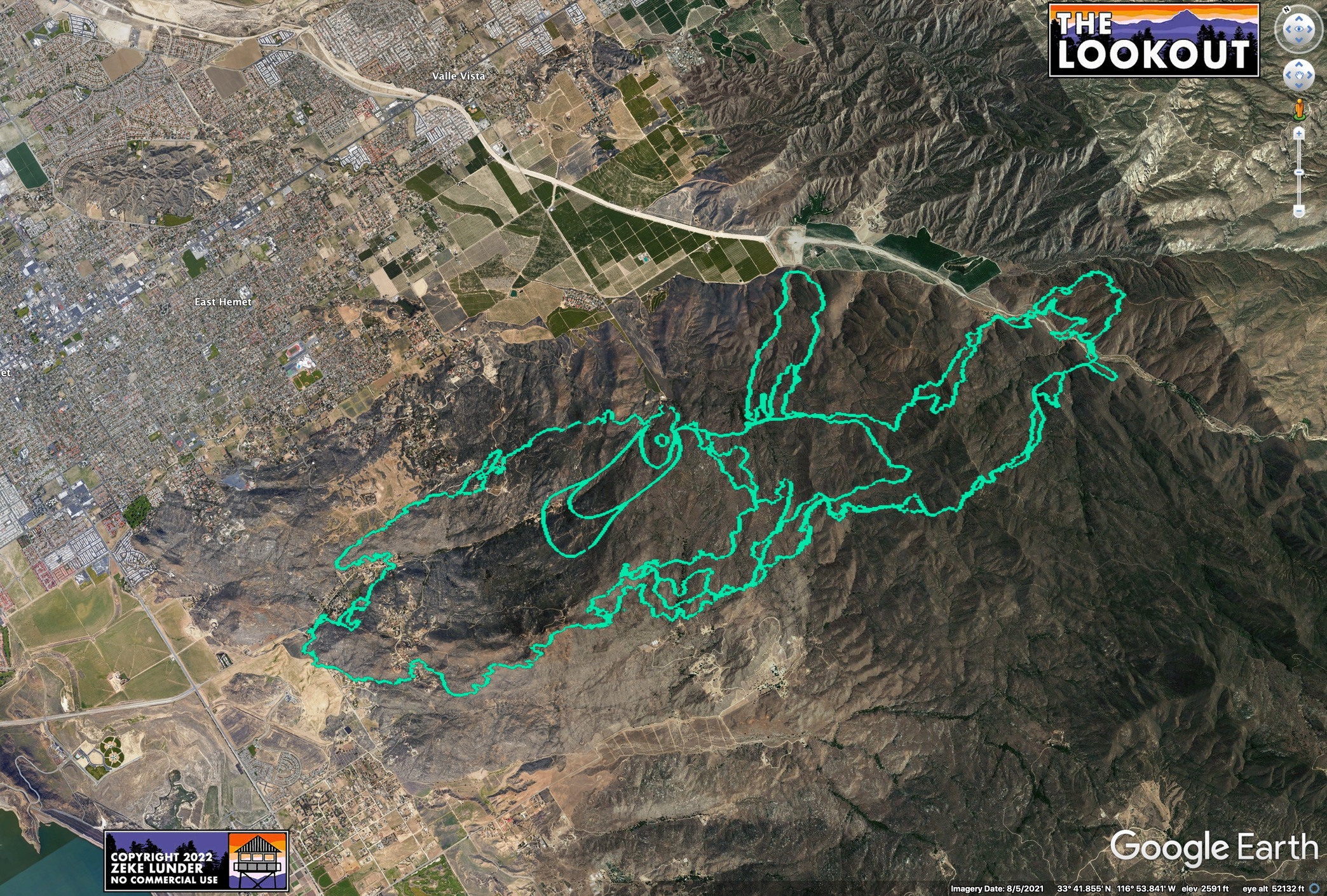
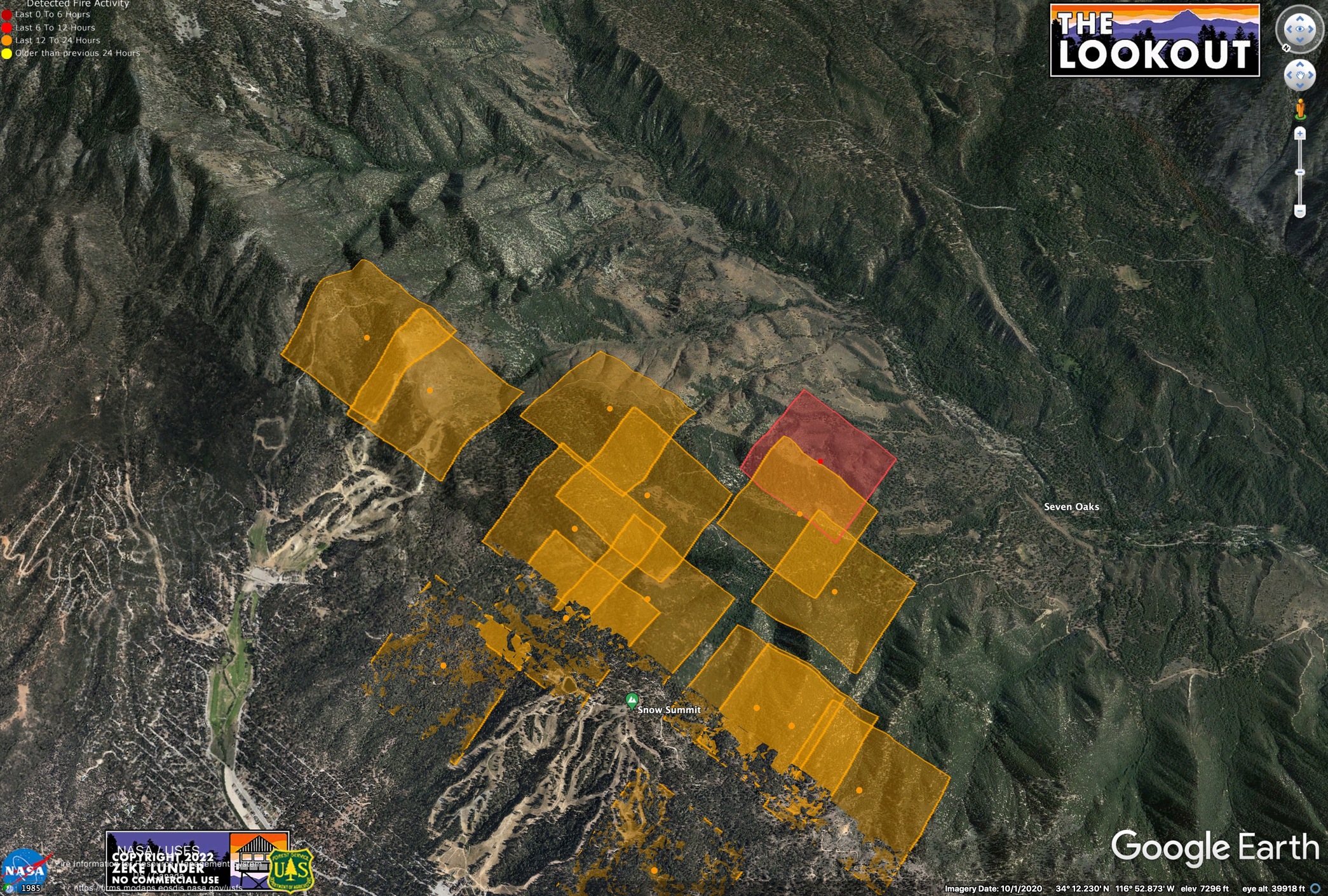
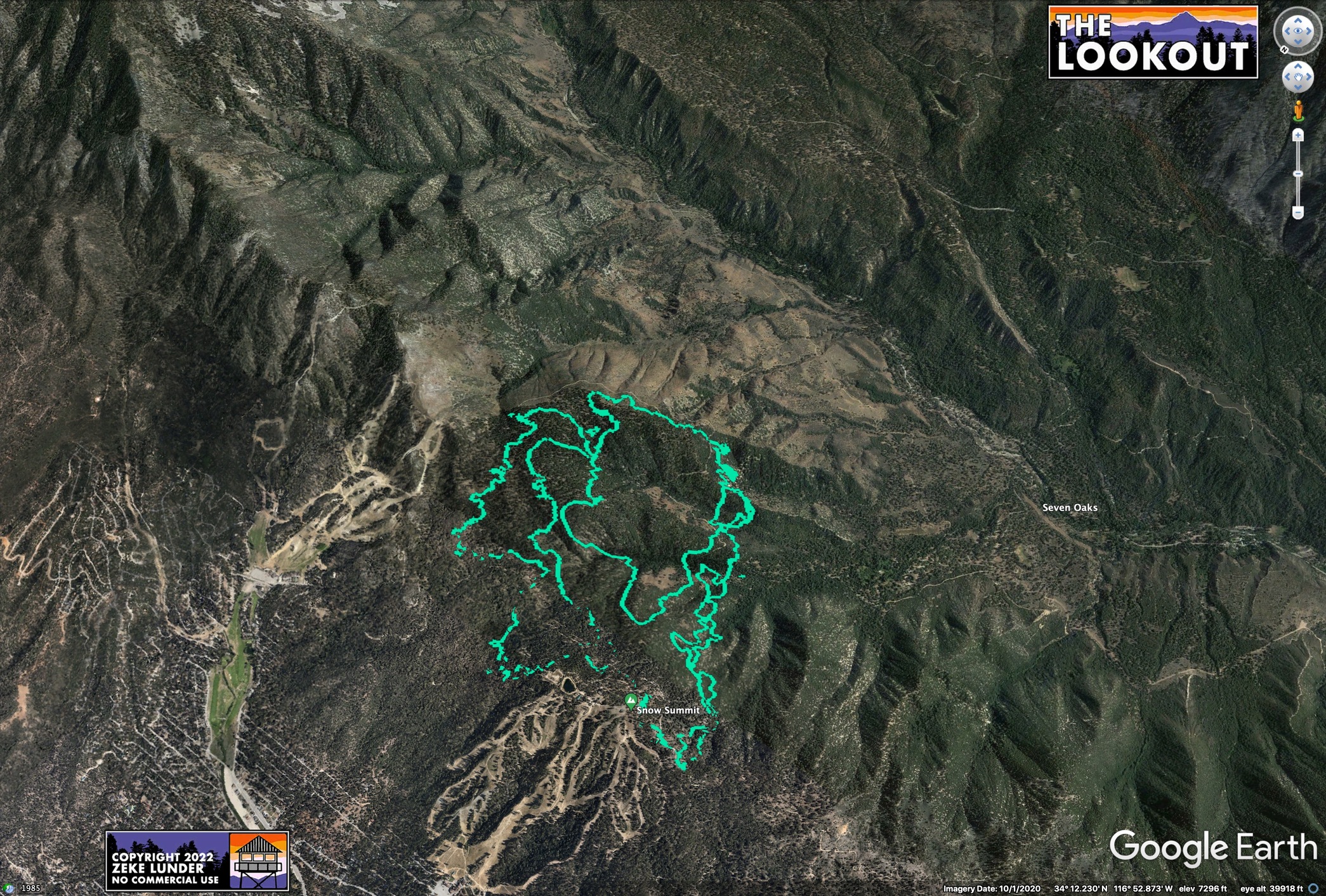
I think the maps tell the story pretty well. Here are two views of the Radley and Fairview Fires - both from publicly-available data captured this afternoon. The green line is FIRIS, which is the type of data some of us would like to see CAL FIRE releasing from their contract ships. The other maps are from MODIS, which is one of our only other options for automated fire data.
The media (including me) are going to publish maps of the fire using best available info.
Which imagery better serves the public? Do you think the Sheriff, animal rescue, inbound contractors, and evacuated public are better served by the images taken from deep space or the ones that are accurate within a few yards? What are the drawbacks of giving the public better data (that they are paying an arm and leg for, BTW)?
During McKinney Fire, the MODIS info was off by TENS OF THOUSANDS OF ACRES. People were panicking, and maps of this data were shared hundreds of thousands of times. Current MODIS of Radley Fire makes it look like the end of the world for Big Bear.
4 Likes