
Id much rather listen to what Zeke has to say than some briefing that has a bunch of old broad brushed data . This is my 40th fire season and his mapping is state of the art in my book .
14 Likes
Is this the Wildland firefighting meme forum?
Oh sorry.
1 Like
What i find so hilarious is this website is called wildfireintel and we are debating weather intel should be put on this site. I have pmd a contributor to this thread hoping get a little more behind what is driving this discussion. I belive one post was in reference to my post of the FIRIS 1730 mapping mission of the FAWN and my mention of a few spots on the east side. The sensor on that aircraft is extremeley sensitive. I also made that post 2 hours after the mission and added the time it was made. Those spots could have been absorbed by the main fire by then who knows. If someone is reading a post i make with openly available data and not using the data themselves to drive their decisions I am not sure how they can even complain. If im a divs or ops or IC and i have this data im gonna make a radio call to the folks working in this area to make sure they are aware of it. I have used FIRIS spot fire data on an incident and it was amazing. Nobody else on the incident had the info on the ground but me. So this rhetoric about the data is for the decission makers and should be locked behind doors is major BS. Im on the edge as a divs making decisions. The data needs to be decentralized. Funny no issue showing where a hurricane is but a fire oh hell no thats priviledged info. Rant over.
25 Likes
Pyro, keep doing what your doing. Your maps are great to see progression, spots, potential for spread, etc. If someone mistakes them as “official” maps then thats on them.
16 Likes
I completely agree! Pyro, keep it going.
8 Likes
Wow… you all really took this topic into some strange spaces…
Back to “My” original comment. Anything titled “Briefing” should come from an official source. It is America and you can all do what you want…
The irony is that all the posts seemed to corroborate what I was stating. All the different sources of information and so much of it is out of context, not connected to the actual events or based on bias.
So… the PIO, OSC or AHJ spend a lot of time cleaning that up, putting out unnecessary fires.
In the end … whatever…
1 Like
I heard your initial concern - that I make it clear I am not officially assigned to the fire and do what i can to ensure my reports are not mistaken as official info from the incident. I think it is a good point. Thanks for bringing it up.
5 Likes
Well to clarify, your original post called him out whether he should be doing this or not because he isn’t assigned to the fire. He has never stated he was assigned to any of the fires, he is posting progression maps based on the untel from all sources…IAP’s, mapping flights, FLIR cameras, etc., to show what the fire has done, is doing and where it may go. He also never said these were official briefing maps, just information…like everyone else that puts together these and posts. Nobody else seems to have a problem with it and understands its just another tool to use especially when your on the line and using a map that was generated from intel that is at least 12 hours old vs. a mapping flight that happened 2 hours ago. Take it how you will but its my opinion.
11 Likes
Let me add some context and intel.
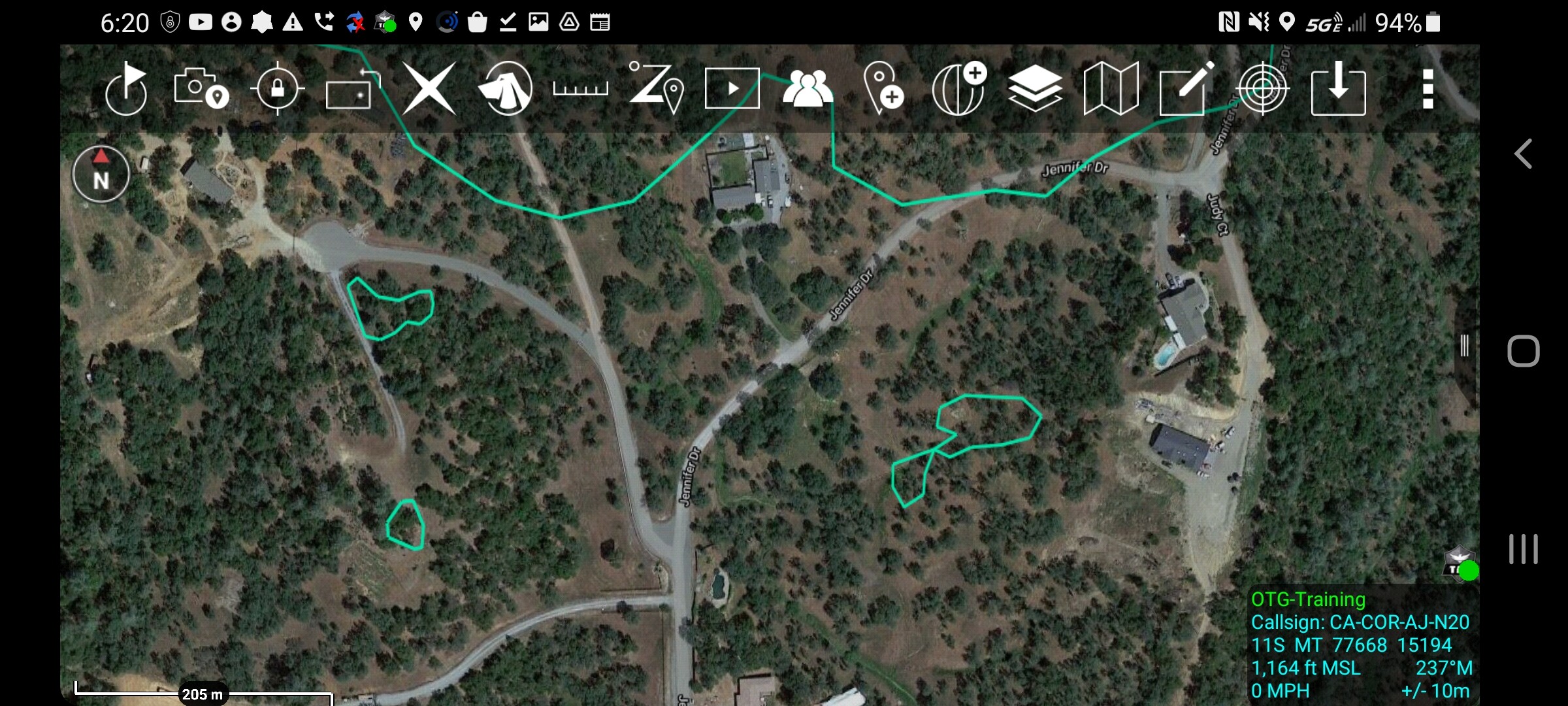
The ATAK platform for Android is a game changer. To have the ability to load a map set for the day from the incident.
THEN get the REAL TIME intel and import that intel for Tactical decision making only adds to the SA available to personnel. As someone who “wears blue” and spent 7 shifts on the Dixie as a DIV “assigned” to the East Side. The TEAM products were adequate at best. But the base maps from each team had their positive and negatives. But using ATAK and building a map set. Then getting the NIROPS, COURTNEY, FIREWATCH intel as it was uploaded into the FTP site WAS HUGE in decision making. All that intel was placed in a PUBLIC ACCESSIBLE location. Additionally, adding my email to the “Intel section” got me access to near real time KML data. I just needed service to access. Every CF CO have access to REAL TIME fire modeling at their fingertips thanks to the WFA app that California purchased from Technosylva. My point in all of this if we try to control the information, we will lose the battle before its even started. IMHO, what @pyrogeography does is takes the LCES and provides a steroid shot to the “C”. Now an argument can be made that the general population doesn’t understand LCES and could care less until it effects them. But I will say this. This site picked up where the Hotlist left off. The SME, available Intel, polite and professional discussions are light years ahead of what the old site had at the end. As someone else mentioned “you just have to adjust your personal filters for the signal to noise ratio” with all of the commercially available intel that is available in 2021. What Zeke does is just that, he tells it like it is, from an unbiased professional point if view.
17 Likes
Plugging Cal Topo some more - it’s a great resource for making a quick map on-the-fly before an incident is evolved enough to have someone else making maps for you. It even has ICS symbology built into it, so you can draw a dozer line on the map and give it the XXXX symbols, or add a water source or staging area. It also plays nice with Avenza - you can save a KML of points or lines out of Avenza, and load them into Cal Topo and overlay them on a USGS topo, hillshade, or aerial photo.
Here is a 2-minute map made of the Rancho Fire in Tehama County that uses the public FIRIS perimeter of the fire with structures and wind vectors.
If you sign up for a (inexpensive) Cal Topo account, you can save your projects, and share them as a URL, like the link, below… You can also save a geo-PDF out of here and load it into Avenza or ATAK.
8 Likes
100% I will be teaching a pseudo type 3 plans class to our folks in a month or so. Our dept bought CAL-TOPO Team account for this exact reason. We need a relatively easy mapping tool to create the next operational period map. No need for a degree in GIS. Down and dirty map that is geospatial and easy to share.
8 Likes
When are you teaching that?
2 Likes
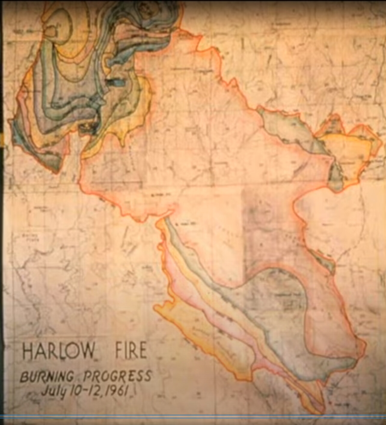
I asked Zeke in a PM if he had the Harlow fire of 1961 all by itself. It didn’t dawn on me that when he said he “simplified the polygons” that the fires were actually still in separate files. I just thought it was one file so I didn’t explore and keep clicking and digging and clicking.
This is an amazing piece of work that I don’t think most, like me, understand the implications of if you dig into it!! This is a complete walk back through my 30 year career being able to look at all the fires I have been on.
It is amazing! This is like the ultimate historical Christmas present!
Zeke, great job!! But do you realize how long its going to take me to go through all the names? I have to admit, each time I find another one it puts a smile on my face and brings back memories (and a cringe or two).
4 Likes
Thanks, @IMT_Geek
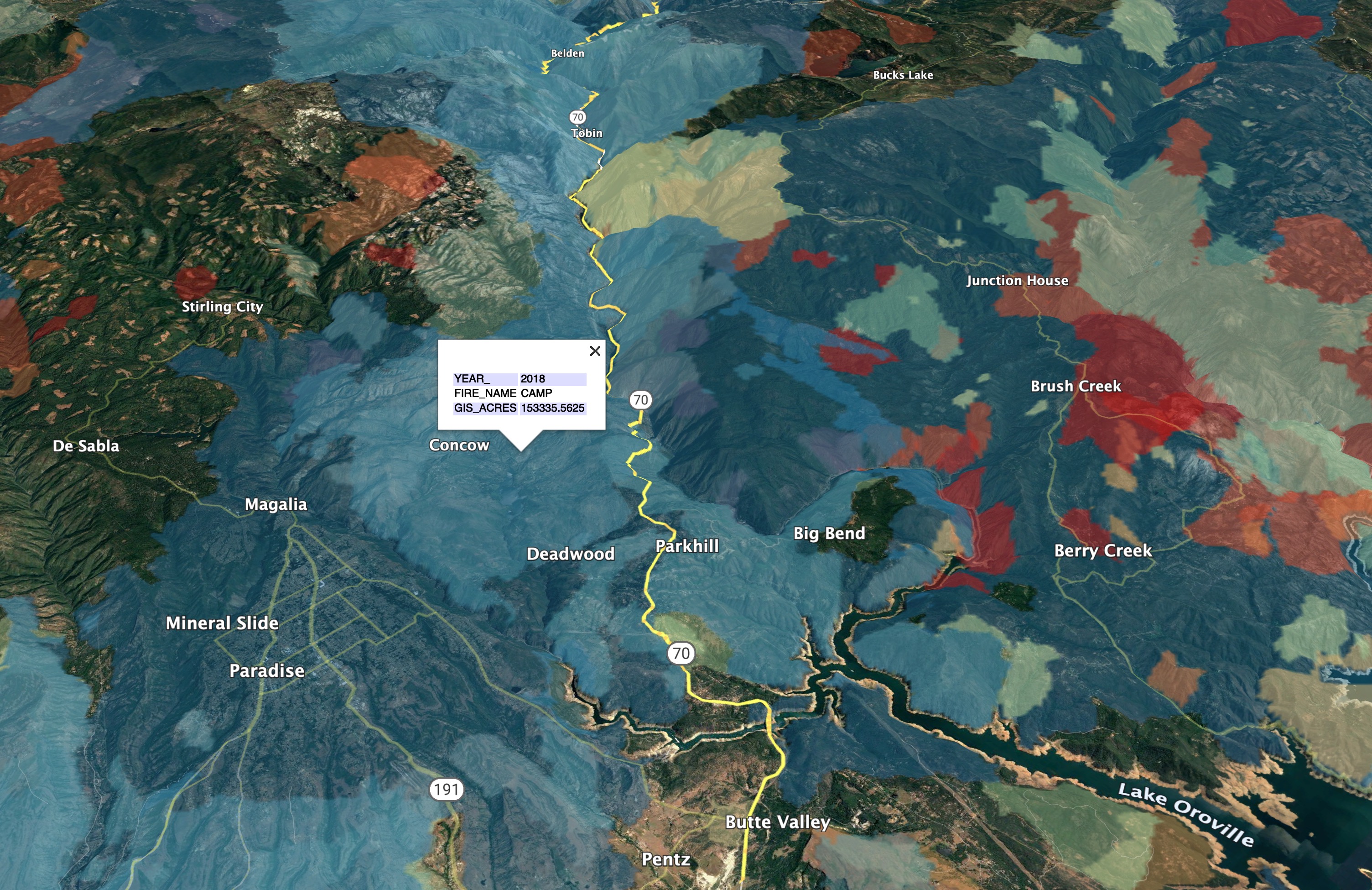
He is referring to the fire history KML layer I shared awhile back:
http://deercreekgis.com/files/California_Fire_History_1927-2019.kmz
If you open the file in Google Earth, you can copy and paste individual fires into your table of contents, or save the individual fires as their own KML/KMZ files. This can be handy for bringing them into Avenza or Cal Topo. The fire’s perimeters are simplified to be small enough to get them all into one file, so the geometry is not spot-on, can be off a few hundred feet.
3 Likes
Chief, you can always hit me up at HQ. I’m back there right now on light duty, doing my old job as a GISS.
1 Like
I just created a new KML for the most up-to-date California Fire History layer (2021).
This is free for non-commercial use, with attribution (if you share maps made from it on social media, cartography projects, or in presentations, please credit Deer Creek Resources).
If you want to use this data on a commercial website or cartography project, please contact me for licensing.
http://deercreekgis.com/files/Ca_Fire_History_Thru_2021_DCR.kmz
9 Likes
Thanks Zeke! Your web address a KML network link worked perfectly in ATAK and I easily searched for the Harlow incident.
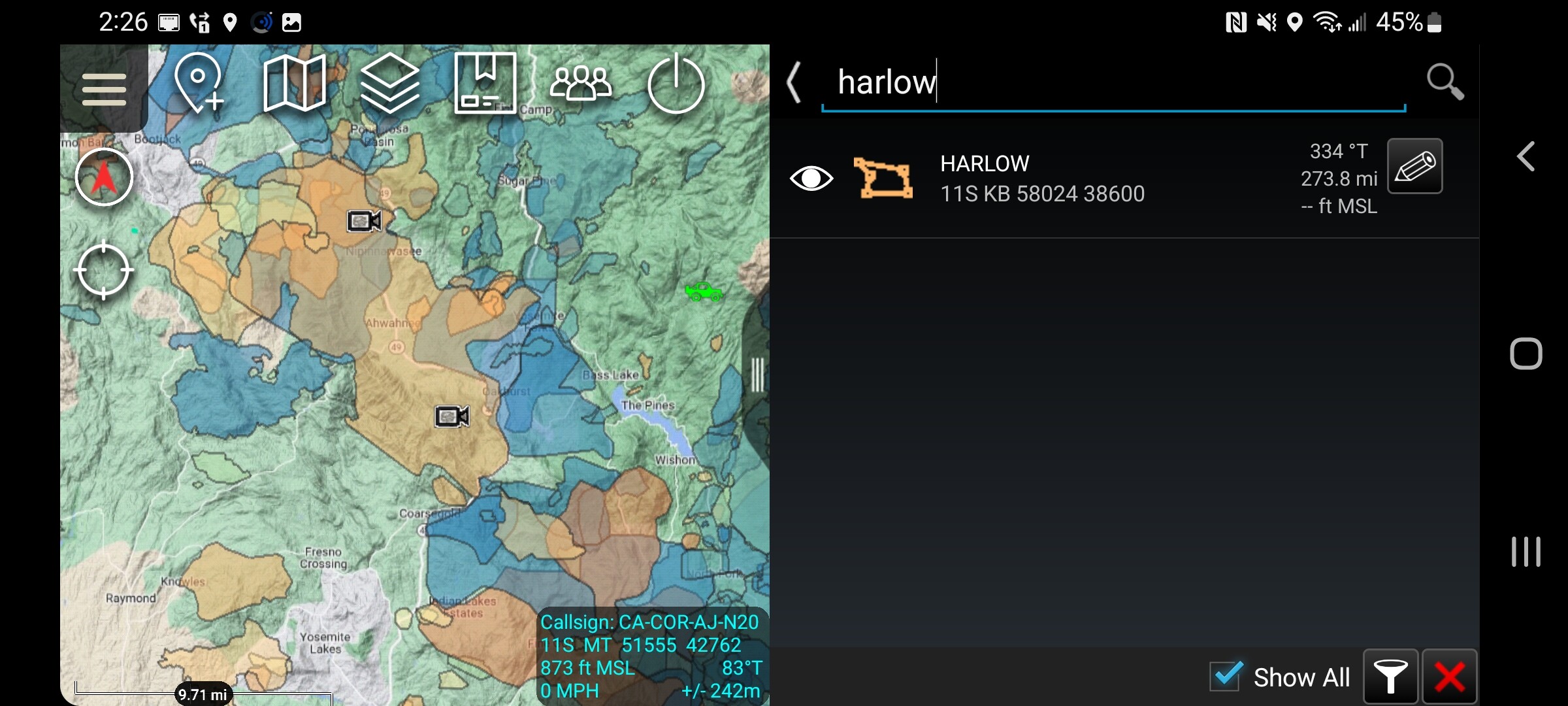
4 Likes
Yes, right there. I was hoping to get a progression map but one may not have been done. There is an image on a movie about it, but it was all hand drawn cartography (high tech for the '60’s!) and probably doesn’t exist outside of that map.
Once I figured out the treasure trove of incidents I kinda got distracted. I’ve been finding and copying the fire files I was on literally from A (Angora) to Z (Zaca).
5 Likes
I’ve thought about making a map of all the fires we have helped map between NorthTree Fire and Deer Creek GIS. At the end of 2020 we were up to over 200 Type I or II GIS assignments since 1999, in 10 states. A lot of mouse clicks and headaches have gone into all of those fire perimeters!
7 Likes
Here is a way back machine view of what your grandparents did, before GIS, computers, and everything else besides a good box of colored #2’s. This is the fire progression map of the July 10 through 12th 1961, Harlow Fire in Mariposa-Oakhurst area. We know the fire will someday repeat itself, so we are trying to get traction with the Firewise program in our neighborhood.
15 Likes