They have it there so it can make more frequent flights instead of originating in Biloxi MS, their home base. As the storm gets closer they will increase the number and frequency of flights.
11 Likes
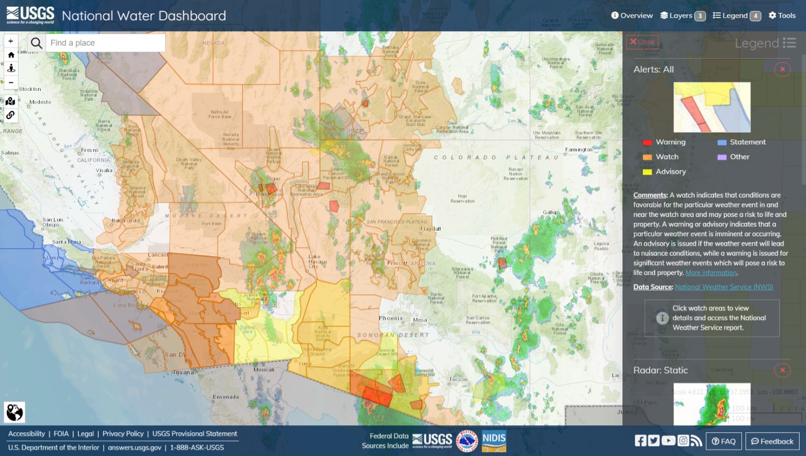
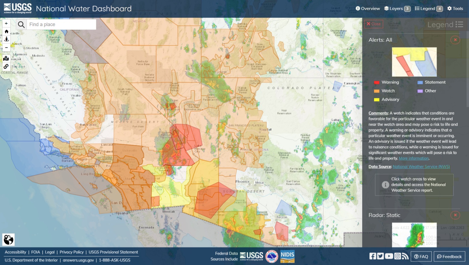
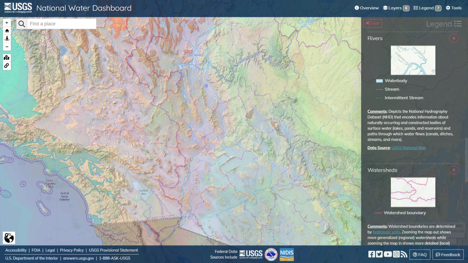
USGS | National Water Dashboard is a good map for this stuff because it has river, watershed and aquifer layers and a couple good topography sets. NWS Flood Watch and Warning zones polygons, past and forecasted precipitation totals and radar loops. Pretty much the factors you might want to consider regarding what happens after the water hits the ground. Generally, where the watershed line is, is where the water is going to split, usually but not always on an elevation line. Aquifers is where saturation will cause more pooling, and where more movement could be occurring that is not easily observable. The river or stream that’s more or less in the topographical low, often the centerline, of a watershed is where the water is probably going to go. Watershed detail becomes more fine as you zoom.
4 Likes
96-5300 as ‘TEAL77’
99-5309 as ‘TEAL81’
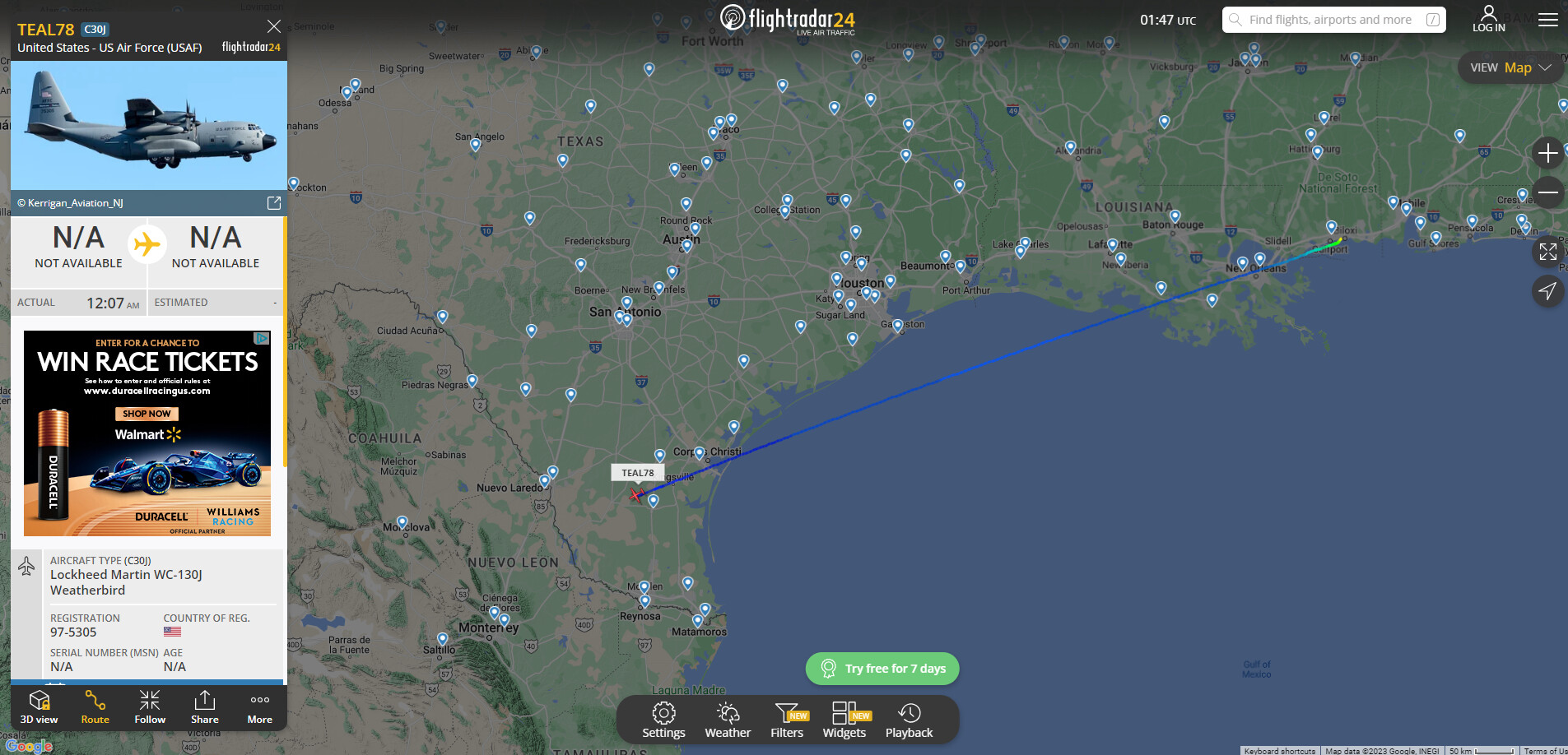
97-5305 as ‘TEAL78’
These are the current Hurricane Hunters that are assigned to recon for Hurricane Hilary. Staging is out of KSMX (Santa Maria Public Airport) in Santa Barbara County. ‘TEAL77’ is the only aircraft so far to finish a recon flight. As stated above they have been moved to KSMX for shorter flight times as to allow more time inside the storm due to fuel limitations when lifting from Biloxi.
9 Likes
TEAL81 moved to SMX earlier today:
TEAL78 is en route from Biloxi to recon and currently over Southern Texas:
3 Likes
If all this comes true HWY 395 should be a fun drive during that time period.
6 Likes
Tropical Storm Warning now issued for Hilary. As of the 8pm PST NHC update….Hilary has maintained winds and pressure over the last 3 hours
Tropical Storm Warning is now in effect for our entire forecast area (San Diego, Orange, W Riverside, SW San Bern. counties). Passage of Hilary will most likely be late Sunday/Sunday evening. Here is the 8 PM bulletin from the National Hurricane Center: nhc.noaa.gov/text/refresh/M…
4 Likes
Can you please correct the link so it works?
2 Likes
People are saying this is the FIRST Tropical Storm of Southern California. FALSE! That storm occurred in September 25th, 1939. After the 1939 storm that killed 100 people the NWS opened its first Southern California office in 1940. The National Hurricane Center was formed in 1955. Long after the 1939 storm had occurred. Just to let you all know the National Weather Service was founded in 1870, before NOAA, NHC, and way before the NWS Severe Storm Prediction Center. With that being said, the NWS did form a Tropical Storm Watch for the 1939 storm, but the NHC could not because, it wasn’t around. Therefore, this proves this isn’t the FIRST Tropical Storm watch for Southern California!
1 Like
Just for clarification……you are correct as far as the 1939 storm being the last. I think what folks are hearing and reading is that this is the 1st tropical storm watch…now warning ever issued for SoCal
5 Likes
Good point on what the NWS called storms when it began in 1870 - tropical watches or warnings. NHC began in 1950 - this is the first since then but not in the history of Ca. tropical storms.
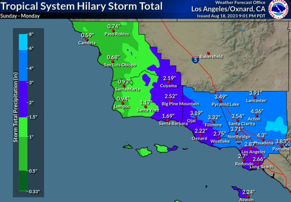
Looks like a lot of rain either way:
4 Likes
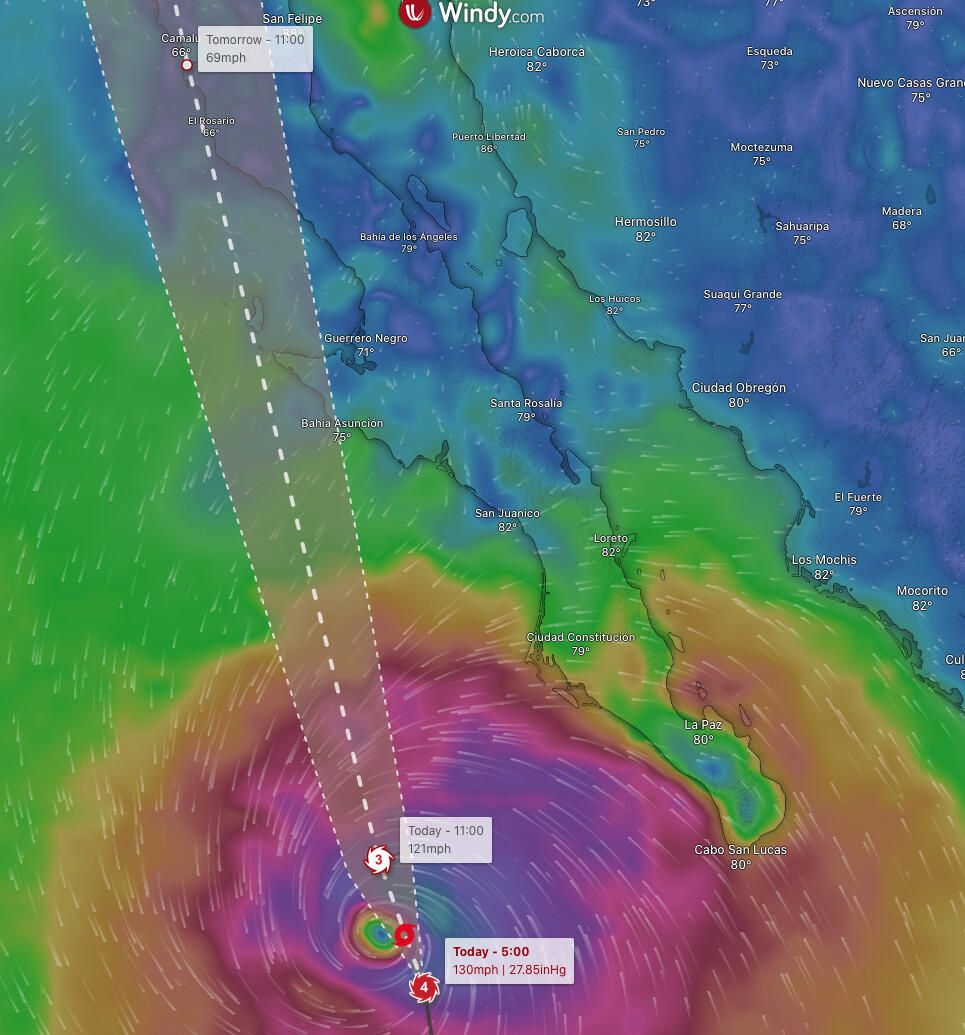
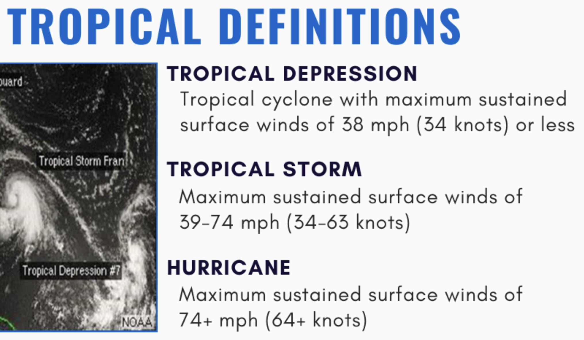
The hurricane hunter plane found that the storm is still a category 4 hurricane with a minimum central pressure of 946 MB and maximum 130 MPH winds. The storm likely peaked in intensity a few hours ago and is now starting to weaken as it encounters wind shear and cooler waters.
8 Likes
Well Hilary has strengthened again. This mornings 5am PST update from the NHC shows her pressure dropped to 943 mb
6:00 AM MDT Sat Aug 19
Location: 21.5°N 113.4°W
Moving: NNW at 13 mph
Min pressure: 943 mb
Max sustained: 130 mph
5 Likes
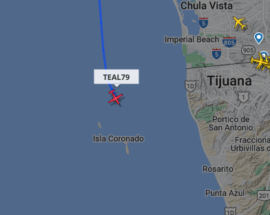
TEAL 79 has been airborne for just under an hour and is off the coast of Rosarito, so we should be getting some greater insight on how things look shortly
2 Likes
 !
!