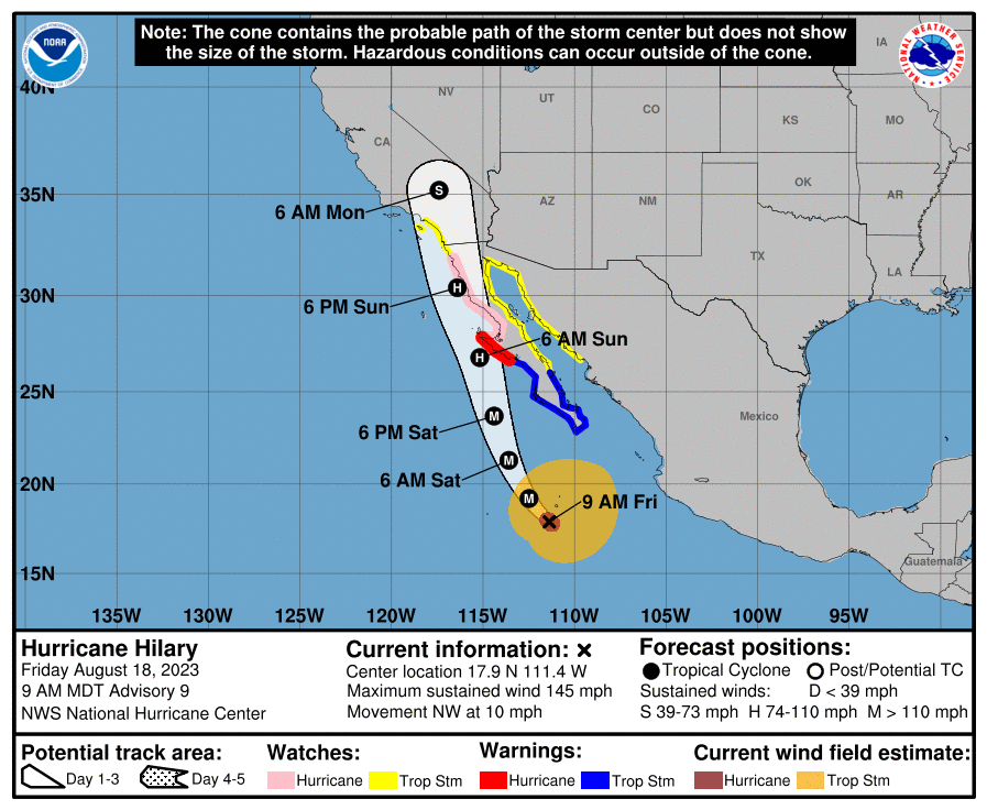
Official Track as of this morning and update:
5 Likes
Hilary is attempting to complete an eyewall replacement cycle this morning. This process has significantly increased the size of the storm. Hurricane Kay peaked at intensity at around 21 degrees north, so this is a good reference point for when Hilary will peak/begin to weaken.
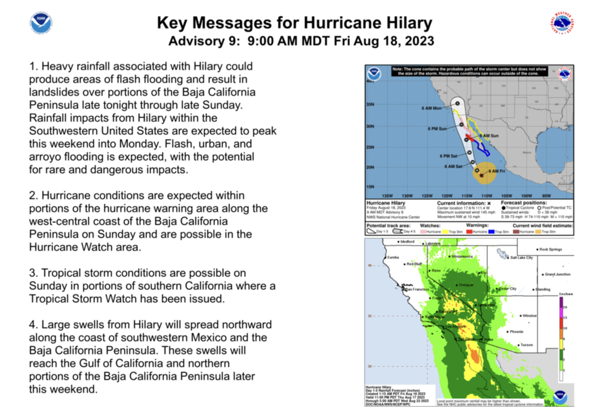
The increased size of the storm (assuming it completes the EWRC) means a slower weakening trend, and I would expect tropical storm watches to be upgraded to tropical storm warnings for Southern California tomorrow with a hurricane watch.
8 Likes
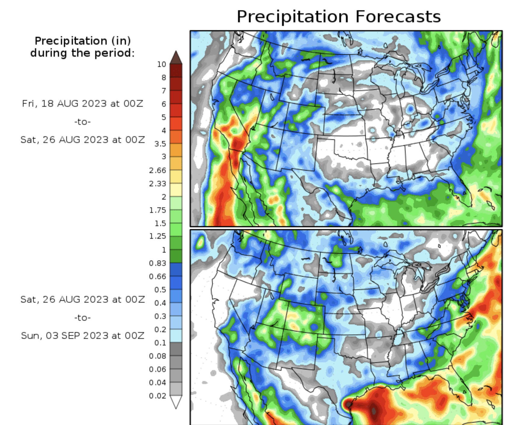
Precipitation forecast map has been trending more widespread precipitation over NorCal. Should be interesting…
Note: Take these forecast maps with a grain of salt, especially in the extended range 8-14 days.
7 Likes
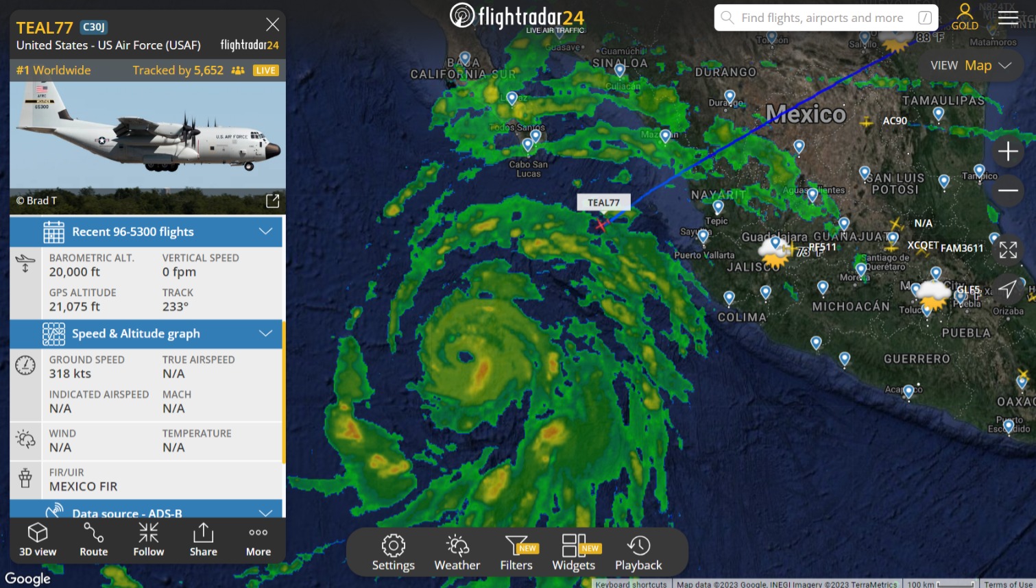
TEAL 77 is approaching the first high wind band at 20,000 ft and 318 kts. I don’t know what the flight plan is, or when, or where, they will deploy dropsondes, but TEAL 77 might already be sending back some good data.
Not displayed, now. Were looking good and stable. USN has an E2 Hawkeye coming south from Coronado. Dunno if they are coordinating, but SCORE92 could be some help if they need it.
12:52 pm TEAL 77 has exited the hurricane core and is looking good.
6 Likes
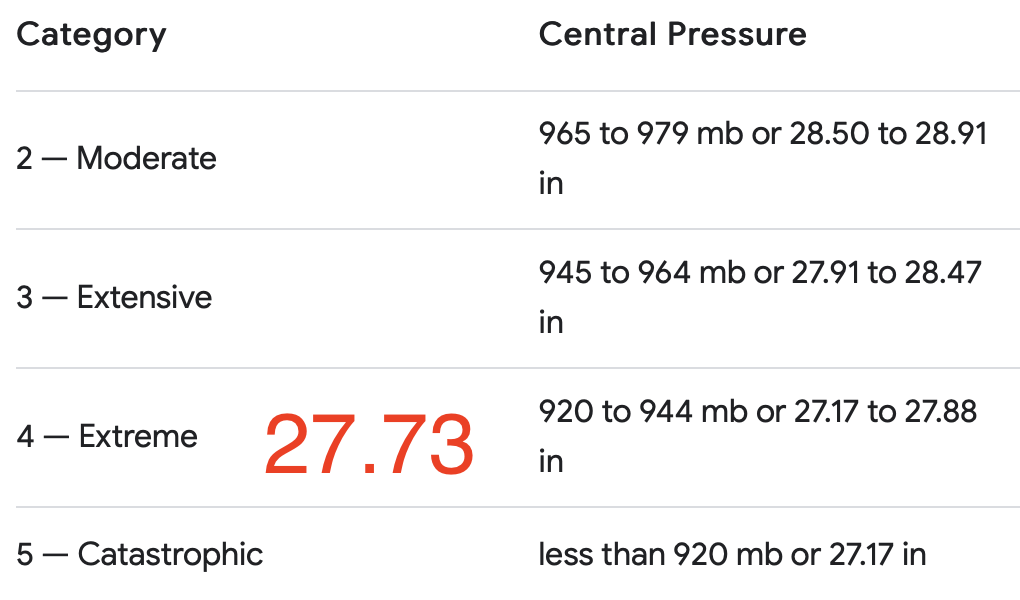
Tropical Storm Watch now in effect for SoCal. TS Warning for the Mexican border south. 11am PST update keeps the storm at same wind speed and min pressure. 145 mph and 939 mb
National Weather Service San Diego CA EP092023
829 AM PDT Fri Aug 18 2023
CAZ050-182330-
/O.NEW.KSGX.TR.A.2009.230818T1529Z-000000T0000Z/
San Diego County Valleys-
829 AM PDT Fri Aug 18 2023
…TROPICAL STORM WATCH IN EFFECT…
A Tropical Storm Watch means tropical storm-force winds are possible
somewhere within this area within the next 48 hours
-
LOCATIONS AFFECTED
- Escondido
- El Cajon
- Lakeside
- Poway
-
WIND
-
LATEST LOCAL FORECAST: Equivalent Tropical Storm force wind
- Peak Wind Forecast: 35-45 mph with gusts to 65 mph
- Window for Tropical Storm force winds: Sunday afternoon
until early Monday morning
-
THREAT TO LIFE AND PROPERTY THAT INCLUDES TYPICAL FORECAST
UNCERTAINTY IN TRACK, SIZE AND INTENSITY: Potential for wind 39
to 57 mph- PLAN: Plan for hazardous wind of equivalent tropical storm
force. - PREPARE: Efforts to protect property should now be
underway. Prepare for limited wind damage. - ACT: Act now to complete preparations before the wind
becomes hazardous.
- PLAN: Plan for hazardous wind of equivalent tropical storm
-
6 Likes
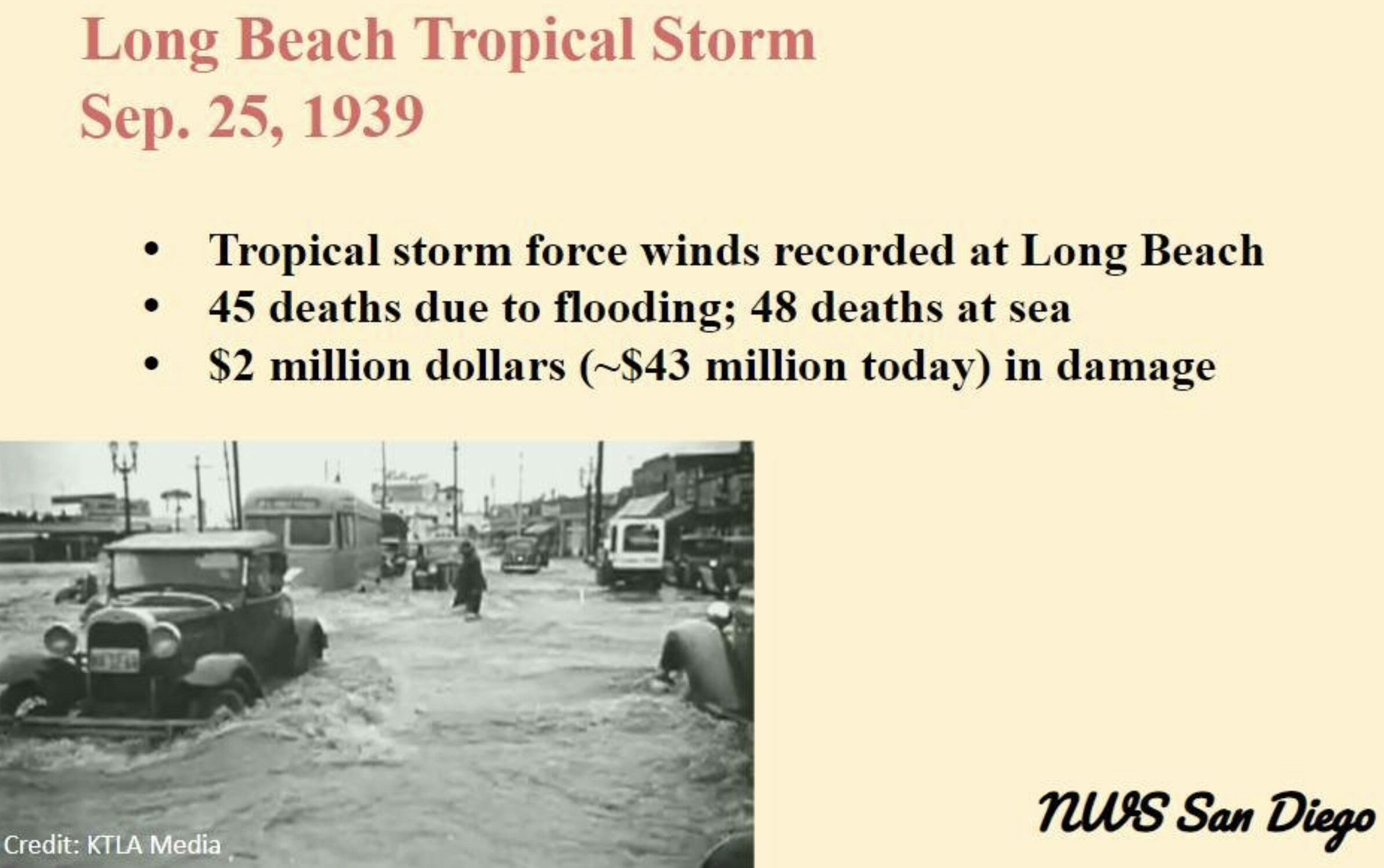
Not hearing much regarding wind impacts. Historically, as in 1976-77 (Kathleen), there were widespread wind impacts on top of the precipitation impacts. The Eastern slopes of the Sierra were seriously impacted and that storm, at its fullest extent, was barely a Cat-1 with no definable eye wall. I remember as a kid those winds affecting the SF Bay Area.
1 Like
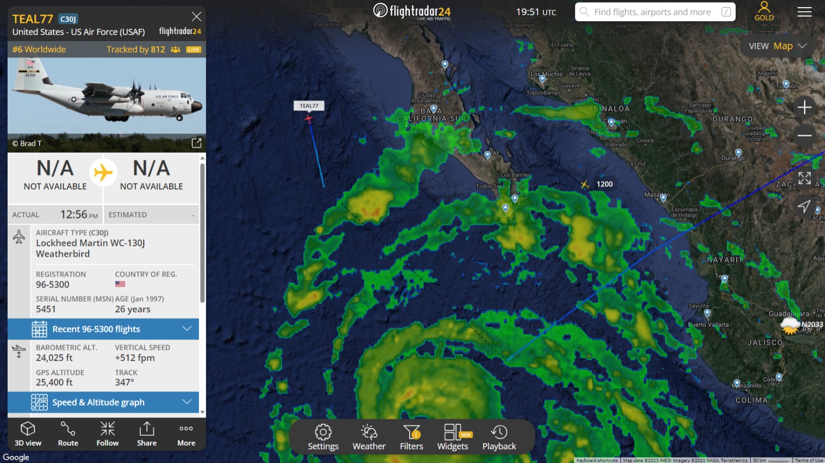
Yeah. Heading north now. I added a screenshot to a previous post. Navy had an E2, a few Hawkers and a KC-135 up north, out of Coronado, I presume. Don’t know if it was coordinated, but they would be in a position to find TEAL 77 if something happened. There’s also the normal sea traffic skirting around the storm, including Mexican Navy patrol aircraft and the US Coast Guard. AFAIK, the C-130 could just go back to Keeler, but maybe they are going to base out of SoCal for the next mission. I see these Hawker Hunters flying around SoCal, now and then. No idea what their nominal mission is. There’s a carrier variant, the Hawker Sea Hawk. Trainers, maybe.
Turns out it was Pt. Magu.
3 Likes
3 Likes
Hilary has peaked in intensity and is now “weakening”. 2PM PST update…winds down from 145 to 130 mph and central min pressure has risen to 948 mb. Movement still NW at 12 mph
4 Likes
@anvilhead was talking about eyewall replacement…wonder if this means the replacement failed, or is still in progress.
2 Likes
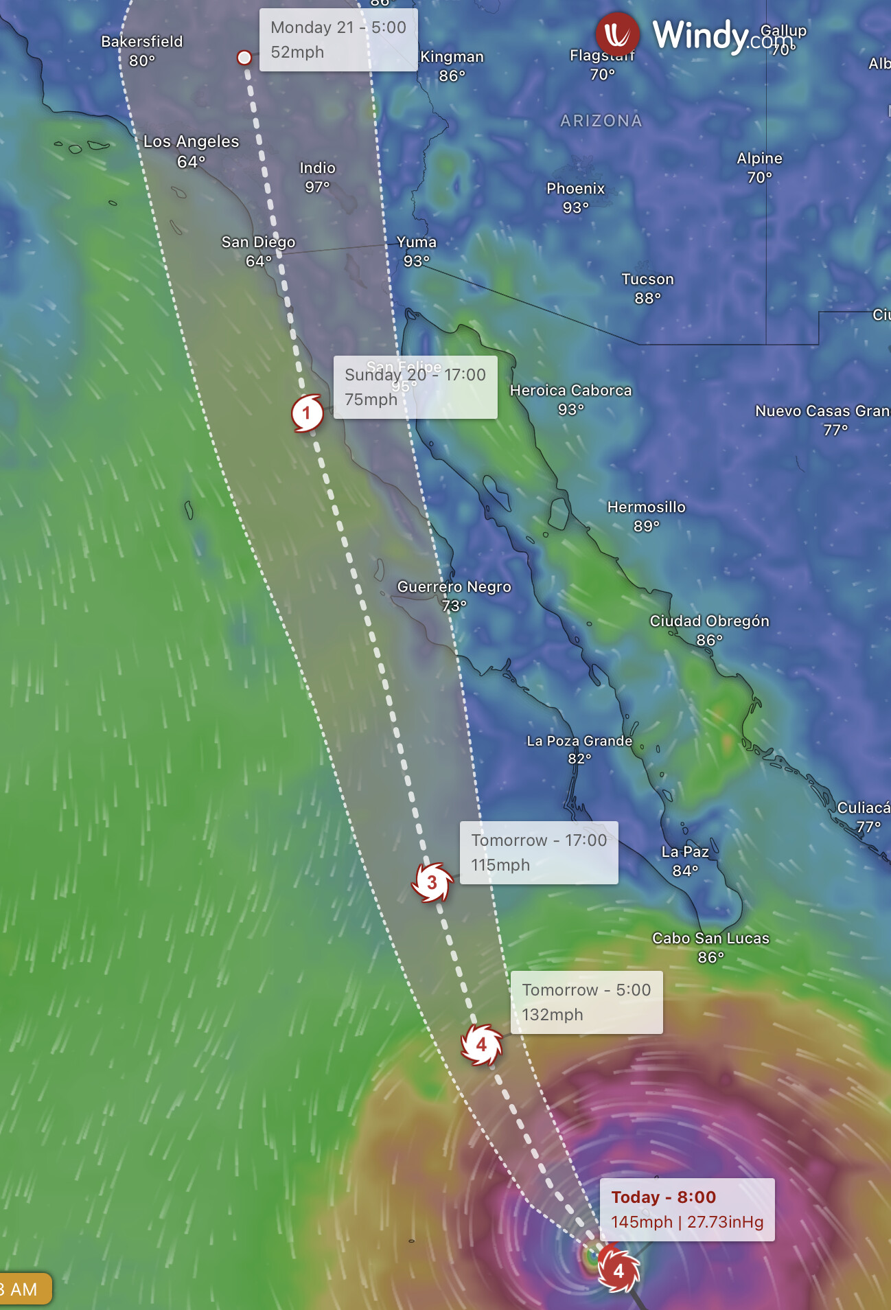
Combination of EWRC and slow forward motion upwelling cold water. The dvorak numbers have increased and looking good on satellite so I think the storm is in the process of restrengthening for the next 6-10 hours. Increased forward motion likely helps the storm at least maintain intensity for the next 12 hours, and the NHC now expects the storm to make landfall 6-8 hours faster than previously thought.

GIF showing the storm improving after EWRC & increased forward motion
12 Likes
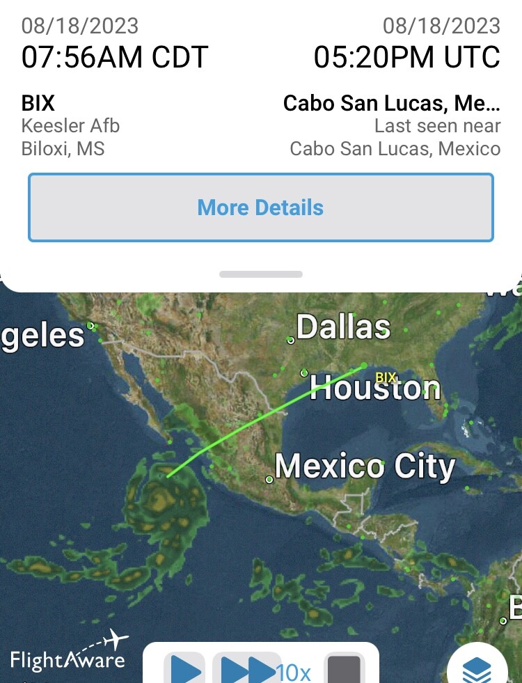
TEAL 77 just landed at SMX. Ready to load up some retardant? Lol, I dunno.
5 Likes
They have it there so it can make more frequent flights instead of originating in Biloxi MS, their home base. As the storm gets closer they will increase the number and frequency of flights.
11 Likes
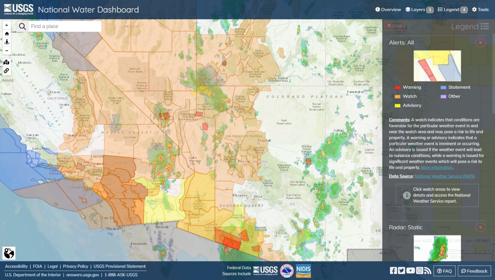
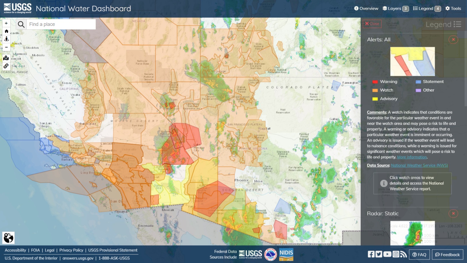
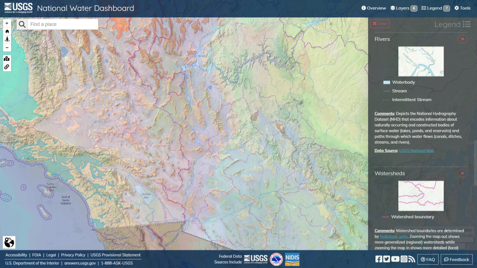
USGS | National Water Dashboard is a good map for this stuff because it has river, watershed and aquifer layers and a couple good topography sets. NWS Flood Watch and Warning zones polygons, past and forecasted precipitation totals and radar loops. Pretty much the factors you might want to consider regarding what happens after the water hits the ground. Generally, where the watershed line is, is where the water is going to split, usually but not always on an elevation line. Aquifers is where saturation will cause more pooling, and where more movement could be occurring that is not easily observable. The river or stream that’s more or less in the topographical low, often the centerline, of a watershed is where the water is probably going to go. Watershed detail becomes more fine as you zoom.
4 Likes