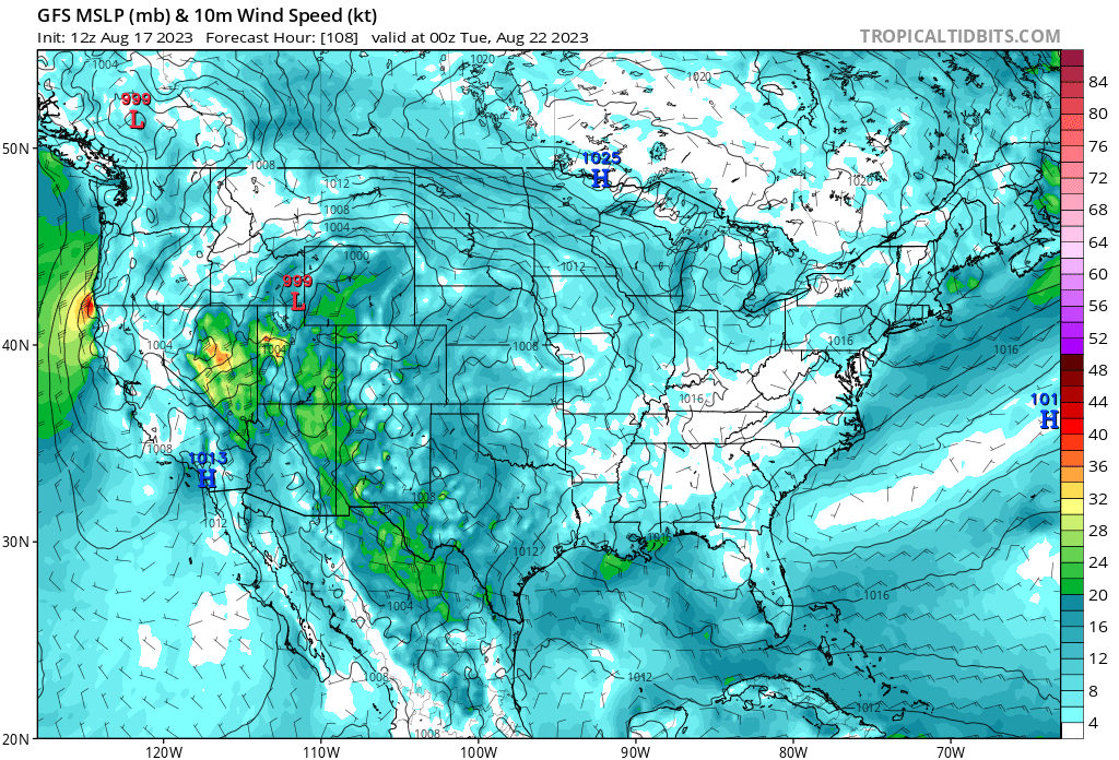
Watch for the pressure differential. The strong low as it moves through the state will generate transitioning winds.

5 Likes
Is that pink on the map the same as the 20" on the legend ? The color is a little off, but if it is, wow
It is very possible that a pressure gradient sets up like a Diablo wind event, which would bring gusty offshore winds and minimal precipitation to the fire areas.
Also in South Ops, there may be a 6-12 hour window where we get gusty offshore winds with no precipitation west of the mountains.
7 Likes
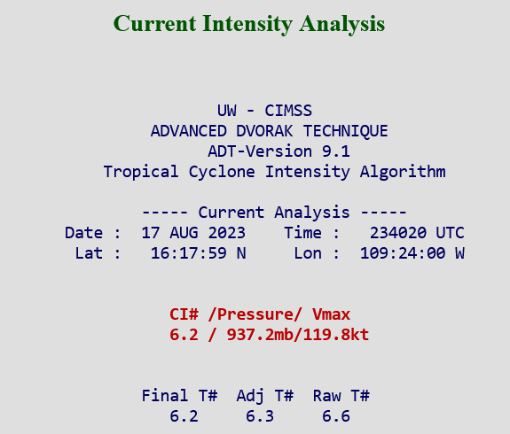
2PM PST advisory is out on Hilary. She dropped another 5MB to 960MB and the winds rose a modest 5MPH to 110 MPH. Keep in mind that I believe all this information is without the assistance of hurricane hunter aircraft which will start flying in shifts tomorrow. That is when we will get real time data to go off of.
7 Likes
That’s what I’ve been seeing.
2 Likes
Is that advisory stating 110mph winds when she makes landfall?
2 Likes
The pics I put up are the 500 mb chart( where all the magic happens). That shows the upper level steering winds.
The lower the 850 mb chart( where we live) shows wind barbs. Too far out…but I would expect a transition to NW winds and then SE and then S before back to normal.
Could have a very high Haines Index. The fires up on the SRF and KNF could see some Haines of 6.
Remember… GCS of 8 intubate… Haines of 6 back off two clicks…
11 Likes
No…those are current winds estimated by radar
4 Likes
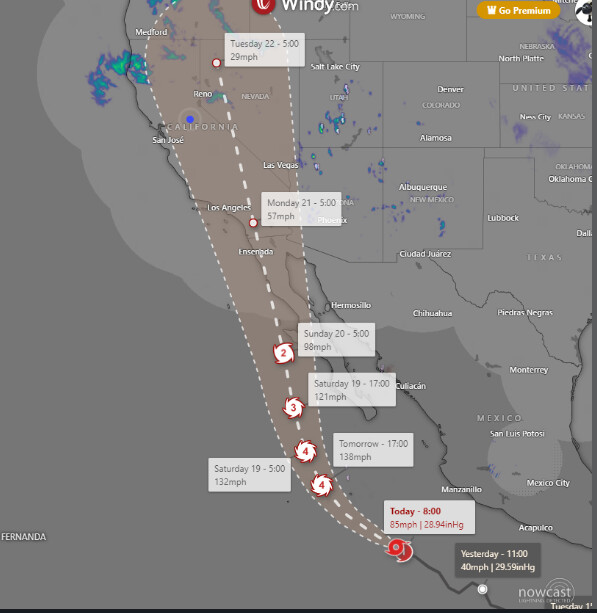
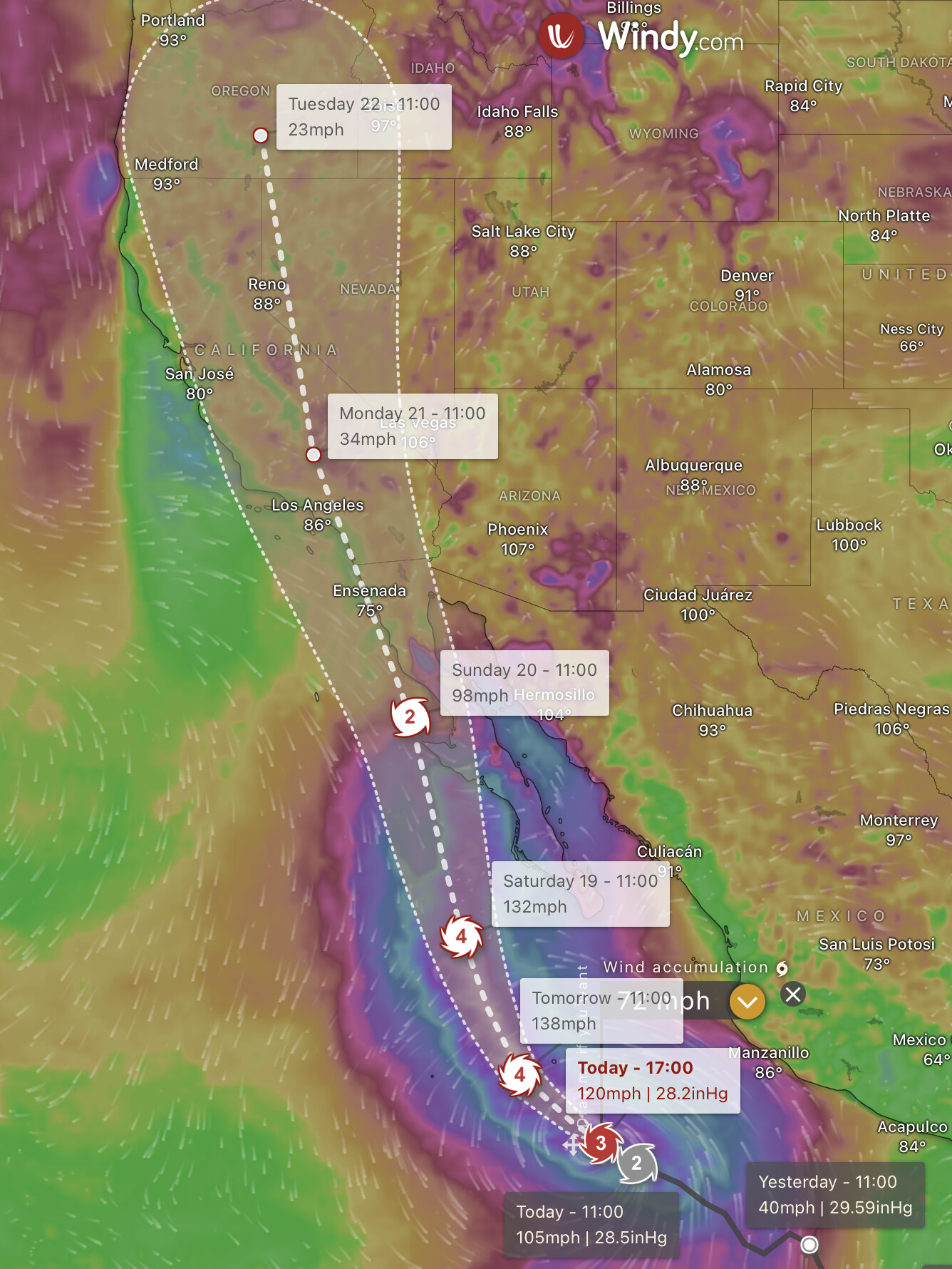
That is a computer simulation on an app… not one of the favored tracks of the models.
6 Likes
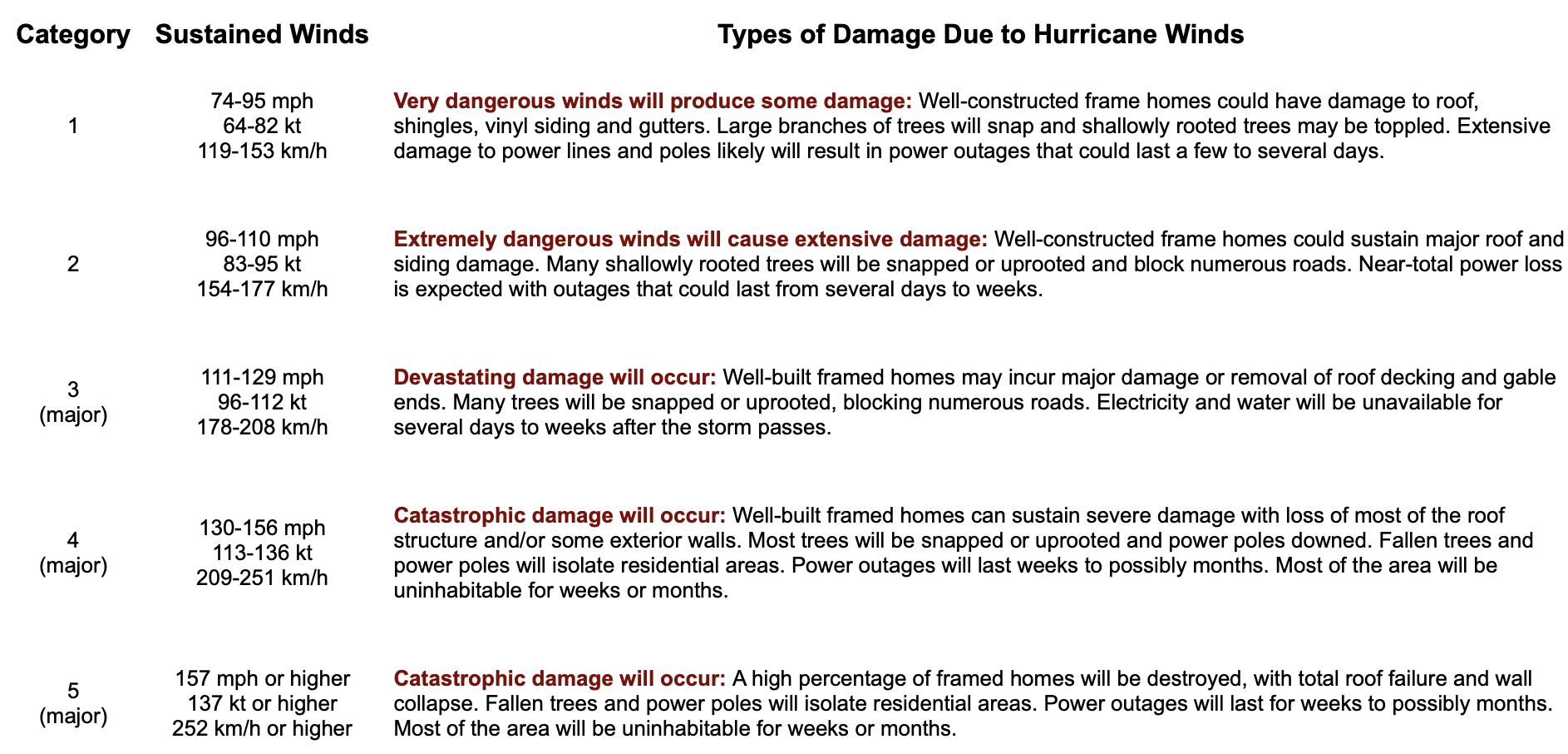
Record heat, dry lightning fires, tropical cyclone landfall, flooding all in one week… might as well throw in an earthquake too
Also, I forgot to mention that there will be a tornado threat in the outer bands… starting Sunday

10 Likes
Updated NWS status
https://www.axios.com/2023/08/16/tropical-storm-hillary-hurricane-flooding-california-arizona
4 Likes
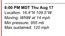
This advisory is very conservative, because ADT estimates the storm to be much stronger than that.
My weather app calling it cat3 now. Man, it’s building fast!
3 Likes
so pressure keeps dropping…
anyone have the stats from lets say katrina when it made landfall?
being that the water in warmer coming north, will this gain strength or lessen thru that passage?
1 Like
The storm has about 36 hours to strengthen before it starts to weaken due to cooler waters and shear.
The storm will likely strengthen a lot tonight, because tropical cyclones have more convection during the overnight hours.
5 Likes
2 Likes
5pm PST update from the NHC on Hilary is she is gaining strength quickly. Up to 120MPH winds and pressure drop to 955MB. She is now a category 3 major hurricane and now forecast to go over 140MPH at her peak. The stronger she gets the less time she has to weaken and move north.
4 Likes
In 24 hours this storm has gone from a 40 MPH tropical storm to a 120 MPH monster. 80MPH increase is extreme rapid intensification. Going to be crazy to watch the development in the next 48 hours. A Cat 5 is not entirely out of the question.
6 Likes
3 Likes