Just a quick few questions for those GIS lads, and lasses;
First, I have tried to Google some maps of fires just can’t get a operational map with dozer, hand and secured lines dicisions and branches on it. Just find it very interesting to see what and where progress is being made.
Second, i was looking for a CA state map with mutiple layers of all the fires of maybe 10,20 or 30 years past to see the areas of burn scars in different shades. I have seen something like this before just not recently.
1 Like
The ops maps get posted to ftp.nifc.gov every night. You have to poke around a bit to find anything, there is a file structure convention but incidents aren’t always exactly where you might expect.
2 Likes
He is a wealth of information.
3 Likes
Similar thread here
And a quick and dirty fire history based on decade, with various layers and base-map choices can be found at CalTopo. On the upper right of screen above the coordinates hover the mouse over the USGS7.5 to bring up the layers menu. Fire History is what you’re looking for.
3 Likes
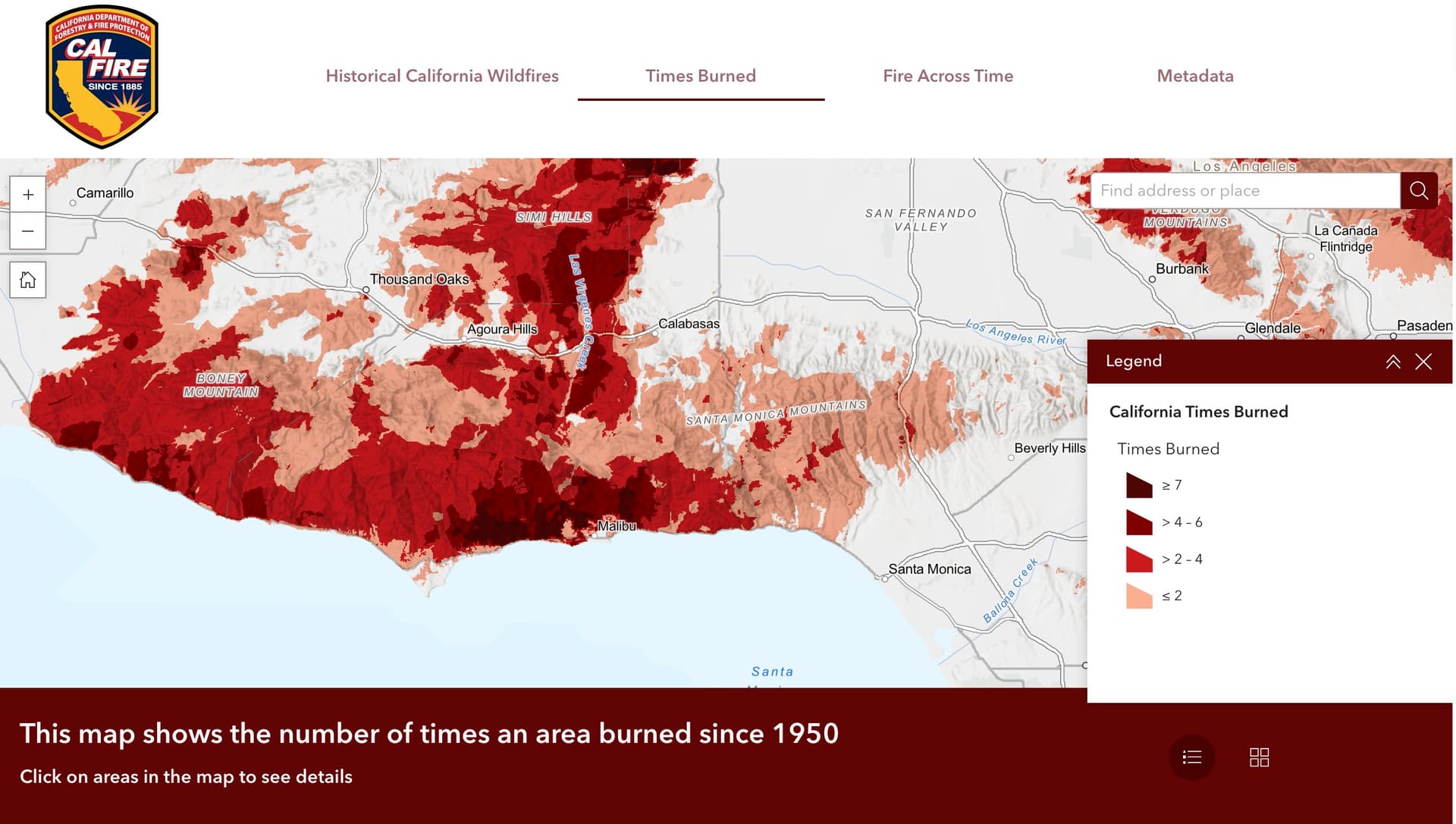
For all of you students of wildfire, out there, Cal Fire has a great new mapping website that allows you to explore the fire history of the California. Really nicely designed, and easy to use. California has so much fire history that it’s kind of difficult to make the data accessible in places with a lot of overlaps, but they did a great job with this site!
It also as a ‘times burned’ feature.
16 Likes