Try coming from 25yr in the private sector where TIME IS MONEY and decisions get made in almost real time. Then coming with that Mentality into one where “You become one with the Borg” and get assimilated into the collective😳
1 Like
10 Likes
Yep. And it’s scheduled to be back on a 24 hour schedule beginning tomorrow at 0800.
6 Likes
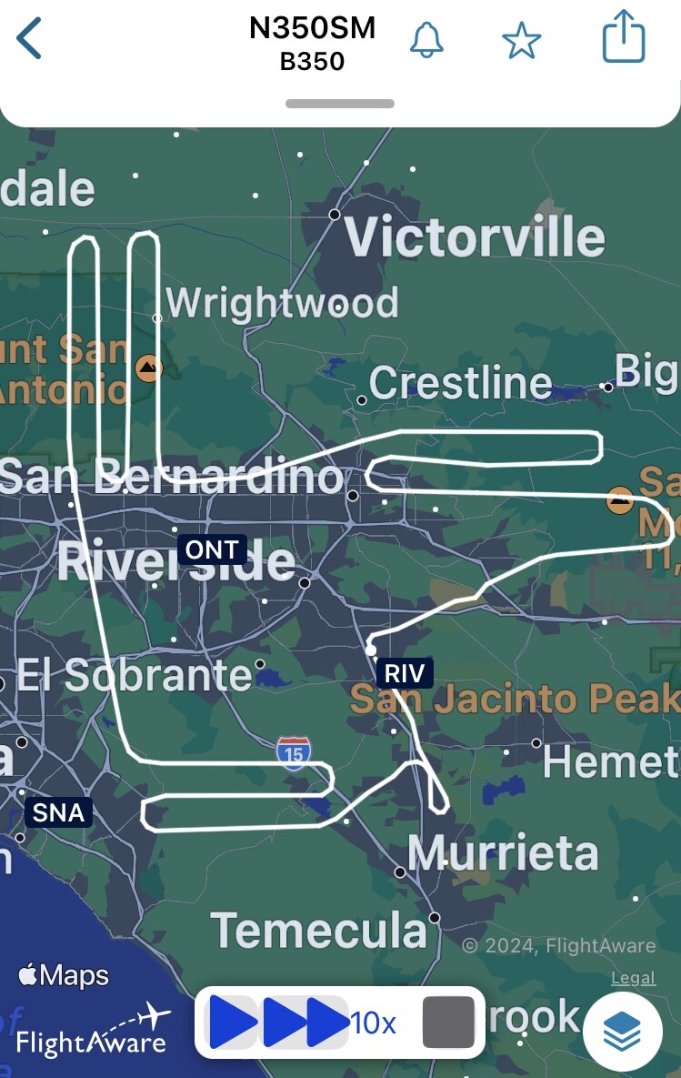
Who or what is N350SM? They are showing as private, flying out of March Air Base and it looks like they are flying a mapping mission over the BDF-Line.
2 Likes
They are a CalFire CWN mapping aircraft. Replacing a broken ship, or augmenting.
5 Likes
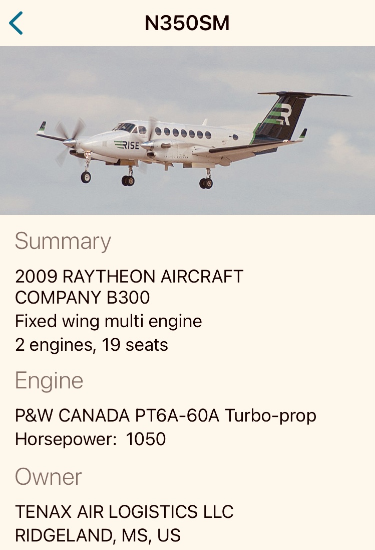
Tenex is also the vendor for the FIRIS program aircraft. CALFIRE Intel 641 should be out of maintenance some time next week.
6 Likes
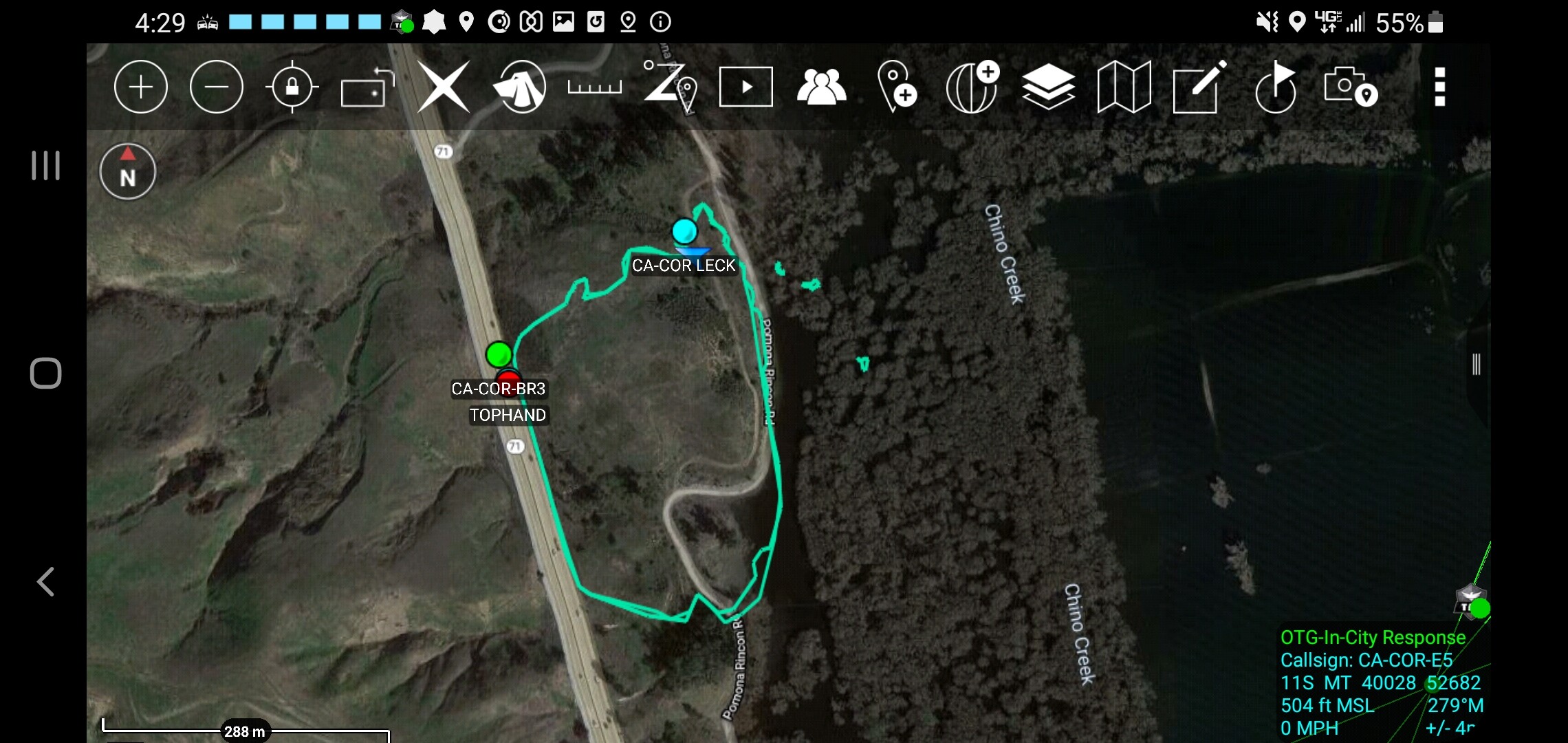
JC why the Airport fire heat signature wasn’t updated yesterday, as the Bridge and line were yesterday evening.
1 Like
@wt818 unless there was a major change, Aevex is the contractor for FIRIS not Tenax.
1 Like
AJ you are correct, my bad.
2 Likes
@SteepNrocky what becomes public immediately depends on who flies the mission. FIRIS has always had public facing Intel from the start. Now CAL-FIRE has followed this same posture. So my only guess if it was flown if was not done by either. I looked around and did not see an ISR flight so looks like they just relied on NIROPS which is public but not in a shareable Geospatial bucket I’m aware of other than it becoming the next days perimeter which is of course available publicly. The main difference for the non Geospatial nerds is the NIROPS data is interpreted by a human on the ground then shared. The real-time perimeters from FIRIS and CAL-FIRE on done while in the air and shared while airborne.
6 Likes
All good @wt818 the future is bright for ISR my friends. Persistent stare is where it’s at. I’m excited for what we might start deploying.
7 Likes
4 Likes