From KCRA - yes non essential personal are asked to evacuate
Any confirmation of evacuation of Travis AFB? There is a lot of occupied realestate between I-80 where the fire crossed and Travis.
1 Like
From the travis facebook page
3 Likes
Thanks. Found it.
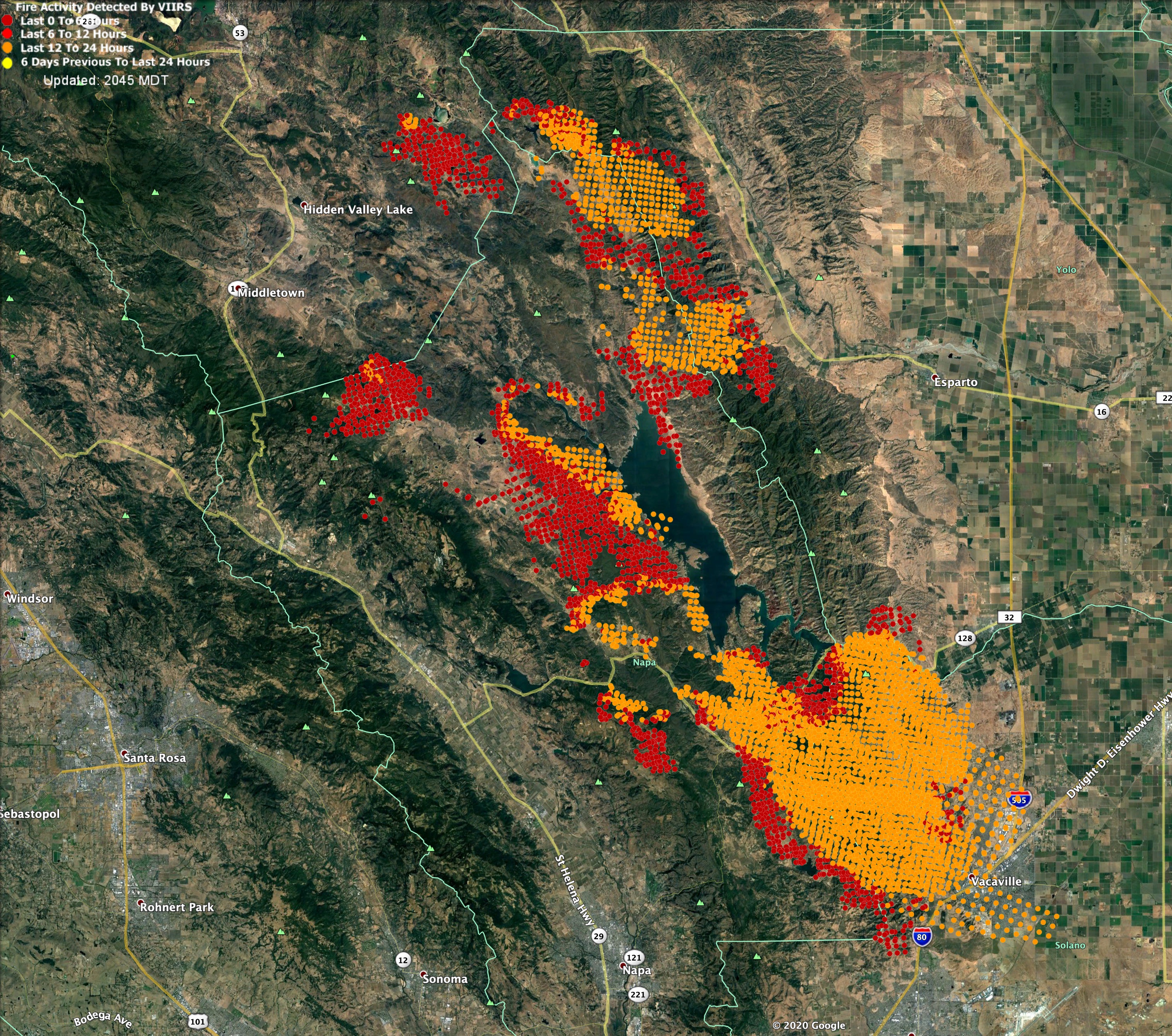
Here is VIIRs data from about 1400, 8/19/2020.
Orange dots have some inaccuracies. Red is growth between 0800 and 1400hrs.
2 Likes
Tonights acreage:
Hennessey - 100,000 acres, 0% contained
Markley - 5,000 acres, 0% contained.
7 Likes
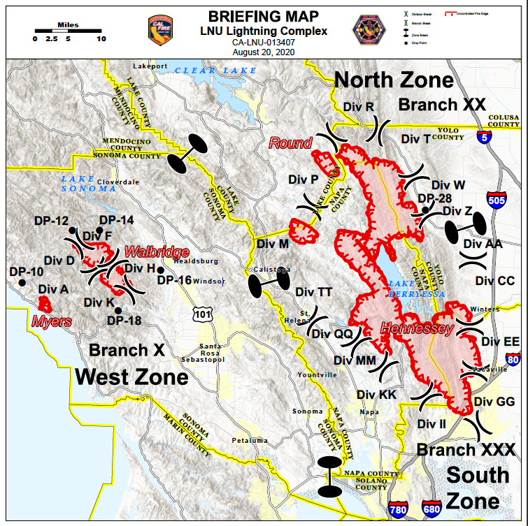
Did it get into the subdivisions at all after jumping I-80 or just the grasslands?
LNU Hennessey has an IA thread for info.
1 Like
11am Cal Fire LNU public briefing on FB. https://www.facebook.com/CALFIRELNU/videos/2709928662667930/
2 Likes
Huge structure loss in the rural part of vacaville.
1 Like
No doubt. Have you seen a damage assessment yet?
LNU lightning complex is 215,000 acres per calfire
3 Likes
Have not but I was doing evacuations that night and have gone through during the day and its unbelievable.
3 Likes
PM update: LNU Complex is 302,388 acres. 15% contained.
of that, 256,102 on the Hennessey, 43,286 on the Wabridge and Meyers is holding at 3,000.
480 structures destroyed, 125 damaged.
“Significant fire growth is expected throughout the rest of the operational period. Extreme fire behavior with short and long range spotting are continuing to challenge firefighting efforts. Fires continue to make runs in multiple directions and impacting multiple communities. Multiple fires have merged on the north side of Lake Berryessa into the Hennessey fire, which is continuing to actively burn with critical spreads and is moving into large areas of timber.”
2 Likes
http://www.alertwildfire.org/northbay/?camera=Axis-MtVaca8
They’ve fixed the Vaca 8 camera and you can see clearly why the camera was compromised.
4 Likes
Moonscape.
Nothing to see on that camera for the next year.
Anyone have the link for the opps maps. Oor IAP Im trying to get the Avensa Map loaded.