
Last i checked - if ALL homeo sapien-sapiens were to disappear tomorrow the trajectory of this rocks climate cycle(s) would continue as if we were never here. And, while we can now observe, drill & measure to find what some “experts” deem as the human contribution to the current warming cycle - it is much larger forces behind the scenes setting the thermostat. Human input to climate didn’t cause the Pleistocene to end and Holocene to begin just sayin…
4 Likes
I think we have more to worry about with an asteroid or huge meteor striking us as well as being concerned with all the space trash circling the Earth. Less sunlight and more danger trying to travel into space.
Worry about what you can change, not what you can’t.
6 Likes
3 Likes

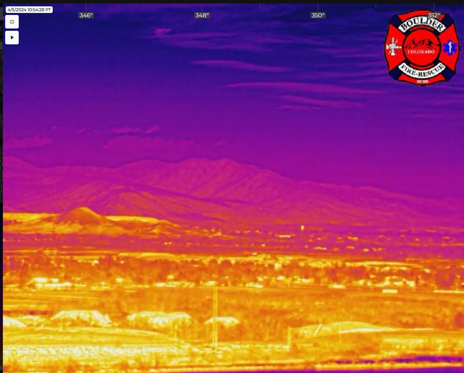
CO thermals.
I might be going out on a limb, but in the long run, if it was red flag month in Region 5s normally dry zones, I’d be expecting some S2Ts. Right? Tell me phoscheck works there? RJs would be picturesque, too. [Gabbart 2022: Video of aircraft working the Ross Fire in Idaho]
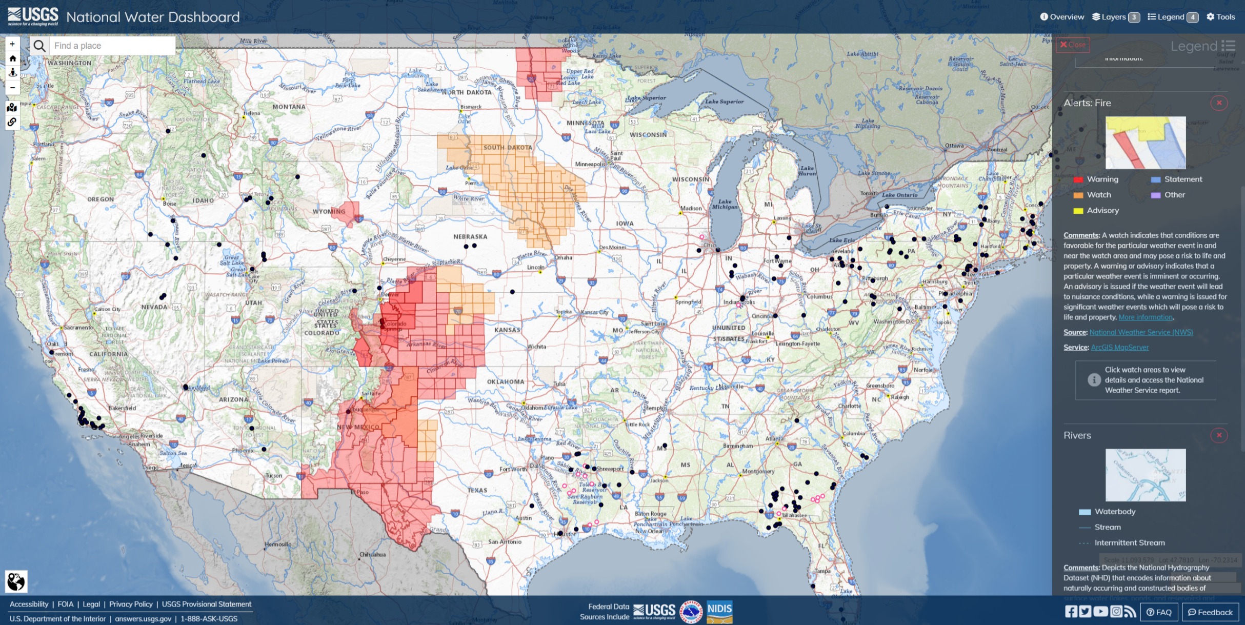
Albuquerque & Bernalillo County Fire/Rescue seemed to be having a wildland fire this morning. A fire attack officer requested traffic control recently. 2 Copters reported in quarters. MAFFs aircraft are in some sort of ready status for the whole area. Good assets to help get in front of a chugging freight train.
2 Likes
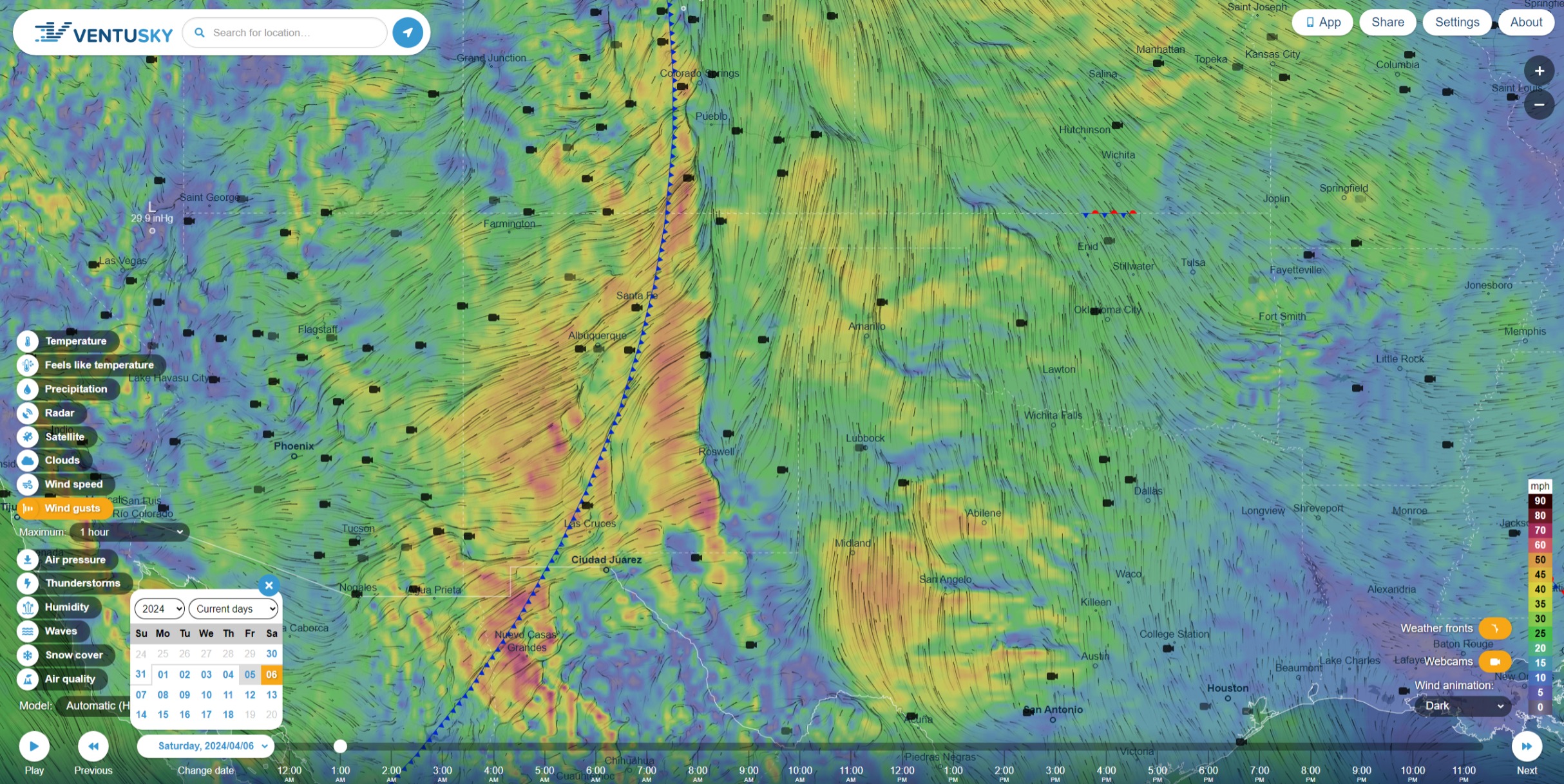
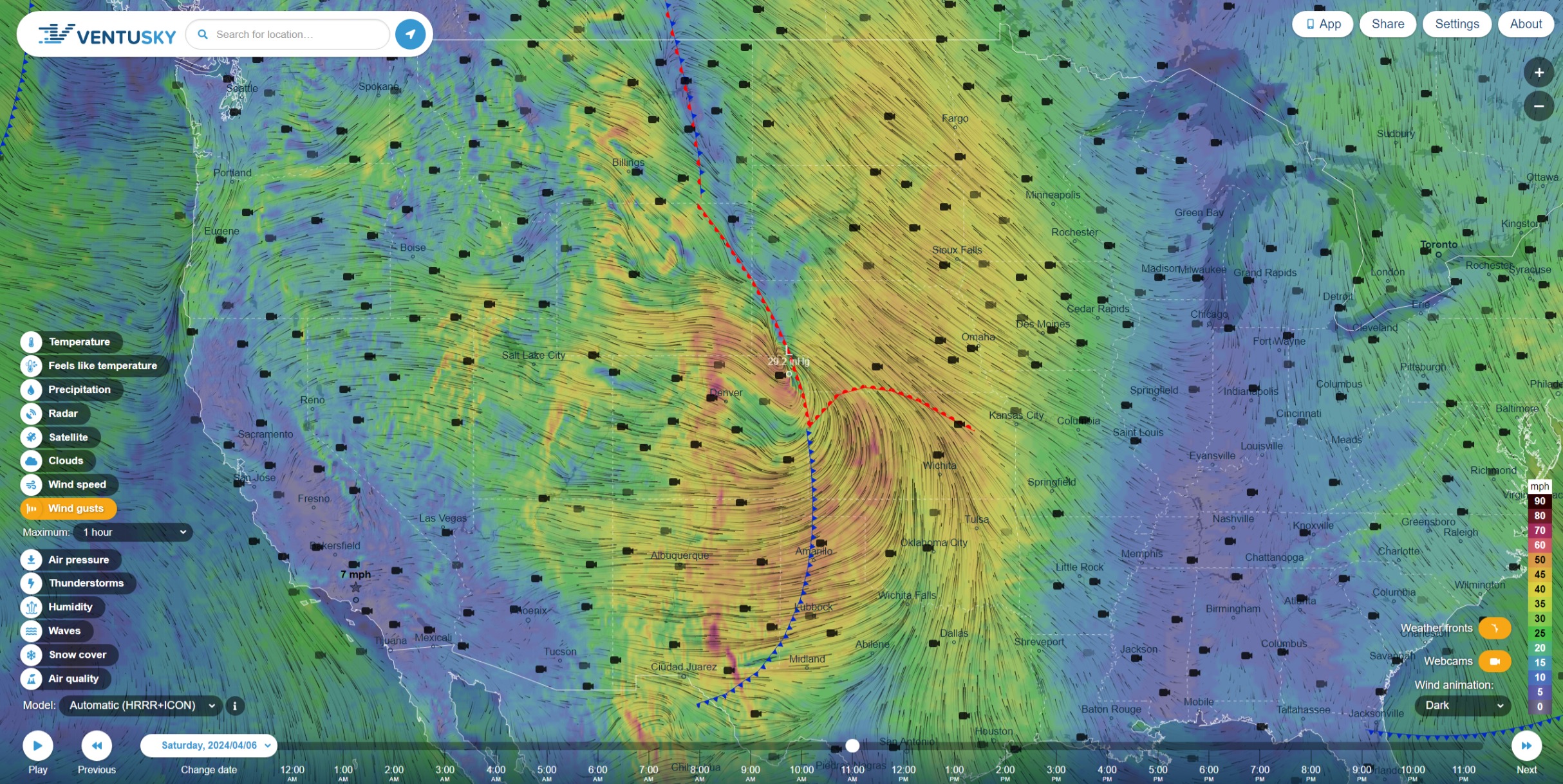
This advancing front on Saturday in the south.
That’s gonna be sporty, sir.
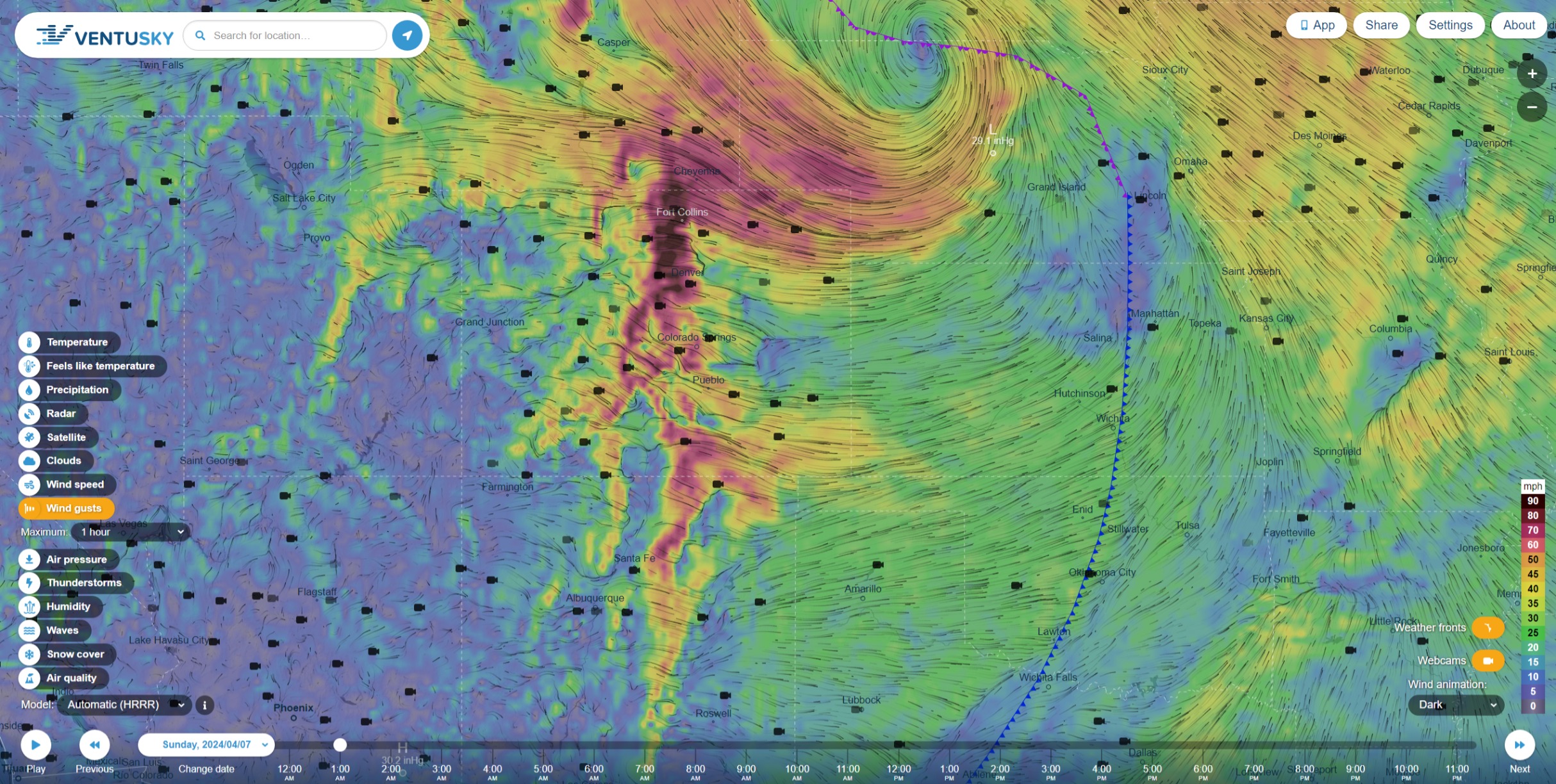
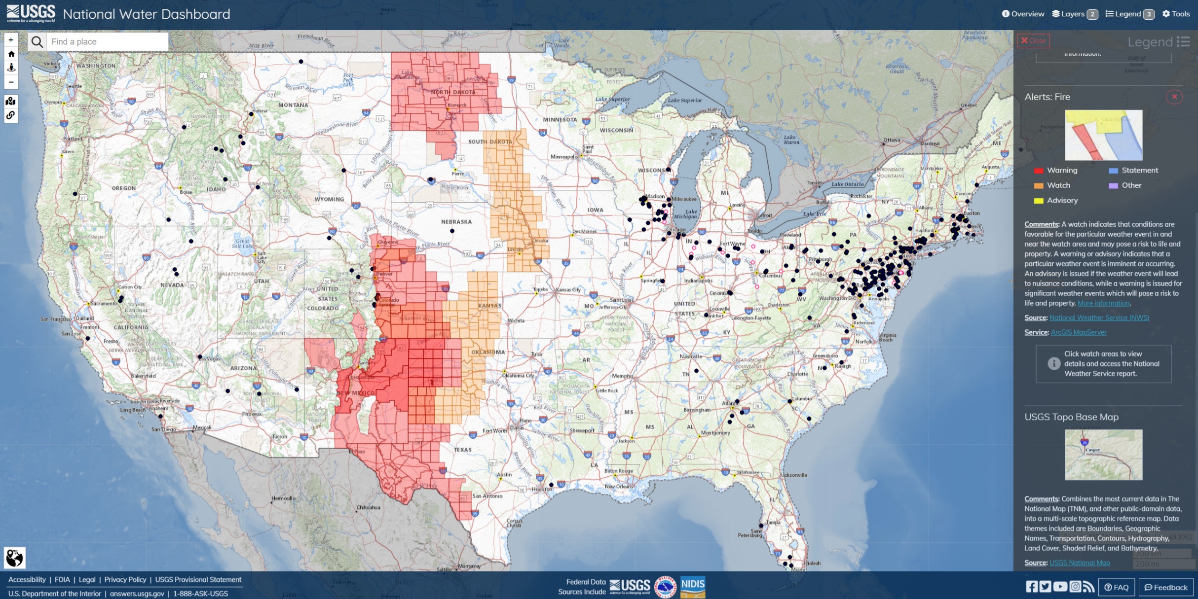
Big winds on Saturday and Sunday in CO, Medicine Bow and points east. Red Flag warning for City of Boulder. 74 degrees today. The blow will bring 40 mph sustained winds with 90-100(!) gusts. Power lines, tree and road hazards with a lot of potentially damaged structures and leaners.
RED FLAG WARNING ISSUED: 12:37 PM APR. 5, 2024 – NATIONAL WEATHER SERVICE…RED FLAG WARNING IN EFFECT FROM NOON SATURDAY TO 6 PM MDT SUNDAY FOR WIND AND LOW RELATIVE HUMIDITY FOR EASTERN BOULDER AND JEFFERSON COUNTIES…
The National Weather Service in Denver has issued a Red Flag
Warning for wind and low relative humidity, which is in effect
from noon Saturday to 6 PM MDT Sunday.
Affected Area…Fire Weather Zone 239.
Timing…From noon Saturday through 6 PM Sunday.
Winds…West 40 to 55 mph with gusts to 80 mph, and locally up
to 100 mph.Relative Humidity…18 to 25 percent, lowest on Sunday.
Impacts…Conditions will be favorable for rapid fire spread.
Avoid outdoor burning and any activity that may produce a
spark and start a wildfire.
4 Likes
5 Likes
The project is the first of its kind in the nation, and local officials hope its success will serve as a blueprint for communities across the country.
Using authority granted by the 2018 Farm Bill, the White River National Forest was able to lease public land to local governments to develop housing. The provision only applies to Forest Service sites that are already being used for administrative purposes, most of which currently have some form of housing or workplace infrastructure.
The current plans call for up to 177 rental units to be constructed at the site and replace aging facilities — with 10 of those units reserved for full-time Forest Service staff and up to 30 beds for seasonal employees.
3 Likes
2 Likes
3 Likes
4 Likes
3 Likes
3 Likes
Outgoing NIFC Predictive Services Outlook for May.
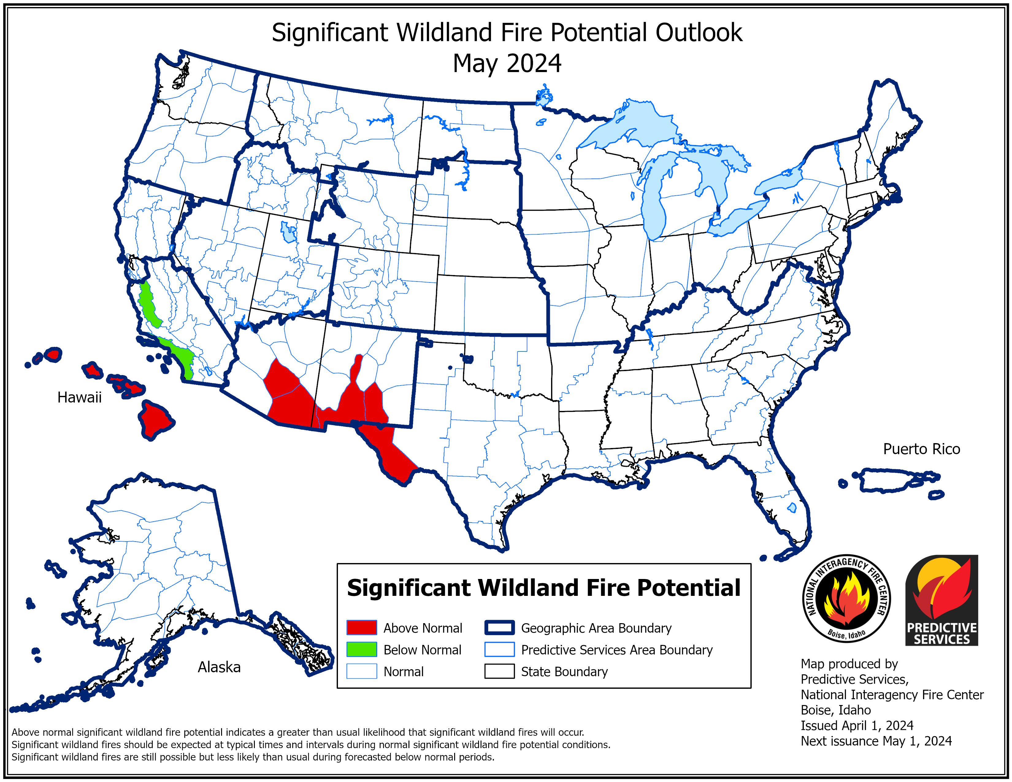
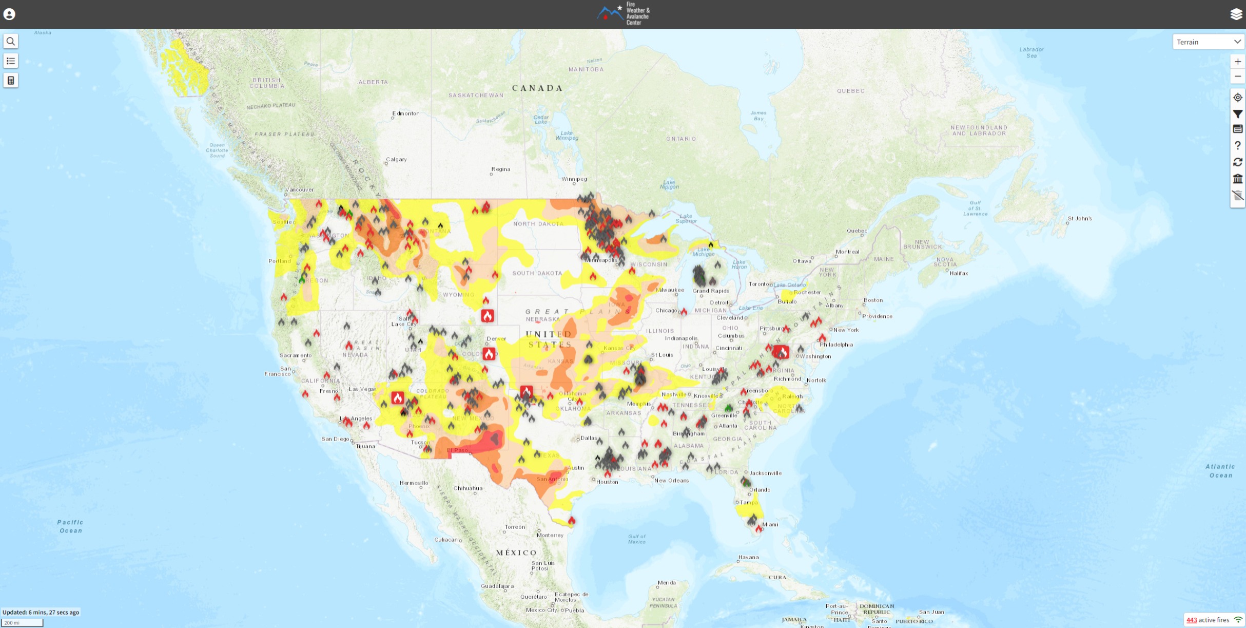
Current FWAC
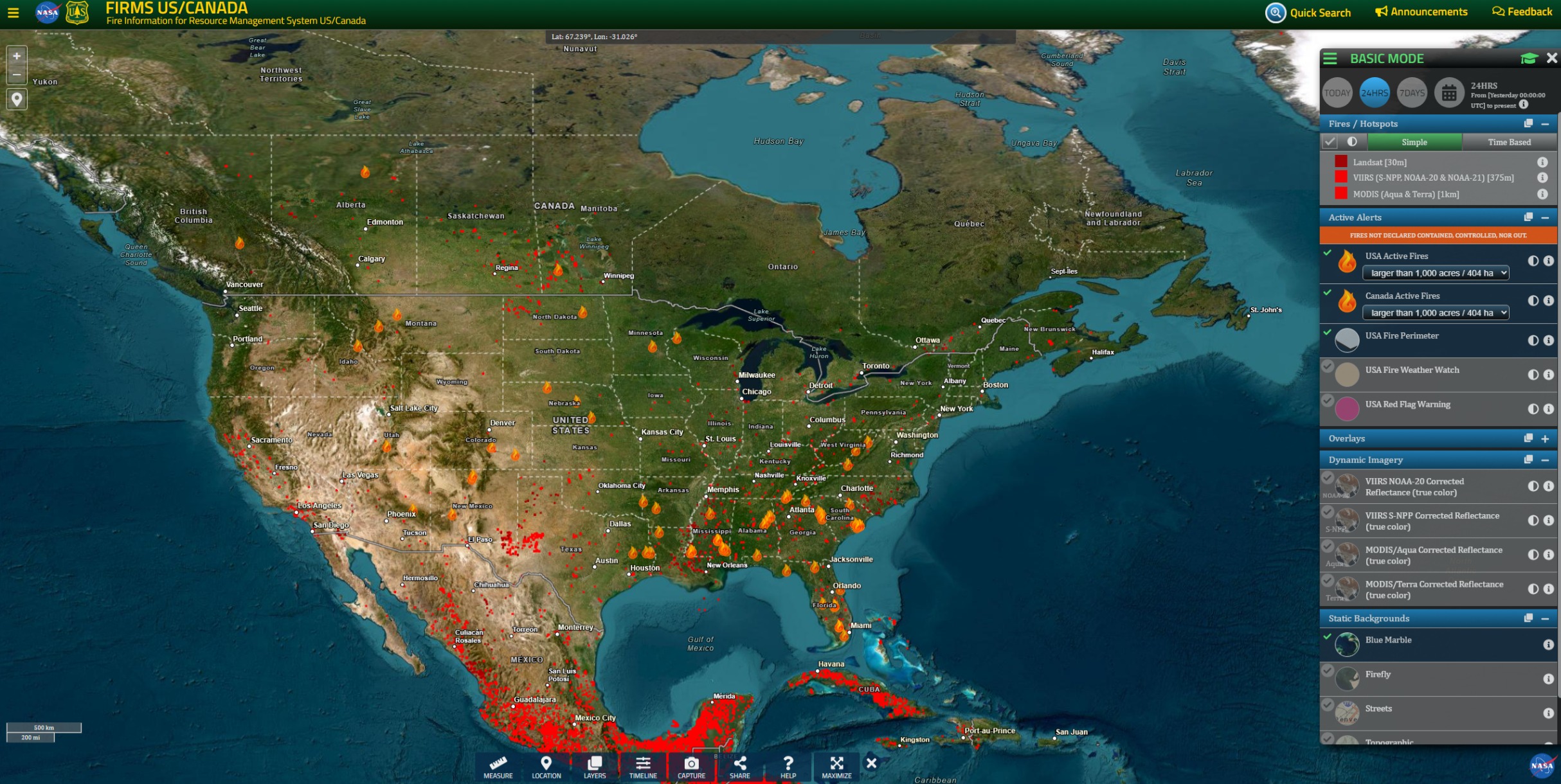
Current FIRMS
Note: Default iconography includes Rx fires. Outlook Maps are intended to show projected deviations from ordinary seasonal fire activity.
Next Outlook will be published on May 1st.
3 Likes
3 Likes

I mean this in the nicest way…
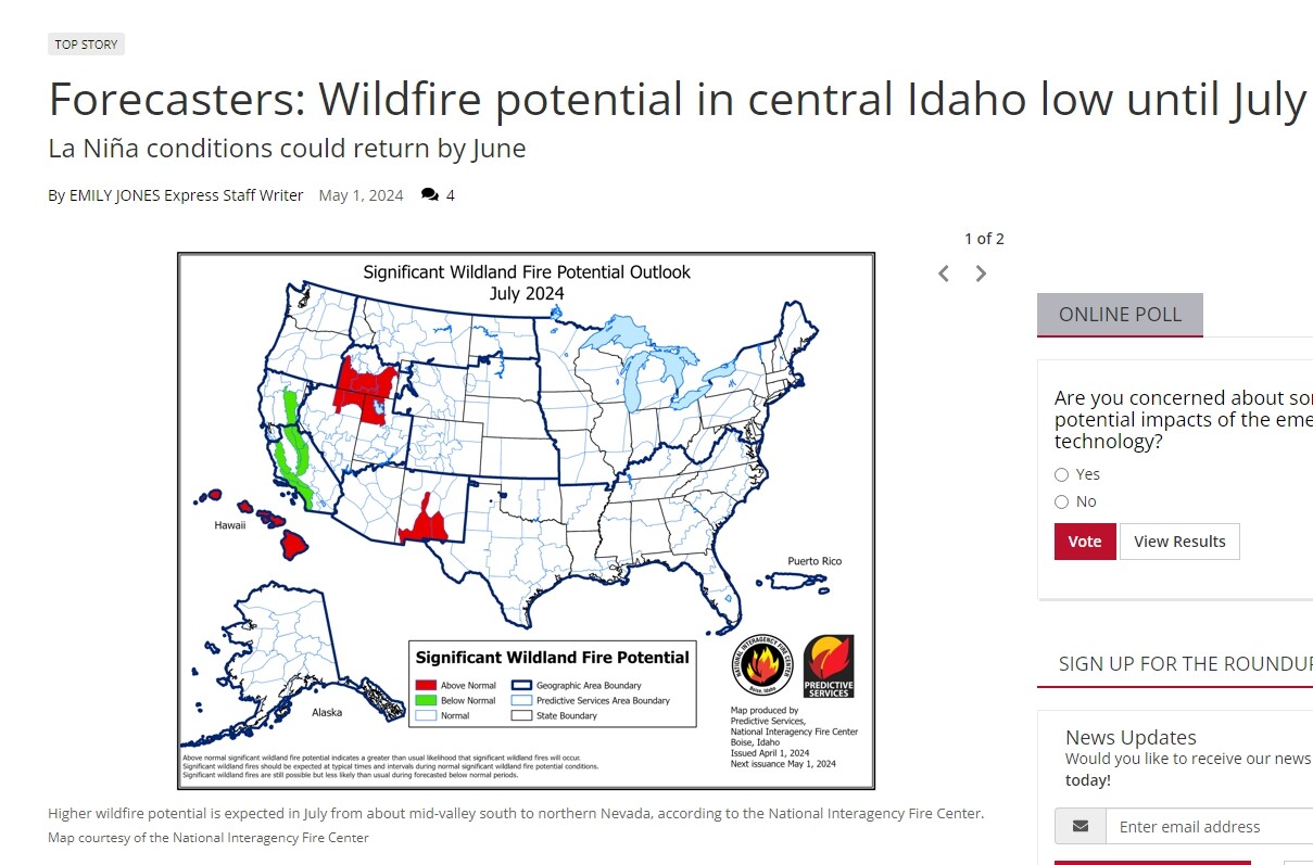
Publishing an April 1st issue Outlook map on May 1st, the day of the new issue, wouldn’t be very accurate in normal course, but is especially inaccurate before we are passed the SPB*, which makes the Summer difficult to predict through most of May. This might have been a simple mistake of uploading the wrong image, or actually not knowing, but in neither case is that the NIFC’s most recent forecast for July.
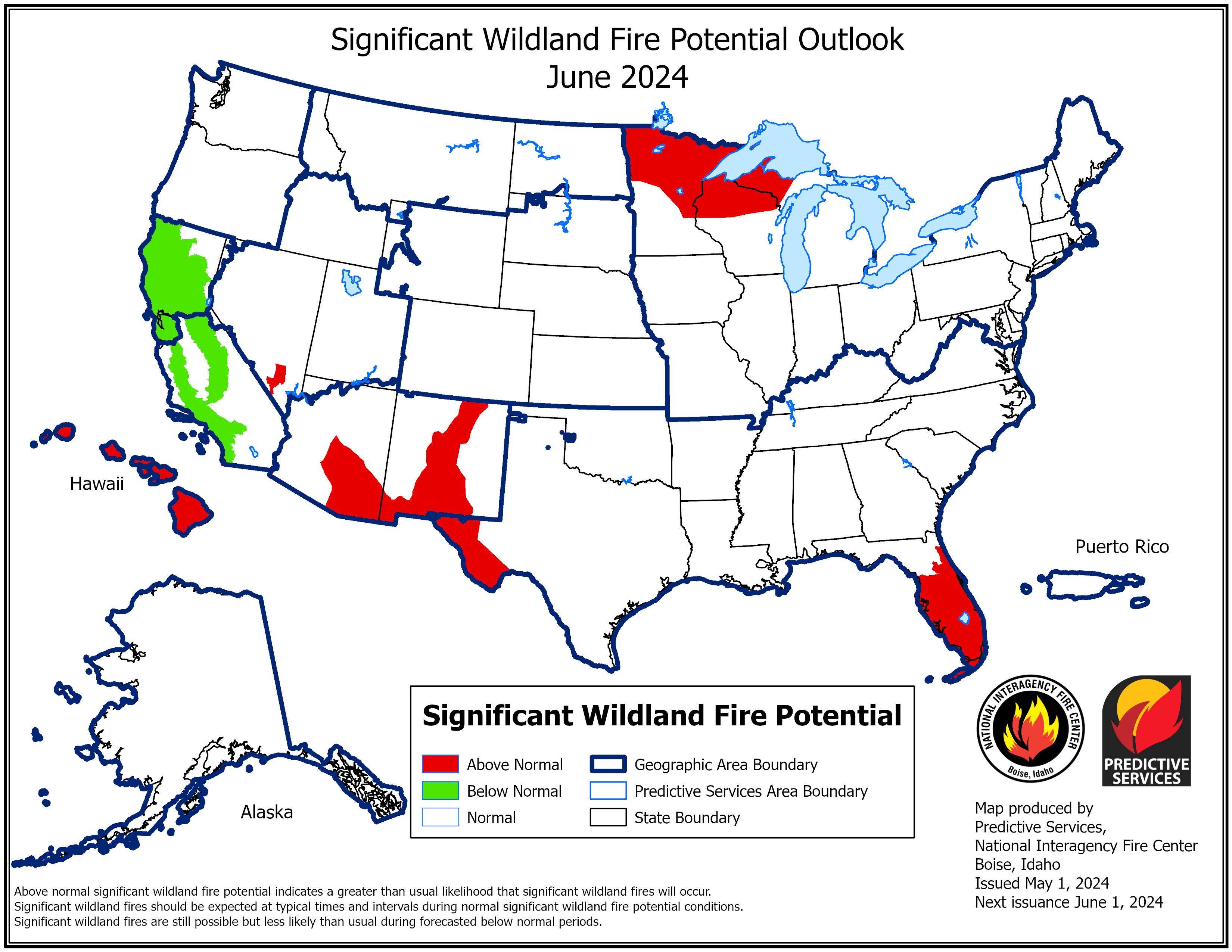
This is the most recent Outlook for July 2024, issued May 1st:

In addition, the NIFC’s May 1st Outlook for June, for Idaho, is not ‘low’, simply because it’s not shaded red, but statistically nominal, or average, which is not the same thing. Indications of ‘low’, or Below Normal, are shaded green:
These can be easy mistakes to make, if your not familiar with the rolling update nature of NIFC Outlooks, and that the reds and greens indicate forecasted departures from statistical averages and norms.
*SPB, or Spring Predictability Barrier, is a complex topic, probably better left to a professional meteorologist or climatologist to explain.
3 Likes