https://news.ucmerced.edu/news/2022/experts-recommend-new-more-innovative-approach-wildfire-research
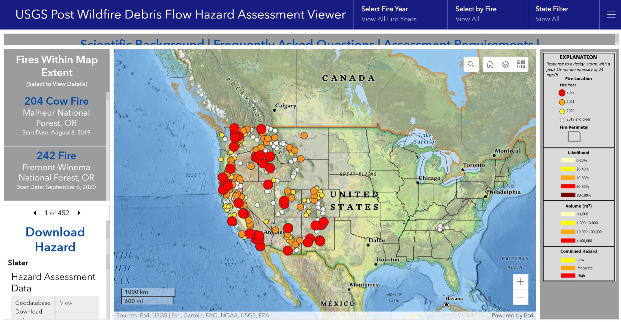
Tool: USGS Post Wildfire Debris Flow Hazard Assessment Viewer
[Sources: Esri, USGS | Esri, Garmin, FAO, NOAA, USGS, EPA]
PWFDF Dashboard (arcgis.com)
Tool: USGS Landslide Inventory (arcgis)
U.S. Landslide Inventory | U.S. Geological Survey (usgs.gov)
Landslide and Debris-Flow Event Summaries (searchable)
USGS Landslide and Debris-Flow Event Summaries
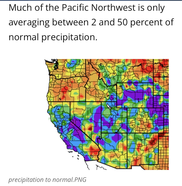
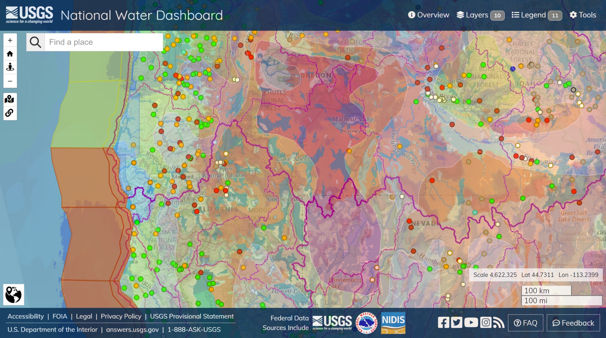
Color enhanced drought. Deschutes, Malheur, Fremont National Forests. Lake Albert. Extreme drought in eastern Oregon and northwestern Nevada. Upper Klamath Lake and the northwest Pacific range have significant snowpack, of which more is to be seen; Bend, southward to Honey Lake and Lake Tahoe. Owyhee River traces a watershed eastward through moderately severe drought.
Red and orange circles, gauges; red are generally dry, yellow lower than nominals in volume or flow. Green are normal.
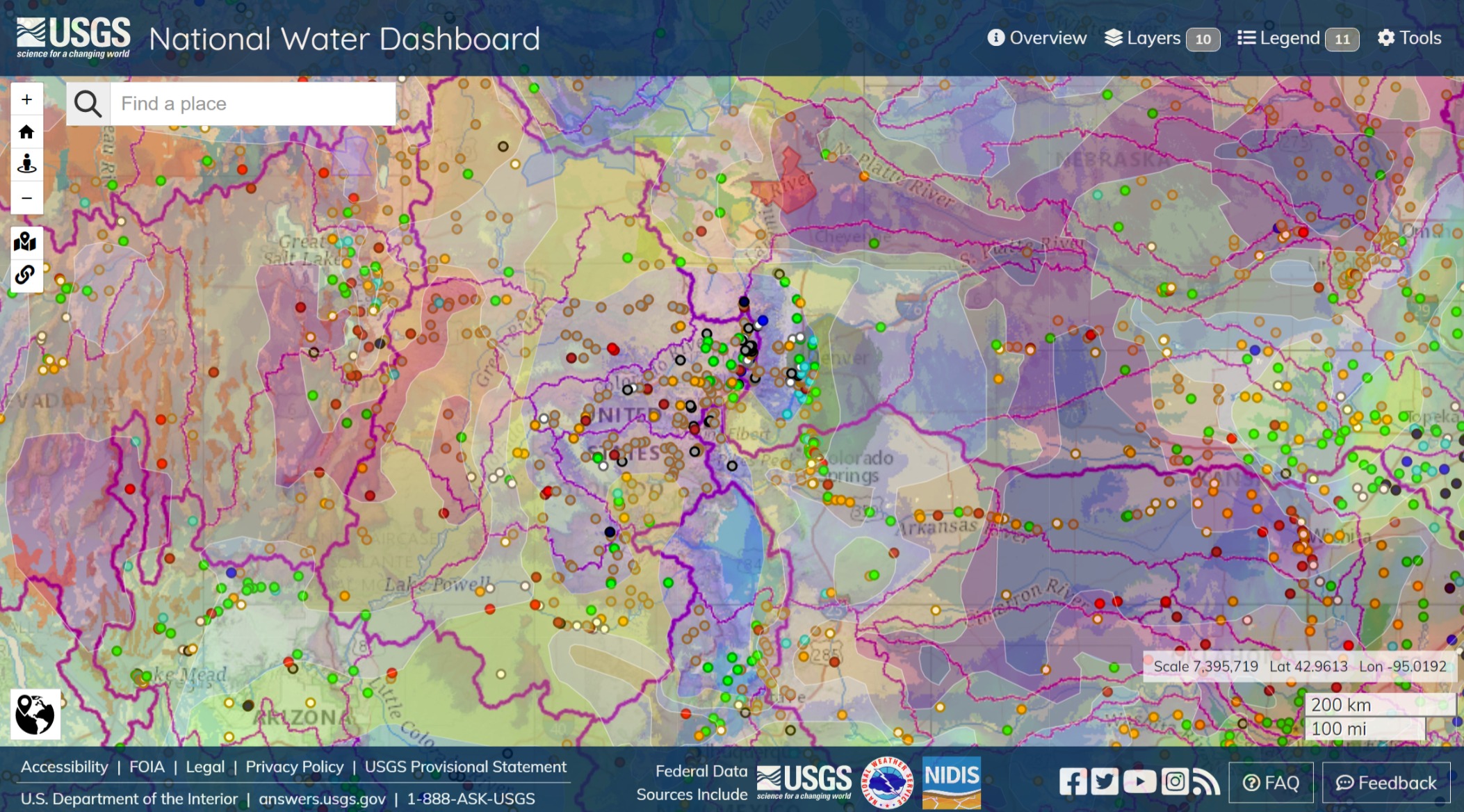
Color enhanced drought. Southeast Nevada and Utah. Moderate, but variable, severity through Colorado and extremes in Kansas and Nebraska.
The thicker and thinner purple lines are the watersheds via USGS. Drought severity patterns are a mix and match of alignments.
Two factors for this pastiche; there is water yet unaccounted for in the form of precipitation, represented with temperature as green and blue shading, which may have a stronger effect on streamflows and immediate water supply and hazard, and another, longer term value associated with aquifers.