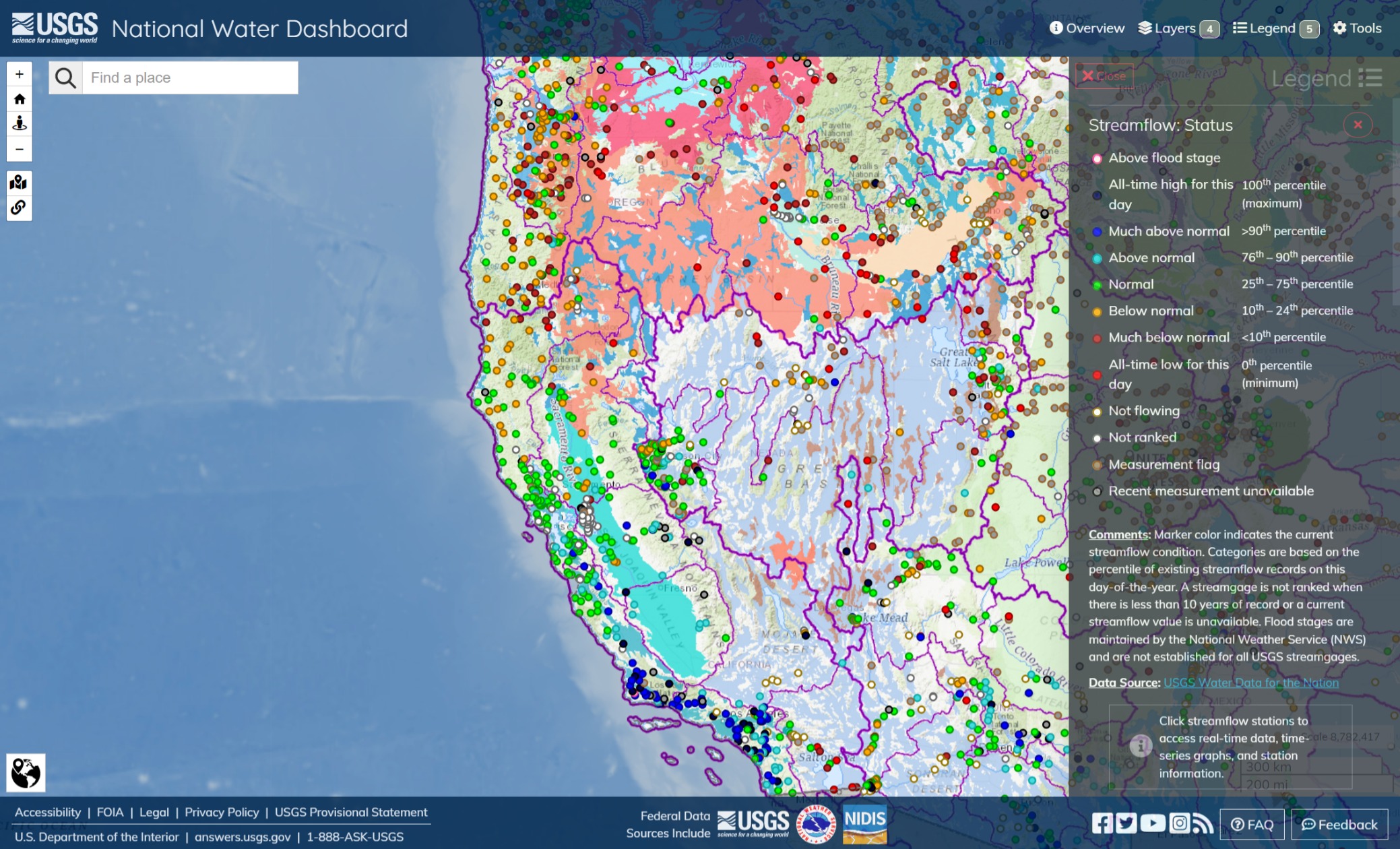
Streamflows in the West. North to south, topology notwithstanding; rivers, streams and other gauges. Oregon, both East and West, are showing very low activity. Perhaps, some snowcap will move the needles in the Spring. South of Redding, the board is generally green, and the rivers are ripping down the south coast of CA.
The Madera foothills have moderate flow, perhaps due to very active water managers. The Kern River looks like its holding its peace, for now, but water is pooling in the southern reach of the Central Valley as gravity pushes water down channels that are approaching as full as considered sound. There is still slack in the system, but as we know, the more hydrostatic pressure you put on a levee or berm, the more likely the water will drill it.
The upper Sierras, the lower Cascades and the Rockies are buried in more snow than I’ve seen since I was a kid and it snowed on the SF Bay Area, not much for that but to keep watching.
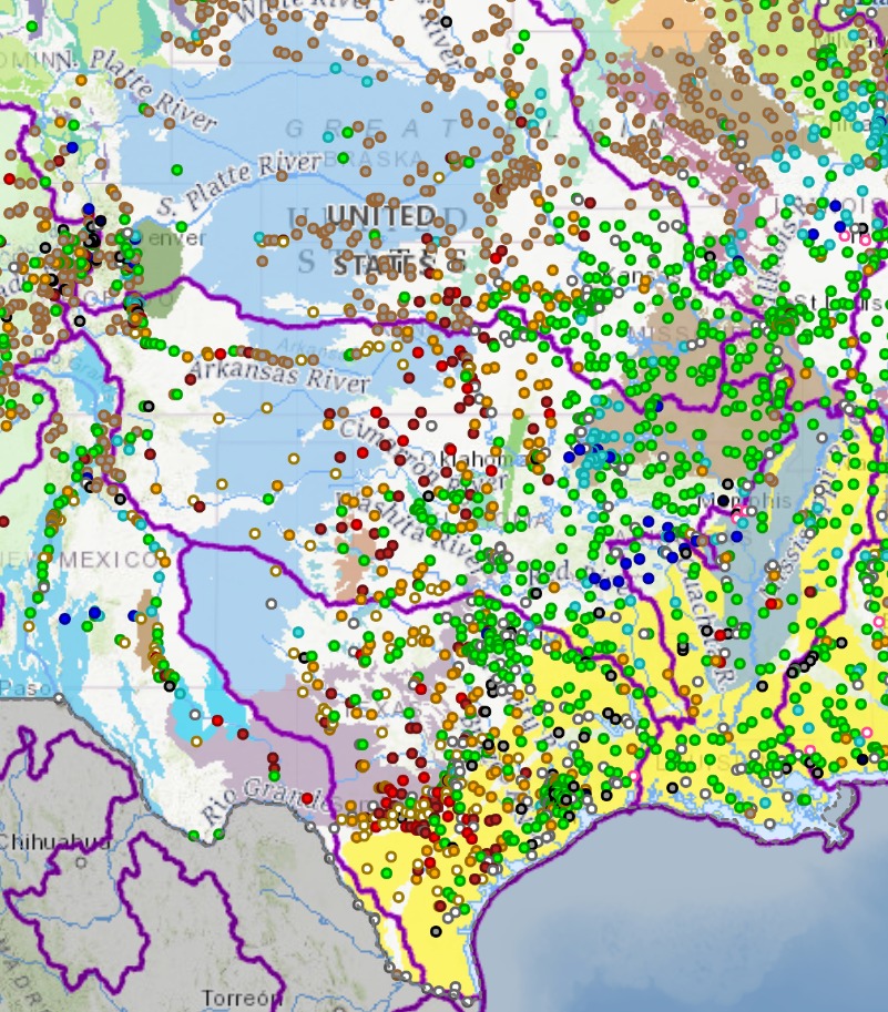
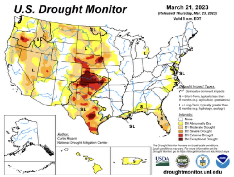
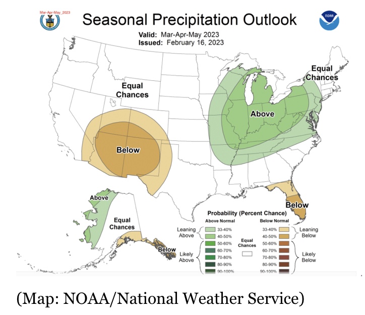
Water supplies are low in the drought regions from Texas, northward to Nebraska. Kansas is generally green in this map, however groundwater and surface water levels are in a seriously depleted state.
I just want to comment here that this general line, from the southern tip of Texas to the eastern side of Nebraska is a very old geologic feature that is sometimes described as the eastern shore of a vast ocean that stretched from central Canada and the Great Lakes to the Gulf of Mexico. Where the mountains rise westward from Colorado could be described as that ocean’s western shores. 
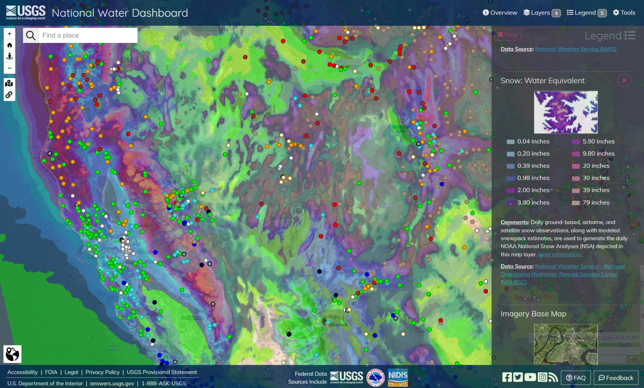
Snowpack to water conversion equivalency from NWS. Inches of snow to roughly equivalent inches of rain.
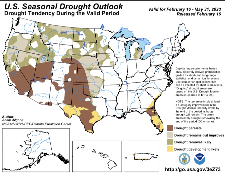
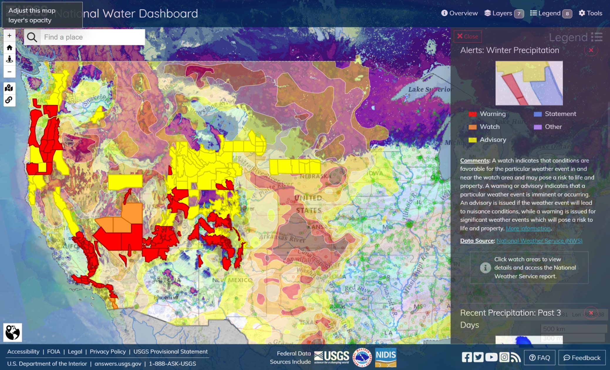
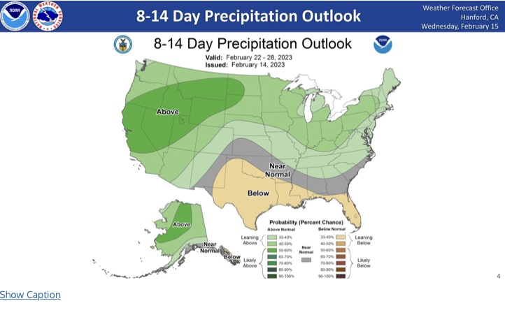
Enhanced color, this year’s snowpack versus the drought. Current precip warnings, with lots of snow, through to the shadow of the Rocky Mountains west of Denver, CO. Eastern Oregon’s glaring drought picture may improve with their Spring melt. Northwest Nevada, through to Lake Mead, will also have a busy Spring.
Notwithstanding casualties, the drought picture looks a little brighter this Spring, west of the Rockies.
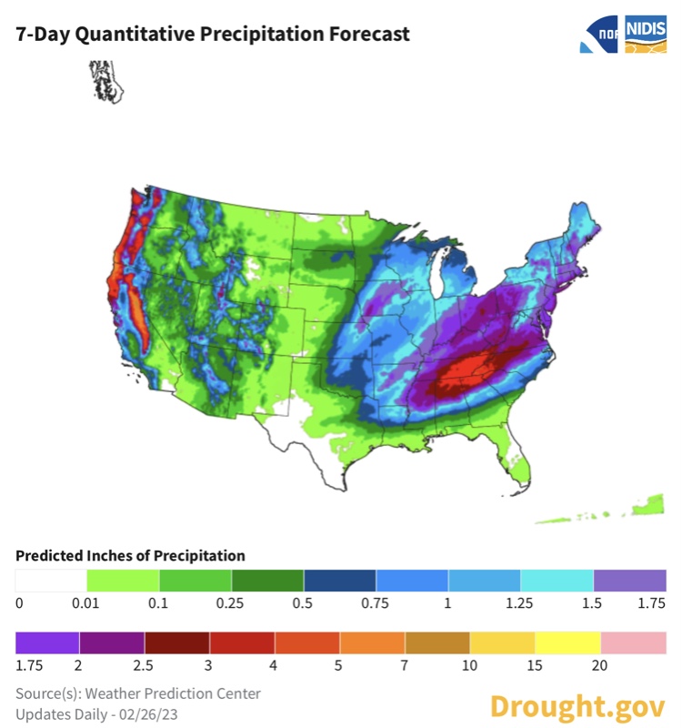
East of the Rockies, the Platte and Arkansas River are very dry. Regional droughts in the extremes from Nebraska to south Texas. Further east, precip is dominant, with the Mississippi and the Ohio Valley having plenty of flood activity this year.
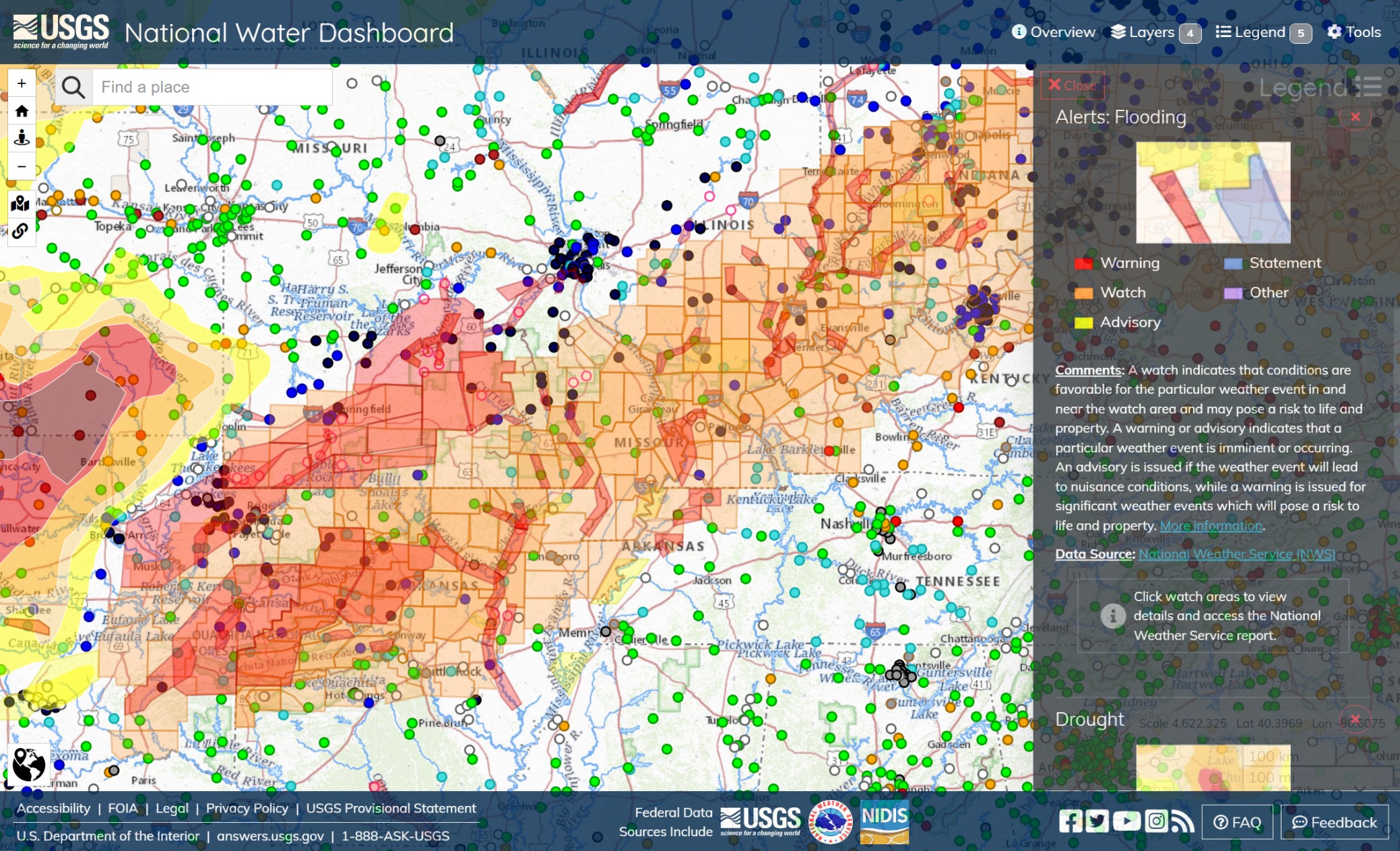
Although its exceptional drought west of Tulsa and Highway 44, the eastern Arkansas River, the Ozarks, Mark Twain National Forest, the Black River, the White River, long sections of the Mississippi and the Ohio Valley’s streams, creeks and rivers have flooded repeatedly over the winter.
That’s one lot of square miles to cover.