Looks like a new start just across the border in Oregon. What is interesting is watching the time lapse of the fire. There is a strong inversion present which is capping the smoke. The smoke is just beginning to push through the inversion. Will be interesting to watch how it (mis) behaves in the next two hours once the slope begins heating and the inversion mixes out. Another smoke visible on one of the Hayfork cameras.. it has a pronounced down canyon on it.. not sure if it is one of the existing or a hold over.
2 Likes
The cell(s) that built to the N & NE of Mt Shasta yesterday were once again #impressive!
4 Likes
Spent most of my spring bear season cutting the roads out on the Oregon side. Still a mess in there with limited access, was back up Sunday scouting.
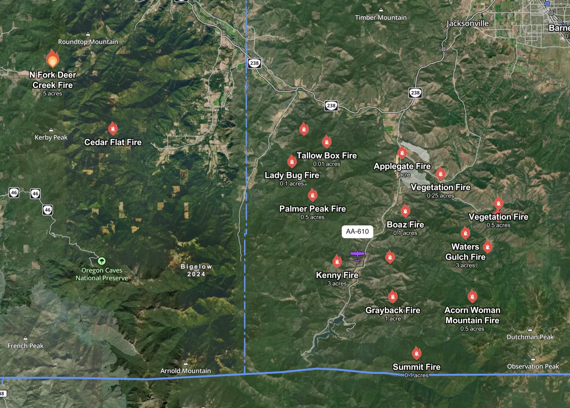
Gonna be an interesting day in there. Lots of homes from colestein to Mt Ashland
3 Likes
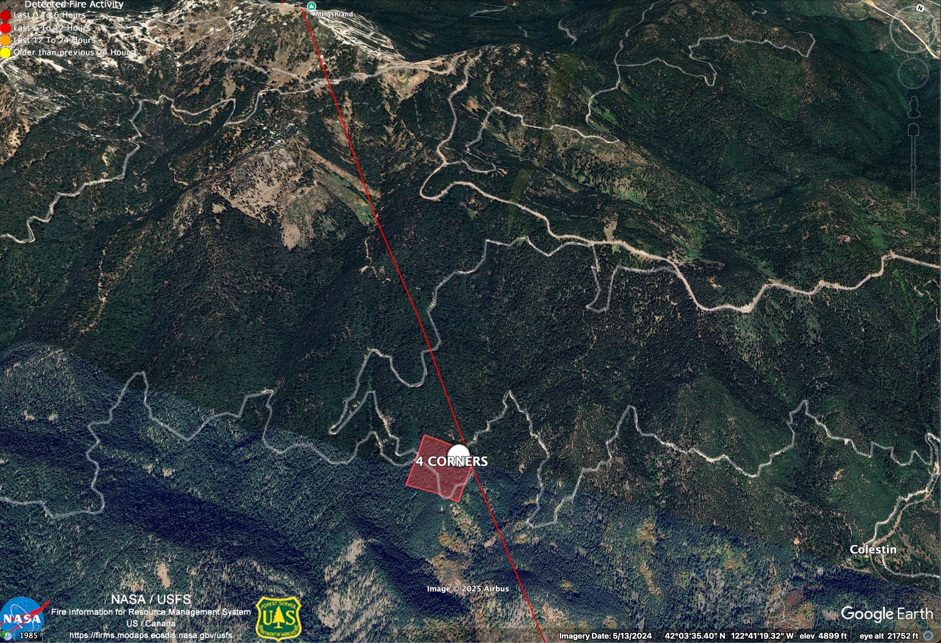
From IRWIN new starts layer:
4 CORNERS INCIDENT
Type: WF - Wildfire
Area Acres Burned: 0.01
Percent Contained: Not Available
Discovered: 7/7/2025, 23:53
Current as of: 7/8/2025, 08:24
Unique Identifier: 2025-CAKNF-004954
Also, is ~2 miles into Oregon
2 Likes
Although in Oregon, it is on the KNF. KNF resources enroute with CAL FIRE Liaison (SONCAL MTZ).
Air Attack, several SEATS and 1 Copter. ODF is tapped from last night’s activity
3 Likes
Looks like it is close to a major road. The NIFC point looks like it is off about 1/2 mile. Here’s a better location, using VIIRs and Hornbrook Camera bearing.
42.04957, -122.68512
3 Likes