State ID:NM
3 letter designator:ADC
Fire name: McBride
Location: Ruidoso
Reported acres:1,000
Rate of spread: rapid
Report on Conditions: high winds and power lines down
Structure threat: immediate
Resources:
Hazards:
Weather:
Radio channels:
Scanner link:
Webcam link:
Agency Website:
4 Likes
2 Likes
#McBrideFire in the heart of #Ruidoso is spreading to the northeast as southwest winds currently gust to 59 mph. Cold front is on approach with very strong winds gusting to 70 mph expected to shift to a west-southwest direction between 8:00-9:00 PM MDT. #NMFire #nmwx https://twitter.com/NWSAlbuquerque/status/1514009123507027970/photo/1
2 Likes
Per Lincoln national forest 15,000 acres. Reports of homes burning.
2 Likes
AA 51 just left the fire after mapping it.
2 Likes
Update 3,000 acres per inciweb.
2 Likes
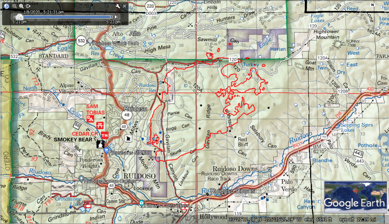
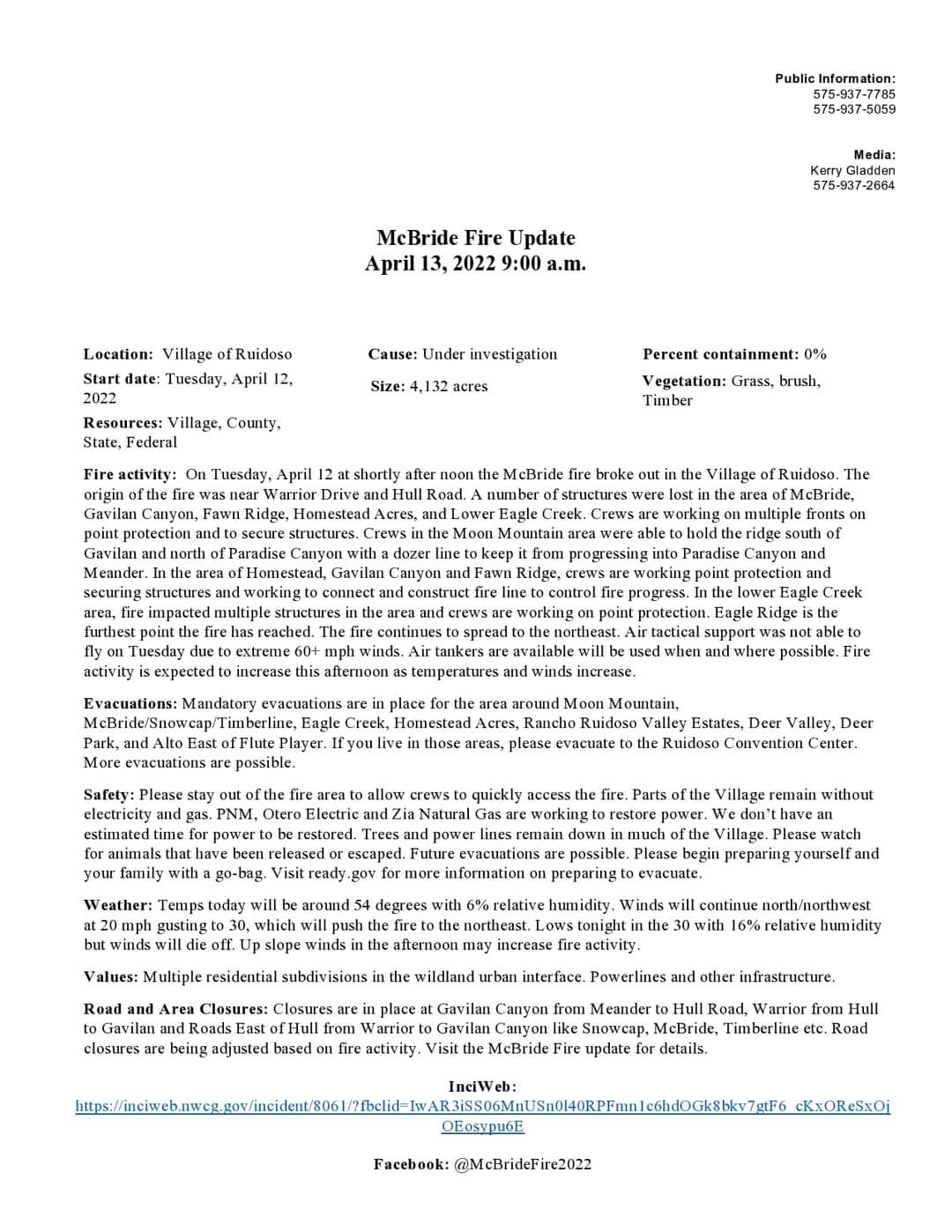
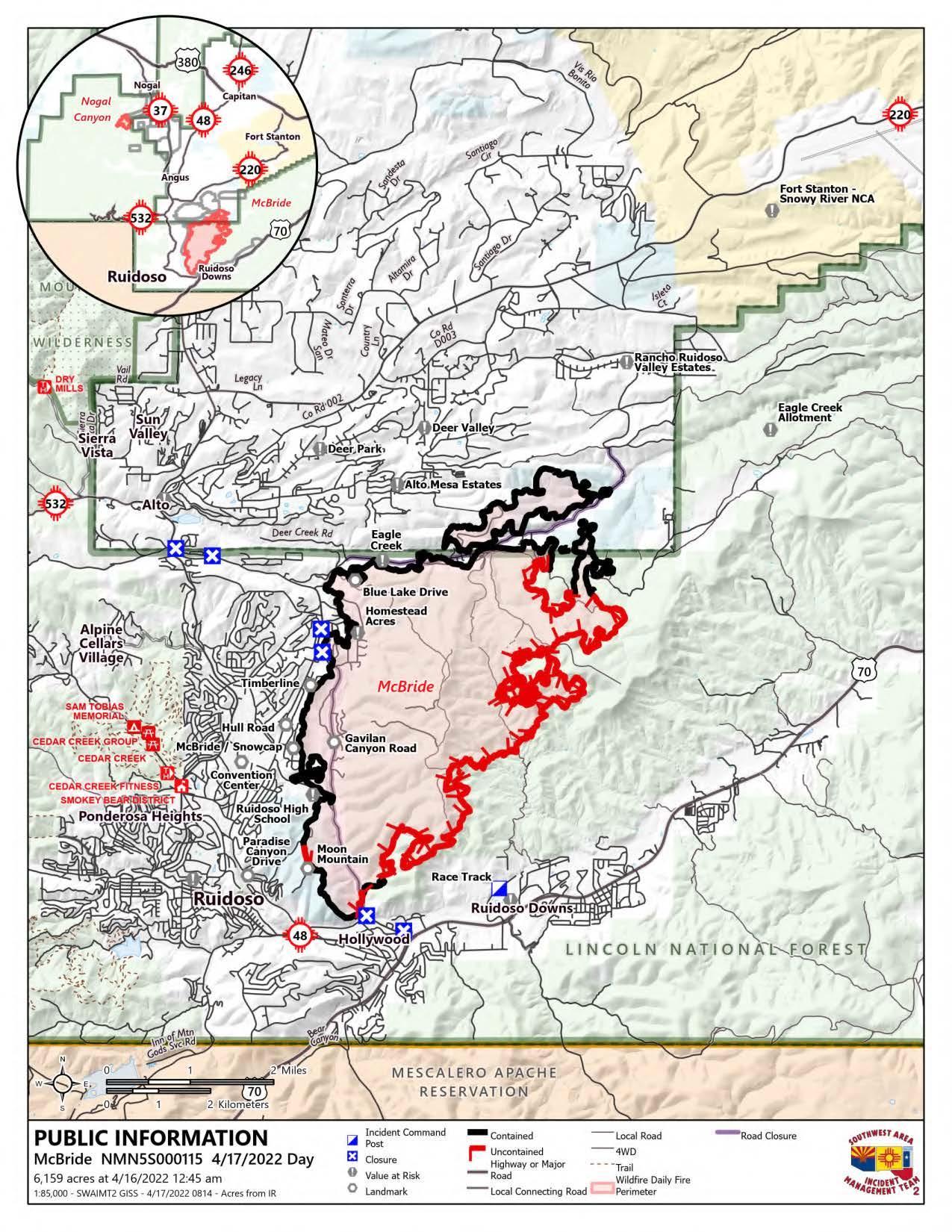
Current acreage 4,132
0% Containment
150 Structures Lost or Damaged
Mesa Hotshots are on scene along with the Southwest Incident Management Team 2
2 Likes
The fire jumped gavilan canyon road on the south side of the fire and made a push towards highway 48 causing more evacuations.
2 Likes
3 Likes
Absolutely awful. 
McBride Fire Update 8 a.m.:
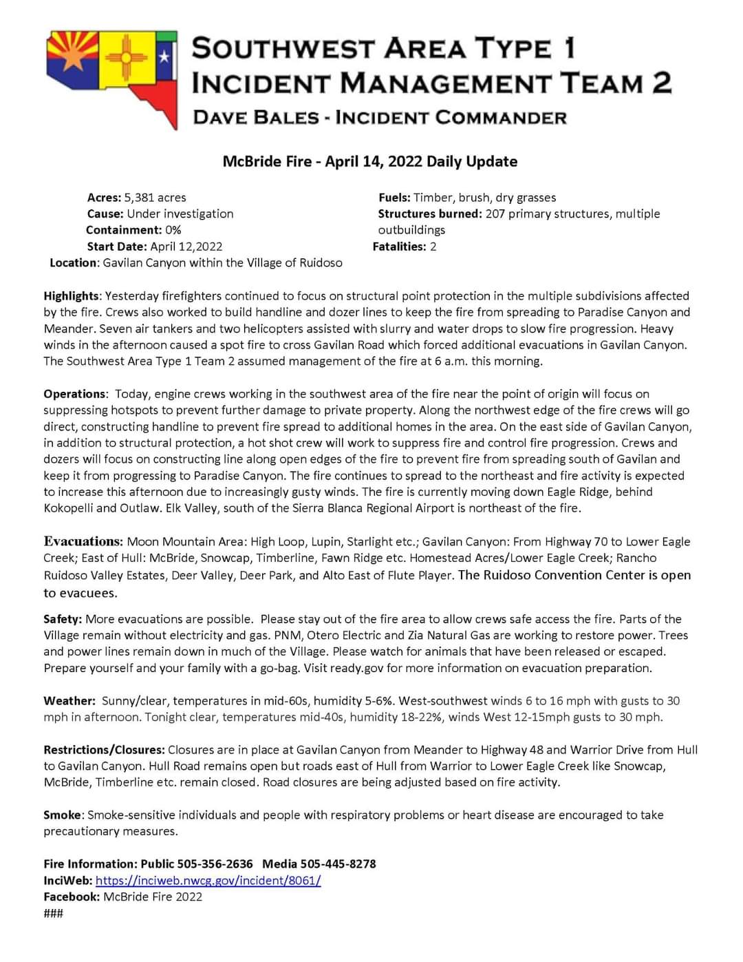
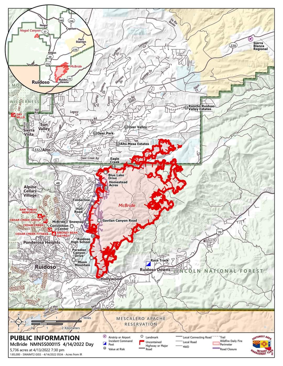
5,736 Current Acreage
0% Containment
200+Primary Resident Structures Lost or Damaged
2 Fatalities
A Type 1 Incident Management Team has been brought in and taken over the McBride and Nogal Canyon Fires. A full update will be provided later this morning. Official updates will continue to be posted on this page.
https://www.facebook.com/105994292086535/posts/107178791968085/
2 Likes
Cameras are back up.
1 Like
6,185 acres and 56% contained.
3 Likes
Last I saw was 89% contained
As of 7 am the McBride Fire has been transferred to a Type-4 Incident Management Team. With high containment numbers and no fire movement for multiple days, we will be switching to a full written update every other day. Expect another full update on Friday. We will continue to post pictures, general fire info and information on the Burned Area Emergency Response (BAER) on this page moving forward.
Residents can continue to call 575-258-6900 for information.
https://www.facebook.com/100080723370324/posts/102433545790758/
2 Likes