State ID: NM
3 letter designator: CNF
Fire name: FOSTER
Location: 31 29.946, -108 56.994
Approx. 22 mi south of Rodeo NM, in the Whitmore WSA
Reported acres: 800
Rate of spread:
Report on Conditions:
Structure threat:
Resources: 1 IMT3, 2 VLAT, 5 LAT1, 2 FWAA, 1 FASM, 1 HE2S, 2 CRW2 ordered / assigned
Hazards:
Weather: wind, red flag warning
Radio channels:
Scanner link:
Webcam link:
Agency Website:
2 Likes
Foster (AZ-CNF, Coronado National Forest). Discovered 5/29. Approx. 22 mi south of Rodeo NM, in the Whitmore WSA (31 29.946, -108 56.994). 800 Acres. 1 IMT3, 2 VLAT, 5 LAT1, 2 FWAA, 1 FASM, 1 HE2S, 2 CRW2 ordered / assigned.
1 Like
Foster (AZ-CNF) update: SEZ IMT3 (Rice) Assigned. Acres: 1000.
3 Likes
Foster (AZ-CNF). Clarification: This fire is in New Mexico (31 30.858, -109 1.446), the land is managed by the Coronado National Forest AZ-CNF. Acres 4500. Add’l orders: 1 WFM2 (T2 Wildland Fire Module), 3 CRW1, 2 CRW2, 2 HE2S, 1 HE3S, 2 ENG6, 2 IMDT (Incident Medical Team).
1 Like
Inciweb Info
https://inciweb.nwcg.gov/incident/8125/
5 Likes
#FosterFire AZ. 6,702 acres based on infrared flight last night at 10:53pm. Other reports are that fire is significantly larger now. #NMfire #NMwx
Open #GISsurfer map: https://bit.ly/3lZ9Z9j https://twitter.com/MappingSupport/status/1531263145141972992/photo/1
2 Likes
The Coronado National Forest is continuing its response to the 6,700 acres Foster Fire reported on May 29, 2022, at 12:53 PM in the Peloncillo Mountains, Douglas Ranger District.
Inciweb updates:
https://inciweb.nwcg.gov/incident/8125/ https://twitter.com/CoronadoNF/status/1531318096576782336/photo/1
2 Likes
The Foster Fire: 10,400 acres. 300 personnel: Air support, 5 hot shot crews, 4 hand crews, and 12 engines are current at the incident. Full suppression efforts are in place.
Inciweb updates:
https://t.co/g2bVBm4KA4
2 Likes
3 Likes
3 Likes
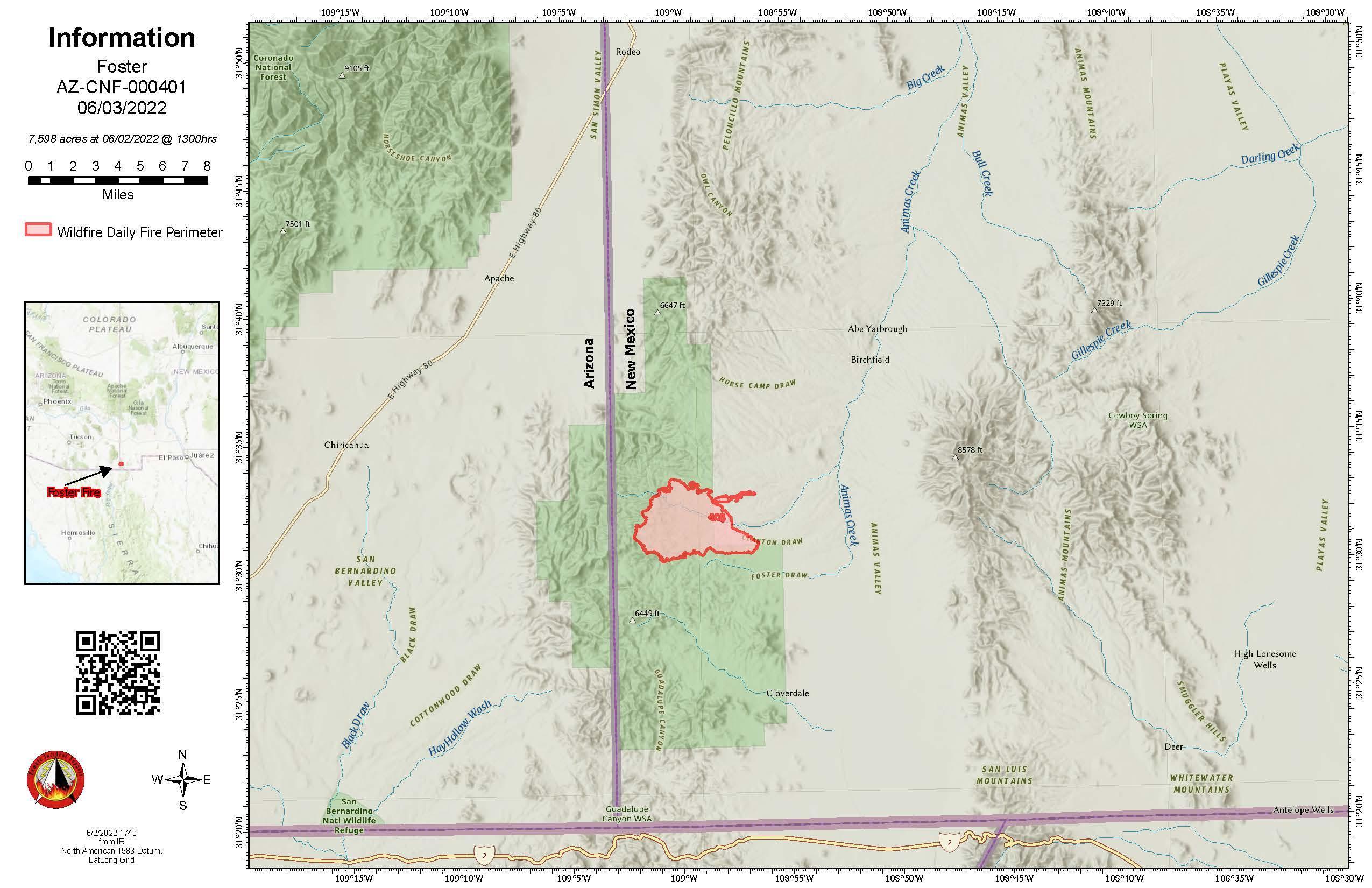
Acres Burned: 7,598
Percent Contained: 100%
3 Likes