Was about 1600 acres yesterday morning has been making some significant runs since then, had a large pyro cb most of yesterday afternoon into the evening. Now over 18,000 acres.
https://inciweb.nwcg.gov/incident/8103/
6 Likes
2 Likes
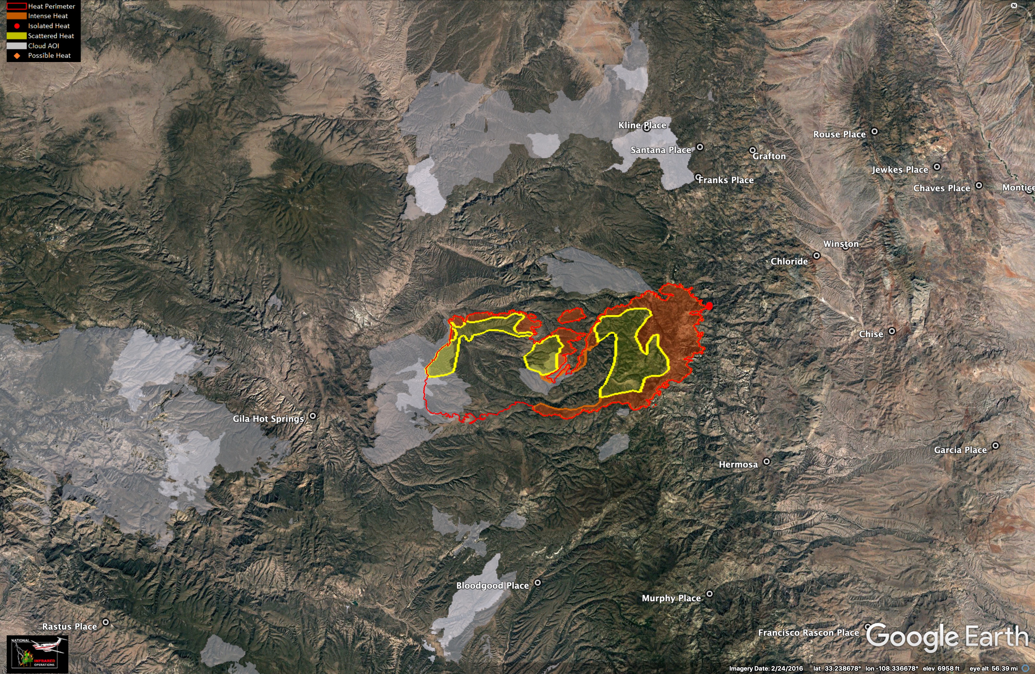
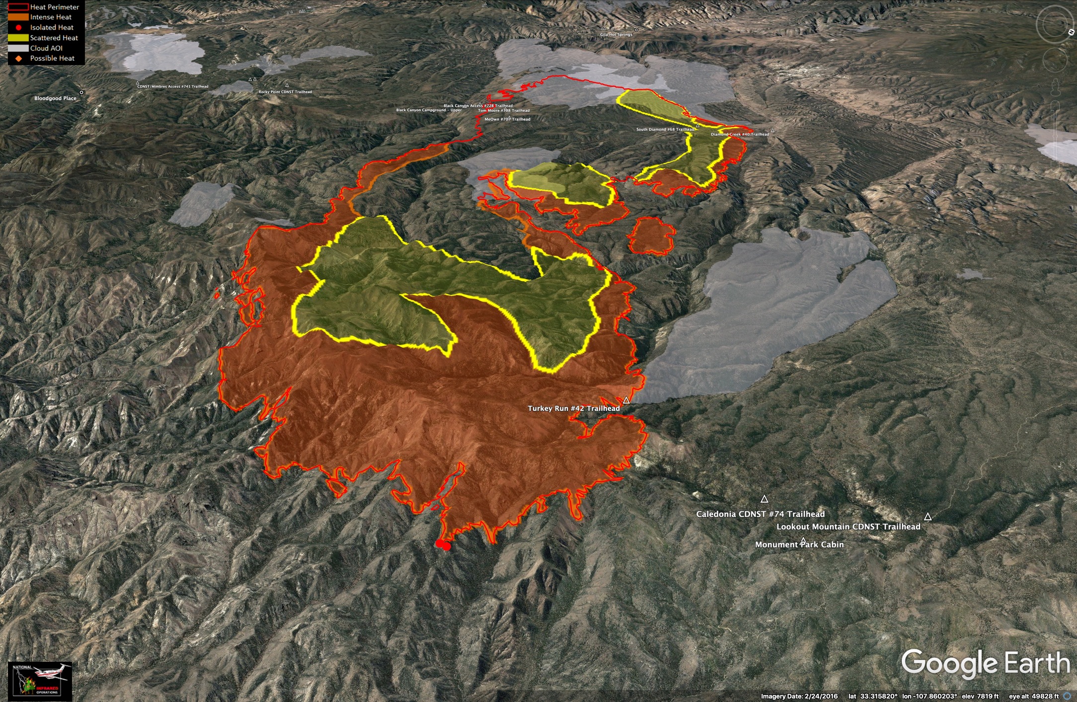
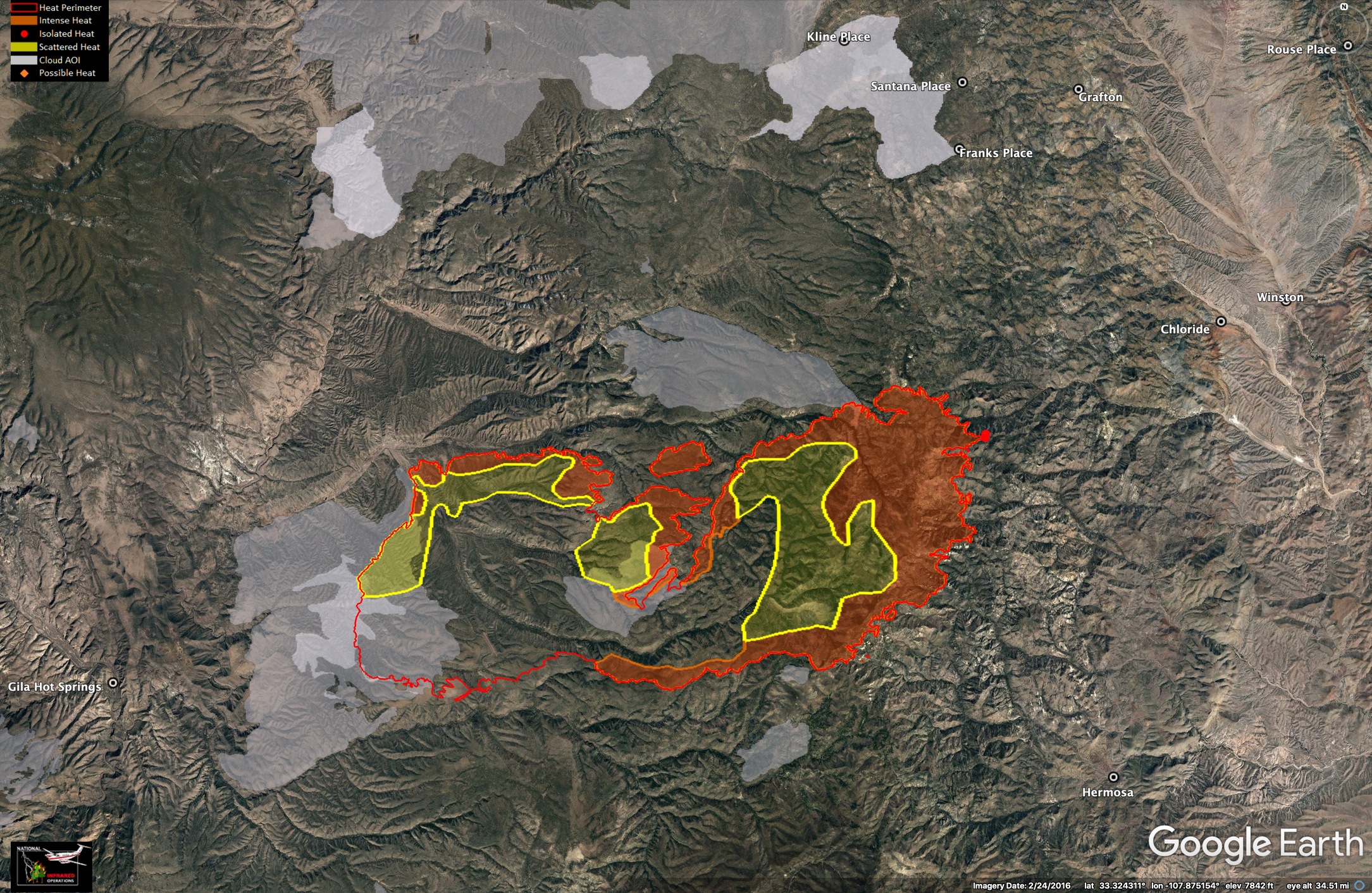
The Black Fire is burning in an area where the US Forest Service has managed many recent fires for resource benefits. Here are current maps of the fire (5/17/22). White fills show places the Gila NF has used prescribed or natural fire since about 2016.
4 Likes
3 Likes
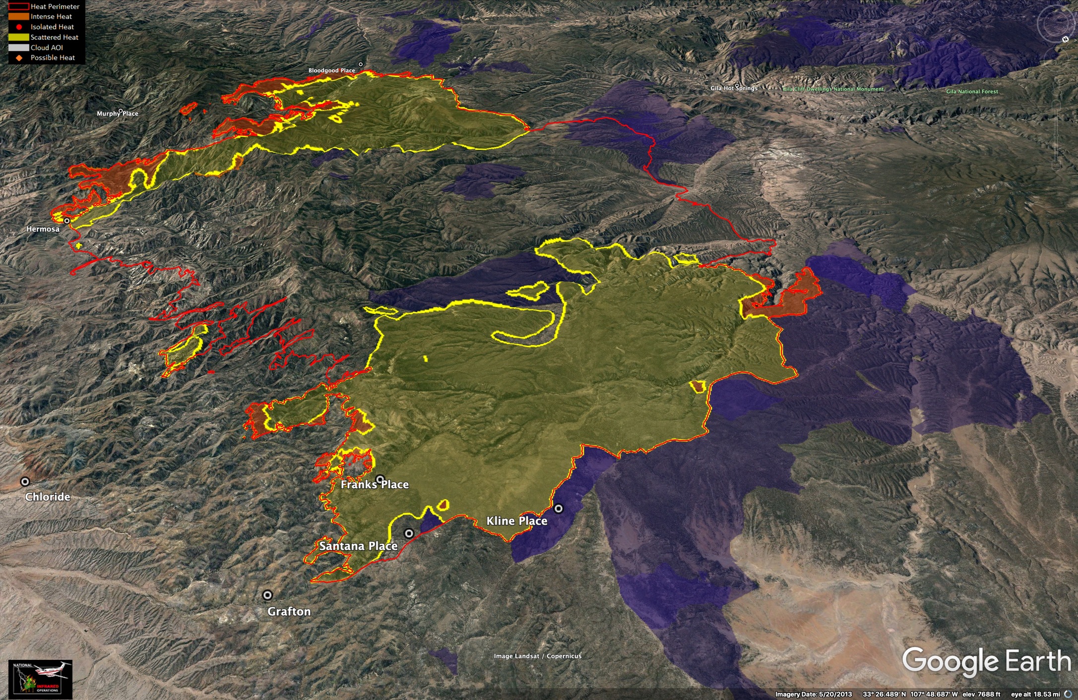
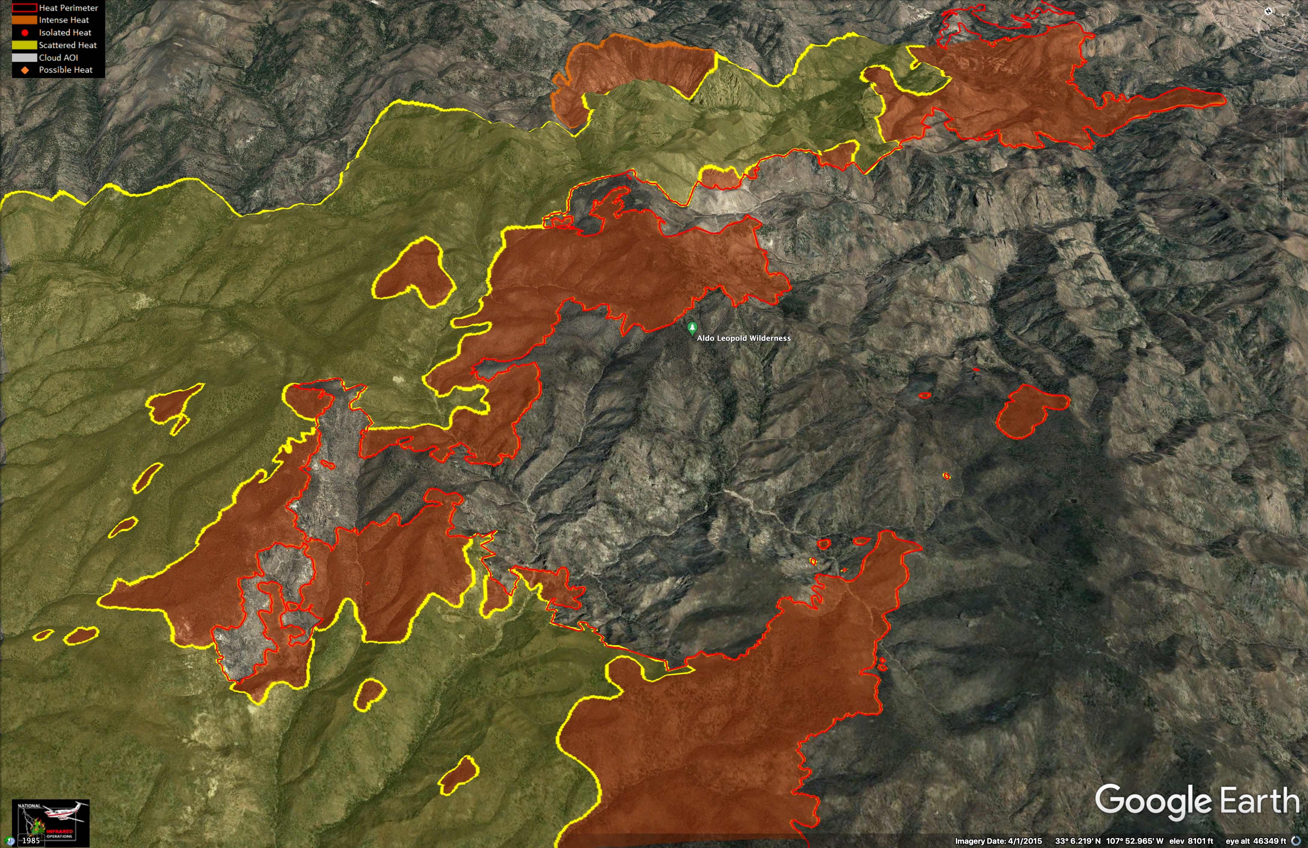
Last night’s IR of the Black Fire, in New Mexico shows spot fires over a mile ahead of the main flaming front. 9pm, 5/29/2022. Another view shows how strategic grazing and large prescribed burns (2016-2017, in dark blue) helped contain much of the north flank.
7 Likes
This video is about 10 days old, but gives a good overview of how previous fires (rx and managed wildfire) are affecting severity and behavior of this fire. LIVE ALERT: Fire Behavior Analyst Discusses the Black Fire - YouTube
5 Likes
3 Likes
6 Likes
324,909 acres and 58% contained.
https://www.facebook.com/100069053205292/posts/333158392329265/?flite=scwspnss
4 Likes
5 Likes
3 Likes
3 Likes